 Block
From the record
42 National Register listings published here.
Sources: the National Register database, National Park Service
66 topographic sheets cover 31 settlements here, and 42 properties are on the National Register of Historic Places.
42 National Register listings published here.
Sources: the National Register database, National Park Service
Every property in this county listed on the National Register of Historic Places, with the year it was listed and the federal nomination document.
| Photograph | Property | Type | Listed | Reference |
|---|---|---|---|---|
| Big Sewee Creek Bridge | structure | 1982 | 82003995 | |
| John M. Black Cabin | building | 1982 | 82004016 | |
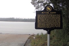 | Blythe Ferry | site | 1983 | 83003055 |
| Blythe Ferry (Boundary Increase) | site | 2007 | 07001046 | |
| Blythe Ferry (Boundary Increase) | site | 2007 | 07001046 | |
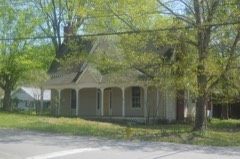 | Buchanan House | building | 1982 | 82003996 |
| James Cowan House | building | 1982 | 82003994 | |
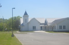 | Decatur Methodist Church | building | 1982 | 82003997 |
| S. S. Eaves House | building | 1982 | 82003998 | |
| Ewing House | building | 1982 | 82004018 | |
| Feezell Barn | building | 1982 | 82004019 | |
| Georgetown Road | site | 2022 | 100007556 | |
| James R. Gettys House | building | 1982 | 82004020 | |
| James R. Gettys Mill | building | 1982 | 82004021 | |
| Jim Godsey House | building | 1982 | 82003999 | |
| James Turk Griffith House | building | 1982 | 82004022 | |
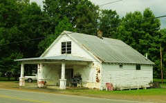 | Jacob L. Grubb Store | building | 1982 | 82004000 |
| Hastings-Locke Ferry | site | 1983 | 83003056 | |
| Hastings-Locke Ferry | site | 1983 | 83003056 | |
| Dr. D. W. Holloway House | building | 1982 | 82004023 | |
| Scott Hooper Garage | building | 1982 | 82004010 | |
| Hutsell Truss Bridge | structure | 1982 | 82004024 | |
| Sam Hutsell House | building | 1982 | 82004025 | |
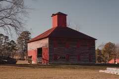 | R. H. Johnson Stable | building | 1982 | 82004026 |
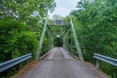 | Kings Mill Bridge | structure | 1982 | 82004001 |
| MacPherson House | building | 1982 | 82004027 | |
| McKenzie Windmill | structure | 1982 | 82004011 | |
 | Meigs County Bank | building | 1982 | 82004003 |
 | Meigs County Courthouse | building | 1978 | 78002613 |
| Mount Zion Church | building | 1982 | 82004006 | |
| Oak Grove Methodist Church | building | 1982 | 82004028 | |
| Alexander Patterson House | building | 1982 | 82004029 | |
| Rice-Marler House | building | 1982 | 82004007 | |
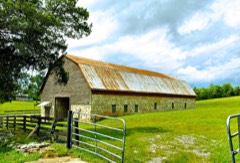 | Bradford Rymer Barn | building | 1982 | 82004012 |
| Elisha Sharp House | building | 1982 | 82004030 | |
| G. W. Shiflett Barn | building | 1982 | 82004013 | |
| H. C. Shiflett Barn | building | 1982 | 82004014 | |
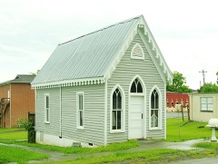 | Robert H. Smith Law Office | building | 1982 | 82004008 |
| John Stewart House | building | 1982 | 82004009 | |
| Surprise Truss Bridge | structure | 1982 | 82004031 | |
| Andy Wood Log House and Willie Wood Blacksmith Shop | building | 1982 | 82004015 |
Every wildfire the federal occurrence database records inside this county: 326 of them, burning about 3,638 acres. 4 started naturally and 159 were recorded as arson. Each settlement page carries the fires within five miles of it.
| Reported cause | Fires |
|---|---|
| Arson/incendiarism | 159 |
| Debris and open burning | 112 |
| Missing data/not specified/undetermined | 26 |
| Equipment and vehicle use | 11 |
| Other causes | 5 |
| Natural | 4 |
| Recreation and ceremony | 3 |
| Misuse of fire by a minor | 3 |
| Power generation/transmission/distribution | 1 |
| Railroad operations and maintenance | 1 |
| Smoking | 1 |
The five largest, by the area the report gives. Three of them were set deliberately.
| Date | Cause | Size | Reported by | Name on the report |
|---|---|---|---|---|
| 29 April 2001 | Arson/incendiarism | 355 acres | Tennessee Division of Forestry | not named |
| 25 March 2008 | Missing data/not specified/undetermined | 331 acres | Tennessee Division of Forestry | not named |
| 11 March 2005 | Arson/incendiarism | 222 acres | Tennessee Division of Forestry | not named |
| 14 January 2003 | Missing data/not specified/undetermined | 160 acres | Tennessee Division of Forestry | PRIG MOORE RD. #1 |
| 11 August 2002 | Equipment and vehicle use | 125 acres | Tennessee Division of Forestry | not named |
| 7 February 2015 | Debris and open burning | 119 acres | Tennessee Division of Forestry | N. NOPONE VALLEY RD. |
| 15 March 2006 | Debris and open burning | 80 acres | Tennessee Division of Forestry | not named |
| 27 April 2014 | Arson/incendiarism | 68 acres | Tennessee Division of Forestry | LIGGET RD |
Every settlement page carries the fires within five miles of it - see the settlement index below.
The NOAA Storm Events Database holds 199 reports for this county, causing 4 deaths, 11 injuries and about $10,978,050 in recorded property damage. Each settlement page carries the reports that name it.
| Kind of event | Reports |
|---|---|
| Thunderstorm Wind | 129 |
| Hail | 43 |
| Flash Flood | 12 |
| Flood | 9 |
| Tornado | 5 |
| Lightning | 1 |
The most serious of them, by death, then injury, then recorded damage. The accounts are quoted exactly as the forecast office filed them.
| When | Event | Place named | Harm | What the report says |
|---|---|---|---|---|
| May 1953 | Tornado (F4) | not stated | 4 killed, 8 hurt, $250,000 | no account filed |
| December 2019 | Thunderstorm Wind | Forest Grove | 2 hurt | Thunderstorm winds rolled a mobile home with two occupants. Both occupants suffered minor injuries. |
| January 2023 | Tornado (EF0) | Decatur | 1 hurt | Straight-line winds blew down trees and caused minor outbuilding damage near Decatur Creek and Goodfield Road. Then, a tornado developed just southwest of the corner of Sharp Road and Highway 58. It tracked northeast across Highway 58, and ended just south of Crestview Lane. Maximum winds were estimated at 75 mph. |
| May 2003 | Flash Flood | Countywide | $9,310,000 | Widespread flooding, road closures, damage, evacuations. |
| February 1993 | Tornado (F1) | Midway to | $500,000 | no account filed |
| May 2003 | Thunderstorm Wind | Big Spg | $75,000 | no account filed |
| July 2004 | Thunderstorm Wind | Decatur | $40,000 | no account filed |
| July 2006 | Thunderstorm Wind | Countywide | $30,000 | no account filed |
| July 2005 | Thunderstorm Wind | Decatur | $30,000 | no account filed |
| November 2002 | Thunderstorm Wind | Countywide | $30,000 | no account filed |
| June 2011 | Thunderstorm Wind | Brittsville | $25,000 | Law enforcement personnel reported several trees downed by thunderstorm wind in and around Brittsbill Road in the Georgetown Community. A home on Brittsbill Road was also damaged by the wind. |
| June 2011 | Thunderstorm Wind | Decatur | $25,000 | Law enforcement personnel reported numerous trees...power poles and powerlines downed by thunderstorm wind on Highway 58 between Highway 68 and Highway 30 near Decatur. |
| March 2005 | Thunderstorm Wind | Countywide | $25,000 | no account filed |
| May 2005 | Thunderstorm Wind | Countywide | $25,000 | no account filed |
| February 1998 | Thunderstorm Wind | Countywide | $25,000 | no account filed |
| June 2010 | Thunderstorm Wind | Decatur | $20,000 | Utility company personnel reported numerous trees and powerlines downed by thunderstorm winds across the northern half of the county from Decatur to near Ten Mile. |
| July 2005 | Thunderstorm Wind | Ten Mile | $20,000 | no account filed |
| July 2005 | Thunderstorm Wind | Countywide | $20,000 | no account filed |
| July 2004 | Thunderstorm Wind | Decatur | $20,000 | no account filed |
| July 2002 | Thunderstorm Wind | Decatur | $20,000 | no account filed |
| August 2005 | Thunderstorm Wind | Big Spg | $18,000 | A few trees down on powerlines near Big Spring. Reported by Volunteer Electric. |
| June 2003 | Thunderstorm Wind | Countywide | $18,000 | no account filed |
| June 2014 | Thunderstorm Wind | Decatur | $15,000 | Law enforcement personnel reported many trees downed by thunderstorms wind in countywide. Hail as large a dime was also reported. |
| April 2011 | Tornado (EF0) | Brittsville | $15,000 | Hiwassee River Tornado. A NWS Storm Survey reported an EF0 tornado touched down in extreme southern Meigs County, just north of the Hamilton County line and just south of the Hiwassee River. It formed near Highway 58 and County Road 114 then tracked parallel to Highway 58 to the Hiwassee River where it dissipated. The max wind of 80 mph downed several trees. |
| June 2011 | Thunderstorm Wind | Decatur | $15,000 | A trained spotter reported an estimated 70 mph (61 kt) wind gust on Highway 30 in the Old Georgetown area near Decatur. Many tree limbs downed by thunderstorm wind on the highway. |
| April 2010 | Thunderstorm Wind | Decatur | $15,000 | Law enforcement personnel reported several trees and powerlines downed by thunderstorm winds in the Decatur area. |
| August 2005 | Thunderstorm Wind | Ten Mile | $15,000 | Several trees down in and around Ten Mile. |
| December 2005 | Thunderstorm Wind | Countywide | $15,000 | Numerous trees down along Hwy 58. |
| March 2003 | Thunderstorm Wind | Central Portion | $15,000 | no account filed |
| May 2003 | Thunderstorm Wind | Countywide | $15,000 | no account filed |
| May 2003 | Thunderstorm Wind | Big Spg | $15,000 | no account filed |
| June 2002 | Thunderstorm Wind | Ten Mile | $15,000 | no account filed |
| June 2002 | Thunderstorm Wind | Decatur | $15,000 | no account filed |
| August 2002 | Thunderstorm Wind | Ten Mile | $15,000 | no account filed |
| October 2001 | Thunderstorm Wind | Countywide | $13,000 | Trees down. |
| June 2006 | Thunderstorm Wind | Decatur | $12,000 | Numerous trees and powerlines down south and east of Decatur. |
| June 2007 | Thunderstorm Wind | Ten Mile | $10,000 | Thunderstorm winds downed a few trees in Ten Mile. |
| June 2006 | Thunderstorm Wind | Countywide | $10,000 | A few trees and powerlines down countywide. |
| June 2006 | Thunderstorm Wind | Countywide | $10,000 | A few trees...large limbs and powerlines down across the southern half of the county. |
| May 1995 | Thunderstorm Wind | Decatur | $10,000 | A roof was blown off of a house. A barn, two cars and a recreational vehicle were damaged as well. |
| May 2004 | Thunderstorm Wind | Ten Mile | $10,000 | no account filed |
| November 2003 | Thunderstorm Wind | Countywide | $10,000 | no account filed |
| July 2002 | Thunderstorm Wind | Decatur | $10,000 | no account filed |
| May 2002 | Thunderstorm Wind | Decatur | $10,000 | no account filed |
| January 2000 | Thunderstorm Wind | Decatur | $10,000 | no account filed |
| July 1999 | Thunderstorm Wind | Decatur | $10,000 | no account filed |
| April 2007 | Thunderstorm Wind | Decatur | $9,000 | Three trees were reported down in Decatur. |
| June 2010 | Thunderstorm Wind | Decatur | $8,000 | Highway department personnel reported 5 trees downed by thunderstorm winds near Decatur. |
| August 2006 | Thunderstorm Wind | Countywide | $8,000 | A few trees and powerlines down countywide. |
| December 2005 | Thunderstorm Wind | Ten Mile | $8,000 | A few trees down in northern portion of county. |
| January 2002 | Thunderstorm Wind | Countywide | $6,000 | A few trees down. |
| May 2006 | Thunderstorm Wind | Ten Mile | $6,000 | no account filed |
| May 2003 | Thunderstorm Wind | Decatur | $6,000 | no account filed |
| April 2000 | Thunderstorm Wind | Decatur | $6,000 | no account filed |
| February 2014 | Thunderstorm Wind | Decatur | $5,000 | Law enforcement reported two trees downed by thunderstorm wind on Highway 58 and Highway 54. |
| February 2011 | Thunderstorm Wind | Decatur | $5,000 | Law enforcement personnel reported a few trees downed by thunderstorm wind in Decatur. |
| June 2010 | Thunderstorm Wind | East View | $5,000 | Law enforcement personnel reported a few trees downed by thunderstorm winds along Highway 60 southeast of Birchwood. |
| June 2009 | Thunderstorm Wind | Breedenton | $5,000 | Law enforcement officials reported a few trees downed by thunderstorm winds in the |Decatur area. |
| April 2008 | Thunderstorm Wind | Euchee | $5,000 | The highway department reported a few trees downed by thunderstorm winds across the northwest portion of the county. |
| August 2007 | Thunderstorm Wind | Decatur | $5,000 | The sheriffs office reported a few trees downed by thunderstorm winds across the northern half of county. |
The Survey's mineral resources record lists 5 workings inside this county. 2 still produce and 3 are closed or unrecorded. Each settlement page carries the workings within five miles of it.
| Commodity | Workings |
|---|---|
| Stone, Crushed/Broken | 2 |
| Stone, Crushed/Broken, Limestone, General | 1 |
| Iron | 1 |
| Limestone, General | 1 |
The least common of them first, because a county's hundredth gravel pit says nothing its first ten did not.
| Where | Site | Commodity | Status | Recorded |
|---|---|---|---|---|
| Decatur Area | Iron | Past Producer | Hematite | |
| Posey Quarry. | Limestone, General | Past Producer | Sedimentary | |
| Ten Mile Quarry Pit #294 | Stone, Crushed/Broken, Limestone, General | Producer | Limestone | |
| Posey Quarry | Stone, Crushed/Broken | Past Producer | ||
| Ten Mile Mine and Mill | Stone, Crushed/Broken | Producer |
Named settlements recorded in the Geographic Names Information System, each with the topographic sheets covering it. Villages, hamlets and abandoned places alike. Each is shown with the nearest named watercourse or landform and the survey quadrangle it falls on.
District 4 · 37880 · On South Fork Little Sewee Creek · Tranquillity quadrangle
23 sheets, 1887 to 1981
District 1 · 37308 · Near Roberts Hollow · Big Spring quadrangle
23 sheets, 1886 to 1981
No longer a settlement
District 3 · 37322 · Near Colbaugh Hollow · Big Spring quadrangle
23 sheets, 1886 to 1981
No longer a settlement
District 4 · 37322 · On Davis Creek · Tranquillity quadrangle
23 sheets, 1887 to 1981
No longer a settlement
District 5 · 37880 · On Wann Branch · Spring City quadrangle
24 sheets, 1887 to 1981
No longer a settlement
District 5 · 37880 · Near Looney Ridge · Ten Mile quadrangle
22 sheets, 1887 to 1981
District 4 · 37322 · Near Waltons Islands (historical) · Spring City quadrangle
24 sheets, 1887 to 1981
District 2 · 37322 · On Nance Branch · Big Spring quadrangle
23 sheets, 1886 to 1981
No longer a settlement
District 4 · 37322 · On South Fork Little Sewee Creek · Tranquillity quadrangle
23 sheets, 1887 to 1981
District 4 · 37322 · Near Brickell Ridge · Tranquillity quadrangle
23 sheets, 1887 to 1981
The vanished settlements of Meigs County: the places named above that are no longer on the map.