 Block
From the record
19 National Register listings published here.
Sources: the National Register database, National Park Service
56 topographic sheets cover 52 settlements here, and 19 properties are on the National Register of Historic Places.
19 National Register listings published here.
Sources: the National Register database, National Park Service
Every property in this county listed on the National Register of Historic Places, with the year it was listed and the federal nomination document.
| Photograph | Property | Type | Listed | Reference |
|---|---|---|---|---|
 | Thomas Leroy Bransford House | building | 1995 | 95000977 |
 | Caldwell Lustron House | building | 1999 | 99000718 |
 | Capitol Theatre | building | 1999 | 99000363 |
 | Central Elementary School | building | 01000141 | |
 | Colored Hotel | building | 08000284 | |
 | Confederate Monument | structure | 1977 | 77001286 |
 | Deering Building | building | 1983 | 83004283 |
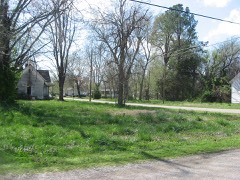 | Dickey's Octagonal Barbershop | building | 1975 | 75001772 |
| East Main Street and Exchange Street Historic District | district | 1999 | 99001394 | |
 | Houser House | building | 2002 | 02000809 |
 | W. W. Morris House | building | 1983 | 83003058 |
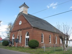 | Mt. Zion Colored Methodist Episcopal Church | building | 2001 | 01000140 |
 | Obion County Courthouse | building | 1995 | 95000340 |
| Railroad Park | district | 1999 | 99000535 | |
 | US Post Office | building | 1984 | 84003671 |
 | Union City Armory | building | 1999 | 99000361 |
 | Union City, Mobile and Ohio Railroad Depot | building | 1995 | 95000933 |
| Washington Avenue and Florida Avenue Historic District | district | 2001 | 01000955 | |
| Whitesell, Jesse Farm (Boundary Increase) | district | 2009 | 06001199 |
Every wildfire the federal occurrence database records inside this county: 218 of them, burning about 1,550 acres. 6 started naturally and 59 were recorded as arson. Each settlement page carries the fires within five miles of it.
| Reported cause | Fires |
|---|---|
| Debris and open burning | 79 |
| Arson/incendiarism | 59 |
| Equipment and vehicle use | 35 |
| Smoking | 12 |
| Missing data/not specified/undetermined | 11 |
| Other causes | 6 |
| Natural | 6 |
| Power generation/transmission/distribution | 3 |
| Recreation and ceremony | 3 |
| Railroad operations and maintenance | 2 |
| Misuse of fire by a minor | 2 |
The five largest, by the area the report gives. One of them was set deliberately.
| Date | Cause | Size | Reported by | Name on the report |
|---|---|---|---|---|
| 7 October 1999 | Equipment and vehicle use | 95 acres | Tennessee Division of Forestry | not named |
| 18 October 2015 | Debris and open burning | 71 acres | Tennessee Division of Forestry | BREVARD RD FIRE |
| 6 September 2010 | Equipment and vehicle use | 50 acres | Tennessee Division of Forestry | SEVENTY FOUR |
| 7 March 2001 | Recreation and ceremony | 45 acres | Tennessee Division of Forestry | not named |
| 4 October 2008 | Debris and open burning | 42 acres | Tennessee Division of Forestry | not named |
| 24 August 2007 | Smoking | 34 acres | Tennessee Division of Forestry | NINETY ONE |
| 20 February 2010 | Debris and open burning | 32 acres | Tennessee Division of Forestry | M&E |
| 16 November 1999 | Arson/incendiarism | 28 acres | Tennessee Division of Forestry | not named |
Every settlement page carries the fires within five miles of it - see the settlement index below.
The NOAA Storm Events Database holds 281 reports for this county, causing 3 deaths, 5 injuries and about $22,207,740 in recorded property damage. Each settlement page carries the reports that name it.
| Kind of event | Reports |
|---|---|
| Thunderstorm Wind | 150 |
| Hail | 57 |
| Flash Flood | 33 |
| Tornado | 25 |
| Flood | 11 |
| Lightning | 4 |
| Funnel Cloud | 1 |
The most serious of them, by death, then injury, then recorded damage. The accounts are quoted exactly as the forecast office filed them.
| When | Event | Place named | Harm | What the report says |
|---|---|---|---|---|
| December 2021 | Tornado (EF2) | Lassiter Corner | 1 killed, $2,500,000 | The tornado crossed from Lake County to Obion County. The tornado's width was shrinking as it approached Samburg, however, it was still strong enough to damage homes, businesses, and city buildings in Samburg. Many homes suffered partial roof loss, and several mobile homes were separated from their undercarriages. A recreational vehicle in a mobile home park along Lake Drive in Samburg was destroyed, resulting in one fatality. The tornado continued northeast from Samburg, damaging several homes along Old Samburg Road. The last observed damage was west of Treece Road. Peak winds in Obion County were estimated at 130 mph. |
| April 2008 | Flash Flood | Union City Arpt | 1 killed, $10,000 | Heavy rain produced flash flooding on a few roadways near the Everett Stewart Airport. A 24 year old man drowned when he ran off of Martin Highway into a swollen creek. The vehicle completely submerged. |
| April 2025 | Thunderstorm Wind | South Fulton | 1 killed | A tree fell onto a moving vehicle on the roadway in South Fulton. |
| February 2018 | Tornado (EF1) | Gibbs | 3 hurt, $2,000,000 | The tornado occurred just east of Union City, Tennessee. The tornado's damage pattern suggested a broad, occasionally disorganized circulation with several small swaths of more intense damage. A number of homes along the path had roof damage. Several mobile homes were destroyed. The most significant damage was noted on Orchard and Jenkins Roads and also along Knox Daniel Road. Peak winds were estimated at 105-110 mph. |
| April 2014 | Tornado (EF2) | Fremont | 1 hurt, $250,000 | A tornado touched down west of Union City and tracked northeast damaging 16 structures. Many structures had roofs removed and several barns destroyed. A minor injury was to an occupant of one of the homes who was sent to the hospital and released. The other occupant of the house was in the garage and saw the tornado coming. The suction was so strong he could not enter the house until part of the roof was blown off. There was major damage to large machine sheds. The tornado moved a 700 pound weight about 15 feet and threw a 40 pound jack about 50 yards. A steel trailer was bent. |
| December 1967 | Tornado (F2) | not stated | 1 hurt, $250,000 | no account filed |
| February 2025 | Flash Flood | Rives | $5,000,000 | Significant flooding occurred in Rives, TN due to a levee overtopping. The entire town was flooded. All 105 homes suffered at least some damage with 60 homes suffering significant damage. Roads and culverts throughout town were damaged. |
| May 2021 | Thunderstorm Wind | Union City | $2,500,000 | Straight-line winds knocked down trees and power lines along US Highway 51. A warehouse suffered roof and wall damage. |
| April 2025 | Flood | Rives | $1,500,000 | The entire community of Rives was flooded due to three levee breeches caused by heavy rainfall. Nearly 100 structures were affected. |
| August 2023 | Flash Flood | Union City | $1,000,000 | A trained spotter in Union City measured 11.49 inches of rain overnight. Evacuations occurred at the nearby Green Acres mobile home park. Numerous roads were closed due to flooding. |
| May 2010 | Flash Flood | Kenton | $500,000 | Heavy rain fell across Obion County early Sunday morning. This caused creeks and ditches to overflow their banks. Several roads were flooded as a result. By Sunday afternoon, the flash flooding event transitioned to a flood event as water from creeks and streams allowed river levels to quickly rise. A breach in the North Fork of the Obion River caused widespread flooding in Kenton. As many as 50 homes were flooded as a result. |
| May 2003 | Thunderstorm Wind | Union City | $400,000 | Six homes and 15 businesses were damaged. Several cars were also damaged. |
| May 2021 | Thunderstorm Wind | Samburg | $350,000 | Widespread tree and roof damage in the Samburg area. |
| April 2025 | Flood | Obion | $300,000 | The Obion River flooded parts of Obion. About a dozen homes were affected. |
| April 2025 | Flood | South Fulton | $300,000 | Flooding in South Fulton near Harris Fork Creek. Nearly 20 homes were affected by standing water. |
| March 2017 | Tornado (EF2) | Woodland Mills | $300,000 | A tornado tracked from the community of Hickman Kentucky southeast into northern Obion county. Damage was sustained to large grain bins, several small barns and outbuildings and a few homes. The peak winds in Obion County were estimated at 100 mph. |
| May 2000 | Thunderstorm Wind | Union City | $300,000 | The roof and doors were blown off a barn. A large pole was snapped. Many trees were blown down. |
| May 2021 | Thunderstorm Wind | Mason Hall | $270,000 | Straight-line winds knocked down several large trees along Hurt Road. A large tree fell on and destroyed a home. |
| April 2025 | Tornado (EF1) | Mason Hall | $250,000 | The tornado crossed into Obion County causing damage to trees and homes at Mason Hall Kenton Roads. Some of the most intense damage occurred along Concord Road, with multiple trees snapped near their tops and uprooted, significant roof damage to multiple barn outbuildings, and damage to the roof and siding of a single-family home. As the tornado crossed Highway 45W, multiple homes had minor roof damage with several trees snapped near their tops or uprooted. The tornado continued eastward through several fields, with additional damage near Macedonia Road and Old Sidonia Kenton Road. The roof of a home was damaged with trees uprooted in this area. Additionally, a farm outbuilding was destroyed along Old Sidonia Kenton Road with the debris flown several hundred yards through nearby fields up to Sidonia Kenton Road. Multiple homes along these roads had minor roof damage, with multiple trees uprooted in the area. The tornado lifted shortly after crossing Sidonia Kenton Road. Peak winds were estimated to be 105 mph. |
| December 2021 | Tornado (EF2) | Kenton | $250,000 | The tornado moved from Gibson County into the southeast corner of Obion County. The tornado uprooted and snapped trees along its path and heavily damaged a couple of homes on Sidonia Kenton Road. The tornado then crossed back into Gibson County. Peak winds were estimated at 125 mph in Obion County. |
| April 1982 | Tornado (F2) | not stated | $250,000 | no account filed |
| April 1982 | Tornado (F0) | not stated | $250,000 | no account filed |
| May 1973 | Tornado (F2) | not stated | $250,000 | no account filed |
| May 2021 | Tornado (EF1) | Wyly | $225,000 | Tornado damaged a 500-foot tower and antennas west of Union City. The tornado downed numerous trees, several of which fell on houses. Peak winds were estimated at 100 mph. |
| June 2014 | Tornado (EF1) | Walnut Log | $200,000 | A tornado crossed into Obion County from Lake County, Tennessee and continued southeast. The tornado caused roof damage to ten homes especially along Possum Trot Road and Treece Road. Significant tree damage also occurred along the path. The tornado lifted near the intersection of Shawtown Road and Davis Road, northwest of Troy. |
| May 2003 | Thunderstorm Wind | Troy | $200,000 | A church and several homes were damaged. Numerous trees and power poles were knocked down. |
| July 1996 | Flash Flood | Union City | $200,000 | no account filed |
| May 2021 | Thunderstorm Wind | Polk | $175,000 | Straight-line winds damaged a workshop and barn on Polk Station Road. A tractor barn was destroyed on Garrett Saw Mill Road. Grain bins and farm sheds were destroyed on Crockett Road. |
| April 2025 | Flood | Harris | $125,000 | The Harris Fork Creek flooded parts of Harris. Several homes were affected. |
| April 2025 | Flood | Kenton | $100,000 | Heavy rain caused flooding along the Rutherford Fork Obion River. About a half-dozen homes were affected in the Obion County part of Kenton. |
| February 2021 | Flash Flood | Harris | $100,000 | Over four inches of rain fell in Union City since midnight. Several roads were washed out in Union City. Several roads were closed across the county. Cleve Duke Road was flooded southwest of Hornbeak. Water was up to the car doors in some areas. |
| December 2021 | Tornado (EF0) | Protemus | $100,000 | A tornado damaged trees and storage buildings along Shawtown Road. Peak winds were estimated at 80 mph. |
| May 2021 | Thunderstorm Wind | Crockett | $100,000 | Trees and power lines were knocked down at Highway 45 and East Union Grove Road. Three irrigation rigs were damaged in the area. |
| August 2013 | Flash Flood | South Fulton | $100,000 | Several inches of rain produced flash flooding in South Fulton. Several residences had to be evacuated due to rising water. |
| June 2013 | Flash Flood | South Fulton | $100,000 | A slow moving thunderstorm produced very heavy rain causing flash flooding in South Fulton. The rain caused Harris Creek to rise rapidly and it flooded many streets and a few homes. Water rescues occurred as a result with water as high as knee to waist deep in a few locations. |
| January 2020 | Tornado (EF1) | Ebenezer | $75,000 | Several barns and outbuildings were severely damaged or destroyed by the tornado. There was also tree damage as well as roof damage to homes. Peak winds were estimated at 90 mph. There was also a substantial area of straight-line wind damage. |
| October 2004 | Thunderstorm Wind | Rives | $75,000 | A pavilion at Rives City Park was destroyed. A church was badly damaged. Several homes and at least three cars were damaged. Many trees were knocked down. |
| May 2000 | Thunderstorm Wind | Cloverdale | $75,000 | Some trees were knocked down. |
| May 2021 | Thunderstorm Wind | Protemus | $50,000 | Straight-line winds tore the roof off home on Shawtown Road. |
| February 2018 | Tornado (EF0) | Antioch | $50,000 | A weak tornado tracked through rural sections of Obion County knocking down a few trees and damaging a few farm outbuildings. |
| June 2016 | Thunderstorm Wind | Fremont | $50,000 | Trees down all over Kenn-Tenn Highway, West Highway 22 and Shawtown Road in Union City. |
| March 2017 | Thunderstorm Wind | South Fulton | $40,000 | Siding ripped off home. Damage area was large enough to allow water to enter the home causing more damage. |
| June 2019 | Thunderstorm Wind | Union City | $30,000 | Trees, power lines and utility poles down across Union City. |
| June 2019 | Thunderstorm Wind | Crockett | $30,000 | Two large oak trees and several apple trees were down off of East Union Grove Road north of Kenton. |
| August 2019 | Thunderstorm Wind | Cloverdale | $30,000 | Power-lines and several large tree limbs down on Millsfield Highway near Cloverdale. |
| May 2017 | Thunderstorm Wind | Spout Spgs | $30,000 | Trees and power lines down in Obion County. especially along Highway 22 from Union City to Samburg. Trees are also down in Clayton and Woodland Mills. |
| May 2003 | Thunderstorm Wind | Kenton | $30,000 | Two mobile homes were damaged. One house lost part of its roof. Some trees and power lines were knocked down. |
| May 1997 | Thunderstorm Wind | Rives | $30,000 | A large farm shed was demolished. |
| April 2025 | Thunderstorm Wind | Mc Connell | $25,000 | A swath of damaging wind was found in eastern Obion County. Several trees were damaged and uprooted along Goose Pond Road and Wolf Creek Road. A home also lost a portion of its shingles and a carport was overturned. Uprooted trees were also found along N Meadows Road. |
| December 2021 | Tornado (EF0) | Woodland Mills | $25,000 | The supercell that produced the long track EF-4 tornado from Craighead County, Arkansas into western Obion County, Tennessee reintensified and formed another tornado in northern Obion County near Woodland Mills. A home suffered roof damage on Woodland Mills Road and trees were uprooted north of Woodland Mills. The tornado then crossed into Fulton County and eventually intensified into an EF-4 as it approached Mayfield, Kentucky. Peak winds in Obion County were estimated at 75 mph. |
| December 2021 | Thunderstorm Wind | Antioch | $25,000 | Straight-line winds damaged several outbuildings and caused tree damage along West Shawtown Road. |
| May 2021 | Thunderstorm Wind | Kenton | $25,000 | Power lines were knocked down and five power poles were destroyed on Highway 45W north of Kenton. |
| July 2010 | Lightning | Kenton | $25,000 | Lightning struck a home in Kenton and started a fire. The roof was burned off the home. |
| September 2006 | Flash Flood | North Portion | $25,000 | Heavy rains caused flooding in low-lying areas of Union City. The city park was under 3.5 feet of water. In South Fulton, extensive flooding was reported. Some businesses reported as much as 12 inches of water in their offices, while the South Fulton football field and facilities were also under water. |
| December 1967 | Tornado (F1) | not stated | $25,000 | no account filed |
| April 2025 | Thunderstorm Wind | Mason Hall | $20,000 | A home sustained damage east of Mason Hall, along Hurt Road near the Kenton tornado path. |
| January 2020 | Thunderstorm Wind | Troy | $20,000 | A farm building was destroyed and spread southeast to the intersection of Key Road and Ebenezer Road. Numerous trees and powerlines were knocked down in the area. This damage was linked to the straight-line winds associated with the tornado that tracked just north of this area. |
| August 2019 | Thunderstorm Wind | Obion | $20,000 | Large tree limb fell on vehicle. |
| February 2008 | Thunderstorm Wind | Troy | $20,000 | Straight line winds blew trees and power lines down across Obion County. The hardest hit area was near Troy. |
| May 2006 | Flash Flood | Countywide | $20,000 | Flash flooding caused ditches to overflow and streets to become impassable with a couple of feet of water on them. Several people became trapped in cars on these impassable streets. In Union City, a quarter of the city was underwater. A large mobile home park was evacuated and a subdivision had 3 to 4 feet of water in it. |
The Survey's mineral resources record lists 29 workings inside this county. 14 still produce and 15 are closed or unrecorded. Each settlement page carries the workings within five miles of it.
| Commodity | Workings |
|---|---|
| Sand and Gravel, Construction | 22 |
| Clay | 6 |
| Fire Clay (Refractory) | 1 |
The least common of them first, because a county's hundredth gravel pit says nothing its first ten did not.
| Where | Site | Commodity | Status | Recorded |
|---|---|---|---|---|
| Union City Pit | Fire Clay (Refractory) | Past Producer | ||
| E.G. Johnson Farm Prospect | Clay | Occurrence | ||
| East Union City Prospect | Clay | Prospect | ||
| J.R. Cude Farm Prospect | Clay | Occurrence | ||
| Obion Pit | Clay | Past Producer | ||
| Rives Prospect | Clay | Past Producer | ||
| Troy Prospect | Clay | Occurrence | ||
| #1 Reelfoot Materials, Inc. Pit | Sand and Gravel, Construction | Producer | Unconsolidated Sediments | |
| #10 Caldwell Pit | Sand and Gravel, Construction | Producer | Unconsolidated Sediments | |
| #3 Maloney Pit | Sand and Gravel, Construction | Producer | Unconsolidated Sediments | |
| Barnett Pit | Sand and Gravel, Construction | Producer | Unconsolidated Sediments | |
| Barnett Pit | Sand and Gravel, Construction | Past Producer | Sedimentary | |
| Barnett Pit | Sand and Gravel, Construction | Past Producer | ||
| C.N. Armour Construction Company | Sand and Gravel, Construction | Producer | ||
| Cole Pit | Sand and Gravel, Construction | Producer | Unconsolidated Sediments | |
| Cole Pit | Sand and Gravel, Construction | Past Producer | Sedimentary | |
| Guy & Sturgiss Pit | Sand and Gravel, Construction | Producer | Unconsolidated Sediments | |
| Guy and Sturgiss Pit | Sand and Gravel, Construction | Past Producer | Sedimentary | |
| Guy and Sturgiss Pit | Sand and Gravel, Construction | Producer | ||
| Mount Moriah Mine | Sand and Gravel, Construction | Producer | ||
| Number 10 Caldwell Pit | Sand and Gravel, Construction | Past Producer | Sedimentary | |
| Number 10 Caldwell Pit | Sand and Gravel, Construction | Past Producer | ||
| Number 3 Maloney Pit | Sand and Gravel, Construction | Past Producer | Sedimentary | |
| Obion County Mine | Sand and Gravel, Construction | Producer | ||
| Obion County Mine | Sand and Gravel, Construction | Producer | ||
| Obion County Mine | Sand and Gravel, Construction | Producer | ||
| Pit #1 | Sand and Gravel, Construction | Producer | ||
| Troy Mine | Sand and Gravel, Construction | Past Producer | ||
| Troy Mine | Sand and Gravel, Construction | Producer |
Named settlements recorded in the Geographic Names Information System, each with the topographic sheets covering it. Villages, hamlets and abandoned places alike. Each is shown with the nearest named watercourse or landform and the survey quadrangle it falls on.
District 5 · 38232 · On South Branch Pawpaw Creek · Hornbeak quadrangle
15 sheets, 1925 to 1983
No longer a settlement
District 5 · 38232 · Near Glady Hollow · Hornbeak quadrangle
15 sheets, 1925 to 1983
District 5 · 38232 · On South Fork Indian Creek · Samburg quadrangle
14 sheets, 1925 to 1983
The vanished settlements of Obion County: the places named above that are no longer on the map.