Block
From the record
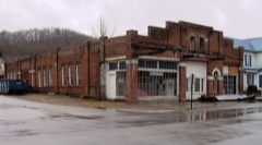
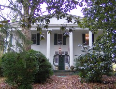
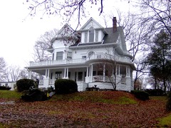
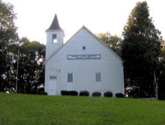
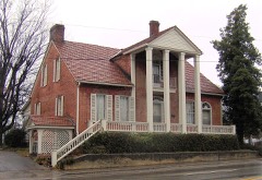
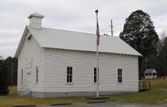
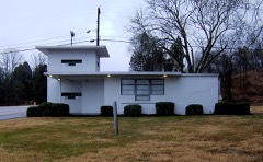
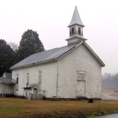
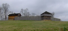
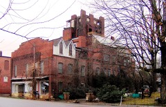
21 National Register listings published here, 1 of them a National Historic Landmark.
Sources: the National Register database, National Park Service
141 topographic sheets cover 135 settlements here, and 21 properties are on the National Register of Historic Places.
21 National Register listings published here, 1 of them a National Historic Landmark.
Sources: the National Register database, National Park Service
Every property in this county listed on the National Register of Historic Places, with the year it was listed and the federal nomination document.
Every wildfire the federal occurrence database records inside this county: 329 of them, burning about 8,854 acres. 4 started naturally and 96 were recorded as arson. Each settlement page carries the fires within five miles of it.
| Reported cause | Fires |
|---|---|
| Debris and open burning | 162 |
| Arson/incendiarism | 96 |
| Missing data/not specified/undetermined | 31 |
| Equipment and vehicle use | 7 |
| Misuse of fire by a minor | 7 |
| Railroad operations and maintenance | 6 |
| Power generation/transmission/distribution | 6 |
| Natural | 4 |
| Recreation and ceremony | 4 |
| Smoking | 3 |
| Other causes | 2 |
| Fireworks | 1 |
The five largest, by the area the report gives. Five of them were set deliberately.
| Date | Cause | Size | Reported by | Name on the report |
|---|---|---|---|---|
| 30 October 2000 | Arson/incendiarism | 3,450 acres | Tennessee Division of Forestry | not named |
| 9 February 2009 | Arson/incendiarism | 420 acres | Tennessee Division of Forestry | BLACK CREEK RD |
| 3 April 2003 | Missing data/not specified/undetermined | 300 acres | Tennessee Division of Forestry | BOWATERS |
| 28 October 2000 | Arson/incendiarism | 298 acres | Tennessee Division of Forestry | not named |
| 14 February 2015 | Arson/incendiarism | 209 acres | Tennessee Division of Forestry | HARRIMAN HWY |
| 7 February 2015 | Arson/incendiarism | 206 acres | Tennessee Division of Forestry | LOWER ROAD FIRE |
| 18 March 2009 | Debris and open burning | 200 acres | Tennessee Division of Forestry | SCENIC DRIVE 1 |
| 12 March 2014 | Power generation/transmission/distribution | 188 acres | Tennessee Division of Forestry | TENNESSEE CHAPEL FIRE |
Every settlement page carries the fires within five miles of it - see the settlement index below.
The NOAA Storm Events Database holds 384 reports for this county, causing 1 death, 3 injuries and about $18,463,001 in recorded property damage. Each settlement page carries the reports that name it.
| Kind of event | Reports |
|---|---|
| Thunderstorm Wind | 280 |
| Hail | 51 |
| Flash Flood | 29 |
| Flood | 13 |
| Tornado | 6 |
| Lightning | 3 |
| Funnel Cloud | 2 |
The most serious of them, by death, then injury, then recorded damage. The accounts are quoted exactly as the forecast office filed them.
| When | Event | Place named | Harm | What the report says |
|---|---|---|---|---|
| July 2018 | Lightning | Kingston | 1 killed | Individual was struck by lightning after mowing lawn. |
| May 2005 | Thunderstorm Wind | Kingston | 2 hurt, $3,000 | no account filed |
| July 2018 | Lightning | Kingston Arpt | 1 hurt | A man was struck by lightning and killed while he was walking home after mowing a lawn. |
| February 2019 | Flood | Glen Alice | $10,500,000 | The flooding of numerous structures and roads was reported across the county. All told, Emergency Management estimated $10.5 million in total damages to property and infrastructure throughout the county for the overall event. |
| May 2003 | Flash Flood | Countywide | $2,810,000 | no account filed |
| May 2003 | Flash Flood | Countywide | $2,780,000 | Flooding and high water problems countywide. |
| November 2005 | Thunderstorm Wind | Oliver Spgs | $400,000 | no account filed |
| February 2011 | Flood | Harriman | $275,000 | Broadcast media reported heavy rain from a thunderstorm caused flooding countywide. 48 homes suffered minor to moderate flood related damage due to the high waters. The Magnolia Estates Apartments also had four units that were flooded. |
| May 2025 | Tornado (EF1) | Jonesville | $50,000 | A 100 yard wide EF-1 tornado with peak winds near 100 mph started near Blair Road and Butler Drive where several trees were uprooted and trunks snapped. The tornado tracked near Old Harriman Highway where numerous tree trunks were snapped along the path. The tornado lifted near Whaley Road and Old Harriman Highway. Tornado was on the ground for roughly a 0.5 mile. |
| June 2014 | Tornado (EF0) | Kingston | $50,000 | An NWS storm survey team found a small EFO formed just east of downtown Kingston...and moved to the northeast along a hillside producing a distinct path with hundreds of downed trees. The path length was 0.5 miles with a path width of 100 yards. The estimated peak wind was 80 mph. |
| May 1995 | Hail | Oliver Springs | $50,000 | Several houses had roofs caved in and skylights broken. Several police cars were damaged. The roof of a pickup truck caved in. The hail accumulated to about four inches on the ground. |
| February 1993 | Tornado (F1) | Cave Creek | $50,000 | The tornado started just west of Cave Creek and travelled east into Loudon County. Several homes were damaged. |
| September 1996 | Thunderstorm Wind | Harriman | $50,000 | no account filed |
| July 2004 | Thunderstorm Wind | Oliver Spgs | $35,000 | no account filed |
| August 2011 | Thunderstorm Wind | Oliver Spgs | $30,000 | Broadcast media reported a barn destroyed and a small shed blown off its foundation by thunderstorm wind in Oliver Springs. Trees and powerlines were also downed by the wind. |
| July 2006 | Thunderstorm Wind | Countywide | $30,000 | no account filed |
| November 2002 | Thunderstorm Wind | Countywide | $30,000 | no account filed |
| October 2001 | Thunderstorm Wind | Countywide | $25,000 | Trees down. A roof was blown off a building in Kingston. |
| May 2006 | Thunderstorm Wind | Rockwood | $25,000 | no account filed |
| July 2006 | Thunderstorm Wind | Harriman | $25,000 | no account filed |
| July 2005 | Thunderstorm Wind | Rockwood | $25,000 | no account filed |
| May 2004 | Thunderstorm Wind | Harriman | $25,000 | no account filed |
| October 1977 | Tornado (F0) | not stated | $25,000 | no account filed |
| April 2015 | Thunderstorm Wind | Rockwood | $20,000 | A trained spotter reported a tin roof blown off a shed and few trees downed by thunderstorm wind 3 miles east of Rockwood. |
| June 2014 | Thunderstorm Wind | Oliver Spgs | $20,000 | A trained spotter reported multiple trees and powerlines downed by thunderstorm wind in around Oliver Springs. The spotter measured a gust at 70 mph. |
| June 2009 | Thunderstorm Wind | Harriman | $20,000 | Law enforcement officials reported numerous trees downed by thunderstorm winds countywide. |
| February 2009 | Thunderstorm Wind | Kingston | $20,000 | Law enforcement personnel reported numerous trees and powerlines downed by thunderstorm winds in Kingston and the remainder of the county as well. |
| April 2008 | Thunderstorm Wind | Harriman | $20,000 | A utility company reported several trees and powerlines downed by thunderstorm winds in the Harriman area. |
| August 2005 | Thunderstorm Wind | Kingston | $20,000 | Numerous trees down in and around Kingston. |
| January 2002 | Thunderstorm Wind | Countywide | $20,000 | Trees and power lines down. |
| May 2005 | Thunderstorm Wind | Kingston | $20,000 | no account filed |
| May 2005 | Thunderstorm Wind | Countywide | $20,000 | no account filed |
| July 2005 | Thunderstorm Wind | Harriman | $20,000 | no account filed |
| May 2004 | Thunderstorm Wind | Countywide | $20,000 | no account filed |
| July 2004 | Thunderstorm Wind | Countywide | $20,000 | no account filed |
| July 2004 | Thunderstorm Wind | Kingston | $20,000 | no account filed |
| July 2004 | Thunderstorm Wind | Countywide | $20,000 | no account filed |
| July 2002 | Thunderstorm Wind | Rockwood | $20,000 | no account filed |
| July 2002 | Thunderstorm Wind | Rockwood | $20,000 | no account filed |
| November 2002 | Thunderstorm Wind | Countywide | $20,000 | no account filed |
| February 1997 | Thunderstorm Wind | Countywide | $20,000 | no account filed |
| April 2006 | Thunderstorm Wind | Kingston | $18,000 | Several trees downed onto a home and a fence on Old Union Road. |
| December 2005 | Thunderstorm Wind | Countywide | $18,000 | Numerous trees down across the county along Hwy 58. |
| April 2006 | Thunderstorm Wind | Harriman | $17,000 | Numerous trees down across the northern half of the county. |
| June 2014 | Thunderstorm Wind | Kingston | $15,000 | Law enforcement personnel reported many trees downed by thunderstorms wind countywide. Also trees were downed on roads and another fell tree on a car. |
| August 2013 | Thunderstorm Wind | Kingston | $15,000 | Law enforcement personnel reported several trees and powerlines downed by thunderstorm wind across the county. |
| October 2010 | Thunderstorm Wind | Kingston | $15,000 | Highway department personnel reported numerous trees downed by thunderstorm wind 5 miles south of Kingston. |
| February 2009 | Thunderstorm Wind | Dyllis | $15,000 | Law enforcement personnel reported numerous trees downed by thunderstorm winds in Oak Ridge and the rest of the county as well. |
| June 2007 | Thunderstorm Wind | Kingston | $15,000 | Several trees were reported down countywide. |
| April 2006 | Thunderstorm Wind | Countywide | $15,000 | Several trees down countywide. |
| June 2003 | Thunderstorm Wind | Countywide | $15,000 | no account filed |
| June 2003 | Thunderstorm Wind | Rockwood | $15,000 | no account filed |
| May 2003 | Thunderstorm Wind | Countywide | $15,000 | no account filed |
| November 2002 | Thunderstorm Wind | Kingston | $15,000 | no account filed |
| November 2002 | Thunderstorm Wind | Oliver Spgs | $15,000 | no account filed |
| August 2002 | Thunderstorm Wind | Countywide | $15,000 | no account filed |
| January 1997 | Thunderstorm Wind | Harriman | $15,000 | no account filed |
| April 1996 | Thunderstorm Wind | Countywide | $15,000 | no account filed |
| June 2005 | Thunderstorm Wind | Kingston | $12,000 | Three trees down on Highway 304. Reported by Sheriffs Office and TN DOT. |
| July 2006 | Thunderstorm Wind | Kingston | $12,000 | no account filed |
The Survey's mineral resources record lists 30 workings inside this county. 7 still produce and 23 are closed or unrecorded. Each settlement page carries the workings within five miles of it.
| Commodity | Workings |
|---|---|
| Barium-Barite | 11 |
| Iron | 8 |
| Stone, Crushed/Broken | 4 |
| Sand and Gravel, Construction | 3 |
| Stone, Crushed/Broken, Limestone, General | 1 |
| Lead, Iron | 1 |
| Limestone, General | 1 |
| Limestone, General, Stone, Crushed/Broken | 1 |
| Silica, Iron, Manganese | 1 |
| Iron, Lead | 1 |
The least common of them first, because a county's hundredth gravel pit says nothing its first ten did not.
| Where | Site | Commodity | Status | Recorded |
|---|---|---|---|---|
| Emory Gap Plant #522 | Limestone, General, Stone, Crushed/Broken | Producer | Limestone | |
| Johnson Prospects | Barium-Barite, Lead, Iron | Past Producer | Residual | |
| Johnson Prospects | Barium-Barite, Iron, Lead | Past Producer | ||
| Lambert Brothers Quarry | Limestone, General | Past Producer | Sedimentary | |
| Roane Electric Furnace | Silica, Iron, Manganese | Plant | ||
| Swan Pond Quarry | Stone, Crushed/Broken, Limestone, General | Producer | Limestone | |
| Oliver Springs Sand Pit | Sand and Gravel, Construction | Producer | ||
| Oliver Springs Sand Quarry | Sand and Gravel, Construction | Past Producer | Sedimentary | |
| Ralph Rogers & Company, Inc. - Oliver Springs Quarry | Sand and Gravel, Construction | Producer | Conglomerate | |
| Emory Gap | Stone, Crushed/Broken | Past Producer | ||
| Lambert Brothers Quarry | Stone, Crushed/Broken | Past Producer | ||
| Swan Pond Quarry | Stone, Crushed/Broken | Producer | ||
| Webster Quarry | Stone, Crushed/Broken | Producer | ||
| Chamberlain-Barnardsville Area | Iron | Past Producer | Hematite | |
| Chamberlain-Barnardsville Area-B | Iron | Past Producer | Hematite | |
| Chamberlain-Barnardville Dep. North | Iron | Past Producer | ||
| Chamberlain-Barnardville Dep. South | Iron | Past Producer | ||
| Chamberlain/Barnardsville Area | Iron | Past Producer | Hematite | |
| Glen Alice Area | Iron | Past Producer | Hematite | |
| Harriman Area | Iron | Past Producer | Hematite | |
| Rockwood-Emory Gap Area | Iron | Past Producer | Hematite | |
| Johnson Prospects | Barium-Barite | Past Producer | Residual | |
| Small Barite Mine | Barium-Barite | Past Producer | Barite | |
| Taylor & Brabson Barite Mine | Barium-Barite | Past Producer | ||
| Taylor and Brabson Barite Mine | Barium-Barite | Past Producer | Barite | |
| Taylor and Brabson Barite Mine | Barium-Barite | Past Producer | Residual | |
| Tootle Mine | Barium-Barite | Past Producer | Barite | |
| Tootle Mine | Barium-Barite | Past Producer | ||
| Unnamed Barite Occurrence | Barium-Barite | Occurrence | Barite | |
| Unnamed Barite Occurrence | Barium-Barite | Occurrence |
Named settlements recorded in the Geographic Names Information System, each with the topographic sheets covering it. Villages, hamlets and abandoned places alike. Each is shown with the nearest named watercourse or landform and the survey quadrangle it falls on.
District 7 · 37763 · On Barnard Narrows Branch · Bacon Gap quadrangle
26 sheets, 1887 to 1981
District 1 · 37854 · Near Cane Hollow · Rockwood quadrangle
25 sheets, 1887 to 1981
District 7 · 37880 · On Blue Spring Branch · Ten Mile quadrangle
22 sheets, 1887 to 1981
District 7 · 37880 · On Blue Spring Branch · Ten Mile quadrangle
22 sheets, 1887 to 1981
District 6 · 37771 · Near Moore Ridge · Bethel Valley quadrangle
24 sheets, 1895 to 1998
District 6 · 37763 · Near Pisgah Ridge · Bacon Gap quadrangle
26 sheets, 1887 to 1981
District 6 · 37763 · Near Bear Creek Valley · Elverton quadrangle
24 sheets, 1895 to 1981
District 1 · 37854 · Near Post-Oak Valley · Rockwood quadrangle
25 sheets, 1887 to 1981
District 1 · 37854 · On Phillips Branch · Rockwood quadrangle
25 sheets, 1887 to 1981
District 1 · 37854 · On Phillips Branch · Rockwood quadrangle
25 sheets, 1887 to 1981
District 6 · 37763 · Near Pisgah Ridge · Cave Creek quadrangle
21 sheets, 1895 to 1981
District 6 · 37763 · Near Pisgah Ridge · Cave Creek quadrangle
21 sheets, 1895 to 1981
District 4 · 37830 · On Gum Hollow Branch · Bethel Valley quadrangle
24 sheets, 1895 to 1998
No longer a settlement
District 7 · 37763 · Near Suck-egg Hollow · Bacon Gap quadrangle
26 sheets, 1887 to 1981
District 7 · 37880 · Near Branham Hollow · Ten Mile quadrangle
22 sheets, 1887 to 1981
District 4 · 37840 · On Massengill Spring Branch · Elverton quadrangle
24 sheets, 1895 to 1981
District 1 · 37854 · Near Bradshaw Hollow · Rockwood quadrangle
25 sheets, 1887 to 1981
District 7 · 37763 · Near Wilker Ridge · Bacon Gap quadrangle
26 sheets, 1887 to 1981
No longer a settlement
District 1 · 37854 · Near Mount Roosevelt · Rockwood quadrangle
25 sheets, 1887 to 1981
No longer a settlement
District 1 · 37854 · On King Creek · Rockwood quadrangle
25 sheets, 1887 to 1981
No longer a settlement
District 3 · 37748 · On Little Emory River · Elverton quadrangle
24 sheets, 1895 to 1981
District 1 · 37854 · Near Mount Roosevelt · Rockwood quadrangle
25 sheets, 1887 to 1981
District 7 · 37763 · On Laurel Bluff Branch · Bacon Gap quadrangle
26 sheets, 1887 to 1981
District 3 · 37748 · Near Breadtray Hollow · Elverton quadrangle
24 sheets, 1895 to 1981
District 7 · 37846 · Near Gage Hill · Pattie Gap quadrangle
22 sheets, 1887 to 1981
No longer a settlement
District 4 · 37830 · On Gum Hollow Branch · Bethel Valley quadrangle
24 sheets, 1895 to 1998
District 3 · 37748 · Near Poplar Creek Valley · Elverton quadrangle
24 sheets, 1895 to 1981
District 7 · 37846 · On Little Paint Rock Creek · Pattie Gap quadrangle
22 sheets, 1887 to 1981
District 7 · 37763 · On Greasy Run Creek · Cave Creek quadrangle
21 sheets, 1895 to 1981
No longer a settlement
District 5 · 37763 · On Greasy Run Creek · Cave Creek quadrangle
21 sheets, 1895 to 1981
District 7 · 37846 · On West Fork Paint Rock Creek · Pattie Gap quadrangle
22 sheets, 1887 to 1981
No longer a settlement
District 6 · 37771 · Near Moore Ridge · Lenoir City quadrangle
24 sheets, 1895 to 1981
District 4 · 37830 · Near Bethel Valley · Bethel Valley quadrangle
24 sheets, 1895 to 1998
No longer a settlement
District 6 · 37763 · On Martin Branch · Bacon Gap quadrangle
26 sheets, 1887 to 1981
District 1 · 37854 · Near Post-Oak Valley · Rockwood quadrangle
25 sheets, 1887 to 1981
District 2 · 37748 · Near Martin Hollow · Harriman quadrangle
27 sheets, 1887 to 1998
District 6 · 37763 · Near Pisgah Ridge · Bacon Gap quadrangle
26 sheets, 1887 to 1981
District 7 · 37880 · Near Ten Mile Ridge · Ten Mile quadrangle
22 sheets, 1887 to 1981
No longer a settlement
District 2 · 37748 · By Wester Bluff · Bacon Gap quadrangle
26 sheets, 1887 to 1981
The vanished settlements of Roane County: the places named above that are no longer on the map.