 Block
From the record
14 National Register listings published here.
Sources: the National Register database, National Park Service
56 topographic sheets cover 52 settlements here, and 14 properties are on the National Register of Historic Places.
14 National Register listings published here.
Sources: the National Register database, National Park Service
Every property in this county listed on the National Register of Historic Places, with the year it was listed and the federal nomination document.
| Photograph | Property | Type | Listed | Reference |
|---|---|---|---|---|
 | Bozo's Hot Pit Bar-B-Q | building | 2018 | 100002264 |
| Canaan Baptist Church | building | 1999 | 99001457 | |
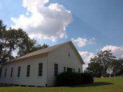 | Charleston United Methodist Church and Cemetery | building | 2002 | 02000811 |
 | Coca-Cola Bottling Plant | building | 1997 | 97000038 |
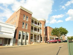 | Hotel Lindo | building | 1982 | 82001733 |
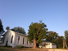 | Mt. Carmel Presbyterian Church | building | 1984 | 84003716 |
 | Oak Hill Farm | district | 2013 | 13000125 |
| Rhodes House | building | 1980 | 80003875 | |
 | Ruffin Theater | building | 1992 | 92000248 |
| South College Street Historic District | district | 1997 | 97000037 | |
| South Main Street Historic District | district | 1992 | 92000427 | |
 | St. Matthew's Episcopal Church | building | 1977 | 77001297 |
| Trinity Church | building | 1984 | 84003719 | |
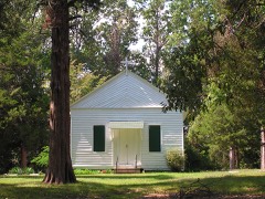 | Trinity Episcopal Church, Old | building | 1997 | 97000039 |
Every wildfire the federal occurrence database records inside this county: 30 of them, burning about 428 acres. None started naturally and 8 were recorded as arson. Each settlement page carries the fires within five miles of it.
| Reported cause | Fires |
|---|---|
| Debris and open burning | 16 |
| Arson/incendiarism | 8 |
| Equipment and vehicle use | 2 |
| Missing data/not specified/undetermined | 1 |
| Recreation and ceremony | 1 |
| Smoking | 1 |
| Other causes | 1 |
The five largest, by the area the report gives. Three of them were set deliberately.
| Date | Cause | Size | Reported by | Name on the report |
|---|---|---|---|---|
| 21 September 2019 | Debris and open burning | 148 acres | Tennessee Division of Forestry | BOWDEN |
| 31 August 2007 | Arson/incendiarism | 82 acres | Tennessee Division of Forestry | HORNET NEST |
| 10 February 2000 | Debris and open burning | 42 acres | Tennessee Division of Forestry | not named |
| 27 February 2006 | Equipment and vehicle use | 24 acres | Tennessee Division of Forestry | not named |
| 9 September 1999 | Arson/incendiarism | 18 acres | Tennessee Division of Forestry | not named |
| 28 June 2012 | Debris and open burning | 18 acres | Tennessee Division of Forestry | ESCUE |
| 11 October 2010 | Debris and open burning | 14 acres | Tennessee Division of Forestry | MILLSTONE MOUNTAIN |
| 12 September 1999 | Arson/incendiarism | 12 acres | Tennessee Division of Forestry | not named |
Every settlement page carries the fires within five miles of it - see the settlement index below.
The NOAA Storm Events Database holds 357 reports for this county, causing 10 deaths, 68 injuries and about $119,138,180 in recorded property damage. Each settlement page carries the reports that name it.
| Kind of event | Reports |
|---|---|
| Thunderstorm Wind | 171 |
| Hail | 98 |
| Flash Flood | 46 |
| Tornado | 28 |
| Flood | 9 |
| Lightning | 4 |
| Heavy Rain | 1 |
The most serious of them, by death, then injury, then recorded damage. The accounts are quoted exactly as the forecast office filed them.
| When | Event | Place named | Harm | What the report says |
|---|---|---|---|---|
| April 1968 | Tornado (F3) | not stated | 4 killed, 28 hurt, $2,500,000 | no account filed |
| March 2023 | Tornado (EF3) | Munford | 1 killed, 28 hurt, $80,000,000 | The tornado developed along Highway 178 just northwest of Munford. A few fences were damaged in this area and small tree limbs were snapped. The tornado traveled east-northeast and damaged farm outbuildings along Beaver Road and then uprooted and snapped trees along Walker Field Road and Walker Field Lane. The tornado then crossed Cattle Branch Creek causing minor tree damage. The first structural damage occurred along Laxton Lane and Fite Road where houses had some minor roof damage. The tornado began to intensify as it crossed Akins Road and approached Marshall Drive. A few power poles were broken in this area. The first EF-3 damage occurred along Myron Creek Drive where significant structural damage occurred to a couple of well-built homes. The tornado crossed Indian Creek Canal and continued to cause major damage to homes and trees along Indian Creek Road and Wright Lane. The lone fatality of the tornado occurred in this area. The tornado continued east-northeast toward Highway 51, where it damaged trees and structures along Jack Bennett and Liberty Church Smith Road. The tornado widened to over one-half mile wide as it approached and crossed Highway 51. Several homes were completely destroyed in this area and dozens of homes had significant damage. Several businesses along Highway 51 suffered heavy damage. EF-3 damage was widespread in this area. Fifty-three power poles had to be replaced along Highway 51 south of Covington. The tornado then moved across the southern section of Covington. This area is mostly industrial and several businesses suffered significant damage along Highways 59 and 384. A metal truss tower was crumpled to the ground. The tornado damaged the middle and elementary schools along Mark Walker Jr. Drive where the elementary school suffered major damage to the gymnasium and several walls. The tornado then crossed South Main Street and Highway 179 damaging several more houses. Substantial damage was caused to several houses along Highway 54. One house was completely destroyed and a couple of large metal power poles were bent to the ground. The tornado widened to almost a mile as it tracked east-northeast just north of Highway 54. This area is rural and the last major structural damage in Tipton County was on Lindsey Road where a home suffered major roof damage. The strong tornado continued tracking east-northeast taking out several large metal power poles and snapping trees between farm fields. Several irrigation pivots were overturned and twisted. In total, over 500 structures were damaged in Tipton County, 82 of which were total losses. The tornado began to weaken across northeast Tipton County as it tracked toward the Hatchie River. The tornado continued into Haywood County. Peak winds in Tipton County were estimated at 150 mph. |
| April 1975 | Tornado (F1) | not stated | 1 killed, 1 hurt, $25,000 | no account filed |
| June 1974 | Tornado (F1) | not stated | 1 killed, 1 hurt, $25,000 | no account filed |
| May 1967 | Tornado (F1) | not stated | 1 killed, 1 hurt, $25,000 | no account filed |
| May 2010 | Flash Flood | Detroit | 1 killed, $20,500,000 | Very heavy rain produced widespread flash flooding across Tipton County. Up to 20 inches of rain fell causing devastating damage to homes, businesses, roads and bridges. In fact, 40 roads were impassable in Tipton County due to the flooding. Twenty-one of those roads and 14 bridges were washed out as a result of the flooding. Other roads received damage just from the heavy rain. Damage was particularly bad in Atoka and Mason. Numerous vehicles were completely submerged in water. Two apartment complexes in Covington sustained major damage. In total, 309 homes received damage from the flooding. Of those, 96 homes were completely destroyed. As many as 93 businesses were flooded and of those 21 were completely destroyed. Nineteen mobile homes were flooded with 14 being destroyed. Many other structures or buildings were flooded as well. One fatality occurred in Mason. The flash flooding event transitioned into a flood event as rivers rose rapidly and overflowed their banks. |
| April 2025 | Flash Flood | Covington | 1 killed, $5,000 | Heavy rain led to creek overflow. A person whom was walking alongside the flooded roadway was swept away due to high water. This person was hospitalized before succumbing to their injuries a few days later. |
| March 1964 | Tornado (F2) | not stated | 3 hurt, $25,000 | no account filed |
| February 1975 | Tornado (F1) | not stated | 2 hurt, $25,000 | no account filed |
| May 1998 | Thunderstorm Wind | Crosstown | 2 hurt, $10,000 | A tree fell on a Tipton County Sheriff car injuring the deputy and a prisoner. A cemetery marker was blown over. Several other trees were knocked down. |
| November 2002 | Tornado (F2) | Randolph | 1 hurt, $6,000,000 | The tornado moved into Tipton county from Mississippi county in Arkansas and moved northeast. The tornado produced significant damage across the county. One man was injured was injured by bricks blown down from the facade of a building in downtown Covington. Across the county, twenty-eight mobile homes, five houses and one business were destroyed. Approximately 275 homes and business were damaged. Numerous trees and power lines were blown down. |
| October 2001 | Thunderstorm Wind | Richardsons | 1 hurt, $10,000 | One person was injured by a flying board. Numerous trees were blown down. |
| June 2025 | Flash Flood | Mason | $5,000,000 | Heavy rain caused flash flooding throughout the Covington area and across much of Tipton County. Over 7 inches of rain fell in a short period of time, causing flooding on Highway 59 and Highway 51, along with South Main Street in Covington. There were multiple water rescues. Thirty-two homes and businesses were flooded. Many roads and bridges were damaged throughout the county. |
| April 2011 | Thunderstorm Wind | Atoka | $1,660,000 | Straight line winds caused damage from Atoka to Brighton. Six houses, four mobile homes, three businesses and eight farm buildings were destroyed. Many trees and signs were also knocked down. |
| May 2011 | Flood | Dixonville | $750,000 | The Mississippi River rose to near record levels during the beginning to middle part of May. A few homes along the river were flooded and sustained damage. Several thousand acres of agriculture fields were flooded. Several roads were flooded and/or damaged. The river remained above flood stage through the end of the month. |
| March 2023 | Tornado (EF2) | Dixonville | $250,000 | The tornado that heavily damaged Wynne, Arkansas crossed the Mississippi River into Tipton County, Tennessee where it produced EF-2 damage across Wilder Farms. As the tornado climbed the Bluff, the tornado circulation began to weaken. From the top of the Bluff at the intersection of Pryor and Leach Roads to south of Burlison where the tornado appears to have lifted, EF-1 and EF-0 damage was observed. Peak winds from this tornado in Tipton County were estimated at 130 mph. It is important to note that as the long-tracked Wynne, Arkansas tornado was dissipating, the Covington, Tennessee tornado was on the ground approximately 3.5 miles away to the south. |
| January 1978 | Tornado (F1) | not stated | $250,000 | no account filed |
| May 2021 | Tornado (EF1) | Drummonds | $200,000 | The first observed damage was east of Dolan Road and west of Glen Springs Road. The tornado uprooted trees and caused roof damage just west of Glen Springs Road. Across Glen Springs Road, the tornado damaged a storage building and additional trees. The tornado crossed Glen Springs Lake and uprooted trees along Slough Road. Evidence suggested the tornado weakened in this area. The tornado strengthened as it approached Campground Road and Munford Giltedge Road. The tornado damaged a barn, large storage shed and caused roof damage to homes in the area. Trees were uprooted, and a couple of tree trunks were snapped. The tornado continued east and uprooted trees along Plantation Road. Several trees fell onto houses. The last observed damage was west of Beaver Road. Peak winds were estimated at 95 mph. |
| May 2013 | Tornado (EF1) | Avrett | $180,000 | The tornado touched down on Mount Lebanon Road and tracked east destroying two homes. The wind moved cars and trucks a significant amount. There was also damage to grain bins and trees were knocked down. A shop was destroyed. |
| April 2017 | Tornado (EF0) | Covington | $100,000 | Damage was primarily to trees and utility poles with minor damage observed at Crestview Middle school. Peak winds estimated at 75 mph. |
| January 1996 | Thunderstorm Wind | Brighton | $80,000 | no account filed |
| February 2008 | Tornado (EF1) | Charleston | $75,000 | A tornado touched down near Smith Road in the coummunity of Charleston in Eastern Tipton County destroying one trailer home and damaging another. The tornado tracked northeast and severely damaged a home on Highway 179 and then flipped over a trailer to an 18-wheeler on McIntyre Road. The tornado then lifted. |
| March 2023 | Thunderstorm Wind | Dixonville | $50,000 | The rear flank downdraft of the tornado tracked across the Mississippi River into western Tipton County and caused straight-line wind damage from Ray Bluff Road northeast toward Drummonds Road. Trees were uprooted, a house and mobile home had roof damage and 12 older wooden power poles were broken. |
| July 2023 | Flash Flood | Quito | $50,000 | The lower floor of a home was flooded in Quito. A roadway was flooded in Quito. |
| May 2017 | Thunderstorm Wind | Flatwood | $50,000 | Several poles down along Double bridges road near Munford. |
| February 2008 | Tornado (EF1) | Antioch | $50,000 | A tornado touched down near the Antioch-Cotton Road in the Hatchie River Bottom east of Covington destroying a trailer home. An adjacent home was also damaged. The tornado then lifted as it moved into the Hatchie River Bottoms. |
| July 1997 | Lightning | Covington | $50,000 | A home was destroyed by a fire started by lightning. |
| November 1994 | Tornado (F1) | Detroit | $50,000 | A house was destroyed by a small tornado which briefly touched down. Several vehicles and two 12-row planters were damaged. |
| June 1998 | Thunderstorm Wind | Brighton | $40,000 | A trailer was overturned and destroyed in Mason. A chicken house was destroyed in Brighton. Several trees were blown down. A large tree was knocked down on top of a car. |
| September 2022 | Thunderstorm Wind | Covington | $35,000 | Trees and powerlines were down across Covington. Significant damage was caused to temporary structures and tents in the Town Square, which were set up for the Heritage Festival. Flying debris damaged downtown structures and broke windows at some local businesses. |
| June 2019 | Thunderstorm Wind | Dixonville | $30,000 | Several trees down across Tipton County, specifcally in the Drummond, Quito, and Covington Areas. Also widespread power outages. |
| May 2009 | Flash Flood | Munford | $30,000 | Heavy rain produced flash flooding in and around Atoka. A home was severely damaged by flooding on Kearns Circle. |
| May 2003 | Thunderstorm Wind | Drummonds | $30,000 | One bridge near Drummonds was destroyed and a second bridge was damaged. A roof was blown off of a restaurant in Brighton. The Brighton Middle School suffered minor damage. Numerous trees and power lines were knocked down between Drummonds and Covington. |
| May 2013 | Thunderstorm Wind | Walnut Grove | $28,000 | Straight line winds produced damaged to a couple of homes northwest of Covington. The homes had roof and some structural damage. |
| June 2023 | Thunderstorm Wind | Crosstown | $25,000 | Powerlines were knocked down on cars just north of the Highway 51 and Walker Crossroad intersection. Tree limbs were also down on Highway 51 in Atoka. |
| July 2023 | Thunderstorm Wind | Crosstown | $25,000 | Numerous trees were knocked down across the southern half of Tipton County. Powerlines were knocked down on Marshall Road in Atoka. |
| October 2019 | Tornado (EF0) | Richardsons | $25,000 | The tornado touched down in farmlands near the Mississippi River and tracked intermittently northeast across the Mississippi into Arkansas breaking tree limbs and uprooting a few trees. |
| January 2005 | Thunderstorm Wind | Drummonds | $25,000 | The roof of a house was peeled off. Several trees were uprooted. |
| April 1998 | Thunderstorm Wind | Wilkinsville | $25,000 | A shed was blown away near Wilkinsville. A house trailer was blown over in Mason. A barn roof was also blown off in Mason. |
| December 1978 | Tornado (F0) | not stated | $25,000 | no account filed |
| March 1976 | Tornado (F1) | not stated | $25,000 | no account filed |
| February 2023 | Flash Flood | Salem | $20,000 | Fayne Road and Lucado Road were closed east of Atoka due to flooding. Vehicles were stalled in the flooded roadways. |
| March 2023 | Tornado (EF3) | Dixonville | $20,000 | The tornado that tracked through Wynne, Arkansas eventually moved from through the oxbows of the Mississippi River crossing between Tennessee and Arkansas a couple of times. Significant tree damage along the Mississippi River occurred. As the tornado passed over Corna Lake in Tipton County (the west side of the Mississippi River) and extreme southern Mississippi County, EF- 3 damage was observed. Peak winds were estimated at 145 mph in this part of Tipton County. |
| June 2017 | Thunderstorm Wind | Mason | $20,000 | Several large trees and power lines downed near the intersection of Highway 70 and Finde Naifeh Drive. |
| July 2016 | Thunderstorm Wind | Idaville | $20,000 | Tin roof ripped off house on Old Memphis Road near Billings Drive. Several large trees down in the area. |
| January 2013 | Flash Flood | Walnut Grove | $20,000 | Heavy rain caused flash flooding in parts of Tipton County. Brighton-Clopton Road was flooded near Brighton. A few homes on Hall Road were flooded with up to one foot of water. Walnut Grove Road and Gay Road were flooded near Burlison. |
| March 1996 | Thunderstorm Wind | Covington | $20,000 | no account filed |
| April 2025 | Flash Flood | Hopewell | $15,000 | Road washed out at the intersection of Girl Scout Rd and Grimes Rd. |
| March 2023 | Flash Flood | Avrett | $15,000 | Part of Mount Lebanon Road was washed out near the intersection of Millstone Mountain Road. |
| September 2022 | Thunderstorm Wind | Clopton | $15,000 | Trees and powerlines down in the 5700 block of Mt. Carmel Road with damage reported to an SUV. |
| April 2026 | Thunderstorm Wind | Brighton | $10,000 | Straight-line winds caused roof damage at the Brighton Town Hall. |
| April 2026 | Thunderstorm Wind | Covington | $10,000 | Multiple trees were knocked down in Covington. |
| March 2023 | Tornado (EF2) | Dixonville | $10,000 | The tornado that tracked through Wynne, Arkansas eventually moved from through the oxbows of the Mississippi River crossing between Tennessee and Arkansas a couple of times. Significant tree damage along the Mississippi River occurred. |
| July 2023 | Thunderstorm Wind | Clopton | $10,000 | Trees were knocked down east of Brighton. |
| September 2022 | Thunderstorm Wind | Crosstown | $10,000 | Several trees down across Munford. |
| August 2020 | Flash Flood | Mason | $10,000 | Flooding occurred near Main Street and L and N Roads in Mason. A few homes were evacuated. |
| October 2019 | Tornado (EF0) | Jamestown | $10,000 | A weak tornado crossed the Mississippi River back into Tennessee. A few tree limbs were broken and trees were uprooted before the tornado lifted south of the Hatchie River northwest of Gilt Edge. |
| February 2018 | Flood | Tipton | $10,000 | Heavy rain resulted in the flooding of Meade Lake Road. The bridge was closed due to washing out around the abutment. |
| March 2017 | Thunderstorm Wind | Crosstown | $10,000 | Trees down across Highway 51 in the Portersville area between Brighton and Atoka. |
| March 2016 | Flash Flood | Salem | $10,000 | Heavy rain resulted in flash flooding across parts of Tipton County. Some roads were flooded and State Highway 206 was washed out. |
The Survey's mineral resources record lists 10 workings inside this county. 9 still produce and 1 is closed or unrecorded. Each settlement page carries the workings within five miles of it.
| Commodity | Workings |
|---|---|
| Sand and Gravel, Construction | 9 |
| Manganese | 1 |
The least common of them first, because a county's hundredth gravel pit says nothing its first ten did not.
| Where | Site | Commodity | Status | Recorded |
|---|---|---|---|---|
| Esb Inc/ Covington, Tn. | Manganese | Plant | ||
| Boyd Pit | Sand and Gravel, Construction | Producer | ||
| Bradshaw Gravel Pit | Sand and Gravel, Construction | Producer | ||
| Bringle-Dawson Pit | Sand and Gravel, Construction | Producer | ||
| Cunningham-Dunlap Orphanage | Sand and Gravel, Construction | Producer | ||
| Dunlap Orphanage Pit | Sand and Gravel, Construction | Producer | ||
| Fee Pit | Sand and Gravel, Construction | Producer | ||
| Franklin Gravel Pit | Sand and Gravel, Construction | Producer | ||
| Munford Sand and Gravel Pit | Sand and Gravel, Construction | Producer | ||
| Nelson Pit | Sand and Gravel, Construction | Past Producer |
Named settlements recorded in the Geographic Names Information System, each with the topographic sheets covering it. Villages, hamlets and abandoned places alike. Each is shown with the nearest named watercourse or landform and the survey quadrangle it falls on.
District 6 · 72338 · Near Island Number Thirty-seven · Pecan Point quadrangle
14 sheets, 1931 to 1986
District 8 · 38023 · Near Hickory Hollow · Drummonds quadrangle
11 sheets, 1942 to 1986