 Block
From the record
7 National Register listings published here.
Sources: the National Register database, National Park Service
60 topographic sheets cover 48 settlements here, and 7 properties are on the National Register of Historic Places.
7 National Register listings published here.
Sources: the National Register database, National Park Service
Every property in this county listed on the National Register of Historic Places, with the year it was listed and the federal nomination document.
| Photograph | Property | Type | Listed | Reference |
|---|---|---|---|---|
| Booker Farm | district | 1999 | 99000721 | |
| Chuck Swan Fire Lookout Tower | structure | 2021 | 100006709 | |
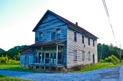 | Hamilton-Lay Store | building | 2011 | 11000084 |
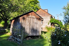 | Hamilton-Tolliver Complex | district | 2010 | 10000087 |
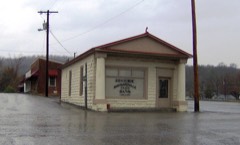 | Maynardville State Bank | building | 2001 | 01001259 |
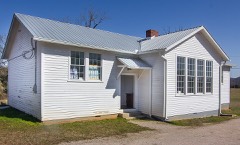 | Oak Grove School | building | 2018 | 100003161 |
 | Baite Ousley House | building | 1975 | 75001794 |
Every wildfire the federal occurrence database records inside this county: 179 of them, burning about 2,623 acres. 1 started naturally and 64 were recorded as arson. Each settlement page carries the fires within five miles of it.
| Reported cause | Fires |
|---|---|
| Debris and open burning | 83 |
| Arson/incendiarism | 64 |
| Missing data/not specified/undetermined | 21 |
| Equipment and vehicle use | 4 |
| Smoking | 2 |
| Misuse of fire by a minor | 2 |
| Power generation/transmission/distribution | 1 |
| Fireworks | 1 |
| Natural | 1 |
The five largest, by the area the report gives. Four of them were set deliberately.
| Date | Cause | Size | Reported by | Name on the report |
|---|---|---|---|---|
| 18 November 1998 | Arson/incendiarism | 200 acres | Tennessee Division of Forestry | not named |
| 18 March 2008 | Missing data/not specified/undetermined | 100 acres | Tennessee Division of Forestry | RED BUD CIRCLE |
| 5 March 2007 | Missing data/not specified/undetermined | 100 acres | Tennessee Division of Forestry | BIG RIDGE STATE PARK |
| 1 November 2000 | Arson/incendiarism | 100 acres | Tennessee Division of Forestry | not named |
| 14 March 2007 | Arson/incendiarism | 100 acres | Tennessee Division of Forestry | BIG RIDGE PARK |
| 12 November 2016 | Arson/incendiarism | 85 acres | Tennessee Division of Forestry | UNION |
| 11 April 2008 | Missing data/not specified/undetermined | 80 acres | Tennessee Division of Forestry | not named |
| 17 April 2009 | Debris and open burning | 50 acres | Tennessee Division of Forestry | HINDS CREEK |
Every settlement page carries the fires within five miles of it - see the settlement index below.
The NOAA Storm Events Database holds 214 reports for this county, causing no deaths, no injuries and about $2,785,204 in recorded property damage. Each settlement page carries the reports that name it.
| Kind of event | Reports |
|---|---|
| Thunderstorm Wind | 175 |
| Hail | 21 |
| Flood | 7 |
| Flash Flood | 6 |
| Tornado | 2 |
| Funnel Cloud | 2 |
| Lightning | 1 |
The most serious of them, by death, then injury, then recorded damage. The accounts are quoted exactly as the forecast office filed them.
| When | Event | Place named | Harm | What the report says |
|---|---|---|---|---|
| February 2011 | Flood | Alder Spgs | $1,530,000 | Flooding occurred across a large part of Union county with water covering several roads and producing damage to several county roads. |
| October 1977 | Tornado (F1) | not stated | $250,000 | no account filed |
| July 2006 | Thunderstorm Wind | Luttrell | $35,000 | no account filed |
| July 2002 | Thunderstorm Wind | Maynardville | $35,000 | no account filed |
| June 2011 | Thunderstorm Wind | Maynardville | $25,000 | Emergency management personnel reported numerous trees downed by thunderstorm wind countywide. |
| July 2006 | Thunderstorm Wind | Sharps Chapel | $25,000 | no account filed |
| January 2002 | Thunderstorm Wind | Countywide | $22,000 | Trees and power lines down. |
| October 2001 | Thunderstorm Wind | Countywide | $22,000 | Trees down and a roof blown off. |
| April 2011 | Thunderstorm Wind | Maynardville | $20,000 | Law enforcement personnel reported numerous trees and powerlines downed by thunderstorm wind countywide. |
| April 2011 | Thunderstorm Wind | Sharps Chapel | $20,000 | Amateur radio personnel reported a tree fell on trailer by thunderstorm wind in Sharps Chapel. |
| June 2009 | Thunderstorm Wind | Maynardville | $20,000 | Law enforcement officials reported four trees and many powerlines downed by thunderstorm winds countywide. A radio antenna in Maynardville was damaged by the winds. |
| April 2007 | Thunderstorm Wind | Paulette | $20,000 | Numerous trees were reported down in the vicinity of Pauletts and Luttrel. |
| July 2006 | Thunderstorm Wind | Maynardville | $20,000 | no account filed |
| July 2006 | Thunderstorm Wind | Luttrell | $20,000 | no account filed |
| May 2005 | Thunderstorm Wind | Maynardville | $20,000 | no account filed |
| July 2004 | Thunderstorm Wind | Countywide | $20,000 | no account filed |
| June 2003 | Thunderstorm Wind | Countywide | $20,000 | no account filed |
| July 1999 | Thunderstorm Wind | Countywide | $20,000 | no account filed |
| June 2005 | Thunderstorm Wind | Sharps Chapel | $18,000 | Numerous trees down into powerlines in Sharp's Chapel area. |
| June 1997 | Thunderstorm Wind | Countywide | $18,000 | Numerous trees and powerlines down throughout county. |
| July 1997 | Thunderstorm Wind | Maynardville | $17,000 | Trees and powerlines down along Pinecrest Drive, Hickory Valley Road and Headsgrove Road. |
| June 2013 | Thunderstorm Wind | Luttrell | $15,000 | Law enforcement personnel reported numerous trees downed by thunderstorm wind in the Luttrell area. |
| February 2009 | Thunderstorm Wind | Maynardville | $15,000 | Law enforcement personnel reported numerous trees downed by thunderstorm winds across the county. |
| June 2009 | Thunderstorm Wind | Maynardville | $15,000 | The newspaper reported several trees and powerlines downed by thunderstorm winds countywide. |
| August 2009 | Thunderstorm Wind | Maynardville | $15,000 | Law enforcement officials reported numerous trees downed by thunderstorm winds from Sharps Chapel to Maynardville. |
| June 2007 | Thunderstorm Wind | Paulette | $15,000 | Several trees were downed by thunderstorm winds in Paulette. |
| June 2005 | Thunderstorm Wind | Maynardville | $15,000 | Several trees down in Big Ridge State Park. |
| June 2004 | Thunderstorm Wind | Maynardville | $15,000 | Several trees and powerlines down on and along Hwy 61 |
| May 2005 | Thunderstorm Wind | Maynardville | $15,000 | no account filed |
| July 2005 | Thunderstorm Wind | Sharps Chapel | $15,000 | no account filed |
| May 2004 | Thunderstorm Wind | Maynardville | $15,000 | no account filed |
| November 2002 | Thunderstorm Wind | Maynardville | $15,000 | no account filed |
| November 2002 | Thunderstorm Wind | Sharps Chapel | $15,000 | no account filed |
| June 2002 | Thunderstorm Wind | Luttrell | $15,000 | no account filed |
| May 2000 | Thunderstorm Wind | Countywide | $15,000 | no account filed |
| June 1999 | Thunderstorm Wind | Countywide | $15,000 | no account filed |
| July 2000 | Thunderstorm Wind | New Loyston | $14,000 | no account filed |
| June 2009 | Thunderstorm Wind | Luttrell | $12,000 | Law enforcement officials reported several trees and powerlines downed by thunderstorm winds in Luttrell. |
| July 2006 | Thunderstorm Wind | Paulette | $12,000 | no account filed |
| May 2005 | Thunderstorm Wind | Maynardville | $12,000 | no account filed |
| May 2004 | Thunderstorm Wind | Luttrell | $12,000 | no account filed |
| July 2004 | Thunderstorm Wind | Luttrell | $12,000 | no account filed |
| May 2003 | Thunderstorm Wind | Maynardville | $12,000 | no account filed |
| May 2002 | Thunderstorm Wind | Maynardville | $12,000 | no account filed |
| April 2015 | Thunderstorm Wind | Maynardville | $10,000 | Dispatch personnel reported a few trees and powerlines downed by thunderstorm wind across the county. |
| June 2014 | Thunderstorm Wind | Maynardville | $10,000 | Law enforcement personnel reported many trees downed by thunderstorms wind countywide. |
| April 2011 | Thunderstorm Wind | Sharps Chapel | $10,000 | Law enforcement personnel reported numerous trees downed by thunderstorm wind in Sharps Chapel. |
| June 2007 | Thunderstorm Wind | Maynardville | $10,000 | A few trees were downed by thunderstorm winds in Maynardville. |
| April 2006 | Thunderstorm Wind | Countywide | $10,000 | Several trees down countywide. |
| April 2006 | Thunderstorm Wind | Maynardville | $10,000 | Several trees down in Maynardville. |
| April 2006 | Thunderstorm Wind | Countywide | $10,000 | A few trees down countywide. |
| October 2006 | Thunderstorm Wind | Maynardville | $10,000 | A few trees and powerlines down countywide. |
| May 1995 | Thunderstorm Wind | Maynardville | $10,000 | Numerous trees were blown down. |
| January 2006 | Thunderstorm Wind | Maynardville | $10,000 | no account filed |
| April 2014 | Thunderstorm Wind | Maynardville | $8,000 | Law enforcement personnel reported several trees downed by thunderstorm wind countywide. |
| May 2004 | Thunderstorm Wind | Luttrell | $8,000 | no account filed |
| May 2000 | Thunderstorm Wind | Luttrell | $7,000 | no account filed |
| April 2006 | Thunderstorm Wind | Maynardville | $6,000 | A few trees down in Chuck Swan Forest |
| July 2006 | Thunderstorm Wind | Maynardville | $6,000 | no account filed |
| May 2003 | Thunderstorm Wind | Maynardville | $6,000 | no account filed |
The Survey's mineral resources record lists 67 workings inside this county. 10 still produce and 57 are closed or unrecorded. Each settlement page carries the workings within five miles of it.
| Commodity | Workings |
|---|---|
| Zinc | 15 |
| Stone, Crushed/Broken | 7 |
| Lead | 6 |
| Iron | 5 |
| Zinc, Lead | 4 |
| Limestone, General | 4 |
| Barium-Barite | 3 |
| Zinc, Iron | 3 |
| Marble, Dimension | 3 |
| Lead, Zinc, Iron | 2 |
| Cadmium | 2 |
| Iron, Zinc | 2 |
| Lead, Zinc | 2 |
| Zinc, Lead, Iron | 2 |
The least common of them first, because a county's hundredth gravel pit says nothing its first ten did not.
| Where | Site | Commodity | Status | Recorded |
|---|---|---|---|---|
| Bill George Quarry | Stone, Crushed/Broken, Limestone, General | Producer | 1969 | |
| Cox Prospects Mine | Zinc, Lead, Iron, Cadmium | Past Producer | Calamine, Cerussite, Galena, Greenockite, Limonite, Pyrite, Smithsonite, Sphalerite | |
| Eastern H. M. Graves | Sulfur-Pyrite, Lead, Zinc | Prospect | ||
| Hickory Valley Quarry | Stone | Past Producer | ||
| Lost Creek Barite Mine | Barium-Barite, Zinc, Sulfur-Pyrite, Lead, Iron | Past Producer | 1935, 1938 | |
| Lost Creek Barite Mine | Barium-Barite, Iron, Lead, Sulfur, Zinc | Past Producer | ||
| New Prospect | Copper, Lead, Zinc | Past Producer | ||
| Russell Prospect Mine | Zinc, Iron, Lead | Past Producer | Galena, Limonite, Smithsonite | |
| Shofner Prospect Northeast | Zinc, Iron, Lead | Occurrence | Galena, Pyrite, Smithsonite, Sphalerite | |
| Southwest Shofner | Sulfur-Pyrite, Zinc | Prospect | ||
| Woods | Lead, Sulfur-Pyrite | Prospect | ||
| Woods Prospect | Lead, Iron | Occurrence | Galena, Pyrite | |
| Braden Prospect Western | Lead, Zinc | Occurrence | Galena, Smithsonite, Sphalerite | |
| Cox #2 | Cadmium, Zinc, Lead, Iron | Prospect | ||
| Cox #3 | Lead, Zinc | Prospect | ||
| Graves Prospects | Zinc, Lead, Iron | Occurrence | Galena, Pyrite, Sphalerite | |
| Luttrell Plant | Calcium | Producer | ||
| New Prospect Mine | Zinc, Lead, Cadmium | Past Producer | 1869, 1883 | |
| Northeast Shofner | Lead, Sulfur-Pyrite, Zinc | Prospect | ||
| Russell | Lead, Zinc, Iron | Past Producer | ||
| Shofner Prospect Southwest | Iron, Zinc | Occurrence | Pyrite | |
| Southern D. F. Tolliver | Lead, Sulfur-Pyrite, Zinc | Prospect | ||
| Stiner Prospects | Iron, Zinc | Occurrence | Limonite, Sphalerite | |
| Tenn-Luttrell Mining Co. Plant | Calcium | Producer | ||
| Tolliver South Prospect | Lead, Zinc, Iron | Occurrence | Galena, Pyrite, Sphalerite | |
| Lost Creek Barite | Barium-Barite | Past Producer | Residual | |
| Luttrell Marble Quarry | Marble, Dimension | Producer | Metamorphic | |
| Luttrell Marble Quarry | Marble, Dimension | Producer | ||
| Republic Quarry | Marble, Dimension, Stone, Crushed/Broken | Past Producer | ||
| Rouse | Zinc, Iron | Prospect | ||
| Rouse Prospect | Zinc, Iron | Occurrence | Limonite, Sphalerite | |
| Stiner | Zinc, Iron | Prospect | ||
| Caldwell | Zinc, Lead | Past Producer | ||
| Caldwell Mine | Zinc, Lead | Past Producer | Galena, Sphalerite | |
| Cox #1 | Zinc, Lead | Prospect | ||
| Harry Hollow Quarry | Limestone, General | Past Producer | Sedimentary | |
| Luttrell Quarry | Limestone, General | Past Producer | Sedimentary | |
| Luttrell Underground Mine | Limestone, General | Producer | ||
| Welch Quarry | Limestone, General | Past Producer | Sedimentary | |
| Western Braden | Zinc, Lead | Prospect | ||
| Eastern Williams Prospect | Iron | Occurrence | ||
| Western Williams Prospect | Iron | Occurrence | ||
| Williams Eastern Prospect | Iron | Occurrence | Limonite | |
| Williams Western Prospect | Iron | Occurrence | Limonite | |
| Wilson Prospect | Iron, Zinc | Prospect | ||
| Evans | Lead | Prospect | ||
| Evans Prospect | Lead | Occurrence | Galena | |
| Shofner-Weaver | Lead | Prospect | ||
| Shofner-Weaver Prospect | Lead | Occurrence | Galena | |
| Western H. M. Graves | Lead | Prospect | ||
| Bill George | Stone, Crushed/Broken | Producer | ||
| Harry Hollow Quarry | Stone, Crushed/Broken | Producer | ||
| Hickory Valley Quarry | Stone, Crushed/Broken | Past Producer | 1967 | |
| Luttrell #3 Underground Mine | Stone, Crushed/Broken | Producer | ||
| Luttrell Quarry | Stone, Crushed/Broken | Producer | ||
| Welch Quarry | Stone, Crushed/Broken | Past Producer | ||
| Beeler | Zinc | Prospect | ||
| Beeler Prospect | Zinc | Occurrence | Smithsonite | |
| Bowen | Zinc | Unknown | ||
| Bowen Occurrence | Zinc | Occurrence | Sphalerite | |
| Braden Prospect Eastern | Zinc | Occurrence | Sphalerite | |
| Dees | Zinc | Prospect | ||
| Dees Prospect | Zinc | Occurrence | Sphalerite | |
| Eastern Braden | Zinc | Prospect | ||
| J. W. Taylor | Zinc | Prospect | ||
| J. W. Taylor Prospect | Zinc | Occurrence | Sphalerite | |
| Unnamed | Zinc | Unknown |
Named settlements recorded in the Geographic Names Information System, each with the topographic sheets covering it. Villages, hamlets and abandoned places alike. Each is shown with the nearest named watercourse or landform and the survey quadrangle it falls on.
District 2 · 37779 · On Woods Gap Branch · Luttrell quadrangle
17 sheets, 1897 to 1981
No longer a settlement
District 3 · 37807 · Near Grose Hollow · Maynardville quadrangle
16 sheets, 1897 to 1981
District 4 · 37807 · On Dry Buffalo Branch · Big Ridge Park quadrangle
16 sheets, 1897 to 1981
No longer a settlement
District 4 · 37705 · On Cavespring Branch · Big Ridge Park quadrangle
16 sheets, 1897 to 1981
No longer a settlement
District 5 · 37866 · Near Lay Hollow · Maynardville quadrangle
16 sheets, 1897 to 1981
No longer a settlement
District 3 · 37807 · On Flint Creek · Powder Springs quadrangle
16 sheets, 1897 to 1981
No longer a settlement
District 4 · 37705 · On Cavespring Branch · Big Ridge Park quadrangle
16 sheets, 1897 to 1981
District 4 · 37807 · Near Hurricane Hollow · Maynardville quadrangle
16 sheets, 1897 to 1981
No longer a settlement
District 5 · 37866 · Near Edwards Hollow · Maynardville quadrangle
16 sheets, 1897 to 1981
District 5 · 37866 · Near Roger Hollow · Well Spring quadrangle
17 sheets, 1897 to 1981
No longer a settlement
District 5 · 37866 · Near Rocky Hollow · Maynardville quadrangle
16 sheets, 1897 to 1981
No longer a settlement
District 5 · 37866 · On White Creek · White Hollow quadrangle
17 sheets, 1897 to 1981
No longer a settlement
District 4 · 37807 · Near Pilot Island · White Hollow quadrangle
17 sheets, 1897 to 1981
No longer a settlement
District 1 · 37807 · Near Arick Hollow · Maynardville quadrangle
16 sheets, 1897 to 1981
District 5 · 37866 · Near Brantley Hollow · White Hollow quadrangle
17 sheets, 1897 to 1981
District 4 · 37705 · On Dry Buffalo Branch · Big Ridge Park quadrangle
16 sheets, 1897 to 1981
District 5 · 37866 · On Straight Branch · Ausmus quadrangle
17 sheets, 1897 to 1981
No longer a settlement
District 6 · 37807 · Near Possum Valley · Big Ridge Park quadrangle
16 sheets, 1897 to 1981
District 3 · 37888 · Near Black Fox Hollow · Powder Springs quadrangle
16 sheets, 1897 to 1981
District 5 · 37870 · Near Blue Spring Hollow · Well Spring quadrangle
17 sheets, 1897 to 1981
No longer a settlement
District 7 · 37779 · On North Fork Bullrun Creek · Graveston quadrangle
18 sheets, 1897 to 1981
District 1 · 37807 · Near Beeler Hollow · Graveston quadrangle
18 sheets, 1897 to 1981
District 5 · 37866 · Near Long Hollow · White Hollow quadrangle
17 sheets, 1897 to 1981
No longer a settlement
District 5 · 37866 · Near Lamb Hollow · White Hollow quadrangle
17 sheets, 1897 to 1981
No longer a settlement
District 4 · 37705 · Near Blue Mud Valley · Big Ridge Park quadrangle
16 sheets, 1897 to 1981
District 5 · Near Bridges Hollow · White Hollow quadrangle
17 sheets, 1897 to 1981
No longer a settlement
District 5 · 37866 · On Hunting Creek · Maynardville quadrangle
16 sheets, 1897 to 1981
District 5 · 37866 · Near Dollar Island · White Hollow quadrangle
17 sheets, 1897 to 1981
No longer a settlement
District 5 · 37866 · On Leadmine Bend Creek · Ausmus quadrangle
17 sheets, 1897 to 1981
No longer a settlement
District 4 · 37807 · On Dry Buffalo Branch · Big Ridge Park quadrangle
16 sheets, 1897 to 1981
District 5 · 37866 · Near Russell Ridge · Maynardville quadrangle
16 sheets, 1897 to 1981
District 7 · 37721 · On North Fork Bullrun Creek · Graveston quadrangle
18 sheets, 1897 to 1981
No longer a settlement
The vanished settlements of Union County: the places named above that are no longer on the map.