 Block
From the record
20 National Register listings published here.
Sources: the National Register database, National Park Service
61 topographic sheets cover 63 settlements here, and 20 properties are on the National Register of Historic Places.
20 National Register listings published here.
Sources: the National Register database, National Park Service
Every property in this county listed on the National Register of Historic Places, with the year it was listed and the federal nomination document.
| Photograph | Property | Type | Listed | Reference |
|---|---|---|---|---|
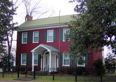 | Black House | building | 1983 | 83004310 |
| City Cemetery | site | 2002 | 02001377 | |
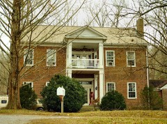 | Falconhurst | building | 1982 | 82004062 |
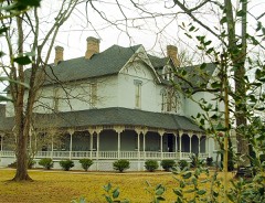 | Clay Faulkner House | building | 1992 | 92000137 |
 | First Methodist Church | building | 2002 | 02001341 |
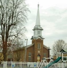 | First Presbyterian Church | building | 1995 | 95001061 |
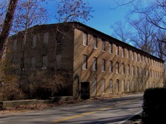 | Great Falls Cotton Mill | building | 1982 | 82004063 |
 | William H. and Edgar Magness Community House and Library | building | 1993 | 93001177 |
| Martin-Miller Farm | district | 2005 | 05000727 | |
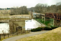 | McMinnville Hydroelectric Station | structure | 1990 | 90000307 |
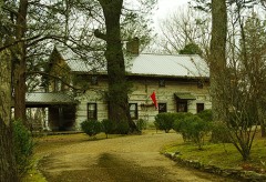 | My Grandfather's House | building | 1985 | 85000702 |
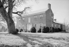 | Northcutt Plantation | building | 1975 | 75001795 |
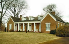 | Oakham | building | 1983 | 83003072 |
 | Philadelphia Church of Christ | building | 1988 | 88002537 |
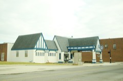 | Spring Street Service Station | building | 2001 | 01001263 |
 | Stone-Pennebaker House | building | 1988 | 88002648 |
 | US Post Office-Main | building | 1985 | 85003089 |
 | Edgar Walling House | building | 1996 | 96000749 |
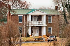 | Joseph Daniel Walling House | building | 1980 | 80003877 |
| Webb Hotel | building | 2020 | 100005145 |
Every wildfire the federal occurrence database records inside this county: 162 of them, burning about 930 acres. 1 started naturally and 40 were recorded as arson. Each settlement page carries the fires within five miles of it.
| Reported cause | Fires |
|---|---|
| Debris and open burning | 88 |
| Arson/incendiarism | 40 |
| Missing data/not specified/undetermined | 12 |
| Equipment and vehicle use | 11 |
| Recreation and ceremony | 3 |
| Smoking | 3 |
| Power generation/transmission/distribution | 2 |
| Other causes | 1 |
| Misuse of fire by a minor | 1 |
| Natural | 1 |
The five largest, by the area the report gives. Four of them were set deliberately.
| Date | Cause | Size | Reported by | Name on the report |
|---|---|---|---|---|
| 21 April 2018 | Missing data/not specified/undetermined | 80 acres | Tennessee Division of Forestry | STONER MTN FIRE |
| 30 November 2012 | Arson/incendiarism | 62 acres | Tennessee Division of Forestry | MT. ZION |
| 25 September 2019 | Equipment and vehicle use | 47 acres | Tennessee Division of Forestry | MATHIS FIRE |
| 18 October 2016 | Equipment and vehicle use | 39 acres | Tennessee Division of Forestry | DANIEL FIRE |
| 30 October 1998 | Arson/incendiarism | 34 acres | Tennessee Division of Forestry | not named |
| 7 March 2002 | Debris and open burning | 32 acres | Tennessee Division of Forestry | not named |
| 17 September 1999 | Arson/incendiarism | 32 acres | Tennessee Division of Forestry | not named |
| 27 January 1999 | Arson/incendiarism | 28 acres | Tennessee Division of Forestry | not named |
Every settlement page carries the fires within five miles of it - see the settlement index below.
The NOAA Storm Events Database holds 265 reports for this county, causing 4 deaths, 8 injuries and about $6,209,410 in recorded property damage. Each settlement page carries the reports that name it.
| Kind of event | Reports |
|---|---|
| Thunderstorm Wind | 170 |
| Hail | 53 |
| Flash Flood | 20 |
| Tornado | 19 |
| Lightning | 1 |
| Heavy Rain | 1 |
| Flood | 1 |
The most serious of them, by death, then injury, then recorded damage. The accounts are quoted exactly as the forecast office filed them.
| When | Event | Place named | Harm | What the report says |
|---|---|---|---|---|
| April 2006 | Tornado (F1) | Mc Minnville | 2 killed, $500,000 | F1 tornado killed 2 people in a mobile home on Foster Rd. A 53 year-old woman was caring for an eldery male friend who also died in the mobile home. He was 81 years-old. She worked at the Federal Mogul plant in Smithville.Shingles were off roofs. Large trees were snapped, uprooted, or blown down. This tornado touched down on Lance Road, near Blue Hill Road. There was damage to a large barn, and shingles were torn off a portion of the roof. The tornado continued along a path due east where it crossed Highway 56 and Highway 287. Damage was noted on this path. |
| April 1974 | Tornado (F2) | not stated | 1 killed, 1 hurt, $250,000 | no account filed |
| April 2006 | Tornado (F1) | Mc Minnville | 1 killed, $100,000 | A second F1 tornado hit Warren County almost two hours later from the first tornado. The tornado touched down near Morrison, TN along Caney Branch Road. This storm complex came out of Coffee County. There was extensive damage to a barn. A cinder block building was badly damaged. Numerous trees were down. The third fatality in Warren County occuured in a trailer home on Bonner Road to a 48 year-old female nurse. The trailer was destroyed. The tornado continued slightly south of east in the Country Club Subdivision. Several houses had roof damage, outbuildings were destroyed and a wooden shed was on its side. Three Weather Channel reporters were arrested for trespassing for being on the property where this fatality occurred. |
| April 2017 | Tornado (EF1) | Irving College | 1 hurt, $50,000 | A fast-moving weak tornado, which was widely viewed and documented on video by numerous residents, touched down in the Irving College area of southeast Warren County about 7 miles southeast of McMinnville. Damage began on Smith Hollow Road where a barn was heavily damaged and several trees were snapped. Another barn was damaged and more trees blown down on Northcutt Cove Road, and one dozen gravestones were blown over and trees blown down at a cemetery between Northcutt Cove Road and Maude Etter Road. Large trees were blown down on Dry Creek Road where one fell onto and heavily damaged a home. The most concentrated damage was around the intersection of Highway 56 and Chapel Hill Drive, where a mobile home was destroyed injuring a woman inside, an outbuilding was destroyed, part of the roof was blown off a home, and several trees and power poles were blown down. The tornado blew down some more trees on Hill Road before lifting near the Collins River. This survey was aided by the Warren County Emergency Management Agency and Warren County 911 Center. |
| March 2017 | Thunderstorm Wind | Green Hill | 1 hurt, $25,000 | A storm survey by Warren County Emergency Management along with Google Earth high resolution satellite imagery indicated a small but severe 0.6 mile long by 150 yard wide microburst struck far northern Warren County just south of the DeKalb County line. A few trees were blown down towards the east-northeast to the west of Highway 56 south of Meridian Drive. A home east of Highway 56 south of Gene Vaughn Road suffered severe wind damage, with the front porch and much of the roof blown off. One person inside the home was injured. Debris from the home was blown into fields over 250 yards to the east and northeast. In the backyard of the home, an outbuilding was destroyed, a greenhouse heavily damaged, the roof was blown off a chicken coop, and a barn lost some roof panels. Several trees were also snapped in the yard. No other damage was noted to the north, south, or east of the home. Winds were estimated up to 95 mph. |
| April 1974 | Tornado (F1) | not stated | 1 hurt, $25,000 | no account filed |
| March 1965 | Tornado (F1) | not stated | 1 hurt, $25,000 | no account filed |
| March 2003 | Tornado (F1) | Mc Minnville | 1 hurt, $10,000 | One trailer was destroyed at the junction of Hwy 70 and Hwy 30. One person was injured in the trailer. Trees were down, barns and sheds were destroyed. There was damage to the Stanley Hillis Trucking Company building. The building was located at 5493 Sparta Highway in Rock Island. This storm complex moved into White county and spawned a tornado. |
| May 2002 | Thunderstorm Wind | Mc Minnville | 1 hurt | Law enforcement reported one home with major damage, 2 homes with minor damage, one mobile home destroyed, 4 mobile homes with major damage. Numerous trees were blown down. A 24 year old male was injured by falling debris. |
| July 2002 | Lightning | Rock Is | 1 hurt | A 9 year-old boy was struck by lightning while coming out of the water at Rock Island State Park. He stopped breathing, and his father administered CPR and revived his son. The boy was hospitalized with some burns, and then released. |
| April 2008 | Tornado (EF1) | Mc Minnville | $1,100,000 | The tornado damaged dozens of homes, including a few with major damage. The tornado demolished at least 2 barns. Trees were snapped and uprooted.||A newspaper article stated that 3 homes were completely destroyed, 5 homes were severely damaged, and 50 to 60 homes had some damage. |
| February 2019 | Flash Flood | Morrison | $541,180 | Warren County 911 Center reported numerous roads were flooded and closed across the county, including Barry Knight Road at Charles Creek, the 700 block of Brown|Prater Road, Wheeler Road, Dark Hollow Road, Robert Wilson Road, Old Morrison Road at Pepper Branch Road. A water rescue of people from a horse-carriage was conducted at the flooded intersection of Ivy Bluff Trail at Pettigap Road. |
| May 2024 | Thunderstorm Wind | Hiawasee | $500,000 | A NWS storm survey team found more straight line wind damage in Morrison with estimated peak winds of 80 mph. Numerous trees in and around Morrison were snapped or uprooted. Structural damage was found as well with barns and other outbuildings suffering roofing damage. Damages are a rough estimate. |
| January 2002 | Flash Flood | Countywide | $250,000 | 911 center reported several roads still closed. Streams and creeks were out of their banks. 10 homes, 2 trailers and 3 utilities were damaged. 12 bridges and 20 roads were closed. 15 people had to be evacuated. Damage estimate was $250,000. |
| April 1996 | Thunderstorm Wind | Countywide | $250,000 | no account filed |
| March 1963 | Tornado (F2) | not stated | $250,000 | no account filed |
| March 1961 | Tornado (F3) | not stated | $250,000 | no account filed |
| March 2002 | Flash Flood | Countywide | $201,000 | 911 center reported several roads closed due to high water. EMA director estimated damage to roads at $201K. |
| August 2023 | Thunderstorm Wind | Crisp Spg | $200,000 | A combination of sentinel satellite imagery, drone video, and damage photos indicate a small but intense 250-500 yards wide microburst caused significant damage from Hollow Springs Road in Cannon County to Pedigap Road in Warren County. The metal roof of a barn-style home at 5990 Hollow Springs Road was partially blown off and the home was shifted slightly off its foundation, causing $100,000 in wind and water damage. Winds were estimated up to 75 mph in this area. Further to the east, a video of the microburst was taken at an automotive business on Jim Cummings Hwy, where winds were also estimated up to 75 mph. Major tree damage occurred from north of McMahan Rd to north of Pedigap Rd, with dozens of trees snapped and uprooted. A silo on Parker Rd was also destroyed and a barn on Pedigap Rd was heavily damaged. Winds were estimated up to 90 mph in this area. About 60 reports of traffic hazards were received with numerous power outages throughout the county. Damages are a rough estimate. |
| May 2020 | Thunderstorm Wind | Mc Minnville | $152,980 | Numerous trees and power lines were blown down across Warren County. |
| April 2011 | Tornado (EF1) | Vervilla | $100,000 | An EF1 tornado with maximum winds 105 to 110 mph affected Warren County beginning around 650 am. Damage began northwest of Viola on State Highway 287. The damage path then followed State Highway 108. The last evidence of damage was approximately 3 miles southeast of McMinnville. |
| July 2009 | Tornado (EF1) | Goodbars | $100,000 | A barn, grain silo, and several buildings were destroyed. A residence suffered minor roof damage. |
| December 2025 | Thunderstorm Wind | Morrison | $50,000 | A swath of damaging wind occurred across portions of Warren County on the evening of December 18th. Damage was sporadic across the area, consisting of trees and tree branches down, some broken power powers, several sheds blown over at a local business, and|several other farm outbuildings with metal roofing peeled off by the wind. There were also a few trees that fell on either houses, farm outbuildings, or sheds. Winds were generally 60-70 mph,|though a few areas likely reached 80 mph. Damages are a rough estimate. |
| May 2024 | Thunderstorm Wind | Morrison | $50,000 | A NWS storm survey team found more straight line wind damage in Morrison with estimated peak winds of 80 mph. Numerous trees in and around Morrison were snapped or uprooted. Structural damage was found as well with barns and other outbuildings suffering roofing damage. Damages are a rough estimate. |
| July 2023 | Thunderstorm Wind | Vervilla | $50,000 | Severe thunderstorm winds destroyed a barn and uprooted numerous trees along McClain Road in Morrison. Damages are a rough estimate. |
| August 2023 | Thunderstorm Wind | Dibrell | $50,000 | Severe thunderstorm winds caused a tree to fall on a house in the 1300 Block of Mike Muncy Road near McMinnville. The house sustained heavy structural damage, but no injuries were reported. Damages are a rough estimate. |
| April 2015 | Thunderstorm Wind | Shady Rest | $50,000 | The apex of a large bow echo caused significant wind damage on the northeast side of McMinnville. The roof of the Sparta Road Vet Clinic was blown off, and the nearby H&H Auction Building warehouse at 3897 Sparta Highway was destroyed. Numerous trees were blown down on Shady Rest Road. |
| January 2010 | Flash Flood | Oakland | $50,000 | Highway department reported some flooded roads in McMinnville. Newspaper reported that roads in the Morrison and Viola area as well as Turner's Bend, Wheeler, Swann Mill, Sullivan, and Fisher Roads, and also various low-lying areas, also experienced flooding. |
| June 2009 | Thunderstorm Wind | Mc Minnville | $50,000 | Trees were reported down county wide. Newspaper reported that in McMinnville a residence on Boyd Street suffered damage when a large tree split in two. Extent of damage to residence was unknown. There was also damage on Rebel Hill Street where a tree fell on electrical lines and knocked out power. |
| June 2005 | Thunderstorm Wind | Mc Minnville | $50,000 | Roof/Structural damage reported. Newspaper article stated a metal roof was blown off Spring Street Motors dealership. The metal roof landed on several cars on the lot. Also, a few shingles were lost from the roof of City Hall in McMinnville. |
| May 1998 | Thunderstorm Wind | Irving College | $50,000 | Trees were blown down. Newspaper article mentions a roof was blown off a restaurant in the Harrison Ferry Mountain area of Warren county. Some of the rafters came from a barn built in 1860. A large portion of the roof fell onto some cars in the parking lot. |
| April 1996 | Thunderstorm Wind | Mt Zion | $50,000 | no account filed |
| February 1997 | Thunderstorm Wind | Mc Minnville | $40,000 | no account filed |
| April 2009 | Thunderstorm Wind | Mt Leo | $30,000 | Large garage was destroyed behind home in Mt. Leo. |
| April 2008 | Thunderstorm Wind | Yager | $30,000 | Numerous large trees, with diameters of 14 to 18 inches, and power lines were down. Two houses and a church had roof damage near U.S Highway 70S and C Rody Rd. |
| May 2024 | Thunderstorm Wind | Mc Minnville | $25,000 | Severe thunderstorm winds downed trees on Rivermont Drive and blew shingles off of roofs. Damages are a rough estimate. |
| July 2023 | Thunderstorm Wind | Mt Leo | $25,000 | Severe thunderstorm winds tore the roof off Meeks Tire Company along Elm Street in McMinnville. Damages are a rough estimate. |
| July 2022 | Thunderstorm Wind | Mc Minnville | $25,000 | Warren County 911 relayed 16 reports of trees and power lines down in and around McMinnville. One power line fell and caused fire damage to the roofs of two homes on Winston Street at Rebel Hill Street. |
| March 2017 | Thunderstorm Wind | Mc Minnville | $25,000 | Warren County Emergency Management reported widespread wind damage in and around McMinnville. The roof was blown off a building at the corner of Lyon and Sparta Streets, and a trained spotter reported roof and siding damage to his home. in the 200 block of Bonner Street. A home in the 200 block of Sparta Street also suffered roof damage. Trees fell on houses at 4113 Old Nashville Highway, 211 Westwood Drive, and Cascade Avenue. A tree also fell onto three vehicles at 105 Whiteoak Drive. Numerous trees and power lines were blown down in other areas with several roadways blocked. |
| July 2012 | Thunderstorm Wind | Mc Minnville | $25,000 | Trees were downed across the county. |
| July 2012 | Thunderstorm Wind | Mc Minnville Arpt Fl | $25,000 | Numerous trees and power lines were downed in Centertown, Newtown, and around the Warren County Airport. |
| September 2009 | Tornado (EF0) | Mc Minnville Arpt Fl | $25,000 | Large trees were snapped and uprooted. Roof damage was reported to a trailer and a car wash. Siding was peeled back off homes on Laws Road. |
| October 2009 | Thunderstorm Wind | Mc Minnville | $25,000 | Trees were downed in McMinnville. |
| January 1953 | Tornado (F2) | not stated | $25,000 | no account filed |
| February 1952 | Tornado (F2) | not stated | $25,000 | no account filed |
| August 2023 | Thunderstorm Wind | Irving College | $20,000 | Severe thunderstorm winds downed a tree and destroyed a shed in Irving College. Damages are a rough estimate. |
| June 2019 | Thunderstorm Wind | Oakland | $20,000 | Public reported 18 trees blown down around their home at 499 Peach Avenue southwest of McMinnville. |
| July 2018 | Thunderstorm Wind | Mc Minnville | $20,000 | The Southern Standard newspaper reported numerous trees were blown down all across Warren County with some trees falling on houses. |
| June 2014 | Thunderstorm Wind | Gath | $16,000 | Sixteen trees were blown down across northern Warren County. |
| May 2024 | Thunderstorm Wind | Centertown | $15,000 | Uprooted trees were reported south of Centertown. Damages are a rough estimate. |
| August 2023 | Thunderstorm Wind | Mc Minnville Arpt Fl | $15,000 | Severe thunderstorm winds blew the roof off of a barn on Castle Street near Senator Jerry Cooper Highway just northwest of McMinnville. No injuries were reported. Damages are a rough estimate. |
| July 2016 | Thunderstorm Wind | Faulkner Spgs | $15,000 | Reports and photos from the Southern Standard newspaper indicated a 1 mile wide by 1.5 mile long microburst struck parts of northern McMinnville. A strip mall awning was blown down in the Plaza Shopping Center on Smithville Highway at Bobby Ray Memorial Highway. Numerous trees and power lines were also blown down on Couch Street, Mullican Street, Chapel Drive, West Sparta Street and near Warren County Middle School. Trees fell on two homes on West Sparta Street and another home on Chapel Drive, while a tree fell and crushed a fence on Cherry Lane. Winds were estimated up to 65 mph. |
| April 2011 | Thunderstorm Wind | Viola | $15,000 | Numerous trees were downed near Viola. |
| April 2000 | Thunderstorm Wind | Mt Zion | $15,000 | A home lost its roof and sustained some structural damage at Mt. Zion Road and Toogoodoo Lane. Debris from the home was scattered about 1/4 mile away. There were also reports of downed trees and power lines from the Viola area to Irving College, again mainly in the southern part of the county. |
| March 2025 | Thunderstorm Wind | Mc Minnville | $10,000 | Severe thunderstorm winds downed numerous trees in the McMinnville area. Damages are a rough estimate. |
| July 2023 | Thunderstorm Wind | Trousdale | $10,000 | Severe thunderstorm winds destroyed a shed off of Shelbyville Road near Trousdale Church west of McMinnville. Damages are a rough estimate. |
| August 2023 | Thunderstorm Wind | Bethany | $10,000 | Severe thunderstorm winds downed multiple trees at Crisp Springs Road and Highway 70 in McMinnville. Damages are a rough estimate. |
| March 2020 | Thunderstorm Wind | Centertown | $10,000 | Trees were blown down in the Hidden Valley neighborhood of Centertown including one tree that fell onto two cars. |
| February 2020 | Tornado (EF0) | Bates Hill | $10,000 | This EF-0 tornado touched down on West Green Hill Road where it snapped a few trees. It continued east-northeast where trees snapped on top of a mobile home on Pigeon Hill Road. A house on Short Mountain Road received minor damage to the front porch and garage. A barn was completely destroyed on Womack Road. Numerous trees were uprooted and snapped along the path before finally lifting near Gath Lucky Road. |
| June 2019 | Thunderstorm Wind | Daylight | $10,000 | The roof of a shop was blown off to the west over a home and landed in the road at 1712 Bethany Road. Several trees were also blown down nearby at 1318 Bethany Road. |
The Survey's mineral resources record lists 12 workings inside this county. 4 still produce and 8 are closed or unrecorded. Each settlement page carries the workings within five miles of it.
| Commodity | Workings |
|---|---|
| Stone, Crushed/Broken | 3 |
| Limestone, Dimension | 3 |
| Stone, Crushed/Broken, Limestone, General | 2 |
| Oil Shale, Uranium | 1 |
| Limestone, General | 1 |
| Strontium | 1 |
| Uranium | 1 |
| Oil Shale | 1 |
The least common of them first, because a county's hundredth gravel pit says nothing its first ten did not.
| Where | Site | Commodity | Status | Recorded |
|---|---|---|---|---|
| Elkins Estate Celestite Prospect | Strontium | Prospect | ||
| Outcrop Sample For Uranium | Oil Shale, Uranium | Occurrence | ||
| Outcrop Sample For Uranium | Uranium, Oil Shale | Occurrence | ||
| Warren Limestone Company Quarry | Limestone, General | Past Producer | Sedimentary | |
| Mcminnville Quarry | Stone, Crushed/Broken, Limestone, General | Producer | Limestone | |
| Mcminnville Stone Co. Quarry | Stone, Crushed/Broken, Limestone, General | Producer | Limestone | |
| Limestone Quarry | Limestone, Dimension | Past Producer | ||
| Limestone Quarry | Limestone, Dimension | Past Producer | ||
| Limestone Quarry | Limestone, Dimension | Past Producer | ||
| Mcminnville Quarry Mill | Stone, Crushed/Broken | Producer | ||
| Mcminnville Stone Co. Quarry | Stone, Crushed/Broken | Producer | ||
| Warren Limestone Company Quarry | Stone, Crushed/Broken | Past Producer |
Named settlements recorded in the Geographic Names Information System, each with the topographic sheets covering it. Villages, hamlets and abandoned places alike. Each is shown with the nearest named watercourse or landform and the survey quadrangle it falls on.
District 11 · 37166 · On Bluff Springs Branch · Dibrell quadrangle
18 sheets, 1893 to 1981
District 8 · 37110 · Near Laurel Creek Gulch · Curtistown quadrangle
17 sheets, 1893 to 1981
District 8 · 37110 · On McGregor Creek · Cardwell Mountain quadrangle
19 sheets, 1893 to 1981
District 4 · 37110 · On Bybee Branch · McMinnville quadrangle
19 sheets, 1893 to 1981
District 7 · 38581 · Near Turkeyscratch Mountain · Welchland quadrangle
16 sheets, 1893 to 1981
District 11 · 37110 · Near Cope Mountain · Campaign quadrangle
20 sheets, 1893 to 1981
District 7 · 37110 · On Cane Hollow Branch · Cardwell Mountain quadrangle
19 sheets, 1893 to 1981
No longer a settlement
District 9 · 37357 · On Keel Branch · Morrison quadrangle
19 sheets, 1893 to 1981
No longer a settlement
District 7 · 38581 · Near Turkeyscratch Mountain · Welchland quadrangle
16 sheets, 1893 to 1981
No longer a settlement
District 11 · 38581 · On Barton Creek · Campaign quadrangle
20 sheets, 1893 to 1981
No longer a settlement
District 8 · 37110 · Near Hughes Cove · Irving College quadrangle
18 sheets, 1893 to 1981
District 10 · 37110 · On North Prong Barren Fork · Centertown quadrangle
21 sheets, 1893 to 1981
No longer a settlement
District 3 · 37357 · On Owen Branch · Centertown quadrangle
21 sheets, 1893 to 1981
No longer a settlement
District 7 · 37110 · On Charles Creek · Cardwell Mountain quadrangle
19 sheets, 1893 to 1981
District 8 · 37110 · On Rams Creek · Cardwell Mountain quadrangle
19 sheets, 1893 to 1981
District 8 · 37110 · On McGregor Creek · Cardwell Mountain quadrangle
19 sheets, 1893 to 1981
District 8 · 37110 · Near Stepp Knob · Irving College quadrangle
18 sheets, 1893 to 1981
District 7 · 37110 · Near Grassy Mountain · Cardwell Mountain quadrangle
19 sheets, 1893 to 1981
District 3 · 37110 · On Peppers Creek · McMinnville quadrangle
19 sheets, 1893 to 1981
District 12 · 37110 · On Hickory Grove Branch · McMinnville quadrangle
19 sheets, 1893 to 1981
The vanished settlements of Warren County: the places named above that are no longer on the map.