Block
From the record
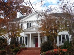
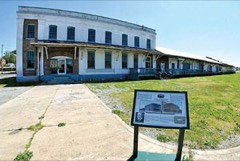
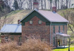
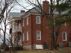
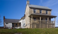
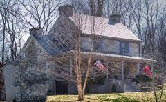
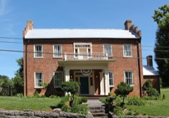
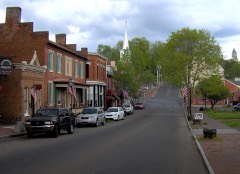
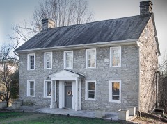
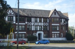
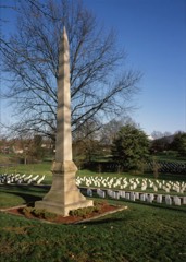
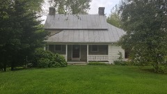
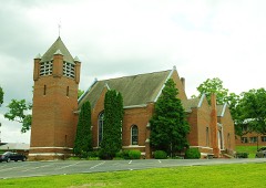
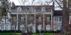
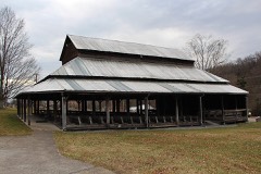
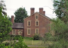
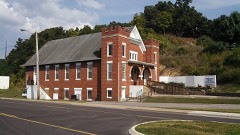
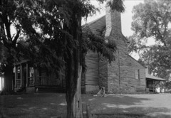
35 National Register listings published here.
Sources: the National Register database, National Park Service
93 topographic sheets cover 199 settlements here, and 35 properties are on the National Register of Historic Places.
35 National Register listings published here.
Sources: the National Register database, National Park Service
Every property in this county listed on the National Register of Historic Places, with the year it was listed and the federal nomination document.
Every wildfire the federal occurrence database records inside this county: 91 of them, burning about 2,756 acres. 4 started naturally and 27 were recorded as arson. Each settlement page carries the fires within five miles of it.
| Reported cause | Fires |
|---|---|
| Debris and open burning | 33 |
| Arson/incendiarism | 27 |
| Missing data/not specified/undetermined | 9 |
| Misuse of fire by a minor | 5 |
| Natural | 4 |
| Equipment and vehicle use | 4 |
| Recreation and ceremony | 3 |
| Other causes | 3 |
| Smoking | 2 |
| Power generation/transmission/distribution | 1 |
The five largest, by the area the report gives. 6 of them were set deliberately.
| Date | Cause | Size | Reported by | Name on the report |
|---|---|---|---|---|
| 7 May 2008 | Arson/incendiarism | 1,500 acres | Cherokee National Forest | LONE OAK |
| 14 March 2014 | Arson/incendiarism | 350 acres | Tennessee Division of Forestry | CRAWFORD HOLLOW |
| 12 November 2001 | Arson/incendiarism | 224 acres | Cherokee National Forest | CLARKS CREEK |
| 29 October 2000 | Natural | 90 acres | Cherokee National Forest | CAN LOT |
| 27 March 2008 | Missing data/not specified/undetermined | 67 acres | Cherokee National Forest | SULFUR SPRINGS BR. |
| 11 July 2011 | Arson/incendiarism | 35 acres | Cherokee National Forest | DEACONS CREEK |
| 16 October 2000 | Arson/incendiarism | 35 acres | Cherokee National Forest | COPPERHEAD |
| 9 November 2005 | Arson/incendiarism | 33 acres | Cherokee National Forest | BUMPUS COVE |
Every settlement page carries the fires within five miles of it - see the settlement index below.
The NOAA Storm Events Database holds 300 reports for this county, causing 4 deaths, 1 injury and about $49,824,100 in recorded property damage. Each settlement page carries the reports that name it.
| Kind of event | Reports |
|---|---|
| Thunderstorm Wind | 192 |
| Hail | 55 |
| Flash Flood | 29 |
| Flood | 12 |
| Tornado | 9 |
| Funnel Cloud | 1 |
| Lightning | 1 |
| Heavy Rain | 1 |
The most serious of them, by death, then injury, then recorded damage. The accounts are quoted exactly as the forecast office filed them.
| When | Event | Place named | Harm | What the report says |
|---|---|---|---|---|
| September 2024 | Flash Flood | Embreeville | 2 killed, $39,000,000 | Flash flooding on the Nolichucky River flowed downstream from Unicoi County. This stretch of the river is a gorge that opens into the flood plain of the Bumpus Cove Road section of the town of Embreeville. Water rescue operations had begun by 9:00 am EST in Embreeville. The stream gauge in Embreeville crossed the 16 foot moderate flood stage around 9:07 am EST. Flooding of low spots along TN 107 between Embreeville and Erwin began around 9:30 am EST. By 10:00 am EST water was beginning to threaten Embreeville homes along the river on Bumpus Cove Road as the river reached 18 feet. The river reached the 20 foot major flood stage shortly after 10:30 am EST, and water was entering some of those Bumpus Cove Road homes. The river gauge at this time was destroyed. The river crested at 33.88 feet during the afternoon (as determined later by high water marks), nearly 10 feet above the previous all-time record crest. Practically every home on Bumpus Cove Road in Embreeville was destroyed. The KOA Campground was destroyed, and even its main building at the highest point in the campground near the highway was substantially damaged. The flood waters progressed downstream all day through Washington County, wiping out homes and structures and bridges and roadways and agricultural land along its path. The threats and impacts of the flood continued through the night. |
| April 2011 | Tornado (EF2) | Liberty | 1 killed, $3,000,000 | Horse Creek Tornado. A NWS storm survey reported an EF3 tornado that initially touched in the Horse Creek area in Greene county, continued a northeast path into Washington county. The tornado had weakened to an EF2 by the time it was in Washington County with 115 mph winds, but still caused extensive damage. One 47-year-old man was killed in his home.||This tornado had a total path length in the two counties of 13.6 miles. |
| May 2018 | Flood | Gray | 1 killed | Toddler wandered into a swollen creek near the home and drowned. |
| June 1990 | Thunderstorm Wind | not stated | 1 hurt | no account filed |
| August 2012 | Flash Flood | Jonesboro | $5,000,000 | Significant Flash Flooding on Dry Creek. Several houses damaged, one house destroyed. A dozen miniature horses killed on a horse farm. Some automobiles destroyed. A mudslide uphill at the Methodist Camp may have temporarily dammed water whose release contributed to the flash flood. The mudslide carried large rocks and boulders into yards. Water rescues required. No civilian injuries. One water rescue raft flipped, resulting in minor injuries to the rescue team. |
| April 2011 | Tornado (EF2) | Milburnton | $500,000 | Ducktown Tornado. A NWS storm survey reported an EF2 tornado touched down in the Ducktown area in Greene County and tracked northeast into Washington County south of Falls Branch. The 120 mph wind ripped off the entire roofs off several homes and downed numerous trees. Across Greene and Washington Counties this tornado had a pathlength of 8.8 miles. |
| June 1997 | Tornado (F1) | Limestone | $500,000 | no account filed |
| February 2019 | Flood | Mc Kinley | $324,000 | Carmel Village mobile home park flooded. Car submerged to hood. All told, there was about 324 thousand dollars in individual and public flood damages throughout the county for the overall event, but fortunately very little in the way of infrastructure and roads. |
| September 2010 | Lightning | Johnson City | $150,000 | Lightning struck a home and caused a fire which destroyed a home. |
| October 2010 | Thunderstorm Wind | Johnson City | $100,000 | Johnson City Power Board reported that 19 utility poles and numerous power lines and trees were downed due to thunderstorm winds. |
| April 2011 | Tornado (EF1) | Jonesboro | $75,000 | Emergency management personnel reported an EF-1 tornado touched down 2 miles east of Jonesborough. It had a 3 mile path length and a path width of 150 yards. The maximum wind of 90 mph downed numerous trees and powerlines. Three barns were also damaged by the wind. |
| October 2010 | Thunderstorm Wind | Johnson City | $50,000 | The Johnson City Press newspaper reported numerous trees downed by thunderstorm winds in Johnson City and across the remainder of the county. Many homes...buildings and businesses were also damaged by the wind. |
| August 2002 | Thunderstorm Wind | Johnson City | $45,000 | no account filed |
| August 2006 | Thunderstorm Wind | Countywide | $35,000 | Numerous trees and powerlines down across the northern half of the county. Three homes in Johnson City sustained roof damage. A small storage building was also destroyed. |
| July 2005 | Thunderstorm Wind | Jonesboro | $30,000 | no account filed |
| July 2005 | Thunderstorm Wind | Countywide | $30,000 | no account filed |
| July 2013 | Flash Flood | Johnson City | $25,000 | Roads flooded across the northern portion of the county including in Johnson City and the town of Fall Branch. Several vehicles stranded. Up to eleven people rescued from vehicles. Some homes flooded in Fall Branch. |
| August 2012 | Flash Flood | Johnson City | $25,000 | Many roads in Johnson City were impassable. Water rescues necessary in downtown. Maintenance garage flooded, with several buses stranded. Riverview Drive on the Watauga River in Johnson City was impassable. Flooding reported at Silver Creek Apartments. Some downtown businesses were flooded. |
| April 2011 | Thunderstorm Wind | Jonesboro | $25,000 | Emergency manager personnel reported numerous large trees downed by thunderstorm wind along Head Town and John Frances Roads near Jonesborough. A roof of a barn was also blown off by the wind. |
| July 1999 | Thunderstorm Wind | Countywide | $25,000 | no account filed |
| July 1997 | Thunderstorm Wind | Sulphur Spgs | $25,000 | no account filed |
| February 2000 | Thunderstorm Wind | Countywide | $21,000 | no account filed |
| June 2011 | Thunderstorm Wind | Gray | $20,000 | Law enforcement personnel reported numerous trees downed by thunderstorm wind in Gray. |
| June 2009 | Thunderstorm Wind | Jonesboro | $20,000 | Law enforcement officials reported numerous trees downed by thunderstorm winds countywide. |
| June 2009 | Thunderstorm Wind | Mc Kinley | $20,000 | Law enforcement personnel reported numerous trees downed by thunderstorm winds in the southeast half of the county. |
| June 2009 | Thunderstorm Wind | Johnson City | $20,000 | Law enforcement officials reported numerous trees and powerlines downed by thunderstorm winds from south of Jonesboro to Johnson City. |
| August 2009 | Thunderstorm Wind | Johnson City | $20,000 | Law enforcement personnel reported numerous trees downed by thunderstorm winds |in Johnson City. |
| May 2006 | Thunderstorm Wind | Johnson City | $20,000 | no account filed |
| May 2006 | Thunderstorm Wind | Jonesboro | $20,000 | no account filed |
| July 2006 | Thunderstorm Wind | Gray | $20,000 | no account filed |
| May 2004 | Thunderstorm Wind | Johnson City | $20,000 | no account filed |
| May 2004 | Thunderstorm Wind | Johnson City | $20,000 | no account filed |
| July 2002 | Thunderstorm Wind | Countywide | $20,000 | no account filed |
| June 2001 | Thunderstorm Wind | Fall Branch | $20,000 | no account filed |
| June 2005 | Thunderstorm Wind | Johnson City | $18,000 | Numerous trees down countywide. |
| June 2013 | Thunderstorm Wind | Johnson City | $15,000 | Law enforcement personnel reported several trees downed on homes by thunderstorm wind in Johnson City. Trees also downed county wide. |
| April 2011 | Thunderstorm Wind | Johnson City | $15,000 | Amateur radio personnel reported trees and powerlines downed by thunderstorm wind near the Johnson City Medical Center. |
| June 2009 | Thunderstorm Wind | Johnson City | $15,000 | Law enforcement personnel reported several trees and powerlines downed by thunderstorm winds countywide. |
| June 2008 | Thunderstorm Wind | Gray | $15,000 | Dispatch reported numerous trees downed by thunderstorm winds in Gray, Johnson City and the northern portion of the county. |
| April 2007 | Thunderstorm Wind | Johnson City | $15,000 | Several trees and large limbs were reported down in the western part of Johnson City. |
| April 2006 | Thunderstorm Wind | Gray | $15,000 | Numerous trees down in Gray and Fall Branch area. |
| July 1997 | Thunderstorm Wind | Countywide | $15,000 | Trees and powerlines down throughout the county. |
| May 2005 | Thunderstorm Wind | Johnson City | $15,000 | no account filed |
| July 2005 | Thunderstorm Wind | Johnson City | $15,000 | no account filed |
| June 1998 | Thunderstorm Wind | Jonesboro | $15,000 | no account filed |
| August 1996 | Thunderstorm Wind | Jonesboro | $15,000 | no account filed |
| June 2010 | Thunderstorm Wind | Johnson City | $12,000 | Law enforcement personnel reported numerous trees downed by thunderstorm winds countywide. |
| July 2000 | Thunderstorm Wind | Johnson City | $12,000 | no account filed |
| June 2014 | Thunderstorm Wind | Johnson City | $10,000 | Law enforcement personnel reported several trees downed by thunderstorm wind in Johnson City and elsewhere across the northern third of the county. |
| April 2011 | Tornado (EF1) | Liberty | $10,000 | Camp Creek Tornado. By the time this tornado crossed into Washington County it had weakened to an EF1 with winds up to 100 mph. Most of the damage in Washington County for this tornado was to trees. The next tornado a couple of hours later in this same area would do much more damage.||The total length of the tornado was 15.8 miles. Earlier in the evening this same storm spawned the Ringgold/Apison Tornado. |
| April 2011 | Flash Flood | Jonesboro | $10,000 | Law enforcement personnel reported heavy rain from thunderstorms produced flooding on Mathews Mill Road and Shanks Road as well as portions of Old State Route 34. |
| April 2011 | Tornado (EF1) | Mc Kinley | $10,000 | An EF-1 tornado with 90 mph maximum winds touched down and downed several large trees throughout its path. |
| June 2011 | Thunderstorm Wind | Jonesboro | $10,000 | Law enforcement personnel reported several trees downed by thunderstorm wind in Jonesborough. |
| June 2011 | Thunderstorm Wind | Johnson City | $10,000 | Law enforcement personnel reported a tree downed on a car by thunderstorm wind in Johnson City. |
| April 2011 | Thunderstorm Wind | Johnson City | $10,000 | Law enforcement personnel reported a few trees and powerlines downed by thunderstorm wind near Johnson City. |
| August 2010 | Thunderstorm Wind | Fairview | $10,000 | Law enforcement personnel reported numerous trees downed by thunderstorm winds across the northern half of the county. |
| October 2010 | Thunderstorm Wind | Johnson City | $10,000 | Coop observer reported numerous trees downed by thunderstorm winds in the Johnson City County Club area. |
| April 2006 | Thunderstorm Wind | Countywide | $10,000 | A few trees down. Reported by Washington County Power. |
| June 2005 | Thunderstorm Wind | Jonesboro | $10,000 | Two trees down near Jonesboro. |
| May 2006 | Thunderstorm Wind | Johnson City | $10,000 | no account filed |
The Survey's mineral resources record lists 50 workings inside this county. 13 still produce and 37 are closed or unrecorded. Each settlement page carries the workings within five miles of it.
| Commodity | Workings |
|---|---|
| Iron | 11 |
| Zinc | 10 |
| Manganese | 8 |
| Stone, Crushed/Broken | 8 |
| Sand and Gravel, Construction | 5 |
| Stone, Crushed/Broken, Limestone, General | 4 |
| Clay | 2 |
| Barium-Barite | 2 |
| Zinc, Lead | 1 |
| Limestone, General | 1 |
| Iron, Lead, Zinc | 1 |
| Sulfur | 1 |
| Thorium | 1 |
| Iron, Manganese, Phosphorus-Phosphates, Silica | 1 |
The least common of them first, because a county's hundredth gravel pit says nothing its first ten did not.
| Where | Site | Commodity | Status | Recorded |
|---|---|---|---|---|
| Cray Quarry | Limestone, General | Past Producer | Sedimentary | |
| Horse Cove Manganese Prospect | Iron, Manganese, Phosphorus-Phosphates, Silica | Past Producer | 1943 | |
| Jackson | Iron, Lead, Zinc | Past Producer | ||
| Jackson Mine | Iron, Zinc, Lead | Past Producer | Galena, Hemimorphite, Limonite, Smithsonite, Sphalerite | |
| No. 14 Mine | Zinc, Sulfur | Past Producer | ||
| Sugar Hollow | Iron, Zinc | Past Producer | ||
| Tn Nuclear Specialties/Jonesboro Tn | Thorium | Plant | ||
| Tucker | Zinc, Iron | Past Producer | ||
| Broadway Tract | Clay | Past Producer | Sedimentary | |
| Broadway Tract | Clay | Producer | ||
| Fall Branch Cemetery Barite Ppt. | Barium-Barite | Occurrence | ||
| Fall Branch Cemetery Barite Prospect | Barium-Barite | Producer | 1934 | |
| Corby Quarry | Stone, Crushed/Broken, Limestone, General | Producer | 1932 | |
| Dillow Quarry | Stone, Crushed/Broken, Limestone, General | Producer | 1933 | |
| Sulfur Springs Quarry. | Stone, Crushed/Broken, Limestone, General | Producer | 1966 | |
| Taylor Bridge Quarry. | Stone, Crushed/Broken, Limestone, General | Producer | 1925 | |
| Boones Creek Quarry | Sand and Gravel, Construction | Past Producer | Sedimentary | |
| Tri City Sand Pit 363 | Sand and Gravel, Construction | Past Producer | Sedimentary | |
| Tri City Sand Pit 363 | Sand and Gravel, Construction | Producer | Unconsolidated Sediments | |
| Tri City Sand Pit 363 | Sand and Gravel, Construction | Past Producer | ||
| Tri-City Pit | Sand and Gravel, Construction | Past Producer | ||
| Boones Creek Quarry | Stone, Crushed/Broken | Producer | 1924 | |
| Boones Creek Quarry | Stone, Crushed/Broken | Past Producer | ||
| Broadway Tract Washington County | Stone, Crushed/Broken | Producer | Sedimentary | |
| Casey Hollow Deposit | Manganese | Past Producer | 1942 | |
| Casey Hollow Manganese Mine | Manganese | Past Producer | 1938, 1942 | |
| Corby Quarry | Stone, Crushed/Broken | Producer | ||
| Cray Quarry | Stone, Crushed/Broken | Past Producer | ||
| Dillow Quarry | Stone, Crushed/Broken | Past Producer | ||
| East Baptist Hollow Deposit | Manganese | Past Producer | 1936 | |
| Locust Mount Quarry | Stone, Crushed/Broken | Producer | ||
| Polly Hollow Iron Mine | Iron, Manganese | Past Producer | Limonite | |
| Polly Hollow Iron Mine | Iron, Manganese | Past Producer | ||
| Rock Quarry Hollow | Manganese | Past Producer | 1935 | |
| Rock Quarry Hollow Manganese Mine | Manganese | Past Producer | 1936 | |
| Taylor Bridge Quarry | Stone, Crushed/Broken | Producer | ||
| West Ore Bank Mine | Manganese | Past Producer | 1935 | |
| Fowler Mine | Zinc | Past Producer | ||
| Klondyke Iron Mine | Iron, Zinc | Past Producer | 1899 | |
| Klondyke Iron Mine | Iron, Zinc | Past Producer | ||
| Little Polly Hollow | Zinc | Past Producer | ||
| Little Polly Hollow Zinc Mine | Zinc | Past Producer | Hemimorphite | |
| Rock Quarry Hollow | Zinc | Past Producer | ||
| Rock Quarry Hollow Zinc Mine | Zinc | Past Producer | 1934, 1942 | |
| Sugar Hollow and No. 10 Iron Mine | Iron, Zinc | Past Producer | 1872 | |
| Tucker Iron Mine | Iron, Zinc | Past Producer | 1899 | |
| Lower Peedee Iron Mine | Iron | Past Producer | 1909 | |
| Lower Peedee Iron Mine | Iron | Past Producer | ||
| Upper Peedee Iron Mine | Iron | Past Producer | 1899 | |
| Upper Peedee Iron Mine | Iron | Past Producer |
Named settlements recorded in the Geographic Names Information System, each with the topographic sheets covering it. Villages, hamlets and abandoned places alike. Each is shown with the nearest named watercourse or landform and the survey quadrangle it falls on.
District 8 · 37601 · Near Cash Hollow · Bluff City quadrangle
22 sheets, 1891 to 1980
District 10 · 37601 · Near Raccoon Hollow · Johnson City quadrangle
22 sheets, 1891 to 2003
District 7 · 37604 · Near Miller Ridge · Jonesborough quadrangle
21 sheets, 1891 to 1980
District 7 · 37601 · Near Tannery Knobs · Johnson City quadrangle
22 sheets, 1891 to 2003
District 7 · 37601 · Near Tannery Knobs · Johnson City quadrangle
22 sheets, 1891 to 2003
District 7 · 37604 · Near Miller Ridge · Jonesborough quadrangle
21 sheets, 1891 to 1980
District 8 · 37604 · Near Indian Ridge · Jonesborough quadrangle
21 sheets, 1891 to 1980
District 9 · 37601 · On Catbird Creek · Johnson City quadrangle
22 sheets, 1891 to 2003
District 2 · 37681 · On Snapp Branch · Telford quadrangle
18 sheets, 1892 to 2003
No longer a settlement
District 11 · 37604 · Near Hartsell Hollow · Johnson City quadrangle
22 sheets, 1891 to 2003
District 5 · 37615 · Near Maupin Hollow · Boone Dam quadrangle
21 sheets, 1891 to 1980
No longer a settlement
District 7 · 37604 · Near Miller Ridge · Jonesborough quadrangle
21 sheets, 1891 to 1980
District 9 · 37601 · Near Tannery Knobs · Johnson City quadrangle
22 sheets, 1891 to 2003
District 13 · 37604 · Near Buncombe Hill · Jonesborough quadrangle
21 sheets, 1891 to 1980
District 14 · 37604 · Near Bowman Ridge · Jonesborough quadrangle
21 sheets, 1891 to 1980
District 12 · 37604 · Near Mahoney Hollow · Jonesborough quadrangle
21 sheets, 1891 to 1980
District 12 · 37604 · On Scott Branch · Jonesborough quadrangle
21 sheets, 1891 to 1980
District 12 · 37604 · Near Hartsell Hollow · Johnson City quadrangle
22 sheets, 1891 to 2003
District 1 · 37681 · Near Tilson Hollow · Leesburg quadrangle
19 sheets, 1892 to 1980
No longer a settlement
District 2 · 37659 · On Katy Branch · Telford quadrangle
18 sheets, 1892 to 2003
No longer a settlement
District 11 · 37604 · Near Hartsell Hollow · Johnson City quadrangle
22 sheets, 1891 to 2003
District 1 · 37656 · Near Fulwiler Hill · Sullivan Gardens quadrangle
18 sheets, 1892 to 1980
District 12 · 37604 · Near Mahoney Hollow · Jonesborough quadrangle
21 sheets, 1891 to 1980
District 12 · 37604 · Near Hartsell Hollow · Jonesborough quadrangle
21 sheets, 1891 to 1980
District 1 · 37656 · Near Howard Ridge · Sullivan Gardens quadrangle
18 sheets, 1892 to 1980
District 12 · 37604 · Near Round Knob · Johnson City quadrangle
22 sheets, 1891 to 2003
District 9 · 37601 · On Catbird Creek · Johnson City quadrangle
22 sheets, 1891 to 2003
District 9 · 37604 · Near Tannery Knobs · Johnson City quadrangle
22 sheets, 1891 to 2003
District 10 · 37601 · Near Dividing Ridge · Johnson City quadrangle
22 sheets, 1891 to 2003
District 9 · 37601 · Near Tannery Knobs · Johnson City quadrangle
22 sheets, 1891 to 2003
District 7 · 37604 · Near Miller Ridge · Jonesborough quadrangle
21 sheets, 1891 to 1980
District 7 · 37604 · Near Miller Ridge · Jonesborough quadrangle
21 sheets, 1891 to 1980
District 2 · 37681 · On Feist Branch · Telford quadrangle
18 sheets, 1892 to 2003
No longer a settlement
District 1 · 37659 · Near Jackson Valley · Sullivan Gardens quadrangle
18 sheets, 1892 to 1980
District 1 · 37656 · Near Howard Ridge · Sullivan Gardens quadrangle
18 sheets, 1892 to 1980
District 12 · 37604 · Near Hartsell Hollow · Johnson City quadrangle
22 sheets, 1891 to 2003
District 8 · 37604 · Near Miller Ridge · Jonesborough quadrangle
21 sheets, 1891 to 1980
District 12 · 37601 · On Catbird Creek · Johnson City quadrangle
22 sheets, 1891 to 2003
District 11 · 37604 · Near Hartsell Hollow · Johnson City quadrangle
22 sheets, 1891 to 2003
District 11 · 37604 · Near Tannery Knobs · Johnson City quadrangle
22 sheets, 1891 to 2003
District 3 · 37659 · Near Greene Hill · Jonesborough quadrangle
21 sheets, 1891 to 1980
District 15 · 37615 · Near Buffalo Ridge · Jonesborough quadrangle
21 sheets, 1891 to 1980
District 1 · 37659 · Near Old Mountain · Sullivan Gardens quadrangle
18 sheets, 1892 to 1980
District 5 · 37615 · On Ford Creek · Boone Dam quadrangle
21 sheets, 1891 to 1980
No longer a settlement
District 7 · 37604 · Near Miller Ridge · Jonesborough quadrangle
21 sheets, 1891 to 1980
District 1 · 37659 · Near Mitchell Ridge · Leesburg quadrangle
19 sheets, 1892 to 1980
No longer a settlement
District 1 · 37690 · On Keebler Branch · Leesburg quadrangle
19 sheets, 1892 to 1980
No longer a settlement
District 2 · 37641 · Near Hoglot Hollow · Telford quadrangle
18 sheets, 1892 to 2003
No longer a settlement
District 15 · 37659 · Near Good Cove · Leesburg quadrangle
19 sheets, 1892 to 1980
No longer a settlement
District 1 · 37659 · Near Old Mountain · Sullivan Gardens quadrangle
18 sheets, 1892 to 1980
District 7 · 37604 · Near Miller Ridge · Jonesborough quadrangle
21 sheets, 1891 to 1980
District 1 · 37659 · Near Mitchell Ridge · Sullivan Gardens quadrangle
18 sheets, 1892 to 1980
District 9 · 37601 · Near Master Knob · Johnson City quadrangle
22 sheets, 1891 to 2003
District 12 · 37604 · Near Hartsell Hollow · Johnson City quadrangle
22 sheets, 1891 to 2003
District 11 · 37604 · Near Tannery Knobs · Johnson City quadrangle
22 sheets, 1891 to 2003
District 3 · 37659 · Near Greene Hill · Jonesborough quadrangle
21 sheets, 1891 to 1980
No longer a settlement
District 2 · 37681 · On Painter Creek · Telford quadrangle
18 sheets, 1892 to 2003
No longer a settlement
District 8 · 37604 · Near Indian Ridge · Jonesborough quadrangle
21 sheets, 1891 to 1980
District 7 · 37604 · Near Miller Ridge · Jonesborough quadrangle
21 sheets, 1891 to 1980
District 7 · 37601 · Near Miller Ridge · Jonesborough quadrangle
21 sheets, 1891 to 1980
District 10 · 37601 · Near Master Knob · Johnson City quadrangle
22 sheets, 1891 to 2003
District 10 · 37601 · Near Master Knob · Johnson City quadrangle
22 sheets, 1891 to 2003
District 2 · 37641 · On Flatrock Branch · Flag Pond quadrangle
17 sheets, 1892 to 2003
District 7 · 37604 · Near Miller Ridge · Jonesborough quadrangle
21 sheets, 1891 to 1980
District 10 · 37601 · Near Dividing Ridge · Johnson City quadrangle
22 sheets, 1891 to 2003
District 15 · 37659 · Near Miller Knob · Leesburg quadrangle
19 sheets, 1892 to 1980
District 8 · 37601 · Near Master Knob · Johnson City quadrangle
22 sheets, 1891 to 2003
District 9 · 37601 · On Catbird Creek · Johnson City quadrangle
22 sheets, 1891 to 2003
District 10 · 37601 · Near Master Knob · Johnson City quadrangle
22 sheets, 1891 to 2003
District 11 · 37604 · Near Round Knob · Johnson City quadrangle
22 sheets, 1891 to 2003
District 12 · 37604 · Near Hartsell Hollow · Johnson City quadrangle
22 sheets, 1891 to 2003
District 8 · 37604 · Near Indian Ridge · Jonesborough quadrangle
21 sheets, 1891 to 1980
District 7 · 37604 · Near Miller Ridge · Jonesborough quadrangle
21 sheets, 1891 to 1980
District 14 · 37604 · Near Miller Ridge · Jonesborough quadrangle
21 sheets, 1891 to 1980
District 12 · 37604 · Near Mahoney Hollow · Jonesborough quadrangle
21 sheets, 1891 to 1980
District 12 · 37601 · On Catbird Creek · Johnson City quadrangle
22 sheets, 1891 to 2003
District 11 · 37604 · Near Tannery Knobs · Johnson City quadrangle
22 sheets, 1891 to 2003
District 10 · 37601 · On Catbird Creek · Johnson City quadrangle
22 sheets, 1891 to 2003
District 12 · 37604 · Near Hartsell Hollow · Johnson City quadrangle
22 sheets, 1891 to 2003
District 15 · 37659 · Near Chestnut Ridge · Leesburg quadrangle
19 sheets, 1892 to 1980
District 14 · 37659 · Near Greene Hill · Jonesborough quadrangle
21 sheets, 1891 to 1980
District 7 · 37604 · Near Miller Ridge · Jonesborough quadrangle
21 sheets, 1891 to 1980
District 12 · 37604 · Near Hartsell Hollow · Johnson City quadrangle
22 sheets, 1891 to 2003
District 2 · 37681 · Near Piney Knob · Telford quadrangle
18 sheets, 1892 to 2003
District 14 · 37604 · Near Bowman Ridge · Jonesborough quadrangle
21 sheets, 1891 to 1980
District 7 · 37604 · Near Indian Ridge · Jonesborough quadrangle
21 sheets, 1891 to 1980
District 1 · 37659 · Near Wheelock Hollow · Sullivan Gardens quadrangle
18 sheets, 1892 to 1980
No longer a settlement
The vanished settlements of Washington County: the places named above that are no longer on the map.