 Block
Erin, Tennessee
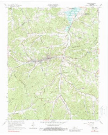
9 topographic sheets cover this place, the earliest surveyed in 1931 and the latest in 1985. It stands in District 3. It lies in ZIP code area 37061. It lies near Owl Hollow. The Survey maps it on the Erin quadrangle. 1,224 people lived here at the 2020 count. It stands 479 feet above sea level.
Research this city
On record in Erin
Buildings and businesses the archive holds for this place. Each opens its own page, with the source record it came from.
On the National Register 3 records
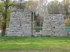 Erin Limekilnslisted 2004
 V. R. Harris Houselisted 1983
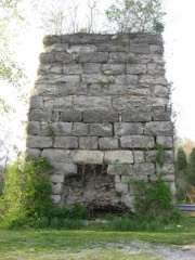 Quarry Limekilnlisted 2004
Population over time
2 figuresErin fell from 1,324 to 1,224 between 2010 and 2020. These are the recorded population figures Wikidata holds for this place, reached through the Geographic Names Information System number this page is keyed on rather than by name, so they belong to this place and not to another of the same name. Most are census counts, but not all are: an early figure may be a founding or settlement estimate, and an estimate published within five years of a census is left out. The change column is computed, and is left blank where more than 20 years separate a figure from the one before it, because a gap that long is not a change between two counts.
| Year | People | Change |
|---|---|---|
| 2010 | 1,324 | |
| 2020 | 1,224 | -100 (-8%) |
Topographic sheets covering this place
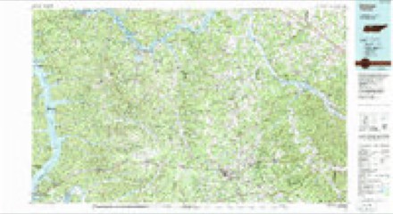
6 surveys from 9 printed sheetsMatched by testing this settlement's coordinate against the published boundary of every sheet in the United States Geological Survey's historical collection. Each opens the scanned sheet at the Survey.
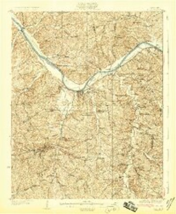
- 1931 USGS Erin quadrangle1:62500
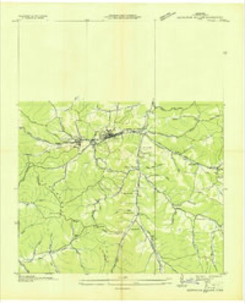
- 1936 USGS Tantrough Hollow quadrangle1:24000
- 1956 USGS Nashville quadrangle1:250000, 2 printings
- 1959 USGS Nashville quadrangle1:250000
- 1965 USGS Erin quadrangle1:24000, 3 printings
- 1985 USGS Dickson quadrangle1:100000


Fires near this place
53 since 1997Regional context, not property-specific evidence. The federal wildfire occurrence database lists 53 fires within 5 miles of Erin between 1997 and 2020, burning about 175 acres in total. None started naturally. 4 were recorded as arson. Distance is straight-line from the map coordinates, so a fire counted here may appear on a neighbouring settlement's page as well.
| Reported cause | Fires |
|---|---|
| Debris and open burning | 27 |
| Equipment and vehicle use | 7 |
| Missing data/not specified/undetermined | 6 |
| Arson/incendiarism | 4 |
| Smoking | 3 |
| Misuse of fire by a minor | 3 |
| Power generation/transmission/distribution | 2 |
| Recreation and ceremony | 1 |
The most recent of them, most recent first, with the day each was reported and the service that recorded it.
| Date | Cause | Size | Reported by | Name on the report |
|---|---|---|---|---|
| 4 September 1999 | Equipment and vehicle use | 3.2 acres | Tennessee Division of Forestry | not named |
| 29 September 2019 | Debris and open burning | under an acre | Tennessee Division of Forestry | KIZER FIRE |
| 2 September 2011 | Missing data/not specified/undetermined | 5.5 acres | Tennessee Division of Forestry | COUNTY DUMP |
| 12 September 2001 | Debris and open burning | 1.3 acres | Tennessee Division of Forestry | not named |
| 4 August 2015 | Power generation/transmission/distribution | under an acre | Tennessee Division of Forestry | KENNEDY ESTATE |
| 20 August 2012 | Debris and open burning | under an acre | Tennessee Division of Forestry | LITTLE FORK 1 |
| 3 July 2011 | Equipment and vehicle use | under an acre | Tennessee Division of Forestry | INDUSTRIAL PARK |
| 11 July 2010 | Debris and open burning | 1.0 acres | Tennessee Division of Forestry | MILTON FIRE |
Settlements close enough to share some of these fires:
Mines and quarries near this place
3 within 5 milesRegional context, not property-specific evidence. The federal mineral resources record lists 3 workings within 5 miles of Erin: 2 producers, 1 past producer. 2 still produce. What was taken out: Stone, Crushed/Broken, Stone, Crushed/Broken, Dolomite. Distance is straight-line from the map coordinates, so a quarry counted here may appear on a neighbouring settlement's page as well.
| Where | Site | Commodity | Status | Recorded |
|---|---|---|---|---|
| Cumberland City Quarry | Stone, Crushed/Broken, Dolomite | Producer | Dolomite | |
| Cumberland City Quarry | Stone, Crushed/Broken | Past Producer | ||
| Dolomite Quarry | Stone, Crushed/Broken | Producer |
Storms near this place
60 of 67 shownRegional context, not property-specific evidence. The National Weather Service names Erin in 67 storm reports between 1994 and 2025: 41 thunderstorm wind, 11 hail, 9 flash flood, 4 tornado. The reports record 1 death. Each account below is quoted exactly as the forecast office filed it, from the NOAA Storm Events Database, and each date opens the federal record of that event.
| When | Event | Place named | Harm | What the report says |
|---|---|---|---|---|
| January 1997 | Thunderstorm Wind | Erin | 1 killed, $30,000 | no account filed |
| May 2000 | Tornado (F3) | Erin | $1,300,000 | The storm complex that produced a tornado in Benton county moved into Houston county and generated a tornado that hit Tennessee Ridge and Erin. The Houston county executive estimated 1.3 million dollars worth of damage. Roofs and walls of some well constructed homes were torn off. Many trees were snapped and blown down along with power lines. The Betty Ligon Pavillion in Erin was flattened. 50 people required shelter at Erin. A storage trailer was moved 50 feet at Tennessee Ridge. |
| May 2010 | Flood | Erin | $800,000 | Numerous homes, numerous businesses, numerous non comercial buildings, along with several county, state, and federal roads across the county received damage due to the flood. |
| November 2005 | Tornado (F2) | Erin | $650,000 | Well built modular home was destroyed at intersection of Waverly Road and Long Branch Road. Other homes in the area were damaged. Damage was estimated to be $650K by the EMA Director. |
| May 2020 | Thunderstorm Wind | Erin | $32,360 | Numerous trees and power outages were reported across Houston County. |
| January 2013 | Thunderstorm Wind | Erin | $30,000 | Building damage reported on Roby Drive in Erin. Specific details concerning extent of building damage and associated repair costs were unknown. Several trees and power lines were downed in the area as well. |
| April 2011 | Thunderstorm Wind | Erin | $25,000 | Trees and power lines were downed on State Highway 231 resulting in the temporarily closer of this road. |
| July 1999 | Thunderstorm Wind | Erin | $20,000 | A sawmill was flattened due to strong thunderstorm winds. The saw mill was located on Clay Wright Road. |
| August 2023 | Thunderstorm Wind | Erin | $15,000 | Severe thunderstorm winds resulted in fallen trees and powerlines across Houston County, mainly in southeast portions between Highway 13 and Highway 231 near the Humphreys county line. Damages are a rough estimate. |
| April 2025 | Thunderstorm Wind | Erin | $10,000 | Severe thunderstorm winds downed several trees in the Erin area. Damages are a rough estimate. |
| March 2017 | Thunderstorm Wind | Erin | $10,000 | Trees were blown down throughout Houston County including in Erin with several roads blocked. Dime size hail was also reported in Erin. |
| July 2023 | Thunderstorm Wind | Erin | $5,000 | The emergency manager reported that severe thunderstorm winds were responsible for downing several trees across Houston County. Damages are a rough estimate. |
| December 2013 | Thunderstorm Wind | Erin | $5,000 | Trees were blown down across Houston County. |
| June 2012 | Thunderstorm Wind | Erin | $5,000 | A few trees and power lines were blown down across the county with power outages reported. |
| April 2010 | Thunderstorm Wind | Erin | $5,000 | Houston county sheriffs office and central dispatch reported multiple trees and power lines down across northern and southwestern portions of the county. |
| November 2005 | Tornado (F1) | Erin | $5,000 | Roof damage to metal sheds and outbuildings near and parallel to Highway 13. |
| June 2003 | Flash Flood | Erin | $5,000 | Newspaper story about flash flooding that hit the city of Erin. Officials said that 4 to 6 inches of rain fell in a 3 hour period. The high water closed off one lane (westbound lane) of State Route 49 in Erin, in front of the AmSouth Bank entrance. There was high water on a road at Grices Creek. Water poured off of Arlington Hill and got inside the Erin Post Office. Ankle deep water got into Bab's Restaurant in Erin. Maple Street was closed as water ran over the low water bridge. Chunks of pavement were broken lose from streets in Erin. The rain was very localized and other parts of Houston County received no rain. This rivaled the last bad flood in 1969 where 9 inches of rain fell in an eight-hour period. |
| January 2020 | Thunderstorm Wind | Erin | $3,000 | Trees were blown down onto power lines on Boone Street in Erin. |
| June 2019 | Thunderstorm Wind | Erin | $3,000 | A few trees were blown down in Erin. |
| March 2017 | Thunderstorm Wind | Erin | $3,000 | TDOT reported trees blown down on Highway 13, Highway 149, and Highway 46 in Houston County. |
| May 2017 | Thunderstorm Wind | Erin | $3,000 | Several trees were blown down across Houston County. |
| June 1995 | Thunderstorm Wind | Erin | $2,000 | Some trees were knocked down. |
| May 1995 | Thunderstorm Wind | Erin | $2,000 | no account filed |
| December 2016 | Thunderstorm Wind | Erin | $1,000 | Tree reportedly blown down in northern Houston County. |
| September 2011 | Flash Flood | Erin | $1,000 | Water went over the road at the intersection of State Highway 49 and Mobley Lane. |
| April 2008 | Flood | Erin | $1,000 | Two school school buses were stranded for a short period of time without children. One bus was on Lewis Branch Road, south of Tennessee Ridge. The other bus was on Rye Hollow Road, or about 5.6 miles southeast of Erin. Water was crossing the road on Highway 147 in western Houston County, State Route 46N, and also just north of State Route 13. In addition, the Spring Hill area had water across the road due to clogged culverts. Also, Buckeye Road had high water. Maple Street in Erin was impassable. |
| November 2005 | Tornado (F0) | Erin | $1,000 | Trees were snapped along Bateman Branch Rd. |
| April 2004 | Flash Flood | Erin | $1,000 | Sheriff's office reported Shady Lane trailer park was being evacuated due to flooding. |
| May 1997 | Thunderstorm Wind | Erin | $1,000 | Large trees limbs and a few power lines were down. |
| June 1994 | Thunderstorm Wind | Erin | $500 | A large tree was blown down. |
| November 1996 | Thunderstorm Wind | Erin | $500 | no account filed |
| August 1995 | Thunderstorm Wind | Erin | $100 | Few trees and power lines down reported by local electric company. |
| March 1995 | Hail | Erin | $100 | no account filed |
| May 1995 | Hail | Erin | $100 | no account filed |
| May 2024 | Flash Flood | Erin | - | Heavy rain in Erin caused flash flooding across the area, particularly for areas along and near Erin Branch Creek. A water rescue was performed for nine children and two adults at a daycare along Store Front Drive. No injuries were reported. Damages are unknown. |
| April 2009 | Hail | Erin | - | Newspaper report stated the emergency management officials reported that quarter size hail fell in Erin and that golf ball size hail was reported in other parts of the county. |
| October 2007 | Thunderstorm Wind | Erin | - | Three trees were blown down in the western part of Houston County including the City of Erin beginning at 820 PM CST and ending at 840 PM CST. |
| May 2006 | Thunderstorm Wind | Erin | - | Trees were down on Highway 231. |
| May 2006 | Thunderstorm Wind | Erin | - | Trees were down on Highway 49 east of Erin. |
| August 2005 | Thunderstorm Wind | Erin | - | Tree was blown down on Highway 46 south. |
| April 2003 | Hail | Erin | - | Public report of nickel size hail that lasted several minutes. |
| May 2003 | Thunderstorm Wind | Erin | - | 911 center reported trees down across State Highway 231. |
| April 2002 | Thunderstorm Wind | Erin | - | Sheriff reported trees down. |
| April 2002 | Thunderstorm Wind | Erin | - | Sheriff reported trees down on Highway 49. |
| July 2002 | Flash Flood | Erin | - | EMA reported a bridge was washed out on Highway 49. Highway 49 was also impassable due to high water at this location. |
| June 2001 | Hail | Erin | - | Sheriff reported dime size hail at McEwen Rd. |
| July 2001 | Thunderstorm Wind | Erin | - | Law enforcement reported a tree was blown down. |
| July 2001 | Thunderstorm Wind | Erin | - | Law enforcement reported a tree was blown down just north of Erin. |
| November 2001 | Flash Flood | Erin | - | One family had to be evacuated due to high water on Dancer Branch Rd. The Largent Hollow Road bridge was washed out, and 4 roads were closed. |
| August 2000 | Hail | Erin | - | EMA reported dime size hail. |
| January 1999 | Hail | Erin | - | Ping pong ball sized hail reported. |
| June 1999 | Thunderstorm Wind | Erin | - | Several small trees were down. |
| May 1998 | Thunderstorm Wind | Erin | - | A few trees were blown down. |
| June 1998 | Flash Flood | Erin | - | Local law enforcement reported water over Highway 231. |
| June 1998 | Flash Flood | Erin | - | Local law enforcemetn reported wtaer over Highway 49. |
| July 1998 | Thunderstorm Wind | Erin | - | Local law enforcement reported trees were blown down. |
| July 1997 | Thunderstorm Wind | Erin | - | Local law enforcement reported several trees were blown down. |
| August 1997 | Thunderstorm Wind | Erin | - | Highway department reported a tree was down on Bethany Road. |
| June 1997 | Thunderstorm Wind | Erin | - | A few trees were blown down. |
| June 1997 | Thunderstorm Wind | Erin | - | A few trees were blown down. |
Nearest settlements
The eight closest, with where each one stands in the county. Distances are straight-line, computed from the Geographic Names Information System coordinates.
| Map | Place | Distance | Sheets |
|---|---|---|---|
| Midway | 0.6 miles | 9 | |
| Arlington | 1.0 miles | 9 | |
| Denmark | 2.3 miles | 9 | |
| Pollard | 3.0 miles | 9 | |
| Grays Crossing | 3.1 miles | 8 | |
| Brownsville | 3.2 miles | 9 | |
| Dolomite | 3.5 miles | 9 | |
| Tennessee Ridge | 4.2 miles | 8 |
Elsewhere
Matched on this settlement's Geographic Names Information System number rather than its name, so it cannot be a different place of the same name in another state.
| Wikipedia article on Erin | An encyclopaedic summary. Its text is share-alike, so it is linked here rather than copied. |
| Wikidata item Q2149199 | The structured record the population and elevation above come from. Public domain (CC0). |
Provenance
This settlement is recorded in the Geographic Names Information System as feature 1283839. The sheet list is computed by point-in-boundary test against the United States Geological Survey's historical topographic inventory. Both are works of the United States government and carry no copyright under 17 U.S.C. 105.
Wildfire. Short, Karen C. 2022. Spatial wildfire occurrence data for the United States, 1992-2020 [FPA_FOD_20221014]. 6th Edition. Fort Collins, CO: Forest Service Research Data Archive. https://doi.org/10.2737/RDS-2013-0009.6 Collected with United States Government funding and usable without additional permissions or fees.
Mines and quarries. USGS Mineral Resources Data System (MRDS) https://mrdata.usgs.gov/mrds/ A work of the United States government, no copyright under 17 U.S.C. 105.
Storms. NOAA National Centers for Environmental Information, Storm Events Database https://www.ncei.noaa.gov/stormevents/ A work of the United States government, no copyright under 17 U.S.C. 105. Narratives are quoted verbatim from the National Weather Service report and are not edited or summarised.