 Block
Woodbury, Tennessee
12 topographic sheets cover this place, the earliest surveyed in 1908 and the latest in 1985. It stands in District 5. It lies in ZIP code area 37190. It stands on Doolittle Branch. The Survey maps it on the Woodbury quadrangle. 2,703 people lived here at the 2020 count. It stands 722 feet above sea level.
Research this city
On record in Woodbury
Buildings and businesses the archive holds for this place. Each opens its own page, with the source record it came from.
On the National Register 5 records
 Baptist Female College-Adams Houselisted 1987
 Brevard-Macon Houselisted 1994
 Cannon County Courthouselisted 1992
 William Cannon Houston Houselisted 1989
- Brown-Hancock Houselisted 2019
Population over time
3 figuresWoodbury grew from 329 to 2,703 between 1870 and 2020. These are the recorded population figures Wikidata holds for this place, reached through the Geographic Names Information System number this page is keyed on rather than by name, so they belong to this place and not to another of the same name. Most are census counts, but not all are: an early figure may be a founding or settlement estimate, and an estimate published within five years of a census is left out. The change column is computed, and is left blank where more than 20 years separate a figure from the one before it, because a gap that long is not a change between two counts.
| Year | People | Change |
|---|---|---|
| 1870 | 329 | |
| 2010 | 2,680 | |
| 2020 | 2,703 | +23 (+1%) |
Topographic sheets covering this place
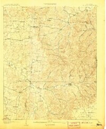
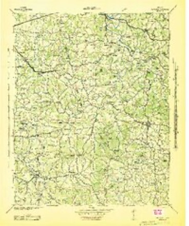
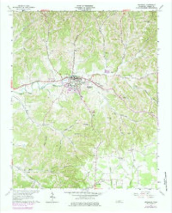
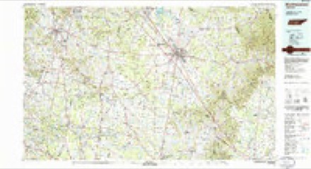
5 surveys from 12 printed sheetsMatched by testing this settlement's coordinate against the published boundary of every sheet in the United States Geological Survey's historical collection. Each opens the scanned sheet at the Survey.
- 1908 USGS Woodbury quadrangle1:62500, 2 printings
- 1942 USGS Statesville quadrangle1:100000
- 1956 USGS Columbia quadrangle1:250000, 6 printings
- 1962 USGS Woodbury quadrangle1:24000, 2 printings
- 1985 USGS Murfreesboro quadrangle1:100000

Fires near this place
80 since 1997Regional context, not property-specific evidence. The federal wildfire occurrence database lists 80 fires within 5 miles of Woodbury between 1997 and 2020, burning about 365 acres in total. 3 started naturally. 13 were recorded as arson. Distance is straight-line from the map coordinates, so a fire counted here may appear on a neighbouring settlement's page as well.
| Reported cause | Fires |
|---|---|
| Debris and open burning | 45 |
| Arson/incendiarism | 13 |
| Missing data/not specified/undetermined | 9 |
| Equipment and vehicle use | 4 |
| Natural | 3 |
| Recreation and ceremony | 2 |
| Other causes | 2 |
| Fireworks | 1 |
| Power generation/transmission/distribution | 1 |
The most recent of them, most recent first, with the day each was reported and the service that recorded it.
| Date | Cause | Size | Reported by | Name on the report |
|---|---|---|---|---|
| 8 September 1999 | Debris and open burning | 7.0 acres | Tennessee Division of Forestry | not named |
| 25 September 2008 | Debris and open burning | under an acre | Tennessee Division of Forestry | not named |
| 24 September 2010 | Debris and open burning | under an acre | Tennessee Division of Forestry | C L BARRETT RD |
| 13 September 2008 | Debris and open burning | under an acre | Tennessee Division of Forestry | not named |
| 9 August 2008 | Missing data/not specified/undetermined | under an acre | Tennessee Division of Forestry | not named |
| 30 August 2011 | Equipment and vehicle use | under an acre | Tennessee Division of Forestry | SUGAR TREE KNOB |
| 17 August 2008 | Missing data/not specified/undetermined | under an acre | Tennessee Division of Forestry | not named |
| 8 July 2008 | Natural | under an acre | Tennessee Division of Forestry | not named |
Settlements close enough to share some of these fires:
Mines and quarries near this place
10 of 18 shownRegional context, not property-specific evidence. The federal mineral resources record lists 18 workings within 5 miles of Woodbury: 11 occurrences, 3 past producers, 2 prospects, 2 producers. 2 still produce. What was taken out: Uranium, Oil Shale, Uranium, Oil Shale, Zinc. Distance is straight-line from the map coordinates, so a quarry counted here may appear on a neighbouring settlement's page as well.
| Where | Site | Commodity | Status | Recorded |
|---|---|---|---|---|
| Carter Prospect | Zinc, Barium-Barite | Occurrence | Vein | |
| Carter Prospect | Barium-Barite, Zinc | Prospect | ||
| Davenport Prospect | Barium-Barite, Zinc, Calcium | Occurrence | 1935 | |
| Davenport Prospect | Zinc, Barium-Barite, Calcium | Past Producer | ||
| Hoover Mine | Zinc, Sulfur-Pyrite, Barium-Barite, Lead | Past Producer | 1889, 1940 | |
| Hoover Mine | Zinc, Lead, Sulfur, Calcium, Barium-Barite | Past Producer | ||
| Norvell Quarry | Stone, Crushed/Broken, Limestone, General | Producer | Limestone | |
| Norvell Quarry | Stone, Crushed/Broken | Producer | ||
| Paschal Prospect | Zinc, Calcium | Occurrence | Calcite, Sphalerite | |
| Paschal Prospect | Zinc, Calcium | Prospect |
Storms near this place
60 of 79 shownRegional context, not property-specific evidence. The National Weather Service names Woodbury in 79 storm reports between 1993 and 2025: 43 thunderstorm wind, 17 hail, 14 flash flood, 3 tornado. The reports record 4 injuries. Each account below is quoted exactly as the forecast office filed it, from the NOAA Storm Events Database, and each date opens the federal record of that event.
| When | Event | Place named | Harm | What the report says |
|---|---|---|---|---|
| May 2020 | Thunderstorm Wind | Woodbury | 2 hurt, $53,000 | Numerous trees and power lines were blown down with power outages across Cannon County. A tree fell onto an ATV injuring 2 people. |
| May 2004 | Lightning | Woodbury | 1 hurt, $3,000 | A man was estimating the cost to heat a 900 square foot horse barn for an efficiency apartment on top of the barn. A poplar tree 30 feet away from the barn was struck by lightning. The man was on the gravel floor in the barn. He was struck by lightning. He drove himself to the hospital where he was treated and released. The barn was on Sally Parton Road. |
| May 2004 | Lightning | Woodbury | 1 hurt | A man was outside clearing a clogged gutter. He was struck by lightning and rushed to the hospital. He was placed under intensive care Monday night and Tuesday morning. |
| May 2003 | Tornado (F1) | Woodbury | $500,000 | EMA reported hundreds of trees were down from Highway 53 North and Big Hill Road and Pea Ridge. Many trees were twisted. Many utility poles were blown down around the county. Homes were damaged at Wilson Hollow and Pleasant Ridge. EMA estimated 60 homes had sustained wind damage. Schools were closed Monday and Tuesday because of many downed trees and flooding problems. |
| January 2013 | Tornado (EF0) | Woodbury | $75,000 | An EF0 tornado touched down about 1 mile north of Woodbury along Doolittle Road and traveled eastward before ending east of Gunter Hollow Road on Short Mountain. Damage included about a hundred snapped or uprooted trees and minor roof and structural damage along the path, including on Gassaway Road. The most significant damage occurred at the summit of Short Mountain. |
| May 2011 | Thunderstorm Wind | Woodbury | $25,000 | Numerous trees were blown down including one on a house and two on cars. Specific details concerning damage to the house and the two cars, along with the associated repair costs, were unknown. |
| June 2009 | Thunderstorm Wind | Woodbury | $25,000 | Trees blown down on to house on Cavander Branch Road. Multiple trees were reported down on vehicles at local library. Extent of any damage to house and vehicles unkown. |
| June 2019 | Thunderstorm Wind | Woodbury | $10,000 | Numerous trees were blown down across Cannon County including on Sunny Slope Road and in the 2600 block of pleasant View Road. |
| April 2015 | Thunderstorm Wind | Woodbury | $10,000 | A roof was blown off a building in Woodbury. |
| August 2014 | Thunderstorm Wind | Woodbury | $10,000 | Several homes received wind damage to siding and roofs and several trees were blown down around Woodbury. |
| May 2011 | Thunderstorm Wind | Woodbury | $10,000 | Several trees and power lines were downed near the intersection of State Highway 53 and Seals Hollow Road. |
| March 2008 | Thunderstorm Wind | Woodbury | $10,000 | Trees were blown down. Outbuildings collapsed. Some homes had roof damage. |
| April 2006 | Thunderstorm Wind | Woodbury | $10,000 | Roof was blown off an office. 4 county buildings damaged, one building had moderate wind damage. |
| January 2005 | Thunderstorm Wind | Woodbury | $10,000 | TDOT reported a tree down on Highway 53. Newspaper story said a wood storage building on South McCrary Street was completely destroyed. Also, brick posts and sign at the north entrance of Brown-Spurlock Park in Woodbury was completely destroyed by the strong thunderstorm winds. Trees were down around the county. |
| June 1997 | Thunderstorm Wind | Woodbury | $10,000 | A tree was blown down onto a house. Numerous reports of downed power lines in Woodbury. |
| June 1996 | Flash Flood | Woodbury | $10,000 | no account filed |
| May 2025 | Thunderstorm Wind | Woodbury | $5,000 | Strong thunderstorm winds downed a few trees and tree limbs south of Woodbury. Damages are a rough estimate. |
| June 2022 | Thunderstorm Wind | Woodbury | $5,000 | Trees were blown down with power outages across Cannon County. |
| June 2016 | Thunderstorm Wind | Woodbury | $5,000 | Multiple reports of trees and power lines down throughout Cannon County. |
| January 2008 | Thunderstorm Wind | Woodbury | $5,000 | Trees and power lines were down around the county. |
| July 1995 | Thunderstorm Wind | Woodbury | $5,000 | Several trees were blown down. |
| March 2020 | Thunderstorm Wind | Woodbury | $3,000 | Trees were blown down and one carport blown off on Doolittle Road. |
| November 2017 | Thunderstorm Wind | Woodbury | $3,000 | Cannon County Sheriff's office reported trees down on McMinnville Highway east of Woodbury. |
| December 2013 | Thunderstorm Wind | Woodbury | $3,000 | Power lines were blown down with several power outages across Cannon County. |
| February 2008 | Thunderstorm Wind | Woodbury | $3,000 | Trees were blown down. |
| May 1995 | Thunderstorm Wind | Woodbury | $2,000 | A few large trees were blown down. |
| July 2023 | Thunderstorm Wind | Woodbury | $1,000 | Severe thunderstorm winds uprooted a tree along Sunny Slope Road near Woodbury. Damages are a rough estimate. |
| August 2023 | Thunderstorm Wind | Woodbury | $1,000 | Severe thunderstorm winds downed a tree along McFerrin Street in Woodbury. Damages are a rough estimate. |
| June 2020 | Hail | Woodbury | $1,000 | Pea to nickel size hail fell on Doolittle Road and a bradford pear tree was snapped. |
| June 2020 | Thunderstorm Wind | Woodbury | $1,000 | A tree was blown down in Woodbury and pea to dime size hail was reported. |
| May 2006 | Flash Flood | Woodbury | $1,000 | Flooding was reported on Hoover Mill Road, which is about 2.6 miles west southwest of Woodbury and Doolittle Road, just north of Woodbury. |
| May 2004 | Flash Flood | Woodbury | $1,000 | Auburntown Road was closed due to high water. |
| July 1996 | Flash Flood | Woodbury | $1,000 | no account filed |
| May 1995 | Hail | Woodbury | $1,000 | no account filed |
| August 1993 | Thunderstorm Wind | Woodbury | $500 | A few trees were blown down. |
| May 2008 | Thunderstorm Wind | Woodbury | $300 | TDOT reported a tree was blown down on Petty Gap Rd. |
| July 2007 | Thunderstorm Wind | Woodbury | $100 | Tree was blown down. |
| June 1995 | Hail | Woodbury | $100 | no account filed |
| April 1994 | Hail | Woodbury | $50 | no account filed |
| May 2024 | Flash Flood | Woodbury | - | Heavy rain caused flash flooding at Dillon Park in Woodbury. Damages are unknown. |
| May 2023 | Flash Flood | Woodbury | - | Heavy rain in Woodbury caused flash flooding in areas in around Greenbrier Street and College Street. Several roads were flooded, and photos shared on Twitter showed a few homes surrounded by flood waters. Damages are not known. |
| May 2022 | Hail | Woodbury | - | Numerous Facebook and Twitter reports indicate pea to quarter size hail fell in Woodbury. |
| August 2021 | Flash Flood | Woodbury | - | Several roads were flooded across the county including Doolittle Road, Sunny Slope Road at Hollis Creek, and Highway 145. A water rescue was conducted for a vehicle that hydroplaned into a flooded ditch on Lassiter Barker Road at John Bragg Highway. |
| February 2019 | Flash Flood | Woodbury | - | Cross the River Drive was flooded and closed at the East Fork Stones River near the Arts Center of Cannon County in Woodbury. |
| August 2014 | Flash Flood | Woodbury | - | Heavy rainfall resulted in flooding around Woodbury forcing the closure of three roads. |
| May 2013 | Flash Flood | Woodbury | - | The Cannon County Sheriff's Office dispatch reported the Stones River Road just east of Woodbury was closed due to flash flooding. |
| March 2006 | Thunderstorm Wind | Woodbury | - | Trees were downon Highway 53 north. |
| April 2006 | Hail | Woodbury | - | Golf ball size hail near Hollow Springs Road along Highway 53. |
| April 2006 | Hail | Woodbury | - | Tennis ball size hail struck Woodbury. The hail struck the town square, causing extensive damage to parked cars, businesses, and windows and roof of the Cannon County Courthouse. Hundreds of tiles on the the Courthouse roof were broken. The tiles had been in place since 1936. The hail had broken windows at the West Side School. There was a lot of damage to the roofs of the Cannon County High School and to Woodbury Grammar School. |
| June 2006 | Thunderstorm Wind | Woodbury | - | Tree down on Lock Creek Rd. |
| September 2006 | Thunderstorm Wind | Woodbury | - | Sheriff's office reported a few trees and power lines were down. |
| May 2004 | Hail | Woodbury | - | Law enforcement reported golf ball size hail. |
| July 2004 | Thunderstorm Wind | Woodbury | - | A barn was destroyed near Short Mountain. Numerous trees were down around the county. |
| July 2004 | Thunderstorm Wind | Woodbury | - | Trees were down along Highway 53 near Woodbury. |
| June 2003 | Thunderstorm Wind | Woodbury | - | TDOT reported a tree was blown down on Gunther Hollow Road in the Short Mountain area of Cannon County. |
| May 2003 | Tornado (F1) | Woodbury | - | Damage to homes on Rogers Road and State Highway 53, continuing onto Whipperville Road which is about a half mile south of the community of Red Hill and ending around the Capp Almond Road and Pleasantview Road area. |
| August 2003 | Flash Flood | Woodbury | - | Sheriff's office reported flooding on Main Street, Short Mountain Road and Auburntown Road. |
| November 2002 | Hail | Woodbury | - | Emergency management reported dime size hail at Intersection of Hollow Springs Road and Burgan Road. |
| March 2002 | Flash Flood | Woodbury | - | EMA reported 2 roads closed. One public building, a dentist's office and a Hardee's received moderate flood damage. |
| May 2002 | Thunderstorm Wind | Woodbury | - | TDOT reported a tree down. |
Nearest settlements
The eight closest, with where each one stands in the county. Distances are straight-line, computed from the Geographic Names Information System coordinates.
| Map | Place | Distance | Sheets |
|---|---|---|---|
| Prospect Hill (historical) | 2.6 miles | 12 | |
| Berea (historical) | 2.6 miles | 12 | |
| Sunny Slope | 2.7 miles | 12 | |
| Talome (historical) | 2.7 miles | 12 | |
| Jones Chapel (historical) | 3.8 miles | 14 | |
| Culpepper | 3.8 miles | 13 | |
| Elkins (historical) | 4.0 miles | 12 | |
| Pleasant Ridge | 4.1 miles | 14 |
Elsewhere
Matched on this settlement's Geographic Names Information System number rather than its name, so it cannot be a different place of the same name in another state.
| Wikipedia article on Woodbury | An encyclopaedic summary. Its text is share-alike, so it is linked here rather than copied. |
| Wikidata item Q2054448 | The structured record the population and elevation above come from. Public domain (CC0). |
Provenance
This settlement is recorded in the Geographic Names Information System as feature 1304664. The sheet list is computed by point-in-boundary test against the United States Geological Survey's historical topographic inventory. Both are works of the United States government and carry no copyright under 17 U.S.C. 105.
Wildfire. Short, Karen C. 2022. Spatial wildfire occurrence data for the United States, 1992-2020 [FPA_FOD_20221014]. 6th Edition. Fort Collins, CO: Forest Service Research Data Archive. https://doi.org/10.2737/RDS-2013-0009.6 Collected with United States Government funding and usable without additional permissions or fees.
Mines and quarries. USGS Mineral Resources Data System (MRDS) https://mrdata.usgs.gov/mrds/ A work of the United States government, no copyright under 17 U.S.C. 105.
Storms. NOAA National Centers for Environmental Information, Storm Events Database https://www.ncei.noaa.gov/stormevents/ A work of the United States government, no copyright under 17 U.S.C. 105. Narratives are quoted verbatim from the National Weather Service report and are not edited or summarised.