 Block
BlockTitus County, Texas
21 topographic sheets cover 25 settlements here.
Research this county
What the record shows
- 218 topographic sheet readings cover the county's settlements.
- The Geographic Names Information System records 25 populated places in this county; 25 are covered by at least one topographic sheet.
Bird's-eye views and land ownership maps
1Drawn when these were printed as single large sheets: the town seen from the air, and the county divided into its farms with every owner named. Each opens the original at the Library of Congress.

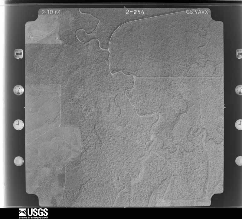
The county from the air
17 shownFlown by the U.S. Geological Survey between 1937 and 1989, the Aerial Photo Single Frames collection is the definitive mid-century view of the land: fields, roads and rivers as the camera saw them. The Survey holds 536 frames inside the rectangle that bounds this county; the 17 frames below were taken over the county itself, chosen across the decades of flights (at most four a year from that rectangle), so one flight cannot crowd out the rest. The full set is free to browse and download at EarthExplorer under the dataset Aerial Photo Single Frames.
















Weather records
7 stations, 2 gagesThe thermometers that kept this county's weather, and the gages that measured the flow of its streams, as the federal records hold them. The extremes below are measured values from those records, not estimates.
- MT PLEASANT 1905 to 2026, hottest 47.8 C, coldest -24.4 C
- MT PLEASANT SCS 8 1941 to 1942
- MOUNT PLEASANT 9.8 NNW 2010 to 2026
- MOUNT PLEASANT 1.6 SE 2016 to 2017
- OMAHA 6.0 W 2023 to 2026
- MOUNT PLEASANT 6.4 SSE 2023 to 2026
- MOUNT PLEASANT 9.5 SE 2024 to 2026
- Big Cypress Ck nr Pittsburg, TX 1943 to 2026
- White Oak Ck nr Talco, TX 1949 to 2026
The 1950 census, district by district
26 districtsWho lived here in 1950, one enumeration district at a time, as the Census Bureau described each district. Each row opens its official National Archives result, with Population Schedules and ED Maps available there.
- 225-1Justice Precinct 1: Mt. Pleasant city: Mt. Pleasant city - That part Bounded by City limits; City limits; E. 3rd; N. Jefferson Ave.
- 225-2Justice Precinct 1: Mt. Pleasant city - That part Bounded by City limits; N. Jefferson Ave.; W. 6th, Johnson Ave., W. 9th; City limits
- 225-3Justice Precinct 1: Mt. Pleasant city - That part Bounded by W. 9th, Johnson Ave., W. 6th; N. Jefferson Ave.; W. 1st; City limits
- 225-4Justice Precinct 1: Mt. Pleasant city - That part Bounded by E. 3rd; City limits; State Highway 49; S. Jefferson Ave., N. Jefferson Ave.
- 225-5Justice Precinct 1: Mt. Pleasant city - That part excluding Pleasant Hotel Bounded by W. 1st; S. Jefferson Ave.; St. Louis Southwestern Railway; City limits
- 225-6Justice Precinct 1: Mt. Pleasant city - That part Bounded by St. Louis Southwestern Railway; S. Jefferson Ave.; City limits; City limits
- 225-7Justice Precinct 1: Mt. Pleasant city - That part Bounded by State Highway 49; City limits; City limits; S. Jefferson Ave.
- 225-8Justice Precinct 1 - That part north of St. Louis Southwestern Railway and east and north of the Paris and Mount Pleasant Railroad, outside Mt. Pleasant city
- 225-9Justice Precinct 1 - That part south and west of and northeast of U.S, Highway 271, outside Mt. Pleasant city
- 225-10Justice Precinct 1 - That part south west of U.S. Highway 271 and north of St. Louis Southwestern Railway, outside Mt. Pleasant city
- 225-11Justice Precinct 1 - That part south and east of St. Louis Southwestern Railway, outside Mt. Pleasant city
- 225-12Justice Precinct 1 - That part south and west of St. Louis Southwestern Railway, outside Mt. Pleasant city
- 225-13Justice Precinct 2
- 225-14Justice Precinct 3: Talco city
- 225-15Justice Precinct 3 - That part east of an Unnamed rd. extending from precinct line to the Talco - Maple Springs School - Wilkinson Rd. and north of the Talco Maple Springs School - Wilkinson Rd., and northeast of U.S. Highway 271, outside Talco city
- 225-16Justice Precinct 3 - That part south of the Talco - Maple Springs School - Wilkinson Rd., and west of an Unnamed rd. extending from Talco - Maple Springs School - Wilkinson Rd. to precinct line, outside Talco city and southwest of U.S. Highway 271 outside Talco city
- 225-17Justice Precinct 4: Justice Precinct 4 - That part north of U.S. Highway 6
- 225-18Justice Precinct 4 - That part south of U.S. Highway 67
- 225-19Justice Precinct 5: Justice Precinct 5 - That part east of Swauano Creek
- 225-20Justice Precinct 5 - That part west of Swauano Creek
- 225-21Justice Precinct 6
- 225-22Justice Precinct 7: Justice Precinct 7 - That part north and east of the Agro - Wilkinson Rd.
- 225-23Justice Precinct 7 - That part south and west of the Agro - Wilkinson Rd.
- 225-24Justice Precinct 8 - That part outside Winfield town
- 225-25Justice Precinct 8: Winfield town
- 225-26Pleasant Hotel (In Mt. Pleasant city, Justice Precinct 1)
Wildfire, 1992 to 2020
1,595 firesEvery wildfire the federal occurrence database records inside this county: 1,595 of them, burning about 8,774 acres. 26 started naturally and 54 were recorded as arson. Each settlement page carries the fires within five miles of it.
| Reported cause | Fires |
|---|---|
| Debris and open burning | 1086 |
| Missing data/not specified/undetermined | 220 |
| Equipment and vehicle use | 107 |
| Power generation/transmission/distribution | 55 |
| Arson/incendiarism | 54 |
| Natural | 26 |
| Recreation and ceremony | 16 |
| Railroad operations and maintenance | 10 |
| Misuse of fire by a minor | 10 |
| Smoking | 10 |
| Fireworks | 1 |
The five largest, by the area the report gives. Two of them were set deliberately.
| Date | Cause | Size | Reported by | Name on the report |
|---|---|---|---|---|
| 3 March 1998 | Missing data/not specified/undetermined | 320 acres | Texas A & M Forest Service | not named |
| 3 September 2000 | Missing data/not specified/undetermined | 263 acres | Texas A & M Forest Service | LINDEN - 354 |
| 1 August 1998 | Arson/incendiarism | 240 acres | Texas A & M Forest Service | not named |
| 1 February 2009 | Missing data/not specified/undetermined | 167 acres | Texas A & M Forest Service | HORSE CREEK |
| 4 September 1998 | Equipment and vehicle use | 160 acres | Texas A & M Forest Service | not named |
| 17 March 1994 | Debris and open burning | 160 acres | Texas A & M Forest Service | not named |
| 1 July 1998 | Arson/incendiarism | 150 acres | Texas A & M Forest Service | not named |
| 19 September 2000 | Missing data/not specified/undetermined | 150 acres | Texas A & M Forest Service | LINDEN - 433 |
Every settlement page carries the fires within five miles of it - see the settlement index below.
Storms, 1955 to 2026
60 of 309 shownThe NOAA Storm Events Database holds 309 reports for this county, causing 2 deaths, 18 injuries and about $4,098,250 in recorded property damage. Each settlement page carries the reports that name it.
| Kind of event | Reports |
|---|---|
| Thunderstorm Wind | 136 |
| Hail | 111 |
| Flash Flood | 28 |
| Tornado | 26 |
| Funnel Cloud | 6 |
| Heavy Rain | 1 |
| Lightning | 1 |
The most serious of them, by death, then injury, then recorded damage. The accounts are quoted exactly as the forecast office filed them.
| When | Event | Place named | Harm | What the report says |
|---|---|---|---|---|
| October 1984 | Tornado (F2) | not stated | 1 killed, 2 hurt, $250,000 | no account filed |
| May 1999 | Tornado (F3) | Winfield | 1 killed, $330,000 | Seven homes were destroyed. Two of the homes were swept from their slabs. |
| March 1961 | Tornado (F3) | not stated | 9 hurt, $250,000 | no account filed |
| November 1983 | Thunderstorm Wind | not stated | 4 hurt | no account filed |
| March 1961 | Tornado (F3) | not stated | 2 hurt, $2,500 | no account filed |
| June 1997 | Thunderstorm Wind | Mt Pleasant | 1 hurt, $1,500,000 | Severe thunderstorms moved from Franklin County to the west across Titus county producing macroburst damage about 5 miles in width across the entire length of the county. The winds knocked down numerous trees and powerlines leaving the entire town without power. The high winds were also blamed for blowing down a wall on an equipment building under construction along with the new Texas Department of transportation building on FM 1845. The wall was 250 feet long and built with concrete blocks. The winds sent trees up to 20 feet in diameter crashing into houses and carports which collapsed onto cars. A 300 foot tower at Farmers Academy that serves Mt. Pleasant's cable TV system was blown over. Ninety-five (95) percent of all the trees and tall structures above 30 feet in height fell to the southeast. Minor damage occurred to a supermarket in town leaving the people trapped inside after the power went out. At least 5 county roads were closed, two trailer homes were damaged significantly and one woman was injured when she was struck by a shopping chart at a grocery store. In the city alone, at least 70 structures were damaged to some extent. |
| June 2011 | Thunderstorm Wind | Mt Pleasant | $750,000 | Numerous trees and powerlines were downed across the county. Roofs were blown off several homes with trees hitting at least 5 homes in the county. |
| April 2000 | Tornado (F2) | Mt Pleasant | $145,000 | This tornado developed in a high precipitation supercell as it moved eastward across the county. Small to moderate pine and oak trees were snapped and broken. A mobile home dealership in Cookville, TX was moderately damaged and several homes suffered shingle loss. This tornado continued into Morris County, TX. The F2 rating is from the Morris County, TX segment of this tornado. |
| April 2015 | Tornado (EF2) | Adbra | $100,000 | A brief but potent EF-2 tornado touched down east of Winfield, Texas during the afternoon of April 13th. This tornado struck the Mid America Pet Food Plant and damage consisted of tossing cars, trucks and trash dumpsters. One dumpster was tossed nearly 150 yards and 40 feet high, landing on top of the warehouse. A second dumpster hit the edge of another building nearly 75 yards away and landed on top of a truck parked below. A portion of the warehouse was completely destroyed when the winds entered open doors and lifted the roof. |
| October 2009 | Flash Flood | Talco | $100,000 | Upwards of 63 roads were closed at one time across Titus County and 3 high water rescues were required. |
| May 2020 | Tornado (EF1) | Winfield | $60,000 | An EF-1 tornado with estimated maximum winds near 100 mph touched down near the intersection of County Road 1220 and County Road 1230 in Western Titus County several miles northeast of the Winfield community, where it snapped and uprooted numerous trees along County Road 1230 as it moved north. This tornado then flipped a two ton cattle trailer numerous times about 75-80 yards from a pasture to the front yard of a home, with two other smaller trailers also thrown about 75 yards in front of the home as well. It is believed that these trailers knocked down the support beams of the front porch of the home, with a license plate to the cattle trailer found about 1.5 miles down the road adjacent to a pond at a nearby farm. Several more trees were snapped and uprooted along and north of the intersection of County Road 1230 and County Road 1165, before the tornado lifted in a pasture just to the west of County Road 1165. |
| July 2007 | Thunderstorm Wind | Talco | $50,000 | Strong wind gusts knocked down trees and power lines. Shingles were blown off some roofs and a mobile home was pushed off its foundation. |A mobile home was also damaged when a tree fell across it. No injuries were reported. A tree also fell across a truck in town. The roof was taken off an old supermarket along Hwy. 271. |
| January 1993 | Thunderstorm Wind | not stated | $50,000 | Three mobile homes were blown over on FM 1000. |
| April 1993 | Thunderstorm Wind | Mount | $50,000 | A tree was blown into a house and sheds were unroofed and blown over by thunderstorm winds. |
| May 1993 | Thunderstorm Wind | Mt. Pleasant | $50,000 | Trees were blown down in Mt. Pleasant and around the county. One tree was blown onto a house causing severe roof damage. |
| December 2012 | Thunderstorm Wind | Mt Pleasant Muni Arp | $40,000 | A tree was downed on a house south of Mount Pleasant. There was no report of injuries. |
| June 2012 | Thunderstorm Wind | Mt Pleasant | $30,000 | A tree was downed on a house on Hwy,. 271 north of County Road 1435. |
| June 2011 | Thunderstorm Wind | Kilfoyle | $30,000 | Trees were downed southeast of Mount Pleasant. Large signs were blown down at the Chapel Hill School and a roof was taken off a mobile home. |
| July 2007 | Flash Flood | Mt Pleasant | $30,000 | Several homes flooded throughout the county including some residents needing to be rescued from high water in their homes. |
| October 2010 | Thunderstorm Wind | Roeder | $25,000 | Trees were downed with one having fallen on a mobile home near Lake Welch. There were no report of injuries. |
| October 1992 | Tornado (F0) | not stated | $25,000 | no account filed |
| March 1979 | Tornado (F2) | not stated | $25,000 | no account filed |
| June 1973 | Tornado (F2) | not stated | $25,000 | no account filed |
| March 1961 | Tornado (F3) | not stated | $25,000 | no account filed |
| May 1960 | Tornado (F0) | not stated | $25,000 | no account filed |
| April 2000 | Thunderstorm Wind | Wilkerson | $20,000 | Several large trees down including one on a building resulting in moderage damage. |
| October 1995 | Thunderstorm Wind | Mount Pleasant | $20,000 | A tree was blown down onto two cars, crushing them. |
| April 1997 | Thunderstorm Wind | Mt Pleasant | $15,000 | Numerous reports of trees and powerlines toppled. Some damage to homes. |
| January 1996 | Thunderstorm Wind | Mt Pleasant | $15,000 | no account filed |
| June 2014 | Thunderstorm Wind | Winfield | $10,000 | Thunderstorm wind gusts knocked down trees and damaged a large storage building. |
| March 2013 | Thunderstorm Wind | Kilfoyle | $10,000 | Roof damage to a home was reported near Chapel Hill along Hwy. 49 southeast of Mount Pleasant. |
| March 2013 | Thunderstorm Wind | Cookville | $5,000 | The roof was blown off a mobile home east northeast of Mount Pleasant. |
| June 2009 | Lightning | Mt Pleasant | $5,000 | Lightning apparently struck a tree where 2 horses and 2 mules were standing under during a severe thunderstorm. The animals were found dead later that night. |
| December 1995 | Tornado (F0) | Talco | $5,000 | The tornado began near a power plant and moved southeast through the town of Talco crossing feet south of Highway 171 and 71 intersection inside the city limits then continued almost due east paralleling Highway 71 on the south side. The tornado moved around 25 mph but displayed a zig-zagged movement. The tornado was reported to have had a well formed condensation tube that pulsed from grey to white. The tornado moved across several trees causing strong shaking but only small branches about twig sized were broken and carried away. The tornado then moved across a mobile home ripping its corragated tin roof off and one piece of the roof was carried 1.1 miles and fell in a pasture. The rest of the roof was twisted in the trees near tree tops about 30 feet in height from the property edge to about one-third mile away. The rest of the mobile home remainded intact. One small utility shed and one chicken house had its roof ripped apart with a 2x6 snapped. |
| May 1994 | Thunderstorm Wind | Talco | $5,000 | Trees were uprooted by thunderstorm winds. |
| November 1994 | Thunderstorm Wind | Countywide | $5,000 | Numerous trees were downed across the county by high winds. |
| November 1994 | Thunderstorm Wind | Talco | $5,000 | Trees were blown down onto a road. |
| October 1993 | Thunderstorm Wind | Winfield | $5,000 | Trees were blown down by thunderstorm winds. |
| June 2004 | Thunderstorm Wind | Mt Pleasant | $3,000 | 1 metal building blown down by severe winds. |
| May 1957 | Tornado (F0) | not stated | $2,500 | no account filed |
| March 1970 | Tornado (F2) | not stated | $250 | no account filed |
| March 2026 | Hail | Green Hill | - | Quarter size hail reported on County Road 1245 northwest of Mount Pleasant. |
| March 2026 | Hail | Roeder | - | Quarter size hail reported in rural Titus County southeast of Mount Pleasant. |
| April 2026 | Thunderstorm Wind | Winfield | - | Structural damage reported at a truck stop in the town of Winfield. |
| April 2026 | Thunderstorm Wind | Monticello | - | Trees uprooted along FM Road 127 between FM Road 21 in Monticello. |
| March 2025 | Thunderstorm Wind | Kilfoyle | - | A 58 mph wind gust was recorded by the AWOS at the Mount Pleasant Regional Airport. |
| March 2025 | Thunderstorm Wind | Kilfoyle | - | Report from Mping. |
| March 2025 | Hail | Mt Pleasant | - | Penny size hail reported in Mount Pleasant. |
| May 2025 | Hail | Mt Pleasant | - | Hail of at least quarter size damaged the skylights of a home in Mount Pleasant. |
| June 2025 | Flash Flood | Mt Pleasant | - | Flash flooding reported in Mount Pleasant via Mping. |
| June 2025 | Thunderstorm Wind | Mt Pleasant | - | Numerous trees downed across Titus County. |
| April 2024 | Hail | Mt Pleasant | - | Quarter size hail reported near Mount Pleasant. |
| April 2024 | Thunderstorm Wind | Kilfoyle | - | A wind gust of 63 mph was measured at the Mount Pleasant Regional Airport. |
| April 2024 | Flash Flood | Mt Pleasant Muni Arp | - | High water reported on city streets in and around Mount Pleasant, especially on the south side of the city. |
| April 2024 | Thunderstorm Wind | Mt Pleasant | - | Numerous trees and power lines were downed in and around Mount Pleasant with three vehicles impacted by falling trees, requiring rescue operations. The worst damage was reported in the Dellwood Park area and south of the Central Fire Station. |
| April 2024 | Flash Flood | Mt Pleasant | - | Several roads impassable in Mount Pleasant due to very high water. |
| May 2024 | Hail | Mt Pleasant | - | Quarter size hail reported in Mount Pleasant. |
| March 2023 | Hail | Green Hill | - | Hail up to golf ball size reported north of Mount Pleasant via social media. |
| March 2023 | Hail | Argo | - | Ping pong ball size hail reported north of Mount Pleasant near the intersection of County Road 3265 and County Road 3250. |
| April 2023 | Hail | Talco | - | Golfball size hail fell just south of Talco. |
Mines and quarries
4 recordedThe Survey's mineral resources record lists 4 workings inside this county. 1 still produces and 3 are closed or unrecorded. Each settlement page carries the workings within five miles of it.
| Commodity | Workings |
|---|---|
| Clay | 3 |
| Sulfur | 1 |
The least common of them first, because a county's hundredth gravel pit says nothing its first ten did not.
| Where | Site | Commodity | Status | Recorded |
|---|---|---|---|---|
| Mt Pleasant Sulfur Plant | Sulfur | Producer | ||
| Unknown | Clay | Past Producer | ||
| Unknown | Clay | Past Producer | ||
| Unknown | Clay | Past Producer |
Every populated place in the county
25Named settlements recorded in the Geographic Names Information System, each with the topographic sheets covering it. Villages, hamlets and abandoned places alike. Each is shown with the nearest named watercourse or landform and the survey quadrangle it falls on.
-
Farmers Academy
Mount Pleasant census division · 75455 · On Dragoo Creek · Winfield quadrangle
8 sheets, 1953 to 1991
-
Gladewater
Mount Pleasant census division · 75455 · Mount Pleasant quadrangle
10 sheets, 1953 to 1992
-
Green Hill
Mount Pleasant census division · 75455 · Mount Pleasant quadrangle
10 sheets, 1953 to 1992
-
Liberty Hill
Mount Pleasant census division · 75455 · Mount Pleasant quadrangle
10 sheets, 1953 to 1992
-
Lone Star
Cookville census division · 75558 · On Taylor Creek · Cookville quadrangle
9 sheets, 1953 to 1992
-
Marshall Springs
Winfield census division · 75455 · On Dorsey Creek · Winfield quadrangle
8 sheets, 1953 to 1991
-
Monticello
Winfield census division · 75455 · On Smith Creek · Monticello quadrangle
8 sheets, 1953 to 1991
-
Mount Pleasant
Mount Pleasant census division · 75455 · Mount Pleasant quadrangle
10 sheets, 1953 to 1992
-
West New Hope
Winfield census division · 75455 · On Dorsey Creek · Winfield quadrangle
8 sheets, 1953 to 1991
Provenance
- Topographic sheets. USGS Historical Topographic Map Collection, county index, measured from the bulk metadata.
- Fire insurance maps. Library of Congress Sanborn collection, faceted to this county.
- Photographs. Each place queried individually against the Library of Congress Prints and Photographs search.
- Wildfire. Short, Karen C. 2022. Spatial wildfire occurrence data for the United States, 1992-2020 [FPA_FOD_20221014]. 6th Edition. Fort Collins, CO: Forest Service Research Data Archive. https://doi.org/10.2737/RDS-2013-0009.6 Collected with United States Government funding and usable without additional permissions or fees.
- Mines and quarries. USGS Mineral Resources Data System (MRDS) https://mrdata.usgs.gov/mrds/ A work of the United States government, no copyright under 17 U.S.C. 105.
- Storms. NOAA National Centers for Environmental Information, Storm Events Database https://www.ncei.noaa.gov/stormevents/ A work of the United States government, no copyright under 17 U.S.C. 105. Narratives are quoted verbatim from the National Weather Service report and are not edited or summarised.