 Block
BlockFrom the record
1 National Register listing published here.
Sources: the National Register database, National Park Service
13 topographic sheets cover 6 settlements here, and 1 property is on the National Register of Historic Places.
1 National Register listing published here.
Sources: the National Register database, National Park Service
Every property in this county listed on the National Register of Historic Places, with the year it was listed and the federal nomination document.
| Photograph | Property | Type | Listed | Reference |
|---|---|---|---|---|
 | Rig Theater | building | 2003 | 03000770 |
Drawn when these were printed as single large sheets: the town seen from the air, and the county divided into its farms with every owner named. Each opens the original at the Library of Congress.

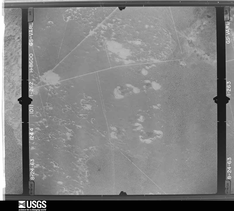
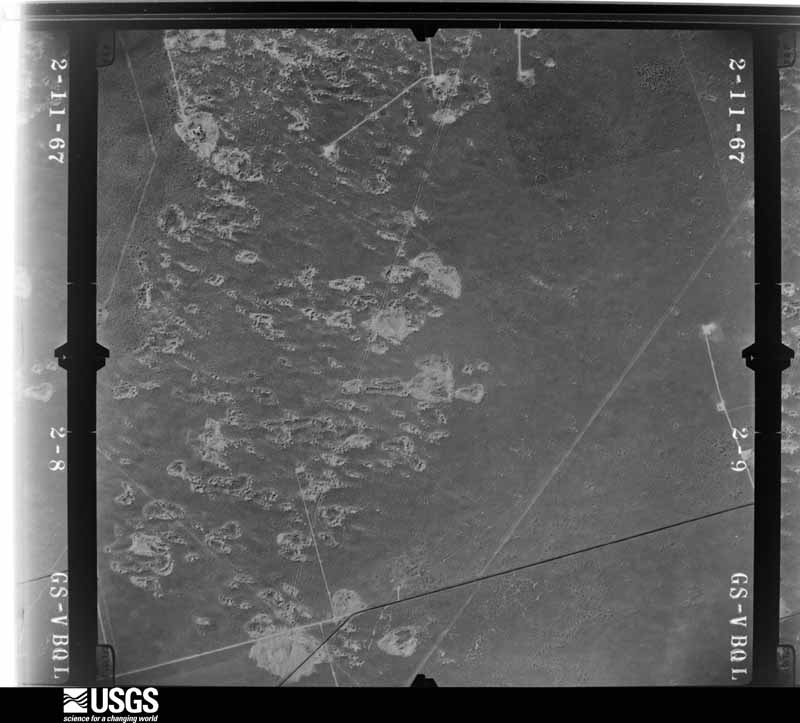
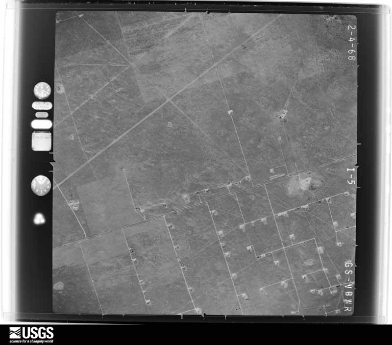
Flown by the U.S. Geological Survey between 1937 and 1989, the Aerial Photo Single Frames collection is the definitive mid-century view of the land: fields, roads and rivers as the camera saw them. The Survey holds 1,492 frames inside the rectangle that bounds this county; the 31 frames below were taken over the county itself, chosen across the decades of flights (at most four a year from that rectangle), so one flight cannot crowd out the rest. The full set is free to browse and download at EarthExplorer under the dataset Aerial Photo Single Frames.




























The thermometers that kept this county's weather, as the federal records hold them. The extremes below are measured values from those records, not estimates.
Who lived here in 1950, one enumeration district at a time, as the Census Bureau described each district. Each row opens its official National Archives result, with Population Schedules and ED Maps available there.
Every wildfire the federal occurrence database records inside this county: 324 of them, burning about 22,608 acres. 32 started naturally and 2 were recorded as arson. Each settlement page carries the fires within five miles of it.
| Reported cause | Fires |
|---|---|
| Equipment and vehicle use | 132 |
| Missing data/not specified/undetermined | 83 |
| Power generation/transmission/distribution | 49 |
| Natural | 32 |
| Debris and open burning | 10 |
| Misuse of fire by a minor | 8 |
| Railroad operations and maintenance | 6 |
| Smoking | 2 |
| Arson/incendiarism | 2 |
The five largest, by the area the report gives. None of them was recorded as arson.
| Date | Cause | Size | Reported by | Name on the report |
|---|---|---|---|---|
| 24 May 2011 | Natural | 2,800 acres | Texas A & M Forest Service | EDINS FIRE |
| 28 June 2008 | Natural | 2,000 acres | Texas A & M Forest Service | not named |
| 17 May 2008 | Missing data/not specified/undetermined | 1,800 acres | Texas A & M Forest Service | not named |
| 23 March 2010 | Missing data/not specified/undetermined | 1,740 acres | Texas A & M Forest Service | HENDERSON #1 FIRE |
| 25 February 2008 | Railroad operations and maintenance | 1,600 acres | Texas A & M Forest Service | not named |
| 27 August 2020 | Power generation/transmission/distribution | 1,166 acres | Texas A & M Forest Service | SANDS |
| 30 January 2008 | Missing data/not specified/undetermined | 1,124 acres | Texas A & M Forest Service | WOLF FIRE |
| 23 April 2011 | Missing data/not specified/undetermined | 1,000 acres | Texas A & M Forest Service | VEST #2 |
Every settlement page carries the fires within five miles of it - see the settlement index below.
The NOAA Storm Events Database holds 222 reports for this county, causing no deaths, no injuries and about $441,750 in recorded property damage. Each settlement page carries the reports that name it.
| Kind of event | Reports |
|---|---|
| Hail | 114 |
| Thunderstorm Wind | 77 |
| Flash Flood | 19 |
| Tornado | 11 |
| Flood | 1 |
The most serious of them, by death, then injury, then recorded damage. The accounts are quoted exactly as the forecast office filed them.
| When | Event | Place named | Harm | What the report says |
|---|---|---|---|---|
| June 2007 | Thunderstorm Wind | (Ink)Winkler Co Arpt | $100,000 | The Automated Surface Observing Station at Wink (KINK) recorded a wind gust of 67 mph. A local media outlet reported downed powerlines and trees in Kermit. The roof at the Family Activity Center of the First Baptist Church in Kermit was severely damaged. |
| June 2022 | Thunderstorm Wind | Kermit Robinson Arpt | $50,000 | A thunderstorm produced wind damage four miles east northeast of Kermit. Power lines and power poles were down along Highway 302 east of Kermit. There were some power lines also down in the City of Kermit. The time was estimated from radar. The wind speed was estimated. The cost of damage is a very rough estimate. |
| June 2022 | Thunderstorm Wind | Wink | $35,000 | A thunderstorm produced wind damage in Wink, TX. The winds caused light roof damage to a church, damage to nearby power poles, and uprooted a tree. Winds were estimated to be between 70 to 80 mph. The cost of damage is a very rough estimate. |
| August 2017 | Thunderstorm Wind | Wink | $30,000 | A thunderstorm moved across Winkler County and produced wind damage in Wink. Trees were down and roofs were damaged in Wink. The power was also knocked out too. The cost of damage is a very rough estimate. |
| July 2004 | Hail | Wink | $25,000 | Public and media reports indicated that tennis ball size hail broke windows out of vehicles and caused damage to melon crops near Wink. |
| May 1955 | Tornado (F2) | not stated | $25,000 | no account filed |
| September 2020 | Thunderstorm Wind | Kermit | $20,000 | A thunderstorm moved across Winkler County and produced wind damage about two miles north of Kermit. A powerline pole was snapped which left streets on the north side of Kermit without power. Several trees were uprooted and there was damage to roofing material and metal awnings. The cost of damage is a very rough estimate. |
| May 2007 | Flash Flood | Kermit | $20,000 | Street flooding occured within the city of Kermit with curb to curb flooding on Texas Highway 18. Several cars were stranded in high water in Kermit. |
| October 2003 | Hail | Kermit | $20,000 | A severe thunderstorm developed in the vicinity of Kermit. Hail to the size of pennies was reported on the south side of the city. The storm intensified as it moved east-northeast along Highway 302. A westbound motorist traveling in a recently purchased vehicle encountered tennis ball size hail ten miles east-northeast of Kermit. In an effort to escape the hail, the motorist turned around and headed east towards the Notrees community in western Ector County. Given slow travel in hazardous driving conditions and the storm's motion along the highway, the motorist continued to experience golfball to tennis ball size hail for the duration of the retreat to Notrees. The vehicle was totaled by the large hail. |
| August 2009 | Thunderstorm Wind | Wink | $14,000 | A total of 7 distribution power poles were knocked down/snapped along County Road 101 just south of Wink, TX. |
| March 2006 | Hail | Wink | $10,000 | Penny to quarter size hail fell in 60 to 65 mph winds in both Kermit and Wink, breaking many windows and shredding south facing building sides. |
| March 2006 | Thunderstorm Wind | Kermit | $10,000 | Penny to quarter size hail fell in 60 to 65 mph winds in both Kermit and Wink, breaking many windows and shredding south facing building sides. |
| March 2006 | Hail | Kermit | $10,000 | The Kermit Police Department reported hail up to two inches in diameter fell in Kermit. Coupled with high winds, the large hail broke many windows and shredded south facing building sides. |
| September 2002 | Thunderstorm Wind | Kermit | $10,000 | A well developed bow echo developed and moved east across Winkler County. The Kermit PD reported damaging winds up to 75 MPH. Large trees were blown down along with power poles. A few tin roofs received minor damage. |
| June 1995 | Hail | Kermit | $10,000 | Baseball-size hail damaged vehicles in Kermit. Reports from sheriff's office and public. At Wink the hail covered the ground. |
| August 2016 | Thunderstorm Wind | Kermit | $7,000 | A thunderstorm moved across Winkler County and produced wind damage in Kermit. A roof was blown off of a building. The cost of damage is a very rough estimate. |
| July 2009 | Thunderstorm Wind | Kermit | $7,000 | Three power poles were knocked down by severe wind gusts. In addition, 6-8 inch diameter tree limbs were snapped. |
| May 2007 | Flash Flood | Wink | $5,000 | Significant street flooding, up to 3 feet, occurred in the town of Wink due to heavy rainfall. Several vehicles were stranded in high water. At least one home had floodwaters on the 1st floor that had to be pumped out. |
| June 1997 | Thunderstorm Wind | Kermit | $5,000 | Microburst winds knocked down fences and blew a tree down in a city park. |
| September 1994 | Hail | Kermit | $5,000 | A Pecos radio station reported quarter-size hail lasting for 10 minutes near Pecos. The public reported up to golf ball-size hail lasting for just under 10 minutes on the south side of Kermit. |
| March 1993 | Thunderstorm Wind | Kermit | $5,000 | Downburst winds in Kermit downed a telephone pole in the city, according to the Winkler County Sheriff's Office. |
| June 2022 | Thunderstorm Wind | Wink Jct Station | $4,000 | A thunderstorm produced wind damage four miles east northeast of Wink. There were powerlines down on Highway 18. The cost of damage is a very rough estimate. |
| March 1958 | Tornado (F1) | not stated | $2,500 | no account filed |
| April 2012 | Hail | Kermit | $2,000 | A thunderstorm moved over Winkler County and produced one inch hail over Kermit. A pickup truck was dented on the east side of Kermit. The cost of the damage to the truck is a rough estimate. |
| August 2009 | Thunderstorm Wind | (Ink)Winkler Co Arpt | $2,000 | One distribution power pole was knocked down near the intersection of County Road 202 and State Highway 302. |
| July 2009 | Thunderstorm Wind | (Ink)Winkler Co Arpt | $2,000 | A powper pole was reported knocked down near the Winkler/Loving county line. |
| August 2025 | Thunderstorm Wind | Kermit | $1,000 | The sheriffs office received a report of an RV roof having been blow off onto a truck in Kermit. The time of occurrence is estimated from radar. The cost of damages is also estimated. |
| May 2019 | Hail | Kermit | $1,000 | A thunderstorm moved across Winkler County and produced tennis ball sized hail 21 miles northeast of Kermit. The hail resulted in broken skylights. The cost of damage is a very rough estimate. |
| September 2014 | Flash Flood | Cheyenne | $1,000 | Heavy rain fell across Winkler County and produced flash flooding in several locations in the county. Water was reported to be covering State Highways 115, 18, and 302. Water was also covering Farm to Market roads 1232 and 874. The cost of damage is a very rough estimate. |
| August 2006 | Thunderstorm Wind | Wink | $1,000 | The Winkler County Sheriff's Office reported that a tree was downed by thunderstorm winds and landed on a carport. They also reported that power lines were downed around Wink. |
| October 2018 | Flash Flood | Wink | $500 | Heavy rain fell across Winkler County and produced flash flooding in Wink. The intersection of State Highway 115 and Wildcat Drive was closed due to flooding. The timing of flooding was estimated. |
| October 2015 | Flash Flood | Kermit | $500 | Heavy rain fell across Winkler County and produced flash flooding in Kermit. One foot of water was reported running over Sycamore Street in Kermit. The cost of damage is a very rough estimate. |
| September 2014 | Flood | (Ink)Winkler Co Arpt | $500 | Local Emergency Management Officials reported that state highway 302 between US Highway 285 and Mentone was closed due to water over the road. Heavy rains from previous days lead to elevated flows along the Pecos that came over the banks and into adjacent low lying areas. |
| March 1993 | Hail | Wink | $500 | The weather observer at the Wink weather station reported quarter-size hail. No significant damage was observed. |
| September 2014 | Flash Flood | Wink Jct Station | $200 | Heavy rain fell across Winkler County and produced flash flooding south of Kermit. There was water running across Highway 18. No damage was reported so the cost of damage is a very rough estimate. |
| May 1993 | Hail | Kermit | $50 | SKYWARN spotters reported dime to quarter-size hail in Kermit. No significant damage resulted. |
| May 2025 | Hail | Kermit | - | A report of ping pong ball-size hail was received from mPING. |
| May 2025 | Hail | Kermit | - | A report of ping pong ball-size hail was received from mPING. |
| May 2025 | Thunderstorm Wind | (Ink)Winkler Co Arpt | - | A maximum wind gust of 77 mph was recorded at the Winkler County Airport ASOS (INK). The ASOS stopped reporting after this gust. |
| April 2025 | Hail | Kermit | - | Public reports of hail near Kermit. Hail was measured with measuring tape with several images of quarter to hen egg size hail stones. Time is estimated from radar. |
| May 2023 | Hail | Wink | - | Winkler County EMC reports golf ball size hail at 113 Aiport Road in Wink. |
| May 2023 | Hail | Wink | - | A trained spotter relayed a report from his son of approximately golf ball size hail 7 miles south of Wink. |
| June 2022 | Thunderstorm Wind | (Ink)Winkler Co Arpt | - | A thunderstorm produced a 66 mph wind gust at the Wink ASOS site. |
| June 2022 | Thunderstorm Wind | Wink | - | A thunderstorm produced a 61 mph wind gust at the ASOS site near Wink. |
| June 2022 | Thunderstorm Wind | Wink | - | A thunderstorm produced a 69 mph wind gust at the ASOS site near Wink. |
| September 2019 | Thunderstorm Wind | Wink | - | A thunderstorm moved across Winkler County and produced a 66 mph wind gust near Wink. |
| September 2019 | Thunderstorm Wind | Wink | - | A thunderstorm moved across Winkler County and produced a 60 mph wind gust at the Winkler County Airport. |
| June 2018 | Thunderstorm Wind | Wink | - | A thunderstorm moved across Winkler County and produced a 69 mph wind gust four miles northwest of Wink. |
| June 2018 | Flash Flood | Kermit | - | Heavy rain fell across Winkler County and produced flash flooding in Kermit. There was water up to the car doors on roads in Kermit. |
| May 2017 | Thunderstorm Wind | (Ink)Winkler Co Arpt | - | A thunderstorm moved across Winkler County and produced a 62 mph wind gust at the Winkler County Airport. |
| March 2017 | Thunderstorm Wind | Wink | - | A thunderstorm moved across Winkler County and produced a 61 mph wind gust at the Wink ASOS site. |
| August 2017 | Thunderstorm Wind | Wink | - | A thunderstorm moved across Winkler County and produced a 72 mph wind gust near Wink. |
| July 2017 | Thunderstorm Wind | Wink | - | A thunderstorm moved across Winkler County and produced a 62 mph wind gust near Wink. |
| May 2016 | Thunderstorm Wind | Wink | - | A thunderstorm moved across Winkler County and produced a 66 mph wind gust at the Wink ASOS. |
| August 2014 | Thunderstorm Wind | Wink | - | A thunderstorm moved across Winkler County and produced a 58 mph wind gust at the Wink ASOS site. No damage was reported. |
| June 2013 | Thunderstorm Wind | (Ink)Winkler Co Arpt | - | A cluster of thunderstorms moved across Winkler County and produced a 54 knot gust at the Wink Aiport. No damage was reported. |
| September 2013 | Thunderstorm Wind | Wink | - | A thunderstorm moved across Winkler County and produced a 62 mph wind gust three miles northwest of Wink. No damage was reported. |
| May 2010 | Tornado (EF0) | Kermit Robinson Arpt | - | Members of the Vortex2 team and TWISTEX both confirmed a rope tornado at 11:56 AM CST approximately 17 miles east southeast of Kermit, TX. The tornado then moved east northeast into western Ector County, with a confirmed dissipation time of 12:04 PM CST. There was no significant damage reported with this tornado. |
| March 2007 | Flash Flood | Wink | - | Local television meteorologists reported one and a half to two feet of water running over streets in the city of Wink, including Texas Highway 115. |
| June 2007 | Hail | Kermit Robinson Arpt | - | Lime sized hail was found in the bar ditches on Texas State Highway 302. |
Named settlements recorded in the Geographic Names Information System, each with the topographic sheets covering it. Villages, hamlets and abandoned places alike. Each is shown with the nearest named watercourse or landform and the survey quadrangle it falls on.