 Block
BlockAlamo, Texas
16 topographic sheets cover this place, the earliest surveyed in 1914 and the latest in 1992. It stands in the McAllen-Pharr census division. It lies in ZIP code area 78516. The Survey maps it on the Donna quadrangle. 19,493 people lived here at the 2020 count. It stands 98 feet above sea level.
Population over time
2 figuresAlamo grew from 18,353 to 19,493 between 2010 and 2020. These are the recorded population figures Wikidata holds for this place, reached through the Geographic Names Information System number this page is keyed on rather than by name, so they belong to this place and not to another of the same name. Most are census counts, but not all are: an early figure may be a founding or settlement estimate, and an estimate published within five years of a census is left out. The change column is computed, and is left blank where more than 20 years separate a figure from the one before it, because a gap that long is not a change between two counts.
| Year | People | Change |
|---|---|---|
| 2010 | 18,353 | |
| 2020 | 19,493 | +1,140 (+6%) |
Topographic sheets covering this place
10 surveys from 16 printed sheetsMatched by testing this settlement's coordinate against the published boundary of every sheet in the United States Geological Survey's historical collection. Each opens the scanned sheet at the Survey.
- 1914 USGS San Juan quadrangle1:48000
- 1914 USGS San Juan quadrangle1:62500
- 1916 USGS San Juan quadrangle1:62500, 3 printings
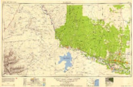
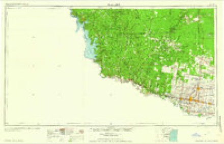
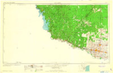
- 1949 USGS Mc Allen quadrangle1:250000
- 1954 USGS McAllen quadrangle1:250000
- 1957 USGS Mc Allen quadrangle1:250000, 2 printings
- 1962 USGS McAllen quadrangle1:250000
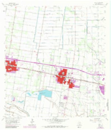
- 1963 USGS Donna quadrangle1:24000, 4 printings
- 1983 USGS Mc Allen quadrangle1:250000
- 1992 USGS Mc Allen quadrangle1:100000
Fires near this place
1,003 since 1996Regional context, not property-specific evidence. The federal wildfire occurrence database lists 1,003 fires within 5 miles of Alamo between 1996 and 2018, burning about 1,450 acres in total. 1 started naturally. 6 were recorded as arson. Distance is straight-line from the map coordinates, so a fire counted here may appear on a neighbouring settlement's page as well.
| Reported cause | Fires |
|---|---|
| Debris and open burning | 944 |
| Missing data/not specified/undetermined | 28 |
| Power generation/transmission/distribution | 19 |
| Arson/incendiarism | 6 |
| Equipment and vehicle use | 4 |
| Natural | 1 |
| Railroad operations and maintenance | 1 |
The most recent of them, most recent first, with the day each was reported and the service that recorded it.
| Date | Cause | Size | Reported by | Name on the report |
|---|---|---|---|---|
| 9 September 2015 | Debris and open burning | 1.0 acres | Texas A & M Forest Service | TRASH FIRE |
| 8 September 2010 | Debris and open burning | 1.0 acres | Texas A & M Forest Service | 10-728 |
| 7 September 2006 | Debris and open burning | 1.0 acres | Texas A & M Forest Service | not named |
| 6 September 2006 | Missing data/not specified/undetermined | 1.0 acres | Texas A & M Forest Service | not named |
| 5 September 2009 | Debris and open burning | 1.0 acres | Texas A & M Forest Service | 09-671 |
| 4 September 2017 | Debris and open burning | 1.0 acres | Texas A & M Forest Service | TRASH FIRE |
| 4 September 2011 | Debris and open burning | 1.0 acres | Texas A & M Forest Service | 11-656 |
| 4 September 2005 | Debris and open burning | 1.0 acres | Texas A & M Forest Service | not named |
Settlements close enough to share some of these fires:
Storms near this place
12 since 1999Regional context, not property-specific evidence. The National Weather Service names Alamo in 12 storm reports between 1999 and 2025: 6 thunderstorm wind, 3 hail, 2 flood, 1 flash flood. The reports record 3 deaths. Each account below is quoted exactly as the forecast office filed it, from the NOAA Storm Events Database, and each date opens the federal record of that event.
| When | Event | Place named | Harm | What the report says |
|---|---|---|---|---|
| March 2025 | Flash Flood | Alamo | 3 killed | Torrential rains moved out from the McAllen/metro into the mid-Valley section of Hidalgo County, to include locations east of Edinburg, including Elsa/Edcouch, then south through San Juan, Alamo, and Donna, extending south to around Military Highway (US 281) east of Pharr and near the Rio Grande.||Poor drainage locations flooded with at least 3 feet of water depth, and nearly the entire IH-2 frontage road had 2 to 3 or more feet of water depth, with dozens of vehicles stranded and at least one hundred more removed from the floodwaters. A number of farm-to-market and state highways had pockets of flood waters, forcing closures that lasted into March 28th. ||In this flood area, there were three known drownings when vehicles became submerged in deeper waters in canals/drainage areas during encounters with law enforcement. One drowning was a juvenile who was unable to be rescued from a vehicle that submerged near Edcouch.||Damage details and further information will be available later in 2025 from these areas. |
| May 2019 | Thunderstorm Wind | Alamo | $20,000 | The pulse-severe thunderstorm that felled trees just north of the Rio Grande minutes earlier produced its strongest gusts in North Alamo. In and near the Red Barn Colonia, at least two poorly homes sustained full destruction, and several downed trees and fences were also reported in the area. |
| August 2014 | Thunderstorm Wind | Alamo | $5,000 | Hidalgo County Sheriff's office reported several spots of trees and power lines down in and around Donna, Alamo, and San Juan. |
| May 1999 | Thunderstorm Wind | Alamo | $5,000 | Large tree limbs down at Santa Ana NWR. |
| June 2019 | Thunderstorm Wind | Alamo | $1,000 | One tree was blown down along Cummings Road in Donna. Time estimated from radar and from nearby gust to 41 mph at McAllen/Miller Airport at 734 PM CDT. |
| May 2019 | Thunderstorm Wind | Alamo | $1,000 | One large live oak tree was blown down at the Santa Ana National Wildlife Refuge along the Rio Grande, taking down several power lines and blocking an access road before removal. Another large tree was reported down a bit farther north in South Alamo, ten minutes later. |
| March 2025 | Flood | Alamo | - | The Texas Department of Transportation, along with local law enforcement, the public, and emergency management, reported high standing water of 2 to 3 feet in several poor drainage locations of southeastern Hidalgo County that persisted for two more days following historic seasonal rainfall/rainfall rates. ||This included much of the IH-2 frontage road from east Alamo through the Cameron County line (Mercedes/La Feria), as well as several Farm-to-Market roads which remained impassible for all or part of this time. Overwhelmed drainage systems took time for the water to run out completely, and the Flood Control Project (Main and North Floodways in southeastern Hidalgo County between Weslaco and Mercedes, extending north to La Villa and east to the Willacy County line near Santa Rosa) continued with up to an estimated 20% of freeboard (capacity).||An unknown number of homes in southeast Hidalgo County had at least 1 foot in them, especially in the poorest draining locations where at least 10 inches of rain fell on the 27th into very early on the 28th. ||Damage estimates will be included with the initial flash flood entries from March 27th. |
| May 2019 | Hail | Alamo | - | Quarter to golf ball sized hail was reported in Alamo with the core of a severe thunderstorm that also produced damaging winds. Golf ball hail was reported at 5 AM approximately 3 miles south of Alamo city center, and quarter-sized hail was reported at 514 AM (CDT) in Alamo, from social media reports. No damage was reported with either event. |
| June 2019 | Hail | Alamo | - | Penny sized hail was reported in Alamo as a strong thunderstorm passed through just before sunset. |
| October 2015 | Flood | Alamo | - | The estimated and measured ten to twelve plus inches of rain that fell in the Weslaco and Progresso area was far too much for drainage systems to handle, and even well after the rainfall stopped, numerous neighborhoods remained flooded and roads remained closed through the 26th. Please see flash flood event for damage estimates. |
| April 2003 | Hail | Alamo | - | no account filed |
| August 2003 | Thunderstorm Wind | Alamo | - | no account filed |
Nearest settlements
The eight closest, with where each one stands in the county. Distances are straight-line, computed from the Geographic Names Information System coordinates.
| Map | Place | Distance | Sheets |
|---|---|---|---|
| Sun Valley Estates Number 1 Colonia | 0.8 miles | 14 | |
| Browning-Ken Number 3 Colonia | 0.8 miles | 16 | |
| New Palm Colonia | 0.8 miles | 16 | |
| Seventh Street Addition Colonia | 0.8 miles | 16 | |
| Miller Resub Lot A Colonia | 0.8 miles | 14 | |
| Ignacio Perez Colonia | 0.8 miles | 16 | |
| San Juan East Colonia | 0.9 miles | 14 | |
| Adkins Colonia | 1.0 miles | 16 |
Elsewhere
Matched on this settlement's Geographic Names Information System number rather than its name, so it cannot be a different place of the same name in another state.
| Wikipedia article on Alamo | An encyclopaedic summary. Its text is share-alike, so it is linked here rather than copied. |
| Wikidata item Q981989 | The structured record the population and elevation above come from. Public domain (CC0). |
Provenance
This settlement is recorded in the Geographic Names Information System as feature 1329296. The sheet list is computed by point-in-boundary test against the United States Geological Survey's historical topographic inventory. Both are works of the United States government and carry no copyright under 17 U.S.C. 105.
Wildfire. Short, Karen C. 2022. Spatial wildfire occurrence data for the United States, 1992-2020 [FPA_FOD_20221014]. 6th Edition. Fort Collins, CO: Forest Service Research Data Archive. https://doi.org/10.2737/RDS-2013-0009.6 Collected with United States Government funding and usable without additional permissions or fees.
Storms. NOAA National Centers for Environmental Information, Storm Events Database https://www.ncei.noaa.gov/stormevents/ A work of the United States government, no copyright under 17 U.S.C. 105. Narratives are quoted verbatim from the National Weather Service report and are not edited or summarised.