 Block
BlockArlington, Texas
18 topographic sheets cover this place, the earliest surveyed in 1894 and the latest in 1995. It stands in the Arlington census division. It lies in ZIP code area 76010. The Survey maps it on the Arlington quadrangle. 394,266 people lived here at the 2020 count. It stands 604 feet above sea level.
On record in Arlington
Buildings and businesses the archive holds for this place. Each opens its own page, with the source record it came from.
On the National Register 6 records
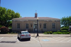 Arlington Post Officelisted 2000
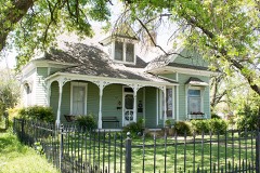 Hutcheson-Smith Houselisted 1984
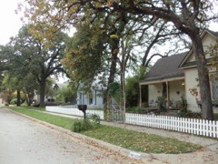 Old Town Historic Districtlisted 2000
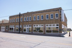 Vandergriff Buildinglisted 2010
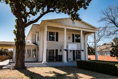 Vaught Houselisted 2005
- South Center Street Historic Districtlisted 2003
Population over time
2 figuresArlington grew from 365,438 to 394,266 between 2010 and 2020. These are the recorded population figures Wikidata holds for this place, reached through the Geographic Names Information System number this page is keyed on rather than by name, so they belong to this place and not to another of the same name. Most are census counts, but not all are: an early figure may be a founding or settlement estimate, and an estimate published within five years of a census is left out. The change column is computed, and is left blank where more than 20 years separate a figure from the one before it, because a gap that long is not a change between two counts.
| Year | People | Change |
|---|---|---|
| 2010 | 365,438 | |
| 2020 | 394,266 | +28,828 (+8%) |
Topographic sheets covering this place
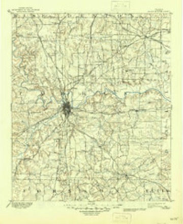
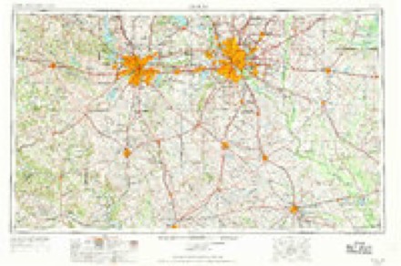
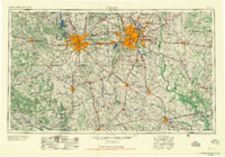
7 surveys from 18 printed sheetsMatched by testing this settlement's coordinate against the published boundary of every sheet in the United States Geological Survey's historical collection. Each opens the scanned sheet at the Survey.
- 1894 USGS Fort Worth quadrangle1:125000, 3 printings
- 1954 USGS Dallas quadrangle1:250000, 4 printings
- 1958 USGS Dallas quadrangle1:250000
- 1959 USGS Arlington quadrangle1:24000, 6 printings
- 1959 USGS Arlington quadrangle1:62500
- 1985 USGS Fort Worth quadrangle1:100000, 2 printings
- 1995 USGS Arlington quadrangle1:24000
Fires near this place
80 since 2005Regional context, not property-specific evidence. The federal wildfire occurrence database lists 80 fires within 5 miles of Arlington between 2005 and 2020, burning about 117 acres in total. None started naturally. 5 were recorded as arson. Distance is straight-line from the map coordinates, so a fire counted here may appear on a neighbouring settlement's page as well.
| Reported cause | Fires |
|---|---|
| Missing data/not specified/undetermined | 67 |
| Arson/incendiarism | 5 |
| Debris and open burning | 5 |
| Equipment and vehicle use | 2 |
| Smoking | 1 |
The most recent of them, most recent first, with the day each was reported and the service that recorded it.
| Date | Cause | Size | Reported by | Name on the report |
|---|---|---|---|---|
| 8 September 2015 | Missing data/not specified/undetermined | under an acre | Texas A & M Forest Service | E LOOP 820 |
| 6 September 2013 | Arson/incendiarism | 1.0 acres | Texas A & M Forest Service | ALLEN AVE |
| 3 September 2015 | Missing data/not specified/undetermined | 2.0 acres | Texas A & M Forest Service | GREENBELT |
| 28 September 2015 | Missing data/not specified/undetermined | under an acre | Texas A & M Forest Service | JOHN T WHITE |
| 27 September 2020 | Missing data/not specified/undetermined | under an acre | Texas A & M Forest Service | MEADOWBROOK |
| 2 September 2015 | Missing data/not specified/undetermined | 7.0 acres | Texas A & M Forest Service | GREENBELT |
| 18 September 2016 | Missing data/not specified/undetermined | under an acre | Texas A & M Forest Service | EAST FREEWAY |
| 18 September 2015 | Missing data/not specified/undetermined | under an acre | Texas A & M Forest Service | EAST FREEWAY |
Settlements close enough to share some of these fires:
Mines and quarries near this place
3 within 5 milesRegional context, not property-specific evidence. The federal mineral resources record lists 3 workings within 5 miles of Arlington: 3 producers. All of them still produce. What was taken out: Sand and Gravel, Construction. Distance is straight-line from the map coordinates, so a quarry counted here may appear on a neighbouring settlement's page as well.
| Where | Site | Commodity | Status | Recorded |
|---|---|---|---|---|
| Gifford Hill Lacy Pit | Sand and Gravel, Construction | Producer | ||
| Harston Gravel Company Operation | Sand and Gravel, Construction | Producer | ||
| Hatton Sumner Pit | Sand and Gravel, Construction | Producer |
Storms near this place
60 of 163 shownRegional context, not property-specific evidence. The National Weather Service names Arlington in 163 storm reports between 1993 and 2026: 70 hail, 53 thunderstorm wind, 23 flash flood, 11 lightning. The reports record 3 deaths and 20 injuries. Each account below is quoted exactly as the forecast office filed it, from the NOAA Storm Events Database, and each date opens the federal record of that event.
| When | Event | Place named | Harm | What the report says |
|---|---|---|---|---|
| July 2004 | Flash Flood | Arlington | 1 killed, $15,000 | One man drowned early Thursday morning when his SUV was swept down Rush Creek by high water.His age was unknown. |
| September 2018 | Flash Flood | Arlington | 1 killed | Broadcast media reported that a man drowned after being swept away by high water on the west side of the University of Texas Arlington campus. |
| January 2017 | Flood | Arlington | 1 killed | Flash flooding after a severe thunderstorm led to a man being swept away near the railroad tracks. |
| September 1993 | Tornado (F2) | Arlington | 5 hurt, $5,000,000 | A tornado touched down in Arlington just north of Interstate 30 on Lamar and Collins streets. A gas station, restaurant, and Ramada Inn motel were unroofed. Five injuries were reported at the Ramada Inn where walls on the second floor were blown inward. Damage was estimated at $3 million. |
| July 2010 | Thunderstorm Wind | Arlington | 5 hurt, $50,000 | Numerous trees and large limbs were blown down with a few trees landing on cars. Power poles were leaning around the Rangers Ballpark in Arlington, where a major league baseball game was to be played at 7 PM. The damage was concentrated from Highway 360 between Interstate 30 and Division Rd, west to Collins Street. Five parking lot attendees for the Texas Rangers suffered minor injuries from flying debris. |
| August 1995 | Thunderstorm Wind | Arlington | 4 hurt, $20,000 | There were numerous reports of trees, power lines and signs blown down. High winds broke the windows of a local theatre with four people injured by flying glass. |
| July 2007 | Flood | Arlington | 3 hurt | A high water rescue was required for three children who had been playing in Johnson Creek and were swept away. The children were treated for minor injuries. |
| July 1997 | Lightning | Arlington | 2 hurt | Lightning struck a pole and injured two men that were walking near it. |
| May 2006 | Lightning | Arlington | 1 hurt, $5,000 | Lightning started a fire at the 800 block of Tucker Boulevard. One person was treated for smoke inhalation. |
| April 1994 | Hail | Arlington | $50,000,000 | During the evening and early nighttime hours two severe thunderstorms moved across Arlington producing golf ball- to softball-size hail, mainly across Arlington south of Interstate 20 and east of Highway 287. Seventy City vehicles were damaged and at least 500 homes had roof,damage. The Buzz Post Pontiac dealership had 1200 vehicles damaged. Total damage for south Arlington is at least 10 million dollars. |
| November 1993 | Thunderstorm Wind | North Arlington | $500,000 | Downburst winds did an estimated $200,000 to businesses and an apartment complex |
| March 2016 | Hail | Arlington | $400,000 | no account filed |
| August 2005 | Lightning | Arlington | $325,000 | A 3,300-square-foot house on the 6400 block of Rock Inlet Court was struck by lightning and burned to the ground. The fire marshall reported a total loss. |
| June 2019 | Tornado (EF1) | Arlington | $200,000 | A National Weather Service survey team confirmed a brief tornado occurred in Arlington across a neighborhood east of Collins Street. The pattern of the damage in this neighborhood indicated a brief EF-1 tornado that dissipated before reaching the AT&T Stadium and Globe Life Park area. A few homes in the neighborhood had significant loss of roofing and several trees were snapped. Additional damage in Arlington was a result of straight-line winds of 60-70 mph. |
| June 2018 | Hail | Arlington | $100,000 | A social media report indicated tennis ball sized hail approximately 2 miles east of Arlington City Center. |
| February 1998 | Lightning | Arlington | $100,000 | Lightning struck and ignited fires in six homes. |
| July 1996 | Thunderstorm Wind | Arlington | $100,000 | no account filed |
| May 2011 | Hail | Arlington | $60,000 | no account filed |
| June 2014 | Flash Flood | Arlington | $50,000 | High water rescues were being conducted in Arlington near North Cooper Street and West Randol Mill Road. |
| July 2004 | Flash Flood | Arlington | $50,000 | Across southern Tarrant County, mostly in Arlington, there were 27 high water rescues, 12 streets closed due to high water, and 7 homes evacuated due to high water. |
| October 1993 | Thunderstorm Wind | Arlington | $50,000 | Two planes were severely damaged, and two construction trailers were blown over at the Arlington Municipal Airport in southeast Arlington. |
| October 1993 | Thunderstorm Wind | Arlington | $50,000 | Power lines and tree limbs blown down by high winds. |
| September 1993 | Thunderstorm Wind | Arlington | $50,000 | The roof was blown off of a home in north Arlington. |
| May 1998 | Lightning | Arlington | $35,000 | Lightning started a fire at a residence. |
| June 2018 | Hail | Arlington | $30,000 | A social media report indicated two-inch diameter hail in the city of Arlington, TX. |
| October 2014 | Thunderstorm Wind | Arlington | $30,000 | A report was received via social media of trees down on roofs. |
| April 2009 | Lightning | Arlington | $30,000 | A lightning strike started a house fire in south Arlington. |
| May 2007 | Thunderstorm Wind | Arlington | $30,000 | Strong winds blew the roof off of an apartment complex in the 1300 block of Timberlake Drive. |
| September 1997 | Lightning | Arlington | $30,000 | Lightning struck a house and started a fire that caused minor damage. |
| April 2012 | Thunderstorm Wind | Arlington | $25,000 | Tree damage was reported around the Bank of America building in Arlington; near the intersection of Ballpark Way and E Lamar Blvd. A few trees had 2 diameter branches snapped off and at least one tree was broken off near the ground. |
| June 1996 | Thunderstorm Wind | Arlington | $25,000 | no account filed |
| October 2014 | Thunderstorm Wind | Arlington | $20,000 | Broadcast media reported that a section of roofing at Arlington High School was lifted off and blown onto Cooper Street. |
| May 2001 | Lightning | Arlington | $20,000 | Lightning started an apartment fire that displaced four families. |
| July 2001 | Flash Flood | Arlington | $20,000 | Widespread reports of street flooding and cars stalled in high water in west and east central parts of the city. High water caused 20k in damage at a Baptist church. |
| May 1998 | Thunderstorm Wind | Arlington | $15,000 | Thunderstorm winds damaged 18 apartment units. |
| March 1998 | Thunderstorm Wind | Arlington | $15,000 | Part of a mobile home roof was peeled back by high winds. Water damage occurred to the interior from rain. |
| February 1997 | Thunderstorm Wind | Arlington | $15,000 | no account filed |
| January 1996 | Thunderstorm Wind | Arlington | $15,000 | no account filed |
| May 2011 | Thunderstorm Wind | Arlington | $12,000 | The automated weather station at Arlington Municipal Airport (KGKY) measured a 70 MPH wind gust. |
| June 2019 | Thunderstorm Wind | Arlington | $10,000 | Enhanced thunderstorm winds damaged trees in Arlington along mainly a west to east path. There were several large tree limbs broken and one tree was snapped. One building did have some window damage as well. This damage occurred around Rolling Hills Country|Club, just north of Interstate 30. |
| September 2018 | Flash Flood | Arlington | $10,000 | A social media report indicated that a swift water rescue was ongoing in the Doug Russell Park area near the intersection of Cooper St and Mitchell St in the city of Arlington, TX. |
| May 2015 | Thunderstorm Wind | Arlington | $10,000 | The ASOS in Arlington measured a wind gust to 69 mph. |
| April 2007 | Hail | Arlington | $10,000 | Golfball-size hail reported. |
| June 2004 | Flash Flood | Arlington | $10,000 | The Six Flags Over Texas amusement park was flooded by Johnson Creek and closed. 6 persons were rescued from a railroad car where they had taken refuge from high water. |
| February 2001 | Thunderstorm Wind | Arlington | $10,000 | Two exterior stucco walls were blown off an apartment complex on the east side of town. |
| June 2019 | Thunderstorm Wind | Arlington | $7,000 | Enhanced thunderstorm winds damaged trees and roofs in Arlington along mainly a west to east path. There was minor roof damage seen across this area and large tree limbs broken. Roof damage was confined to shingles removed from several homes and an apartment complex. This damage occurred southwest of AT&T Stadium between|Cooper St and AT&T Way. |
| June 2014 | Flash Flood | Arlington | $7,000 | Johnson Creek in Arlington overflowed its banks due to several inches of rain. The creek flooded part of Six Flags Over Texas. |
| October 2018 | Flash Flood | Arlington | $5,000 | Multiple road closures across Arlington, including 2100 Park Spring BLVD, California & Cannon DR and Fort Edge Dr. |
| May 2017 | Thunderstorm Wind | Arlington | $5,000 | A news article indicated that gusty winds associated with a thunderstorm caused safety sensors on a roller coaster at Six Flags to engage, trapping 8 passengers on the ride for 2 to 3 hours. |
| January 2007 | Flash Flood | Arlington | $5,000 | A high water rescue was required in North Arlington near Interstate 30. |
| February 2001 | Thunderstorm Wind | Arlington | $5,000 | A motel was unroofed by high winds. Large signs were blown down. |
| May 1999 | Lightning | Arlington | $5,000 | Lightning started a fire at an apartment complex. Damage was estimated at around 5,000 dollars. |
| June 1997 | Thunderstorm Wind | Arlington | $5,000 | Strong winds blew down trees and power lines, and damaged sheds. |
| August 1994 | Thunderstorm Wind | Arlington | $5,000 | A large billboard was blown down at the intersection of Loop 820 and the Mansfield Highway. |
| August 1994 | Thunderstorm Wind | Arlington | $5,000 | Power lines were blown down by high winds. |
| October 1993 | Thunderstorm Wind | Arlington | $5,000 | Trees were uprooted, and signs were blown down. Fences and a brick wall were blown down by thunderstorm winds. |
| May 2007 | Hail | Arlington | $5,000 | no account filed |
| July 2025 | Thunderstorm Wind | Arlington | $3,000 | Arlington Emergency Management and social media photos showed tree damage across Arlington. Radar analysis indicated a downburst with winds of 50-60 mph occurred and caused the damage. |
| August 2005 | Thunderstorm Wind | Arlington | $3,000 | Roof of an apartment complex was damaged. |
| July 1997 | Thunderstorm Wind | Arlington | $3,000 | Strong winds blew down trees and fences. |
Nearest settlements
The eight closest, with where each one stands in the county. Distances are straight-line, computed from the Geographic Names Information System coordinates.
| Map | Place | Distance | Sheets |
|---|---|---|---|
| University Park Village | 1.3 miles | 16 | |
| Pantego | 3.0 miles | 16 | |
| Johnsons Station | 3.2 miles | 16 | |
| Dalworthington Gardens | 3.4 miles | 16 | |
| Southland Acres | 4.2 miles | 18 | |
| Ederville | 5.6 miles | 20 | |
| Tarrant | 5.8 miles | 21 | |
| Handley | 5.8 miles | 16 |
Elsewhere
Matched on this settlement's Geographic Names Information System number rather than its name, so it cannot be a different place of the same name in another state.
| Wikipedia article on Arlington | An encyclopaedic summary. Its text is share-alike, so it is linked here rather than copied. |
| Wikidata item Q17943 | The structured record the population and elevation above come from. Public domain (CC0). |
Provenance
This settlement is recorded in the Geographic Names Information System as feature 1372320. The sheet list is computed by point-in-boundary test against the United States Geological Survey's historical topographic inventory. Both are works of the United States government and carry no copyright under 17 U.S.C. 105.
Wildfire. Short, Karen C. 2022. Spatial wildfire occurrence data for the United States, 1992-2020 [FPA_FOD_20221014]. 6th Edition. Fort Collins, CO: Forest Service Research Data Archive. https://doi.org/10.2737/RDS-2013-0009.6 Collected with United States Government funding and usable without additional permissions or fees.
Mines and quarries. USGS Mineral Resources Data System (MRDS) https://mrdata.usgs.gov/mrds/ A work of the United States government, no copyright under 17 U.S.C. 105.
Storms. NOAA National Centers for Environmental Information, Storm Events Database https://www.ncei.noaa.gov/stormevents/ A work of the United States government, no copyright under 17 U.S.C. 105. Narratives are quoted verbatim from the National Weather Service report and are not edited or summarised.