 Block
BlockCrowell, Texas
7 topographic sheets cover this place, the earliest surveyed in 1954 and the latest in 1985. It stands in the Crowell census division. It lies in ZIP code area 79227. The Survey maps it on the Crowell quadrangle. 769 people lived here at the 2020 count. It stands 1,473 feet above sea level.
Research this city
Population over time
2 figuresCrowell fell from 948 to 769 between 2010 and 2020. These are the recorded population figures Wikidata holds for this place, reached through the Geographic Names Information System number this page is keyed on rather than by name, so they belong to this place and not to another of the same name. Most are census counts, but not all are: an early figure may be a founding or settlement estimate, and an estimate published within five years of a census is left out. The change column is computed, and is left blank where more than 20 years separate a figure from the one before it, because a gap that long is not a change between two counts.
| Year | People | Change |
|---|---|---|
| 2010 | 948 | |
| 2020 | 769 | -179 (-19%) |
Topographic sheets covering this place
4 surveys from 7 printed sheetsMatched by testing this settlement's coordinate against the published boundary of every sheet in the United States Geological Survey's historical collection. Each opens the scanned sheet at the Survey.
- 1954 USGS Wichita Falls quadrangle1:250000, 3 printings
- 1958 USGS Wichita Falls quadrangle1:250000
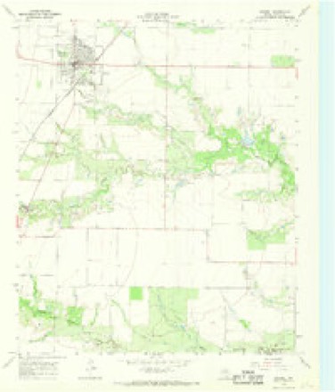
- 1966 USGS Crowell quadrangle1:24000
- 1985 USGS Lake Kemp quadrangle1:100000, 2 printings
Fires near this place
5 since 2007Regional context, not property-specific evidence. The federal wildfire occurrence database lists 5 fires within 5 miles of Crowell between 2007 and 2019, burning about 12,030 acres in total. None started naturally. None was recorded as arson. Distance is straight-line from the map coordinates, so a fire counted here may appear on a neighbouring settlement's page as well.
| Reported cause | Fires |
|---|---|
| Power generation/transmission/distribution | 3 |
| Equipment and vehicle use | 1 |
| Missing data/not specified/undetermined | 1 |
The most recent of them, most recent first, with the day each was reported and the service that recorded it.
| Date | Cause | Size | Reported by | Name on the report |
|---|---|---|---|---|
| 7 August 2011 | Equipment and vehicle use | 2.0 acres | Texas A & M Forest Service | PATILLO FIRE |
| 20 August 2019 | Power generation/transmission/distribution | 12,021 acres | Texas A & M Forest Service | VIVIAN |
| 22 June 2007 | Missing data/not specified/undetermined | 1.0 acres | Texas A & M Forest Service | not named |
| 14 June 2011 | Power generation/transmission/distribution | 5.0 acres | Texas A & M Forest Service | PARKHILL FIRE |
| 15 April 2011 | Power generation/transmission/distribution | under an acre | Texas A & M Forest Service | FM3103 |
Settlements close enough to share some of these fires:
Mines and quarries near this place
2 within 5 milesRegional context, not property-specific evidence. The federal mineral resources record lists 2 workings within 5 miles of Crowell: 1 occurrence, 1 unknown. None of them still produces. What was taken out: Copper. Distance is straight-line from the map coordinates, so a quarry counted here may appear on a neighbouring settlement's page as well.
| Where | Site | Commodity | Status | Recorded |
|---|---|---|---|---|
| Raggedy Creek | Copper | Unknown | ||
| Raggedy Creek-1 | Copper | Occurrence | 1877 |
Storms near this place
60 of 174 shownRegional context, not property-specific evidence. The National Weather Service names Crowell in 174 storm reports between 1993 and 2025: 110 hail, 50 thunderstorm wind, 9 tornado, 2 flood. No death or injury is recorded in these reports. Each account below is quoted exactly as the forecast office filed it, from the NOAA Storm Events Database, and each date opens the federal record of that event.
| When | Event | Place named | Harm | What the report says |
|---|---|---|---|---|
| August 1994 | Tornado (F2) | Crowell | $500,000 | no account filed |
| April 2000 | Thunderstorm Wind | Crowell | $60,000 | A barn, several sheds and grain storage bins were blown down on the south side of Crowell, while on the southeast side of Crowell, numerous power poles were downed; sheet metal was blown off a carport; house windows were blown out, and a tree was downed. |
| February 2000 | Hail | Crowell | $50,000 | Numerous roofs and vehicles were damaged by hail to the size of golf balls (1.75 inches). |
| May 1994 | Thunderstorm Wind | Crowell | $50,000 | no account filed |
| December 2012 | Thunderstorm Wind | Crowell | $10,000 | Power lines were reported down and windows blown in, along with tin roofs peeled back. |
| June 1999 | Lightning | Crowell | $6,000 | no account filed |
| June 2009 | Thunderstorm Wind | Crowell | $5,000 | A pick-up truck pulling a trailer was blown off of Highway 6 south of Crowell. Monetary damages were estimated. |
| May 1994 | Thunderstorm Wind | Crowell | $5,000 | no account filed |
| June 1994 | Thunderstorm Wind | Crowell | $5,000 | no account filed |
| October 1993 | Hail | Crowell | $5,000 | no account filed |
| March 1993 | Hail | Crowell | $5,000 | no account filed |
| April 1999 | Thunderstorm Wind | Crowell | $3,000 | no account filed |
| September 2005 | Thunderstorm Wind | Crowell | $750 | Three inch diameter tree limbs were downed. There was also minor sign damage. The shutters were blown off a house. |
| April 2000 | Thunderstorm Wind | Crowell | $500 | Powerlines were downed. |
| May 1998 | Thunderstorm Wind | Crowell | $500 | no account filed |
| May 2025 | Thunderstorm Wind | Crowell | - | Comanche Springs (COMA) Mesonet observation. Intermittent severe (>50-knot) wind gusts beginning at 2308 LST, with the peak gust of 57 knots at 2314 LST. A heat burst was likely responsible for this event. |
| July 2025 | Thunderstorm Wind | Crowell | - | Crowell (CROW) Mesonet observation. |
| July 2025 | Thunderstorm Wind | Crowell | - | Crowell (CROW) Mesonet observation. |
| July 2025 | Thunderstorm Wind | Crowell | - | Crowell (CROW) Mesonet observation. |
| July 2025 | Thunderstorm Wind | Crowell | - | Comanche Springs (COMA) Mesonet. Severe (>50-knot) wind gusts occurred during the event time, with the peak gust of 59 knots occurring at 2032 LST. |
| July 2025 | Thunderstorm Wind | Crowell | - | Crowell (CROW) Mesonet observation. Severe (>50-knot) wind gusts occurred during the event time, with the peak gust of 70 knots occurring at 2053 LST. |
| March 2024 | Hail | Crowell | - | Time is radar estimated. |
| February 2024 | Thunderstorm Wind | Crowell | - | Comanche Springs (COMA) Mesonet observation. |
| November 2024 | Thunderstorm Wind | Crowell | - | Comanche Springs (COMA) Mesonet observation. |
| May 2024 | Thunderstorm Wind | Crowell | - | Relayed by 911 call center. |
| July 2023 | Thunderstorm Wind | Crowell | - | Crowell (CROW) Mesonet observation. |
| May 2022 | Thunderstorm Wind | Crowell | - | While surveying the tornado path that crossed south of Crowell, storm surveyors noted tree damage along State Highway 6 and along County Road 340 to the north of the tornado path. |
| May 2022 | Tornado (EFU) | Crowell | - | Storm chasers reported a tornado southeast of Crowell at 811 pm CDT. No damage is known to have occurred and the location is estimated based on the chasers' viewpoints. |
| May 2022 | Tornado (EFU) | Crowell | - | Storm chasers observed this tornado that initially developed in northern King County TX (see separate entry for King County from NWS Lubbock TX) before moving northeast into the far southwest corner of Foard County. A storm survey observed no damage as this tornado occurred in open ranchland with few roads, so the specific location is estimated. |
| May 2022 | Tornado (EF0) | Crowell | - | This tornado developed southwest of Crowell and was observed by many storm spotters and storm chasers. Although information from storm chasers indicate that the tornado initially formed farther to the west-southwest in open ranchland, the damage found in a storm survey was generally confined to mesquite tree limb damage observed on FM-263 about 3 miles west of State Highway 6. Numerous storm chaser videos and observations show that the tornado turned more to just south of east after crossing FM-263 and narrowly missed wind turbines along FM-263 just west of Highway 6 before turning to the northeast and crossing State Highway 6 before dissipating. |
| April 2021 | Hail | Crowell | - | Twitter picture, location radar estimated. |
| May 2018 | Thunderstorm Wind | Crowell | - | No damage reported. |
| May 2018 | Flash Flood | Crowell | - | Eight inches of water reported over FM 263 and FM 1594. |
| May 2015 | Flash Flood | Crowell | - | Highway 6 and several rural roads closed due to flooding with up to a foot of water over many roadways. |
| May 2015 | Tornado (EF0) | Crowell | - | Storm spotters observed a tornado approximately 6 miles west of Crowell. No damage was reported. |
| May 2015 | Hail | Crowell | - | Time estimated from radar. |
| May 2015 | Thunderstorm Wind | Crowell | - | No damage reported. |
| May 2015 | Hail | Crowell | - | No damage reported. |
| May 2015 | Hail | Crowell | - | Time estimated from radar. No damage reported. |
| May 2015 | Hail | Crowell | - | Time estimated from radar after delayed report. |
| May 2015 | Thunderstorm Wind | Crowell | - | No damage reported. |
| May 2015 | Hail | Crowell | - | No damage was reported. |
| May 2015 | Thunderstorm Wind | Crowell | - | Less than 2-inch small tree limbs downed. |
| May 2015 | Thunderstorm Wind | Crowell | - | No damage reported. |
| May 2014 | Thunderstorm Wind | Crowell | - | Several power lines and a wind generator were damaged near Crowell. Time estimated from radar. |
| May 2012 | Tornado (EF0) | Crowell | - | A storm chaser reported a large rain-wrapped tornado estimated to be about 10 miles northwest of Truscott. This tornado occurred in open country and no damage was reported. This tornado may have been a longer duration event, but the high-precipitation character of the storm and lack of damage likely prevented confirmation of the tornado through much of the tornado's life cycle. |
| June 2011 | Thunderstorm Wind | Crowell | - | No damage occurred with the wind gust. |
| April 2009 | Hail | Crowell | - | Hail up to half dollar-size was reported. Winds of 40 to 50 mph were also reported. |
| April 2009 | Hail | Crowell | - | Quarter- to golf ball-size hail covered the ground. |
| April 2009 | Hail | Crowell | - | Hail up to ping pong ball size fell for about 10 minutes, covering the ground. |
| June 2009 | Hail | Crowell | - | Nickel to ping pong ball size hail was reported. The hail lasted about five minutes. |
| June 2009 | Hail | Crowell | - | Forty to fifty mile per hour winds were also reported. |
| June 2009 | Thunderstorm Wind | Crowell | - | Significant damage was reported to a coop on the south side of Crowell on Highway 6 Two 15,000 bushel grain bins were destroyed and the roofs of four other bins were completely removed. The side of a 290,000 bushel bin was also caved in. The debris was strewn across Highway 6 on the south side of town. Several roofs were removed from structures surrounding the courthouse, which also reported broken windows. A few residences also reported minor roof damage. Many trees were uprooted and large power poles were knocked down. Power lines were downed across of Highway 70, and numerous signs were damaged. Monetary damage estimates were not available. |
| May 2007 | Hail | Crowell | - | The hail was reported on Highway 6. |
| June 2007 | Hail | Crowell | - | The report was relayed by WFO Lubbock. |
| June 2007 | Thunderstorm Wind | Crowell | - | The wind gust was reported on HWY 70 near the Cottle/Foard county line. |
| June 2007 | Thunderstorm Wind | Crowell | - | The wind gust was reported at Fish Ranch. |
| June 2007 | Thunderstorm Wind | Crowell | - | The wind gust was reported by the county sheriff. |
| June 2007 | Thunderstorm Wind | Crowell | - | Several large tree limbs and power lines were downed. Monetary damages were estimated. |
| October 2006 | Flood | Crowell | - | A moderate flood crest occurred along the North Wichita River near Truscott, TX in northern Knox and southern Foard counties on October 16-17. The North Wichita River crested at 18.3 feet, 4.3 feet above flood stage, at 6:30 pm CST on October 16, and remained above flood stage from 1:00 am CST on October 16 to 9:00 pm CST on October 17. Flooding of agricultural lands along the river occurred during this event. |
Nearest settlements
The eight closest, with where each one stands in the county. Distances are straight-line, computed from the Geographic Names Information System coordinates.
| Map | Place | Distance | Sheets |
|---|---|---|---|
| Margaret | 6.0 miles | 10 | |
| Foard City | 8.1 miles | 7 | |
| Thalia | 9.9 miles | 7 | |
| Rayland | 14.0 miles | 10 | |
| Vivian | 14.3 miles | 11 |
Elsewhere
Matched on this settlement's Geographic Names Information System number rather than its name, so it cannot be a different place of the same name in another state.
| Wikipedia article on Crowell | An encyclopaedic summary. Its text is share-alike, so it is linked here rather than copied. |
| Wikidata item Q958976 | The structured record the population and elevation above come from. Public domain (CC0). |
Provenance
This settlement is recorded in the Geographic Names Information System as feature 1355438. The sheet list is computed by point-in-boundary test against the United States Geological Survey's historical topographic inventory. Both are works of the United States government and carry no copyright under 17 U.S.C. 105.
Wildfire. Short, Karen C. 2022. Spatial wildfire occurrence data for the United States, 1992-2020 [FPA_FOD_20221014]. 6th Edition. Fort Collins, CO: Forest Service Research Data Archive. https://doi.org/10.2737/RDS-2013-0009.6 Collected with United States Government funding and usable without additional permissions or fees.
Mines and quarries. USGS Mineral Resources Data System (MRDS) https://mrdata.usgs.gov/mrds/ A work of the United States government, no copyright under 17 U.S.C. 105.
Storms. NOAA National Centers for Environmental Information, Storm Events Database https://www.ncei.noaa.gov/stormevents/ A work of the United States government, no copyright under 17 U.S.C. 105. Narratives are quoted verbatim from the National Weather Service report and are not edited or summarised.