 Block
BlockEast Bernard, Texas
11 topographic sheets cover this place, the earliest surveyed in 1953 and the latest in 1985. It stands in the East Bernard census division. It lies in ZIP code area 77435. The Survey maps it on the East Bernard quadrangle. 2,218 people lived here at the 2020 count. It stands 125 feet above sea level.
Population over time
2 figuresEast Bernard fell from 2,272 to 2,218 between 2010 and 2020. These are the recorded population figures Wikidata holds for this place, reached through the Geographic Names Information System number this page is keyed on rather than by name, so they belong to this place and not to another of the same name. Most are census counts, but not all are: an early figure may be a founding or settlement estimate, and an estimate published within five years of a census is left out. The change column is computed, and is left blank where more than 20 years separate a figure from the one before it, because a gap that long is not a change between two counts.
| Year | People | Change |
|---|---|---|
| 2010 | 2,272 | |
| 2020 | 2,218 | -54 (-2%) |
Topographic sheets covering this place
5 surveys from 11 printed sheetsMatched by testing this settlement's coordinate against the published boundary of every sheet in the United States Geological Survey's historical collection. Each opens the scanned sheet at the Survey.
- 1953 USGS Seguin quadrangle1:250000, 4 printings
- 1956 USGS Wallis quadrangle1:62500
- 1958 USGS Seguin quadrangle1:250000
- 1960 USGS East Bernard quadrangle1:24000, 3 printings
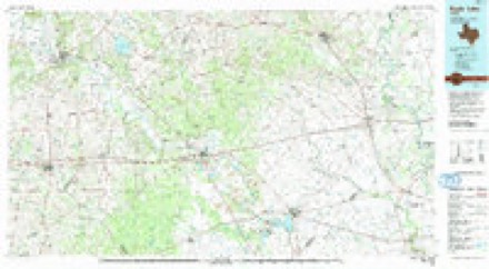
- 1985 USGS Eagle Lake quadrangle1:100000, 2 printings
Storms near this place
20 since 1995Regional context, not property-specific evidence. The National Weather Service names East Bernard in 20 storm reports between 1995 and 2024: 9 thunderstorm wind, 6 hail, 2 lightning, 2 tornado. The reports record 3 injuries. Each account below is quoted exactly as the forecast office filed it, from the NOAA Storm Events Database, and each date opens the federal record of that event.
| When | Event | Place named | Harm | What the report says |
|---|---|---|---|---|
| June 2011 | Thunderstorm Wind | East Bernard | 3 hurt | A pulse severe thunderstorm produce strong winds that downed power lines in East Bernard. |
| August 2017 | Tornado (EF1) | East Bernard | $300,000 | Tornado began as a weak EF0 in East Bernard then tracked NW across SH 90 where it strengthened to EF1 snapping the trunks of several large mature oak and pecan trees. A house suffered significant brick facade damage to one side of the home. Four apartments were damaged on college street. |
| May 2000 | Thunderstorm Wind | East Bernard | $150,000 | Roof blown off Big State Grass Farm near SH 60. Trailer overturned, carport destroyed, and trees down in El Lobo subdivision. |
| August 2017 | Tornado (EF0) | East Bernard | $50,000 | Trees down along a southeast to northwest path. Horse trailer overturned. Tornado caught on video. |
| May 2006 | Lightning | East Bernard | $25,000 | Lightning strike caused a house attic fire that produced minor damage. |
| August 2000 | Hail | East Bernard | $25,000 | no account filed |
| May 2006 | Lightning | East Bernard | $20,000 | Lightning strike caused minor damage to a home. |
| April 2000 | Hail | East Bernard | $15,000 | Quarter sized hail reported at East Bernard and at Spanish Camp. |
| June 2019 | Thunderstorm Wind | East Bernard | $11,000 | Houses were damaged in the East Bernard area close to Highway 60. |
| May 2024 | Thunderstorm Wind | East Bernard | $10,000 | Wind gusts collapsed a metal bleacher at the East Bernard High School. |
| June 2008 | Thunderstorm Wind | East Bernard | $9,000 | Strong thunderstorm winds caused major roof damage to a residential home on the 400 block of Lewis Street in East Bernard. |
| September 1996 | Thunderstorm Wind | East Bernard | $5,000 | no account filed |
| April 2003 | Hail | East Bernard | $4,000 | no account filed |
| September 2011 | Thunderstorm Wind | East Bernard | $3,000 | Severe thunderstorm winds downed large tree limbs onto power lines and cars in the East Bernard area. |
| August 1998 | Thunderstorm Wind | East Bernard | $3,000 | Large limbs blown down. |
| April 1995 | Hail | East Bernard | $1,000 | Sheriffs office reported dime- to quarter-size hail in east Bernard. |
| May 2019 | Hail | East Bernard | - | Quarter sized hail was reported. |
| April 2015 | Thunderstorm Wind | East Bernard | - | Trees were downed and there was damage to a barn on the east end of CR 272 near the San Bernard River. |
| January 2012 | Hail | East Bernard | - | Severe thunderstorms produced ping pong sized hail in the East Bernard area. |
| August 2005 | Funnel Cloud | East Bernard | - | no account filed |
Nearest settlements
The eight closest, with where each one stands in the county. Distances are straight-line, computed from the Geographic Names Information System coordinates.
| Map | Place | Distance | Sheets |
|---|---|---|---|
| Nottawa | 4.2 miles | 10 | |
| Lissie | 8.4 miles | 10 | |
| Hungerford | 9.1 miles | 8 | |
| Sand Ridge | 12.4 miles | 9 | |
| Egypt | 12.4 miles | 8 | |
| Bonus | 12.4 miles | 9 | |
| Dorman | 12.9 miles | 8 | |
| Sorrelle | 14.1 miles | 9 |
Elsewhere
Matched on this settlement's Geographic Names Information System number rather than its name, so it cannot be a different place of the same name in another state.
| Wikipedia article on East Bernard | An encyclopaedic summary. Its text is share-alike, so it is linked here rather than copied. |
| Wikidata item Q974279 | The structured record the population and elevation above come from. Public domain (CC0). |
Provenance
This settlement is recorded in the Geographic Names Information System as feature 1334880. The sheet list is computed by point-in-boundary test against the United States Geological Survey's historical topographic inventory. Both are works of the United States government and carry no copyright under 17 U.S.C. 105.
Storms. NOAA National Centers for Environmental Information, Storm Events Database https://www.ncei.noaa.gov/stormevents/ A work of the United States government, no copyright under 17 U.S.C. 105. Narratives are quoted verbatim from the National Weather Service report and are not edited or summarised.