 Block
BlockEdcouch, Texas
9 topographic sheets cover this place, the earliest surveyed in 1953 and the latest in 1992. It stands in the Edcouch-Elsa census division. It lies in ZIP code area 78538. The Survey maps it on the Edcouch quadrangle. 2,732 people lived here at the 2020 count. It stands 59 feet above sea level.
Population over time
2 figuresEdcouch fell from 3,161 to 2,732 between 2010 and 2020. These are the recorded population figures Wikidata holds for this place, reached through the Geographic Names Information System number this page is keyed on rather than by name, so they belong to this place and not to another of the same name. Most are census counts, but not all are: an early figure may be a founding or settlement estimate, and an estimate published within five years of a census is left out. The change column is computed, and is left blank where more than 20 years separate a figure from the one before it, because a gap that long is not a change between two counts.
| Year | People | Change |
|---|---|---|
| 2010 | 3,161 | |
| 2020 | 2,732 | -429 (-14%) |
Topographic sheets covering this place
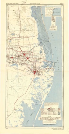
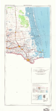
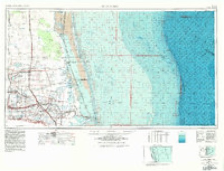
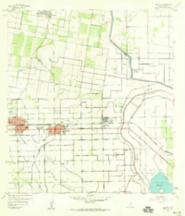
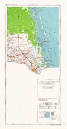
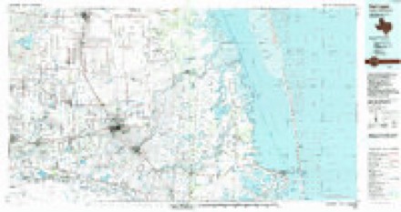
6 surveys from 9 printed sheetsMatched by testing this settlement's coordinate against the published boundary of every sheet in the United States Geological Survey's historical collection. Each opens the scanned sheet at the Survey.
- 1953 USGS Brownsville quadrangle1:250000
- 1956 USGS Brownsville quadrangle1:250000, 2 printings
- 1956 USGS Port Isabel quadrangle1:250000
- 1957 USGS Edcouch quadrangle1:24000, 3 printings
- 1962 USGS Brownsville quadrangle1:250000
- 1992 USGS Harlingen quadrangle1:100000
Fires near this place
41 since 1999Regional context, not property-specific evidence. The federal wildfire occurrence database lists 41 fires within 5 miles of Edcouch between 1999 and 2017, burning about 385 acres in total. None started naturally. 1 was recorded as arson. Distance is straight-line from the map coordinates, so a fire counted here may appear on a neighbouring settlement's page as well.
| Reported cause | Fires |
|---|---|
| Missing data/not specified/undetermined | 25 |
| Debris and open burning | 13 |
| Misuse of fire by a minor | 1 |
| Smoking | 1 |
| Arson/incendiarism | 1 |
The most recent of them, most recent first, with the day each was reported and the service that recorded it.
| Date | Cause | Size | Reported by | Name on the report |
|---|---|---|---|---|
| 20 August 2009 | Misuse of fire by a minor | 9.0 acres | Texas A & M Forest Service | ELSA FIRE |
| 8 July 2005 | Debris and open burning | 2.0 acres | South Texas Refuge Complex | 12 MILE |
| 1 July 2007 | Debris and open burning | 1.0 acres | South Texas Refuge Complex | EDCOUCH |
| 13 June 1999 | Missing data/not specified/undetermined | 60 acres | Lower Rio Grande Valley National Wildlife Refuge | LRGV |
| 15 May 2005 | Arson/incendiarism | 5.0 acres | South Texas Refuge Complex | CEMETARY |
| 8 April 2006 | Debris and open burning | 1.0 acres | Texas A & M Forest Service | not named |
| 6 April 2005 | Debris and open burning | 125 acres | South Texas Refuge Complex | ELSA |
| 30 April 2006 | Debris and open burning | 2.0 acres | Texas A & M Forest Service | not named |
Settlements close enough to share some of these fires:
Storms near this place
8 since 2001Regional context, not property-specific evidence. The National Weather Service names Edcouch in 8 storm reports between 2001 and 2025: 3 thunderstorm wind, 2 flash flood, 1 hail, 1 flood. No death or injury is recorded in these reports. Each account below is quoted exactly as the forecast office filed it, from the NOAA Storm Events Database, and each date opens the federal record of that event.
| When | Event | Place named | Harm | What the report says |
|---|---|---|---|---|
| March 2025 | Tornado (EF0) | Edcouch | $500,000 | A small tornado briefly touched down about 1.5 |miles east of Edcouch, lifting the sheet metal roof of a warehouse|belonging to a crop dusting company. Pieces of the roof were |blown to the northeast along the 0.25 mile path, landing in open |fields on the north and south side of SH-107. The debris was |scattered in varying directions along the path. Partial metal wall|failure was also noted to the building, which was a total loss. A|metal building structure (MBS) hangar that sheltered one of the |crop-dusting aircraft was also damaged, with a small portion of |the roof lifted off and the garage door bent inward, toward the |center of the circulation. The aircraft inside was also impacted, |with an estimated $500 thousand in damage to it. Each structure |was old with generally poor connectors and rusted metal parts, |each built more than 80 years ago, according to the owner.||Other damage included parts of an unanchored fence blown down at |a drive-through convenience store, several large mesquite limbs |snapped off in open areas along the track, one rotting and unused |telephone pole snapped, and another one bent. ||A resident of a manufactured home who witnessed the event noted a|swirling column of rain as the tornado passed by, indicating that|the tornado was likely rain-wrapped. |
| July 2008 | Flash Flood | Edcouch | $28,500 | Torrential rains from Hurricane Dolly began pelting eastern Hidalgo County around 3 PM CDT on the 23rd, and flash flooding began soon after, probably at around 4 PM CDT in the Edcouch/Elsa/Mercedes area, spreading slowly west during the rest of the afternoon and evening. The initial surge of torrential rains, which pounded these areas until around 7 PM CDT or so, became a more widespread area of moderate to locally heavy rainfall later in the evening and overnight, generally along a stripe of central Hidalgo County, along and just north of Federal Highway 83. As with Cameron and Willacy Counties earlier on the 23rd, the heaviest rains were associated with the western and southern portions of Dolly's circulation, which edged into eastern Hidalgo County by around 9 PM CDT on the 23rd, then eased northwest overnight, reaching the four corners of Jim Hogg, Brooks, Hidalgo, and Starr County at little after 230 AM on the 24th. ||The prolonged heavy rains quickly produced high standing water, particularly in poorly draining areas of eastern Hidalgo County by late afternoon of the 23rd, including Mercedes, Elsa, and Edcouch. Residential and business flooding with some areas having at least 3 feet of water, continued through the night. Farther west, including the more populated portions of central Hidalgo County, minor to moderate flash flooding developed later in the evening and overnight, with worst conditions favoring poor drainage locations. ||Heaviest measured and estimated rainfall included a swath of 10 inches or more from rural western Hidalgo County through the Hidalgo/Cameron and Hidalgo/Willacy County lines, immediately west and south of Dolly's Center. This included the northern portions of Mission, McAllen, Donna, and Weslaco, as well as Edinburg and Alton. Estimated and measured storm totals of 12 to 16 inches were found from Monte Alto the Edcouch and Elsa; it's possible that more than 16 inches fell near the Willacy/Cameron/Hidalgo County line near Monte Alto.||High standing water, particularly in eastern portions of the county, continued for more than a day after the flash flood; some poor drainage locations near Elsa, Edcouch, and Mercedes would maintain flood conditions for another week or more.||Property damage values are those received on insured properties by the National Flood Insurance Program, and are likely well below the actual damages caused by the flooding, particularly in eastern Hidalgo County. Crop and agricultural damage is based, thus far, on data as of October 3rd from the Texas Agrilife Extension Service, who reported Dolly's flood losses to cotton and sorghum as the worst agricultural disaster in decades. Updated values will be provided as data are received. Please note that damages have been split between the flash flood period, and the longer, general flood which followed. |
| July 2008 | Flood | Edcouch | $28,500 | The combination of 10 to 16 inches of rain, poor drainage issues, and the overarching fact that the flat, saturated landscape of the Lower Rio Grande River Delta drains very slowly, maintained widespread flood conditions well after the rains ended during the early morning of the 24th. Numerous roads and neighborhoods, particularly across eastern and central Hidalgo County, remained flooded right through the weekend which followed Dolly's passage. In some areas, where ground drainage mechanisms were exceptionally poor, the flooding persisted into August. ||Some of these areas included neighborhoods in and near Elsa, Edcouch, and Mercedes, and likely in others farther west from Edinburg to Alton, as well as parts of McAllen as well. Near Mercedes, an employee of the International Boundary and Water Commission (IBWC) reported that a structure which allows the canal to drain into the Arroyo Colorado Floodway collapsed. This created an obstruction so the canal filled up and started flowing back into the adjacent community, exacerbating the ongoing flood. Pumping efforts began over the weekend of the 26th and 27th. Other notorious neighborhoods with poor drainage, particularly in and near Elsa, had continued high water for several weeks after Dolly's passage.||Property damage values are those received on insured properties by the National Flood Insurance Program, and are likely well below the actual damages caused by the flooding, particularly in eastern Hidalgo County. Crop and agricultural damage is based, thus far, on data as of October 3rd from the Texas Agrilife Extension Service, who reported Dolly's flood losses to cotton and sorghum as the worst agricultural disaster in decades. Updated values will be provided as data are received. Please note that damages have been split between the general flood listed here, and the flash flood period which preceded it. |
| May 2010 | Thunderstorm Wind | Edcouch | $5,000 | Broadcast media reported a roof was blown off a mobile home during a thunderstorm that produced high winds across the area. Radar indicated a couplet of winds, as well as a reflectivity overhang, had moved across the area, suggesting a possible tornado. There were no confirmed reports of a tornado, however. |
| April 2015 | Thunderstorm Wind | Edcouch | - | Several powerlines were reported down in the city of Edcouch. |
| May 2014 | Thunderstorm Wind | Edcouch | - | Spotter reported wind gusts of an estimated 55 to 60 mph in Edcouch. |
| May 2007 | Flash Flood | Edcouch | - | Flash flooding of Farm to Market Road 1015 and Highway 107 reported. |
| April 2001 | Hail | Edcouch | - | no account filed |
Nearest settlements
The eight closest, with where each one stands in the county. Distances are straight-line, computed from the Geographic Names Information System coordinates.
| Map | Place | Distance | Sheets |
|---|---|---|---|
| L D Morgan's Colonia | 0.2 miles | 9 | |
| McDaniel Addition Colonia | 0.6 miles | 9 | |
| La Hacienda Colonia | 1.3 miles | 9 | |
| Salinas-Hinojosa Colonia | 1.4 miles | 9 | |
| Ten Acres Colonia | 1.7 miles | 9 | |
| Elsa | 1.7 miles | 9 | |
| La Villa | 1.7 miles | 9 | |
| Catherine Colonia | 1.8 miles | 9 |
Elsewhere
Matched on this settlement's Geographic Names Information System number rather than its name, so it cannot be a different place of the same name in another state.
| Wikipedia article on Edcouch | An encyclopaedic summary. Its text is share-alike, so it is linked here rather than copied. |
| Wikidata item Q981965 | The structured record the population and elevation above come from. Public domain (CC0). |
Provenance
This settlement is recorded in the Geographic Names Information System as feature 1335079. The sheet list is computed by point-in-boundary test against the United States Geological Survey's historical topographic inventory. Both are works of the United States government and carry no copyright under 17 U.S.C. 105.
Wildfire. Short, Karen C. 2022. Spatial wildfire occurrence data for the United States, 1992-2020 [FPA_FOD_20221014]. 6th Edition. Fort Collins, CO: Forest Service Research Data Archive. https://doi.org/10.2737/RDS-2013-0009.6 Collected with United States Government funding and usable without additional permissions or fees.
Storms. NOAA National Centers for Environmental Information, Storm Events Database https://www.ncei.noaa.gov/stormevents/ A work of the United States government, no copyright under 17 U.S.C. 105. Narratives are quoted verbatim from the National Weather Service report and are not edited or summarised.