 Block
BlockElgin, Texas
17 topographic sheets cover this place, the earliest surveyed in 1885 and the latest in 1985. It stands in the Elgin census division. It lies in ZIP code area 78621. The Survey maps it on the Elgin East quadrangle. 9,784 people lived here at the 2020 count. It stands 561 feet above sea level.
On record in Elgin
Buildings and businesses the archive holds for this place. Each opens its own page, with the source record it came from.
On the National Register 2 records
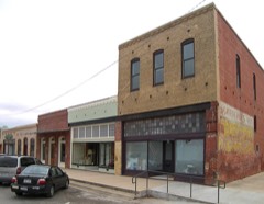 Elgin Commercial Historic Districtlisted 1996
- Mary Christian Burleson Houselisted 2024
Population over time
2 figuresElgin grew from 8,135 to 9,784 between 2010 and 2020. These are the recorded population figures Wikidata holds for this place, reached through the Geographic Names Information System number this page is keyed on rather than by name, so they belong to this place and not to another of the same name. Most are census counts, but not all are: an early figure may be a founding or settlement estimate, and an estimate published within five years of a census is left out. The change column is computed, and is left blank where more than 20 years separate a figure from the one before it, because a gap that long is not a change between two counts.
| Year | People | Change |
|---|---|---|
| 2010 | 8,135 | |
| 2020 | 9,784 | +1,649 (+20%) |
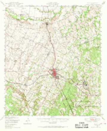
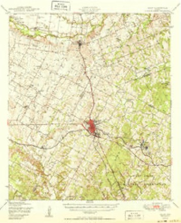
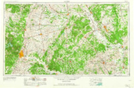
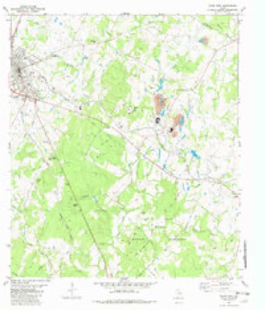
Topographic sheets covering this place
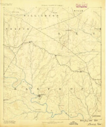
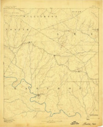
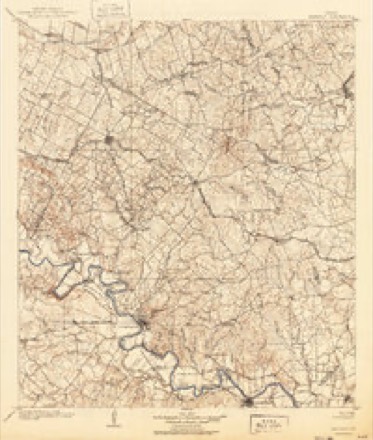
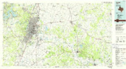
8 surveys from 17 printed sheetsMatched by testing this settlement's coordinate against the published boundary of every sheet in the United States Geological Survey's historical collection. Each opens the scanned sheet at the Survey.
- 1885 USGS Bastrop quadrangle1:125000
- 1893 USGS Bastrop quadrangle1:125000
- 1904 USGS Bastrop quadrangle1:125000, 3 printings
- 1948 USGS Elgin quadrangle1:62500, 2 printings
- 1950 USGS Elgin quadrangle1:62500
- 1954 USGS Austin quadrangle1:250000, 4 printings
- 1982 USGS Elgin East quadrangle1:24000, 2 printings
- 1985 USGS Austin quadrangle1:100000, 3 printings
Fires near this place
74 since 1992Regional context, not property-specific evidence. The federal wildfire occurrence database lists 74 fires within 5 miles of Elgin between 1992 and 2019, burning about 803 acres in total. 2 started naturally. 4 were recorded as arson. Distance is straight-line from the map coordinates, so a fire counted here may appear on a neighbouring settlement's page as well.
| Reported cause | Fires |
|---|---|
| Debris and open burning | 40 |
| Missing data/not specified/undetermined | 18 |
| Equipment and vehicle use | 4 |
| Arson/incendiarism | 4 |
| Smoking | 2 |
| Natural | 2 |
| Misuse of fire by a minor | 2 |
| Power generation/transmission/distribution | 1 |
| Recreation and ceremony | 1 |
The most recent of them, most recent first, with the day each was reported and the service that recorded it.
| Date | Cause | Size | Reported by | Name on the report |
|---|---|---|---|---|
| 5 August 2011 | Missing data/not specified/undetermined | 1.0 acres | Texas A & M Forest Service | TASK FORCE 12 |
| 29 August 1992 | Debris and open burning | 10 acres | Texas A & M Forest Service | not named |
| 16 August 1998 | Missing data/not specified/undetermined | 2.0 acres | Texas A & M Forest Service | not named |
| 12 August 1998 | Debris and open burning | 1.0 acres | Texas A & M Forest Service | not named |
| 12 August 1998 | Equipment and vehicle use | 2.0 acres | Texas A & M Forest Service | not named |
| 28 July 2011 | Power generation/transmission/distribution | 2.0 acres | Texas A & M Forest Service | NATURES WAY |
| 27 July 1992 | Smoking | 200 acres | Texas A & M Forest Service | not named |
| 25 July 2013 | Missing data/not specified/undetermined | 1.0 acres | Texas A & M Forest Service | YOUNG PRAIRIE |
Settlements close enough to share some of these fires:
Mines and quarries near this place
7 within 5 milesRegional context, not property-specific evidence. The federal mineral resources record lists 7 workings within 5 miles of Elgin: 6 producers, 1 past producer. 6 still produce. What was taken out: Clay, Fire Clay (Refractory). Distance is straight-line from the map coordinates, so a quarry counted here may appear on a neighbouring settlement's page as well.
| Where | Site | Commodity | Status | Recorded |
|---|---|---|---|---|
| Weaver Pit | Fire Clay (Refractory) | Producer | Sedimentary | |
| Landing Strip Pit | Clay | Producer | Clay | |
| Payne Brick Co Plant | Clay | Producer | ||
| Payne Clay Pits and Plants | Clay | Producer | ||
| Plant No. 1 | Clay | Producer | ||
| Standard Pit & Plant | Clay | Past Producer | ||
| Unnamed Pit | Clay | Producer | Clay |
Storms near this place
48 since 1993Regional context, not property-specific evidence. The National Weather Service names Elgin in 48 storm reports between 1993 and 2024: 19 hail, 11 thunderstorm wind, 10 flash flood, 5 tornado. The reports record 1 injury. Each account below is quoted exactly as the forecast office filed it, from the NOAA Storm Events Database, and each date opens the federal record of that event.
| When | Event | Place named | Harm | What the report says |
|---|---|---|---|---|
| October 1998 | Tornado (F1) | Elgin | 1 hurt, $30,000 | A very small and short-lived tornado struck briefly near Elgin. It destroyed a mobile home and knocked over several trees before lifting back into the parent thunderstorm. The only reported injury was to a baby in the mobile home. |
| May 2017 | Tornado (EF0) | Elgin | $100,000 | A NWS storm survey found that a tornado was produced by the bookend vortex |of a bow echo that moved through the city of Elgin on the afternoon|of May 23rd 2017. The tornado began just east of Texas Highway 95|and just north of Roemer Road, where it displaced and flipped a shed |off its foundation. The tornado then caused extensive damage to a|business along Roemer Road. As it continued to the east-southeast,|the tornado ripped the metal roof off a large barn and caused roof|damage to a well-built home adjacent to the barn. In the pasture |adjacent to these structures, there were multiple pieces of splintered |wood that were driven into the ground from the opposite direction from |which the storm came. Several cattle and a bull were reportedly thrown |about 1500 feet from one pasture into another, jumping a couple of fences |in the process. The tornado then completely destroyed an old wooden barn |just north of Roemer Road. At this point, the tornado was approximately |moving along Roemer Road, and caused some minor tree damage. The tornado |then crossed Red Town Road just south of Roemer Road and ended just east |of Red Town Road, where it caused some minor damage to a structure. |
| May 2017 | Thunderstorm Wind | Elgin | $100,000 | A thunderstorm produced wind gusts estimated at 75 mph that blew down trees and power lines in Elgin. |
| June 2002 | Thunderstorm Wind | Elgin | $100,000 | Several large trees were knocked over by severe thunderstorm winds in and around the Elgin area. Windows were also broken out in homes by large limbs knocked off trees. |
| April 1997 | Thunderstorm Wind | Elgin | $100,000 | no account filed |
| October 1998 | Tornado (F1) | Elgin | $50,000 | A second small, narrow and short-lived tornado was reported over thirty minutes after the first tornado. It also formed in the Elgin area and stayed on the ground about two minutes. It moved into a light residential area, destroying one home, then lifted up and dissipating. The family in the destroyed home took shelter in the bathroom, escaping injury. |
| March 2005 | Tornado (F0) | Elgin | $40,000 | A second tornado descended from the same south end of the line of thunderstorms that had produced the Littig tornado. This touchdown was around 2 miles east of Littig, in Bastrop County, where the Old Shiloh Baptist Church and the new Shiloh Baptist Church both sustained considerable exterior and roof damage. The location is just east of County Line Road and just south of Voelker Lane. This touchdown would have been very brief, less than one quarter mile in length. It was timed near 2202 CST and was rated as F0. |
| September 2000 | Thunderstorm Wind | Elgin | $20,000 | Severe thunderstorm winds blew down several trees just east of Elgin. |
| May 2015 | Flash Flood | Elgin | $10,000 | Water was inundated at least one home in the city of Bastrop. Numerous road closures were also ongoing in the city. |
| August 2011 | Thunderstorm Wind | Elgin | $10,000 | A thunderstorm produced wind gusts estimated at 60 mph which moved a porch away from a house, downed power lines, and knocked over a couple of trees. |
| May 2000 | Flash Flood | Elgin | $10,000 | The Police Department reported brief flash flooding and road closures in the town of Elgin as thunderstorms dropped 3 inches of rain in little over 1 hour. |
| July 2013 | Lightning | Elgin | $5,000 | A thunderstorm produced lightning that struck and disabled the 911 Center in Elgin. |
| August 2009 | Thunderstorm Wind | Elgin | $3,000 | A thunderstorm produced wind gusts, estimated at 50 knots, that caused minor damage to a home and knocked over several trees. In addition, this storm dropped quarter size hail. |
| April 2024 | Hail | Elgin | - | A thunderstorm produced quarter to golf ball size hail on the north side of Elgin. |
| April 2024 | Hail | Elgin | - | A thunderstorm produced quarter size hail on the north side of Elgin. |
| December 2024 | Hail | Elgin | - | A thunderstorm produced half dollar size hail northeast of Elgin. |
| May 2021 | Flash Flood | Elgin | - | Thunderstorms produced heavy rain that led to flash flooding. The intersection of FM 1704 and Arbuckle Rd. in Elgin was flooded. |
| April 2021 | Hail | Elgin | - | A thunderstorm produced ping pong ball size hail in Elgin. |
| April 2021 | Hail | Elgin | - | A thunderstorm produced quarter size hail in Elgin. |
| April 2021 | Hail | Elgin | - | A thunderstorms produced golf ball size hail in Elgin. |
| June 2019 | Hail | Elgin | - | A thunderstorm produced one inch hail in Elgin. |
| May 2017 | Hail | Elgin | - | A thunderstorm produced quarter size hail along Hwy 290 just west of Elgin. |
| May 2017 | Thunderstorm Wind | Elgin | - | A thunderstorm produced wind gusts estimated at 60 mph that knocked down small tree limbs in Elgin. |
| February 2017 | Thunderstorm Wind | Elgin | - | A thunderstorm produced wind gusts estimated at 70 mph knocked down multiple power poles and damaged some trees and roofs across the southern part of Elgin. |
| May 2015 | Flash Flood | Elgin | - | Thunderstorms produced heavy rain that caused flash flooding closing numerous roads in and around Elgin including Old Sayer Rd., FM 812 near the county line, Woody Ln. at FM 1704, and Young Prairie at FM 1704. |
| May 2015 | Flash Flood | Elgin | - | The low water crossing at County Line Road and Highway 290 was closed due to high water. |
| April 2015 | Hail | Elgin | - | Nickel size hail was reported in the city of Elgin by local law enforcement. |
| October 2015 | Flash Flood | Elgin | - | Thunderstorms produced heavy rain that caused flash flooding requiring high water rescues of people in stranded vehicles in Elgin. |
| March 2014 | Hail | Elgin | - | A thunderstorm produced golf ball size hail at Elgin High School. |
| May 2013 | Thunderstorm Wind | Elgin | - | A thunderstorm produced wind gusts estimated at 58 mph that downed trees on Red Town Rd. in Elgin. |
| May 2013 | Flash Flood | Elgin | - | Thunderstorms produced heavy rain that caused flash flooding on N. Avenue B, N. Avenue C, W. 3rd St., and Brenham St. in Elgin. |
| May 2013 | Flash Flood | Elgin | - | Thunderstorms produced heavy rain that caused flash flooding closing Hwy 290 at County Line Rd. outside of Elgin. |
| January 2012 | Flash Flood | Elgin | - | Thunderstorms produced heavy rain which caused flooding near Elgin. People were rescued from flood waters along Highway 290. A CoCoRAHS observer southwest of Elgin reported 5.58 inches of rain from these storms. |
| July 2007 | Flash Flood | Elgin | - | Heavy rain over Caldwell and Bastrop Counties averaged between 2 and 3 inches in the early morning hours, with up to 7 inches between Elgin and Bastrop. SH95, FM1704, and FM2336 were closed. |
| January 2007 | Flood | Elgin | - | Wilbarger Creek in Elgin crested at 34.10 feet at 2100cst on January 13, where 27 feet is flood stage. |
| June 2007 | Flood | Elgin | - | Wilbarger Creek at Elgin crested at 30.2 feet at 2300cst on June 20, where 27 feet is flood stage. |
| March 2005 | Thunderstorm Wind | Elgin | - | As the severe line of thunderstorms moved eastward, they produced winds that uprooted trees both to the east and the west of SH95, south of the town of Elgin. |
| July 2005 | Thunderstorm Wind | Elgin | - | Thunderstorms forming along the northern Texas Hill Country in the late afternoon moved southward into the evening hours. The storms knocked over trees near Elgin. |
| November 2000 | Tornado (F0) | Elgin | - | A small and short-lived tornado was observed by the public near Elgin. It caused no damage. |
| March 1993 | Hail | Elgin | - | Half-dollar-size hail was reported in Utley by a weather observer. As a second areas of thunderstorms moved into the county, quarter-size hail was reported between Elgin and Bastrop. Five minutes later the Elgin Police reported quarter-size hail just south of Elgin. Hail up to softball-size was reported in Paige. At least one car had its windshield knocked out. |
| May 2013 | Hail | Elgin | - | no account filed |
| May 2011 | Hail | Elgin | - | no account filed |
| June 2002 | Hail | Elgin | - | no account filed |
| March 2000 | Hail | Elgin | - | no account filed |
| March 2000 | Hail | Elgin | - | no account filed |
| February 1998 | Hail | Elgin | - | no account filed |
| May 1997 | Hail | Elgin | - | no account filed |
| March 1995 | Hail | Elgin | - | no account filed |
Nearest settlements
The eight closest, with where each one stands in the county. Distances are straight-line, computed from the Geographic Names Information System coordinates.
| Map | Place | Distance | Sheets |
|---|---|---|---|
| Pleasant Grove (historical) | 3.7 miles | 16 | |
| Butler | 4.4 miles | 17 | |
| McDade | 8.4 miles | 15 | |
| Sayersville | 8.4 miles | 16 | |
| Swiftex | 10.3 miles | 16 | |
| Camp Swift | 11.7 miles | 16 | |
| Utley | 11.9 miles | 17 | |
| Phelan | 13.4 miles | 16 |
Elsewhere
Matched on this settlement's Geographic Names Information System number rather than its name, so it cannot be a different place of the same name in another state.
| Wikipedia article on Elgin | An encyclopaedic summary. Its text is share-alike, so it is linked here rather than copied. |
| Wikidata item Q976529 | The structured record the population and elevation above come from. Public domain (CC0). |
Provenance
This settlement is recorded in the Geographic Names Information System as feature 1373617. The sheet list is computed by point-in-boundary test against the United States Geological Survey's historical topographic inventory. Both are works of the United States government and carry no copyright under 17 U.S.C. 105.
Wildfire. Short, Karen C. 2022. Spatial wildfire occurrence data for the United States, 1992-2020 [FPA_FOD_20221014]. 6th Edition. Fort Collins, CO: Forest Service Research Data Archive. https://doi.org/10.2737/RDS-2013-0009.6 Collected with United States Government funding and usable without additional permissions or fees.
Mines and quarries. USGS Mineral Resources Data System (MRDS) https://mrdata.usgs.gov/mrds/ A work of the United States government, no copyright under 17 U.S.C. 105.
Storms. NOAA National Centers for Environmental Information, Storm Events Database https://www.ncei.noaa.gov/stormevents/ A work of the United States government, no copyright under 17 U.S.C. 105. Narratives are quoted verbatim from the National Weather Service report and are not edited or summarised.