 Block
BlockGrapevine, Texas
18 topographic sheets cover this place, the earliest surveyed in 1894 and the latest in 1985. It stands in the Northeast Tarrant census division. It lies in ZIP code area 76051. It stands on Silver Lake Branch. The Survey maps it on the Grapevine quadrangle. 50,631 people lived here at the 2020 count. It stands 640 feet above sea level.
On record in Grapevine
Buildings and businesses the archive holds for this place. Each opens its own page, with the source record it came from.
On the National Register 6 records
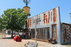 Cotton Belt Railroad Industrial Historic Districtlisted 1997
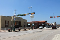 Grapevine Commercial Historic Districtlisted 1992
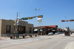 Grapevine Commercial Historic District (Boundary Increase II)listed 2002
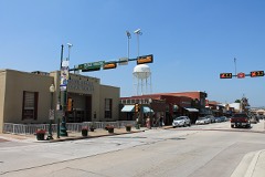 Grapevine Commercial Historic District (Boundary Increase)listed 1997
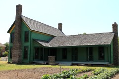 Thomas J. and Elizabeth Nash Farmlisted 2010
- Original Town Residential Historic Districtlisted 1998
Population over time
2 figuresGrapevine grew from 46,334 to 50,631 between 2010 and 2020. These are the recorded population figures Wikidata holds for this place, reached through the Geographic Names Information System number this page is keyed on rather than by name, so they belong to this place and not to another of the same name. Most are census counts, but not all are: an early figure may be a founding or settlement estimate, and an estimate published within five years of a census is left out. The change column is computed, and is left blank where more than 20 years separate a figure from the one before it, because a gap that long is not a change between two counts.
| Year | People | Change |
|---|---|---|
| 2010 | 46,334 | |
| 2020 | 50,631 | +4,297 (+9%) |
Topographic sheets covering this place
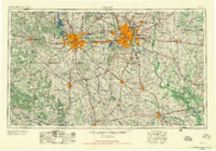
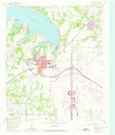
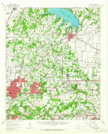
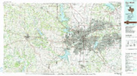
7 surveys from 18 printed sheetsMatched by testing this settlement's coordinate against the published boundary of every sheet in the United States Geological Survey's historical collection. Each opens the scanned sheet at the Survey.
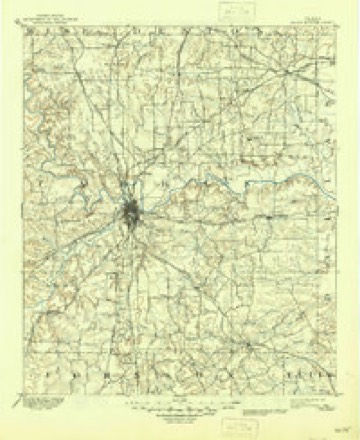
- 1894 USGS Fort Worth quadrangle1:125000, 3 printings
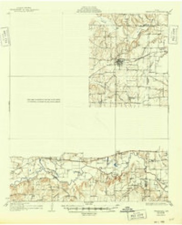
- 1931 USGS Grapevine quadrangle1:62500, 2 printings
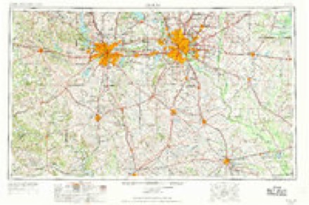
- 1954 USGS Dallas quadrangle1:250000, 4 printings
- 1958 USGS Dallas quadrangle1:250000
- 1959 USGS Grapevine quadrangle1:24000, 5 printings
- 1959 USGS Grapevine quadrangle1:62500
- 1985 USGS Fort Worth quadrangle1:100000, 2 printings
Fires near this place
17 since 2006Regional context, not property-specific evidence. The federal wildfire occurrence database lists 17 fires within 5 miles of Grapevine between 2006 and 2018, burning about 62 acres in total. None started naturally. 1 was recorded as arson. Distance is straight-line from the map coordinates, so a fire counted here may appear on a neighbouring settlement's page as well.
| Reported cause | Fires |
|---|---|
| Missing data/not specified/undetermined | 9 |
| Recreation and ceremony | 3 |
| Power generation/transmission/distribution | 2 |
| Equipment and vehicle use | 1 |
| Misuse of fire by a minor | 1 |
| Arson/incendiarism | 1 |
The most recent of them, most recent first, with the day each was reported and the service that recorded it.
| Date | Cause | Size | Reported by | Name on the report |
|---|---|---|---|---|
| 8 September 2009 | Equipment and vehicle use | 2.0 acres | Texas A & M Forest Service | 4900 LONG PRAIRIE |
| 6 September 2010 | Recreation and ceremony | under an acre | Texas A & M Forest Service | 5000 MURRELL PARK |
| 3 July 2018 | Missing data/not specified/undetermined | 1.0 acres | Texas A & M Forest Service | HWY114 EB |
| 29 July 2018 | Missing data/not specified/undetermined | 1.0 acres | Texas A & M Forest Service | EAST SOUTHLAKE BLVD |
| 28 July 2018 | Missing data/not specified/undetermined | 1.0 acres | Texas A & M Forest Service | EAST DOVE ROAD |
| 6 June 2006 | Missing data/not specified/undetermined | 25 acres | Texas A & M Forest Service | not named |
| 29 April 2017 | Misuse of fire by a minor | 1.0 acres | Texas A & M Forest Service | NONE |
| 19 March 2018 | Missing data/not specified/undetermined | 1.0 acres | Texas A & M Forest Service | LONGFORD CIR |
Settlements close enough to share some of these fires:
Mines and quarries near this place
1 within 5 milesRegional context, not property-specific evidence. The federal mineral resources record lists 1 working within 5 miles of Grapevine: 1 producer. All of them still produce. What was taken out: Sand and Gravel, Construction. Distance is straight-line from the map coordinates, so a quarry counted here may appear on a neighbouring settlement's page as well.
| Where | Site | Commodity | Status | Recorded |
|---|---|---|---|---|
| Tom Conley and Associates Operation | Sand and Gravel, Construction | Producer |
Storms near this place
60 of 81 shownRegional context, not property-specific evidence. The National Weather Service names Grapevine in 81 storm reports between 1994 and 2025: 37 hail, 35 thunderstorm wind, 4 lightning, 3 flash flood. The reports record 5 injuries. Each account below is quoted exactly as the forecast office filed it, from the NOAA Storm Events Database, and each date opens the federal record of that event.
| When | Event | Place named | Harm | What the report says |
|---|---|---|---|---|
| December 2022 | Tornado (EF1) | Grapevine | 5 hurt | An EF-1 tornado moved through Grapevine beginning near the Mustang Elite Car Wash on Ira E Woods Ave south of Hwy 114. The tornado crossed Ira E Woods Ave causing significant roof damage to the Sam's Club. Large sections of the roof were peeled off leaving large holes. The tornado then damaged a storage unit facility and a Discount Tire store. Many of the windows of the Discount Tire lobby where blown out, and a few power poles next to the store were also damaged. The tornado continued moving northeast damaging trees and shingles in a residential area. Near the intersection of Northwest Highway & North Dove Road the tornado damaged another car wash and a restaurant. The tornado next caused damage to two HVACs at Grapevine Middle School. The next notable damage was to the Grapevine Service Center where significant roof damage was observed, and several garage doors where blown out. One small truck was also overturned. The tornado continued through a residential area where it caused minor damage to several trees and roofs, but it damaged several large trees at the Grapevine Cemetery. The tornado continued to weaken from here until it dissipated near the Glass Cactus on the Gaylord Texan Resort property. Maximum estimated winds were 110 mph. |
| March 1996 | Hail | Grapevine | $15,000,000 | no account filed |
| March 2009 | Hail | Grapevine | $5,000,000 | Golfball size hail was reported in Grapevine. |
| August 1994 | Thunderstorm Wind | Grapevine | $500,000 | The roof was blown off the Farmers Market building, and roof damage occurred to the Heritage building. |
| October 1996 | Hail | Grapevine | $400,000 | no account filed |
| May 2011 | Hail | Grapevine | $320,000 | Golfball sized hail fell for several minutes in Grapevine. The hail damaged many cars parked outside at DFW International Airport. In addition, about 50 American Airlines airplanes and three other large planes were damaged by the hail. |
| May 2024 | Thunderstorm Wind | Grapevine | $100,000 | The DFW International Airport ASOS measured a 77 mph wind gust. |
| June 2003 | Lightning | Grapevine | $96,000 | A lightning started fire completely destroyed a house. |
| June 2012 | Hail | Grapevine | $80,000 | Half dollar sized hail was reported near Highway 114 and Highway 121 in Grapevine. |
| July 2012 | Thunderstorm Wind | Grapevine | $80,000 | Thunderstorm winds blew over an 18 wheeler truck on State Highway 114 in Tarrant County. This occurred just north of the Dallas-Fort Worth International airport (KDFW). |
| April 2011 | Hail | Grapevine | $50,000 | Quarter to golfball sized hail fell in Grapevine. |
| May 2002 | Lightning | Grapevine | $50,000 | Lightning strikes started three house fires and heavily damaged one. |
| March 2009 | Hail | Grapevine | $40,000 | Quarter size hail was reported in Grapevine. |
| March 2019 | Thunderstorm Wind | Grapevine | $25,000 | A broadcast media report indicated that a logistics facility on Airfield Drive at DFW Airport had major roof damage, causing multiple cars in the parking lot to be damaged. |
| June 2009 | Thunderstorm Wind | Grapevine | $12,000 | A UPS tractor trailer was blown over onto an embankment on Highway 121 when strong crosswinds caused it to tip over. |
| August 2013 | Thunderstorm Wind | Grapevine | $10,000 | A 60 MPH wind gust was recorded by the Automated Surface Observing System at Dallas-Fort Worth International Airport. |
| April 2011 | Hail | Grapevine | $10,000 | Golfball size hail fell on the north end of the Dallas-Fort Worth International Airport. |
| May 2011 | Lightning | Grapevine | $7,000 | A house in Grapevine was struck by lightning. A fire occurred in the attic of the home. |
| June 2025 | Thunderstorm Wind | Grapevine | $5,000 | DFW Airport ASOS gusted to 68 mph / 59 kt. |
| April 2019 | Thunderstorm Wind | Grapevine | $5,000 | A 60 MPH wind gust was measured by the Dallas-Fort Worth International Airport Automated Surface Observation System (DFW ASOS). |
| April 2019 | Thunderstorm Wind | Grapevine | $5,000 | A 63 MPH wind gust was measured by the Dallas-Fort Worth International Airport Automated Surface Observation System (DFW ASOS). |
| May 2007 | Lightning | Grapevine | $5,000 | Lightning struck runway 18R and left a 2-inch hole in the pavement, shutting down the airport for over an hour. |
| May 1998 | Thunderstorm Wind | Grapevine | $5,000 | Thunderstorm winds blew the roof from a convenience store. |
| May 1994 | Thunderstorm Wind | Grapevine | $5,000 | Power lines were blown down by thunderstorm winds. |
| May 2013 | Hail | Grapevine | $4,000 | A trained spotter reported half dollar sized hail. |
| July 2020 | Thunderstorm Wind | Grapevine | $3,000 | A downburst happened near the Highway 114/121 exchange in Grapevine. Several large tree limbs were knocked down near the movie theater on the south side of the interchange, and a large retail store sustained minor roof damage on the north side of the interchange. |
| March 2025 | Thunderstorm Wind | Grapevine | $2,000 | Emergency management reported power lines down in Grapevine. |
| August 2016 | Thunderstorm Wind | Grapevine | $2,000 | Localized damage reported in Grapevine mostly to businesses. Doors were blown down as well as outdoor lightning knocked off the wall. |
| June 2009 | Flash Flood | Grapevine | $1,000 | Water was reported over roads near the junction of HWY 360 and HWY 121 in Grapevine. The flooding was the result of training echoes over Tarrant County. |
| August 2025 | Thunderstorm Wind | Grapevine | - | A social media photo indicated a tree down near the intersection of William D Tate Avenue and Timberline Drive in Grapevine. |
| May 2024 | Hail | Grapevine | - | A member of the public reported dime to quarter size hail in Grapevine. |
| May 2024 | Hail | Grapevine | - | Report from mPING: Dime (0.75 in.). |
| March 2023 | Thunderstorm Wind | Grapevine | - | The ASOS at KDFW reported a 58 mph wind gust. |
| March 2023 | Thunderstorm Wind | Grapevine | - | The DFW Airport ASOS measured a 71 mph wind gust. |
| November 2022 | Thunderstorm Wind | Grapevine | - | A 63 MPH wind gust was measured by the Automated Surface Observation System at DFW International Airport. |
| December 2022 | Tornado (EF1) | Grapevine | - | A brief EF-1 tornado damaged parts of Grapevine Mills Mall including portions of the roof near the food court, paneling and HVACs on the roof of the mall, and the walls around the Burlington store. The tornado tracked north where it damaged some roofs in the Terrawood Apartment complex. There was also some minor tree damage in between the mall and the apartment complex. The tornado dissipated shortly after that. Maximum estimated winds were 100 mph. |
| August 2020 | Thunderstorm Wind | Grapevine | - | The Automated Surface Observation System at Dallas-Fort Worth International Airport measured a wind gust of 68 MPH. |
| July 2020 | Thunderstorm Wind | Grapevine | - | The DFW ASOS reported a wind gust of 61 mph. |
| March 2019 | Hail | Grapevine | - | A social media report indicated quarter-sized hail in the city of Grapevine, TX. |
| March 2019 | Thunderstorm Wind | Grapevine | - | A 78 MPH wind gust was measured by the Dallas/Fort Worth International Airport Automated Surface Observation System. |
| July 2019 | Thunderstorm Wind | Grapevine | - | A trained spotter reported large tree trunks snapped approximately 3 miles north of the city of Grapevine, TX. |
| May 2019 | Hail | Grapevine | - | Amateur radio reported penny size hail approximately 3 miles north of the city of Grapevine, TX. |
| May 2019 | Thunderstorm Wind | Grapevine | - | The DFW Airport ASOS reported a 62 mph wind gust. |
| October 2019 | Thunderstorm Wind | Grapevine | - | A 67 MPH wind gust was measured by the Automated Surface Observation System at Dallas-Fort Worth International Airport. |
| June 2018 | Hail | Grapevine | - | A social media report indicated quarter-sized hail in the city of Grapevine, TX. |
| March 2016 | Thunderstorm Wind | Grapevine | - | A National Weather Service employee reported tree damage in Grapevine, TX just west of the Hwy 121 & Hwy 360 split. |
| May 2016 | Hail | Grapevine | - | A storm chaser reported penny-sized hail on the south side of Grapevine Reservoir. |
| November 2016 | Flash Flood | Grapevine | - | Tarrant County Sheriff's Department reported flash flooding on FM 2499 between Grapevine Mills Blvd and Gerault Rd. |
| November 2015 | Thunderstorm Wind | Grapevine | - | A public report was received indicating that a large mature tree (4 feet in diameter) was uprooted at 1715 Silverside Dr in Grapevine. |
| May 2013 | Thunderstorm Wind | Grapevine | - | A former NWS employee reported a wind gust of 60 mph in Grapevine. |
| May 2013 | Thunderstorm Wind | Grapevine | - | The DFW ASOS recorded a 51 knot wind gust. |
| April 2008 | Thunderstorm Wind | Grapevine | - | A 75 MPH wind gust was measured at the Dallas/Fort Worth International Airport. |
| June 2007 | Thunderstorm Wind | Grapevine | - | Trees downed. |
| May 2007 | Flash Flood | Grapevine | - | Flooding reported along East Broad Street between Highways 287 and 360. |
| May 2007 | Thunderstorm Wind | Grapevine | - | Large limbs down in Grapevine. |
| September 2005 | Hail | Grapevine | - | Reported on the north side of the Dallas/Fort Worth airport. |
| April 2002 | Hail | Grapevine | - | Occurred at DFW Airport observation site. |
| April 2002 | Thunderstorm Wind | Grapevine | - | Occurred at DFW Airport obs site. |
| May 1999 | Hail | Grapevine | - | Hail was reported just west of D/FW Airport. |
| June 1997 | Thunderstorm Wind | Grapevine | - | Strong winds blew down trees. |
Nearest settlements
The eight closest, with where each one stands in the county. Distances are straight-line, computed from the Geographic Names Information System coordinates.
| Map | Place | Distance | Sheets |
|---|---|---|---|
| Old Union | 2.7 miles | 18 | |
| Southlake | 3.0 miles | 18 | |
| Minters Chapel | 3.5 miles | 18 | |
| Bransford | 5.3 miles | 18 | |
| Colleyville | 5.5 miles | 18 | |
| Euless | 6.7 miles | 21 | |
| Bedford | 7.1 miles | 20 | |
| Westlake | 7.3 miles | 18 |
Elsewhere
Matched on this settlement's Geographic Names Information System number rather than its name, so it cannot be a different place of the same name in another state.
| Wikipedia article on Grapevine | An encyclopaedic summary. Its text is share-alike, so it is linked here rather than copied. |
| Wikidata item Q185216 | The structured record the population and elevation above come from. Public domain (CC0). |
Provenance
This settlement is recorded in the Geographic Names Information System as feature 1336834. The sheet list is computed by point-in-boundary test against the United States Geological Survey's historical topographic inventory. Both are works of the United States government and carry no copyright under 17 U.S.C. 105.
Wildfire. Short, Karen C. 2022. Spatial wildfire occurrence data for the United States, 1992-2020 [FPA_FOD_20221014]. 6th Edition. Fort Collins, CO: Forest Service Research Data Archive. https://doi.org/10.2737/RDS-2013-0009.6 Collected with United States Government funding and usable without additional permissions or fees.
Mines and quarries. USGS Mineral Resources Data System (MRDS) https://mrdata.usgs.gov/mrds/ A work of the United States government, no copyright under 17 U.S.C. 105.
Storms. NOAA National Centers for Environmental Information, Storm Events Database https://www.ncei.noaa.gov/stormevents/ A work of the United States government, no copyright under 17 U.S.C. 105. Narratives are quoted verbatim from the National Weather Service report and are not edited or summarised.