 Block
BlockHebbronville, Texas
6 topographic sheets cover this place, the earliest surveyed in 1956 and the latest in 1985. It stands in the North Jim Hogg census division. It lies in ZIP code area 78361. The Survey maps it on the Hebbronville quadrangle. 4,101 people lived here at the 2020 count. It stands 548 feet above sea level.
Research this city
Population over time
2 figuresHebbronville fell from 4,558 to 4,101 between 2010 and 2020. These are the recorded population figures Wikidata holds for this place, reached through the Geographic Names Information System number this page is keyed on rather than by name, so they belong to this place and not to another of the same name. Most are census counts, but not all are: an early figure may be a founding or settlement estimate, and an estimate published within five years of a census is left out. The change column is computed, and is left blank where more than 20 years separate a figure from the one before it, because a gap that long is not a change between two counts.
| Year | People | Change |
|---|---|---|
| 2010 | 4,558 | |
| 2020 | 4,101 | -457 (-10%) |
Topographic sheets covering this place
3 surveys from 6 printed sheetsMatched by testing this settlement's coordinate against the published boundary of every sheet in the United States Geological Survey's historical collection. Each opens the scanned sheet at the Survey.
- 1956 USGS Laredo quadrangle1:250000, 3 printings
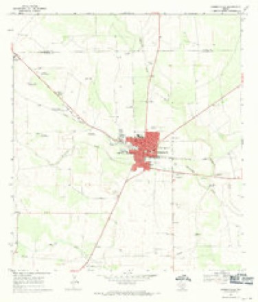
- 1967 USGS Hebbronville quadrangle1:24000
- 1985 USGS Falfurrias quadrangle1:100000, 2 printings
Fires near this place
5 since 2007Regional context, not property-specific evidence. The federal wildfire occurrence database lists 5 fires within 5 miles of Hebbronville between 2007 and 2017, burning about 1,725 acres in total. None started naturally. None was recorded as arson. Distance is straight-line from the map coordinates, so a fire counted here may appear on a neighbouring settlement's page as well.
| Reported cause | Fires |
|---|---|
| Missing data/not specified/undetermined | 3 |
| Equipment and vehicle use | 1 |
| Power generation/transmission/distribution | 1 |
The most recent of them, most recent first, with the day each was reported and the service that recorded it.
| Date | Cause | Size | Reported by | Name on the report |
|---|---|---|---|---|
| 30 April 2009 | Missing data/not specified/undetermined | 250 acres | Texas A & M Forest Service | STATE 16 HWY./FM 649 RD. |
| 16 April 2008 | Missing data/not specified/undetermined | 500 acres | Texas A & M Forest Service | HEBBRONVILLE |
| 10 March 2009 | Equipment and vehicle use | 675 acres | Texas A & M Forest Service | LOS OLMOS FIRE |
| 22 December 2007 | Missing data/not specified/undetermined | 200 acres | Texas A & M Forest Service | not named |
| 22 January 2017 | Power generation/transmission/distribution | 100 acres | Texas A & M Forest Service | HEBBRONVILLE FIRE |
Settlements close enough to share some of these fires:
Mines and quarries near this place
2 within 5 milesRegional context, not property-specific evidence. The federal mineral resources record lists 2 workings within 5 miles of Hebbronville: 1 past producer, 1 producer. 1 still produces. What was taken out: Uranium. Distance is straight-line from the map coordinates, so a quarry counted here may appear on a neighbouring settlement's page as well.
| Where | Site | Commodity | Status | Recorded |
|---|---|---|---|---|
| Mobil El Mesquite Plant | Uranium | Producer | ||
| Silver Lake Deposit | Uranium | Past Producer | Stratabound |
Storms near this place
60 of 67 shownRegional context, not property-specific evidence. The National Weather Service names Hebbronville in 67 storm reports between 1995 and 2024: 21 thunderstorm wind, 20 hail, 14 flash flood, 7 heavy rain. No death or injury is recorded in these reports. Each account below is quoted exactly as the forecast office filed it, from the NOAA Storm Events Database, and each date opens the federal record of that event.
| When | Event | Place named | Harm | What the report says |
|---|---|---|---|---|
| July 2010 | Tornado (EF1) | Hebbronville | $1,500,000 | A tornado was reported in the Hebbronville area by the border patrol and public.|A tornado touched down in the Hebbronville area just after 5 pm, flipping a tractor trailer, uprooting trees, snapping large limbs, and causing a gas leak. The tornado knocked out power to at least 1762 AEP Power customers, more than half of the town. The tornado formed along a remnant shear axis left behind after Hurricane Alex dissipated in Mexico. The elevated humidity levels combined with daytime heating and low to mid level turbulence likely contributed to the development of the tornado producing thunderstorm.||A preliminary assessment of damages in Hebbronville indicated areas of EF-1 (85 to 105 mph) winds. The EF-1 damages occurred in the central and southeast areas of Hebbronville into the center of town, EF-0 damages occurred from the center of town to areas northwest of town which included areas around Hebbronville High School. ||The tornado formed to the southeast of Hebbronville between 450 and 5 pm. The tornado crossed State Highway 285 about 1/2 mile east of the intersection with State Highway 16, and entered a Texas Department of Transportation maintenance yard, tearing a section off a roof and collapsing a section of a metal parking area. It continued to the north northwest into a residential area, taking the roof off one modular home, snapping several power poles, rolling a mobile home onto its roof, and damaging numerous mesquite trees. The tornado continued moving northwest toward downtown and knocked down numerous power lines, then struck a grocery store and blew a billboard onto a few parked cars. A loaded tractor trailer was rolled onto its roof and against the grocery store. The tornado then moved north northwest, causing lesser tree damage along Maria and Frans Avenues. The weakening tornado crossed over a school, with no notable damage. It then moved by Hebbronville High Schools Gruy stadium, bending a goalpost and knocking over some fencing around tennis courts just west of the school campus. The tornado then lifted, with no damage noted beyond this location.||Considerable damage was rated EF-1 from the southeast side of Hebbronville until reaching downtown, with wind speeds of 90 to 100 mph. EF-0 damage (below 85 mph) was seen from northwest of downtown to the area around the high school. |
| June 2015 | Flash Flood | Hebbronville | $100,000 | Heavy rainfall across northern Jim Hogg County resulted in flash flooding in Hebbronville. Hebbronville Fire Department reported that at least 2.5 feet of flowing water was over the road on Galbraith Street, in particular near the intersections of Galbraith Street and N Maria Avenue and Galbraith Street and Wilhelma Avenue. At least one car was stuck in the flowing water, with water over the hood of the car. |
| June 2006 | Flash Flood | Hebbronville | $25,000 | Thunderstorms produced 7 inches of rain in a short period of time in Hebbronville. The runoff from this rainfall quickly produced street flooding and flooding of low-lying that affected businesses and homes. Additionally, the creek that runs through Hebbronville went over its banks. |
| May 2004 | Thunderstorm Wind | Hebbronville | $25,000 | The fire department in Hebbronville reported that winds around 60 mph blew down power lines in the south side of Hebbronville. Residents suffered power outages of nearly 2 hours. |
| May 2015 | Flash Flood | Hebbronville | $20,000 | Jim Hogg County Sheriffs Office reported 6 inches to 1 foot of water on all roads in Hebbronville. 2 water rescues were from vehicles were completed and water was reported inside 1 building. Los Olmos Creek was reported to be at capacity and in danger of flowing over the roadway. |
| May 1997 | Thunderstorm Wind | Hebbronville | $10,000 | EXTENSIVE TREE DAMAGE |
| April 2014 | Thunderstorm Wind | Hebbronville | $5,000 | Trained spotter reported damage near the intersection of FM3073 and Highway 16, southwest of Hebbronville. Travel trailers, portable buildings and trees were blown over. |
| May 1995 | Thunderstorm Wind | Hebbronville | $5,000 | Power lines down. Streets flooded. |
| June 2010 | Thunderstorm Wind | Hebbronville | $4,000 | Law enforcement reported that four utility poles were toppled by strong gusty winds which occurred during a squall line which moved through Hebbronville late Wednesday evening June 2nd. There was a brief power loss affecting the entire city of Hebbronville as a result of the utility pole damages. At 834 PM CST, the public reported estimated gusts of 50 mph on the leading edge of the line. At Hebbronville Airport (about 4 miles northwest of town), a peak gust of 38 mph was recorded at 820 PM CST. |
| May 1999 | Thunderstorm Wind | Hebbronville | $4,000 | Wind damage to residence. |
| June 2010 | Lightning | Hebbronville | $3,000 | Law enforcement reported that several power poles were struck by lightning late Wednesday evening throughout Hebbronville and western Jim Hogg County. |
| May 2010 | Flash Flood | Hebbronville | $2,000 | Persistent heavy thunderstorms dropped several inches of rainfall from Hebbronville to the northeast Jim Hogg/Brooks County line for a couple hours around sunset. Emergency management reported extensive street flooding in downtown Hebbronville, but water heights and structural damage information was unavailable as of this writing. Radar estimated heavier rains along and north of Highway 285 east of town. Removing possible hail contamination, perhaps 6 inches fell in the northeast quarter of the county, similar to observed values just north in Duval County. The cooperative observation at Hebbronville (north side of town) recorded 2.32 inches. |
| August 2009 | Lightning | Hebbronville | $2,000 | Two transformers were struck by lightning in the city of Hebbronville, reported by the Jim Hogg County Sheriff Department. |
| May 1999 | Thunderstorm Wind | Hebbronville | $2,000 | Trees and limbs down. |
| May 1997 | Thunderstorm Wind | Hebbronville | $2,000 | no account filed |
| May 1997 | Thunderstorm Wind | Hebbronville | $2,000 | no account filed |
| February 1998 | Thunderstorm Wind | Hebbronville | $1,000 | Barn damaged by wind. |
| May 2024 | Thunderstorm Wind | Hebbronville | - | Emergency Management reported a tree on a car in Hebbronville. Wind speed estimated. |
| April 2023 | Hail | Hebbronville | - | Member of the public shared a picture of a hail stone that was estimated to be about the size of a quarter in the Hebbronville area at 9:10AM CDT. The post was made at 9:14AM CDT and radar corroborated the report. |
| April 2023 | Hail | Hebbronville | - | Nickel to quarter sized hail was reported by the public around 9:25PM CDT a little over 2 miles southwest of Hebbronville along Texas Highway 16 near the intersection of Farm to Market 3073. Additional reports of penny to quarter sized hail were reported by the public from the same storm in and around the town of Hebbronville between 9:30PM CDT and 9:50PM CDT. |
| April 2023 | Thunderstorm Wind | Hebbronville | - | The Hebbronville RAWS site recorded a wind gust of 54 knots at 9:46PM CDT. |
| September 2023 | Thunderstorm Wind | Hebbronville | - | A complex of showers and storms moved through Jim Hogg County the evening of September 15th into the very early morning hours of September 16th. According to utility companies, over half of their customers lost power during the event. Unfortunately, this led to the AWOS in Hebbronville to stop reporting shortly before the worst of the storm arrived. Before it went offline, the AWOS station recorded a gust of 38 mph. The combination of the number of power outages coupled with radar data was used a guide for this event. |
| May 2017 | Heavy Rain | Hebbronville | - | Jim Hogg County Sheriff's Office reported flooding on West Galbraith and at the intersection of Viggie and Hinjosa. Radar estimated 2.0 to 2.5 inches of rainfall. |
| April 2017 | Heavy Rain | Hebbronville | - | Jim Hogg County Sheriffs Office reported flooding at the intersections of Linar and Smith, Mesquite and Smith, and Viggie and Smith. |
| April 2017 | Heavy Rain | Hebbronville | - | COOP observer in Hebbronville reported 2.60 inches of rain. |
| March 2015 | Heavy Rain | Hebbronville | - | Hebbronville Co-Op observer reported 3.8 inches of rainfall. |
| May 2014 | Thunderstorm Wind | Hebbronville | - | Jim Hogg County EM reported powerlines down over the roadway in Hebbronville. |
| May 2014 | Thunderstorm Wind | Hebbronville | - | Local law enforcement reported wind damage to trailers and trees in the South Fork Estates at the intersection of FM 3073 and Highway 16. |
| July 2012 | Heavy Rain | Hebbronville | - | An area of bias-corrected rainfall of 4 to 6 inches fell in rural Jim Hogg County during the evening of July 13th. |
| May 2010 | Heavy Rain | Hebbronville | - | The cooperative observer in Hebbronville recorded 4.47 inches of rain in several hours as a cluster of slow moving storms moved across the Brush Country of Deep South Texas into the King Ranch region of Brooks and Kenedy County. This one day rainfall was well above the monthly average and shattered the single day record for May 25th. Urban type nuisance flooding occurred in town, with no threat to property. |
| May 2009 | Hail | Hebbronville | - | The Jim Hogg Sheriffs Department reported golf ball size hail fell on Highway 16 approximately 10 miles south of the city of Hebbronville as a severe thunderstorm moved through the area. |
| August 2009 | Heavy Rain | Hebbronville | - | More than 2.7 inches of rain fell during a two to three hour period at the cooperative observing site in Hebbronville during the late evening of August 28th. |
| March 2007 | Hail | Hebbronville | - | Spotters with the Hebbronville Fire Department reported hail the size of pennies. |
| June 2007 | Flash Flood | Hebbronville | - | Jim Hogg County sheriff Department reported standing water om FM 1017 and Highway 16. Fm 1017 from Hebbronville to 18 miles south is impassible. |
| June 2007 | Flash Flood | Hebbronville | - | Flooding of Highway 16 southwest of Hebbronville near Randado was reported. |
| April 2006 | Hail | Hebbronville | - | Large hail to 1 inch in diameter was reported by the Hebbronville Fire Department. |
| April 2006 | Thunderstorm Wind | Hebbronville | - | A wind gust to 65 mph was estimated in a severe thunderstorm by the Hebbronville Fire Department. |
| April 2006 | Flash Flood | Hebbronville | - | Jim Hogg Sheriff's Department reported flash flooding across the convergence of FM 1017 and Highway 16. |
| July 2005 | Tornado (F0) | Hebbronville | - | Tornado occurred just southwest of Hebbronville over open rangeland. No damage noted or reported. |
| April 2004 | Hail | Hebbronville | - | Large hail reported by a NWS Co-op observer. |
| April 2004 | Hail | Hebbronville | - | Large hail reported by Jim Hogg County Sheriff's Office. |
| April 2004 | Hail | Hebbronville | - | Hail to the size of pennies was reported by the local emergency manager. |
| June 2004 | Flash Flood | Hebbronville | - | Thunderstorms with very heavy rainfall produced flash flooding of Farm to Market road 1017 near Hebbronville. |
| November 2004 | Thunderstorm Wind | Hebbronville | - | A cluster of severe thunderstorms produced golf ball size hail and damaging winds in and just south of Hebbronville. |
| October 2003 | Flash Flood | Hebbronville | - | Flash flooding of numerous roadways in and around Hebbronville was reported by the Jim Hogg county Sheriff's Office. |
| May 2002 | Hail | Hebbronville | - | Border Patrol reported golf ball hail southwest of Hebbronville |
| July 2002 | Flash Flood | Hebbronville | - | Intense thunderstorms produced up to 4 inches of rain in an hour and flash flooding in Hebbronville. |
| July 2002 | Flash Flood | Hebbronville | - | Flash flooding of Highway 1017 west of Hebbronville was reported by the Hebbronville Fire Department. |
| September 2002 | Flash Flood | Hebbronville | - | Intense thunderstorms produced flash flooding south of Hebbronville. The flood waters resulted in the temporary closing of Highway 1017. |
| May 2001 | Thunderstorm Wind | Hebbronville | - | The public reported large tree limbs down southeast of Hebbronville. |
| May 2001 | Thunderstorm Wind | Hebbronville | - | The public reported large tree limbs down south of Hebbronville. |
| August 2001 | Flash Flood | Hebbronville | - | Law enforcement officials from Jim Hogg county reported that Highway 16 remained closed due to the high water over the road. |
| August 2001 | Flash Flood | Hebbronville | - | Law enforcement officials from Jim Hogg county reported flash flooding on Highway 16. The high water was primarily a result of runoff from heavy rain that occurred overnight in neighboring Duval county. Both Highway 16 and Highway 359 were closed for a good portion of the day, as a result of the high water. |
| May 2000 | Tornado (F0) | Hebbronville | - | Border Patrol saw the twister from highway 1017. The tornado briefly touched down and tore up some fence, trees and it destroyed a barn. The tornado damage was located about 5 miles south of Highway 285. |
| June 1995 | Thunderstorm Wind | Hebbronville | - | Large tree limbs broken. |
| November 2004 | Hail | Hebbronville | - | no account filed |
| May 2001 | Hail | Hebbronville | - | no account filed |
| June 2001 | Hail | Hebbronville | - | no account filed |
| June 2001 | Thunderstorm Wind | Hebbronville | - | no account filed |
| May 2000 | Hail | Hebbronville | - | no account filed |
Nearest settlements
The eight closest, with where each one stands in the county. Distances are straight-line, computed from the Geographic Names Information System coordinates.
| Map | Place | Distance | Sheets |
|---|---|---|---|
| Las Lomitas B Colonia | 1.9 miles | 6 | |
| Las Lomitas | 2.5 miles | 6 | |
| South Fork Colonia | 2.8 miles | 6 | |
| South Fork Estates | 3.0 miles | 6 | |
| Las Lomitas C Colonia | 3.2 miles | 6 | |
| Las Lomitas A Colonia | 3.4 miles | 6 | |
| Thompsonville | 15.5 miles | 9 | |
| Randado | 18.9 miles | 8 |
Elsewhere
Matched on this settlement's Geographic Names Information System number rather than its name, so it cannot be a different place of the same name in another state.
| Wikipedia article on Hebbronville | An encyclopaedic summary. Its text is share-alike, so it is linked here rather than copied. |
| Wikidata item Q630260 | The structured record the population and elevation above come from. Public domain (CC0). |
Provenance
This settlement is recorded in the Geographic Names Information System as feature 1337545. The sheet list is computed by point-in-boundary test against the United States Geological Survey's historical topographic inventory. Both are works of the United States government and carry no copyright under 17 U.S.C. 105.
Wildfire. Short, Karen C. 2022. Spatial wildfire occurrence data for the United States, 1992-2020 [FPA_FOD_20221014]. 6th Edition. Fort Collins, CO: Forest Service Research Data Archive. https://doi.org/10.2737/RDS-2013-0009.6 Collected with United States Government funding and usable without additional permissions or fees.
Mines and quarries. USGS Mineral Resources Data System (MRDS) https://mrdata.usgs.gov/mrds/ A work of the United States government, no copyright under 17 U.S.C. 105.
Storms. NOAA National Centers for Environmental Information, Storm Events Database https://www.ncei.noaa.gov/stormevents/ A work of the United States government, no copyright under 17 U.S.C. 105. Narratives are quoted verbatim from the National Weather Service report and are not edited or summarised.