 Block
BlockHouston, Texas
17 topographic sheets cover this place, the earliest surveyed in 1916 and the latest in 1995. It stands in the Houston census division. It lies in ZIP code area 77002. It stands on Whiteoak Bayou. The Survey maps it on the Settegast quadrangle. 2,304,580 people lived here at the 2020 count. It stands 43 feet above sea level.
Research this city
On record in Houston
Buildings and businesses the archive holds for this place. Each opens its own page, with the source record it came from.
On the National Register 12 of 294 shown
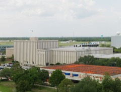 Apollo Mission Control CenterNational Historic Landmark · listed 1985
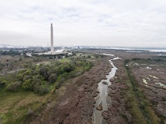 San Jacinto BattlefieldNational Historic Landmark · listed 1966
 Space Environment Simulation LaboratoryNational Historic Landmark · listed 1985
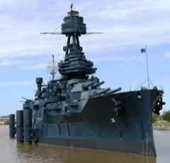 U.S.S. TEXASNational Historic Landmark · listed 1976
 1879 Houston Waterworkslisted 1976
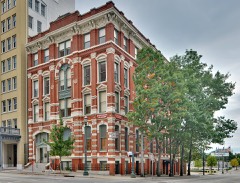 1884 Houston Cotton Exchange Buildinglisted 1971
 500 Jefferson Buildinglisted 2019
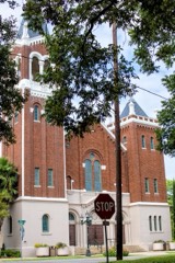 All Saints Roman Catholic Churchlisted 1983
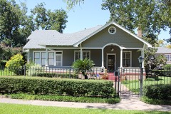 Allbach Houselisted 1983
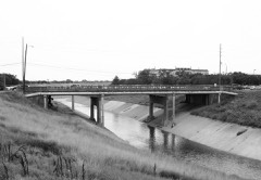 Almeda Road Bridge over Brays Bayoulisted 2007
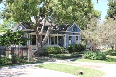 John W. Anderson Houselisted 1988
 Annunciation Churchlisted 1975
Population over time
2 figuresHouston grew from 2,195,914 to 2,304,580 between 2013 and 2020. These are the recorded population figures Wikidata holds for this place, reached through the Geographic Names Information System number this page is keyed on rather than by name, so they belong to this place and not to another of the same name. Most are census counts, but not all are: an early figure may be a founding or settlement estimate, and an estimate published within five years of a census is left out. The change column is computed, and is left blank where more than 20 years separate a figure from the one before it, because a gap that long is not a change between two counts.
| Year | People | Change |
|---|---|---|
| 2013 | 2,195,914 | |
| 2020 | 2,304,580 | +108,666 (+5%) |
Topographic sheets covering this place
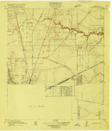
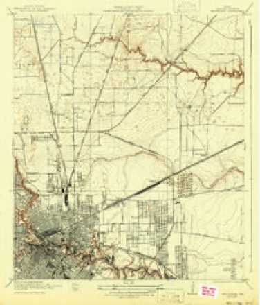
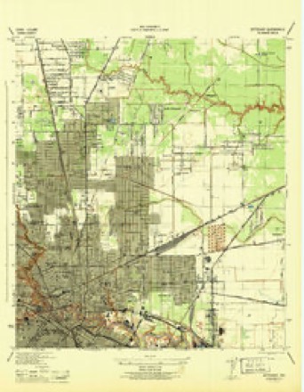
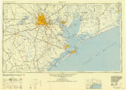
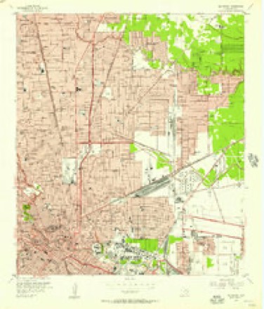
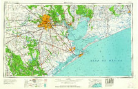
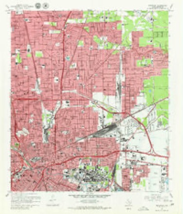
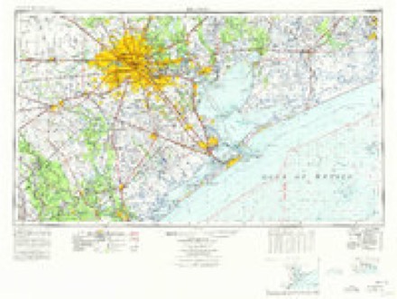
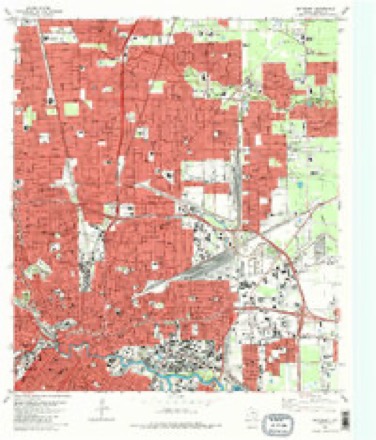
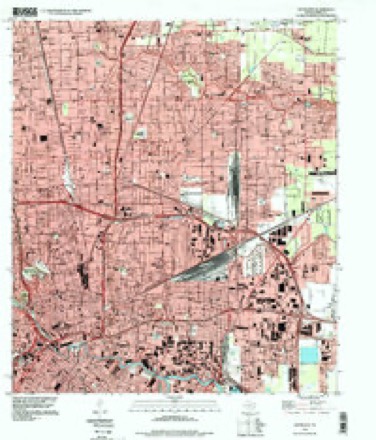
11 surveys from 17 printed sheetsMatched by testing this settlement's coordinate against the published boundary of every sheet in the United States Geological Survey's historical collection. Each opens the scanned sheet at the Survey.
- 1916 USGS Settegast quadrangle1:24000, 2 printings
- 1922 USGS Settegast quadrangle1:31680, 2 printings
- 1946 USGS Settegast quadrangle1:31680
- 1950 USGS Houston quadrangle1:250000
- 1955 USGS Settegast quadrangle1:24000
- 1956 USGS Houston quadrangle1:250000, 2 printings
- 1967 USGS Settegast quadrangle1:24000, 2 printings
- 1975 USGS Houston quadrangle1:250000, 2 printings
- 1982 USGS Settegast quadrangle1:24000, 2 printings
- 1992 USGS Houston quadrangle1:100000
- 1995 USGS Settegast quadrangle1:24000
Fires near this place
104 since 2019Regional context, not property-specific evidence. The federal wildfire occurrence database lists 104 fires within 5 miles of Houston between 2019 and 2020, burning about 15 acres in total. None started naturally. None was recorded as arson. Distance is straight-line from the map coordinates, so a fire counted here may appear on a neighbouring settlement's page as well.
| Reported cause | Fires |
|---|---|
| Missing data/not specified/undetermined | 104 |
The most recent of them, most recent first, with the day each was reported and the service that recorded it.
| Date | Cause | Size | Reported by | Name on the report |
|---|---|---|---|---|
| 9 September 2019 | Missing data/not specified/undetermined | under an acre | Texas A & M Forest Service | D6,D8,E7,E8,E9,E16,E17,L6,L7,L16,M19,SF30 |
| 6 September 2019 | Missing data/not specified/undetermined | under an acre | Texas A & M Forest Service | E017 |
| 6 September 2019 | Missing data/not specified/undetermined | under an acre | Texas A & M Forest Service | D6,D19,E12,E15,E19,E30,L6,L19,M19,SF30 |
| 3 September 2019 | Missing data/not specified/undetermined | under an acre | Texas A & M Forest Service | E039 |
| 25 September 2019 | Missing data/not specified/undetermined | under an acre | Texas A & M Forest Service | E017 |
| 19 September 2019 | Missing data/not specified/undetermined | 1.0 acres | Texas A & M Forest Service | D028, E007, E016, L007, M006, SF024 |
| 15 September 2019 | Missing data/not specified/undetermined | under an acre | Texas A & M Forest Service | E007 |
| 9 August 2019 | Missing data/not specified/undetermined | under an acre | Texas A & M Forest Service | E016 |
Settlements close enough to share some of these fires:
Mines and quarries near this place
10 of 12 shownRegional context, not property-specific evidence. The federal mineral resources record lists 12 workings within 5 miles of Houston: 10 producers, 2 past producers. 10 still produce. What was taken out: Barium-Barite, Sulfur, Vermiculite, Sand and Gravel, Construction. Distance is straight-line from the map coordinates, so a quarry counted here may appear on a neighbouring settlement's page as well.
| Where | Site | Commodity | Status | Recorded |
|---|---|---|---|---|
| Echo Ii Sand Dredge | Sand and Gravel, Construction | Past Producer | ||
| Gulf Coast Clay Pit | Clay | Producer | ||
| Gulf Coast Plant | Stone, Crushed/Broken | Past Producer | ||
| Houston Cement Plant | Limestone, General | Producer | ||
| Pasadena Plant | Phosphorus-Phosphates | Producer | ||
| Southern Clay Products Inc | Bentonite | Producer | ||
| Vermiculite Products Plant | Vermiculite | Producer | ||
| Houston Sulfur Plant | Sulfur | Producer | ||
| Signal Sulfur Plant | Sulfur | Producer | ||
| Chromalloy American Corp | Barium-Barite | Producer |
Storms near this place
60 of 266 shownRegional context, not property-specific evidence. The National Weather Service names Houston in 266 storm reports between 1993 and 2025: 118 thunderstorm wind, 94 hail, 28 flash flood, 12 lightning. The reports record 13 deaths and 65 injuries. Each account below is quoted exactly as the forecast office filed it, from the NOAA Storm Events Database, and each date opens the federal record of that event.
| When | Event | Place named | Harm | What the report says |
|---|---|---|---|---|
| August 2007 | Flash Flood | Houston | 3 killed, $750,000 | Numerous roads flooded and impassable across the eastern half of Harris County from the Houston area to the La Porte, Pasadena, and Deer Park areas. Flooding in Deer Park included homes off of Hender, Martha, and Eight Streets, as well as Harvard Avenue, with two feet of water reported over portions of East Boulevard. Pasadena area flooding included Strawberry Park, Southmore, Red Bluff, and Burke Streets, as well as Beltway 8 exits being closed due to high water. House flooding also occurred in Pasadena. At least a dozen schools, majority of these being in East Houston, received water damage. There were reports of Vince Bayou exceeding its banks at Shaw Street. Homes and businesses were also flooded in the La Porte area where some structures were inundated with more than a foot of water. Heavy rainfall collapsed a warehouse roof in Houston on Harrisburg Boulevard. There were three fatalities. Two men died (one at the scene, the other several hours later in a hospital) when heavy rainfall collapsed the roof of a grocery store in Clear Lake. A third fatality occurred when an eighteen wheeler was accidentally driven into a 26 foot deep flooded retention pond in La Porte. The driver drowned. |
| October 2006 | Flash Flood | Houston | 2 killed, $12,000 | A 36 year old mother and her 16 year old daughter drowned in an SUV at the underpass of Interstate 45 and Tellepsen Road. The victims were discovered several hours later as flood waters began to slowly recede when law enforcement noticed the top of their vehicle. The SUV was pulled out of the water and the two victims were discovered in the back of the vehicle. |
| November 2003 | Flash Flood | Houston | 1 killed, 1 hurt, $3,000,000 | Extensive flooding in and around the Sharpstown area. One 17 year old female fatality with one 18 year old male injury when van they were driving became flooded outside of high school. Flooding extended into Houston metro with numerous flooded or completely submerged vehicles. 300 homes flooded. |
| February 2005 | Lightning | Houston | 1 killed, 1 hurt | Lightning strike killed one man and injured another man while walking through a parking lot to their vehicles. |
| August 1999 | Thunderstorm Wind | Houston | 1 killed, $990,000 | A construction worker was killed when the Hawthorne Suites Motel under construction at intersection of Beltway 8 and Stancliff collapsed. Roof damage reproted at Gillman Subaru at Bellaire and US 59, and wall of glass blown down at Red Lion Hotel in Galleria area. Traffic light damaged at intersection of Corporate Dr. and Bellaire, and power lines downed in Westbury area. Numerous reports of trees down across central and southwest Houston including along 5th Street in Alief and in Westbury area. Highest wind gust of 63 MPH at KPRC-TV on US 59. |
| May 1997 | Flash Flood | Houston | 1 killed, $50,000 | Street flooding in west Houston from 6-8" training rains. An elderly man drove into a flooded underpass (about 8 ft deep) where he drowned. |
| August 2002 | Thunderstorm Wind | Houston | 1 killed, $15,000 | Man killed by tree falling on car at Cutten&1960. |
| April 2016 | Lightning | Houston | 1 killed | Lightning struck a worker installing an air conditioning unit on the roof of a residence and later died from his injuries that included electric shock and blunt force trauma after falling off the roof. |
| June 2004 | Lightning | Houston | 1 killed | 65 year old woman killed when lightning struck a nearby pine tree while she was walking to catch a bus (Key Map 492S). |
| March 2000 | Lightning | Houston | 1 killed | Woman killed by lightning in parking lot in northeast Houston. |
| November 1993 | Tornado (F1) | Houston | 26 hurt, $5,000,000 | The Lake Houston dam operator reported a tornado moving northeast across Lake Houston. The tornado lifted back into the parent thunderstorm before reaching the eastern shore of Lake Houston. |
| August 2000 | Lightning | Houston | 17 hurt | Lightning struck tree at Astroworld injuring 17 teenagers. |
| June 1997 | Thunderstorm Wind | Houston | 6 hurt, $30,000 | 6 minor injuries due to flying broken glass at One Shell Plaza in downtown Houston. |
| May 1997 | Flash Flood | Houston | 2 hurt, $250,000 | Severe flooding in Houston. 50-75 homes had flood damage. Creeks and bayous out of banks at many locations. A cab driver and 12 year old boy had to be rescued after flood waters swept them away from White Oak Bayou. Both hung onto trees before being rescued and had many ant bites. Many cars also flooded. |
| November 2000 | Thunderstorm Wind | Houston | 2 hurt, $150,000 | Extensive roof damage to an apartment complex on the south side of Houston on Barberry (near Cullen) with 2 injuries nearby from flying glass. Extensive tree damage in area. Winds estimated between 80 and 100 mph. |
| February 1998 | Thunderstorm Wind | Houston | 2 hurt, $75,000 | Roof peeled off and structural damage to Walton Mills Apartments in southwest Houston. Key map 529Q. |
| June 1997 | Thunderstorm Wind | Houston | 2 hurt, $30,000 | 2 minor injuries due to flying broken glass at 500 Jefferson St. in downtown Houston. |
| December 1995 | Thunderstorm Wind | Houston | 2 hurt, $20,000 | Tree blown onto a car injuring two people at Interstate 10 and Uvalde. |
| September 1997 | Lightning | Houston | 1 hurt, $200,000 | Lightning induced fire damaged 18 units at Riverbrook Apartments. Boy taken to hospital for smoke inhilation. |
| August 2004 | Lightning | Houston | 1 hurt, $20,000 | 19 year old woman injured by lightning strike in Southeast Houston at the Morley and Broadway intersection. Water main also was struck and burst. CPR was successfully performed on victim. |
| February 2005 | Lightning | Houston | 1 hurt | 40 year old man injured while holding an umbrella in Houston's Memorial Park. |
| May 2005 | Lightning | Houston | 1 hurt | 15 year old male injured when lightning struck his home as he was talking on the phone. |
| April 2001 | Hail | Houston | $20,000,000 | Numerous reports of hail on the west side of Houston. 0.75 inch to 1.5 inch hail along I-10 between Hunters Creek Village and the West Loop. 1 to 1.5 inch hail near South Braeswood and Fondren Road accumulated to several inches deep and was still on the ground 24 hours after the storm. 1.5 inch hail near South Post Oak Road and West Bellfort. 1 inch hail at Westheimer and Hillcroft. 0.8 inch hail near Gessner and Highway 59. Numerous reports of windows broken and trees and shrubs stripped of their leaves. |
| April 2001 | Thunderstorm Wind | Houston | $15,000,000 | Numerous reports of trees down on the west side of Houston. Power lines down near South Post Oak Road and Beltway 8. |
| April 2001 | Thunderstorm Wind | Houston | $10,000,000 | Numerous reports of trees down on the west side of Houston. |
| June 2006 | Flash Flood | South Houston | $3,300,000 | Approximately 3,370 homes were flooded with some water rescues in the Interstate 45 and Beltway 610 vicinity (Belfort and Telephone Roads). The Washburn Tunnel was flooded and impassable while Interstate 10 at Federal Street's bypass was under water. Sections of Sims, Halls, and Hunting Bayous with Vogel and White Oak Creeks experienced significant flooding. Homes along these bayous and creeks had flood water in them from 2 to 8 inches to as high as 18 to 20 inches. |
| December 1995 | Thunderstorm Wind | Houston | $1,000,000 | Thunderstorm winds downed billboards and trees throughout north Houston causing substantial damage to businesses and homes. |
| October 2006 | Flash Flood | Houston | $750,000 | Heavy rain caused widespread county and metro flooding of numerous roads. There were approximately 125 flooded homes and 92 flooded apartment units. |
| May 2007 | Flash Flood | Houston | $650,000 | Brickhouse Gully exceeded its banks and resulted in house flooding upstream of US 290 in the Langwood Subdivision. Six to eight homes were flooded with 1 to 2 of water at Antoine Dr and Chantilly. Up to 10 homes were flooded in the Spring Shadows Subdivision. Most homes received less than 6 of flooding. Total flooded northern Houston metro home count for the event was between 70 to 90 homes. |
| October 2002 | Flash Flood | Houston | $575,000 | Widespread flooding across Harris County with many streets impassable and closed and numerous creeks and bayous out of their banks. |
| November 2003 | Tornado (F2) | South Houston | $550,000 | Tornado touched down just east of Highway 288 in the Third Ward. One church completely destroyed, 50 homes damaged, and extensive tree damage. Wind damage to several downtown buildings in SE Houston near Minute Maid ballpark. |
| May 1999 | Thunderstorm Wind | Houston | $500,000 | Bow echo tracked across center of Houston from Katy to downtown Houston to Channelview. Widespread reports of trees and power lines down including in the Memorial Area, along Loop 610 near Airline Dr., and in the La Strada area. Roofs damaged in the Memorial area, at an apartment complex along Westlayan, at Oates Elementary, at the Hyatt Regency Houston, and at the Yorktown Apartments. Windows blown out of several buildings in downtown Houston with computers blown out of the buildings by the wind. Winds estimated at 60-70 mph in most areas. |
| June 1996 | Thunderstorm Wind | Houston | $250,000 | no account filed |
| May 2005 | Lightning | Houston | $200,000 | Lightning strike sparked a fire that destroyed a church sanctuary. |
| May 2000 | Thunderstorm Wind | Houston | $200,000 | Numerous trees and power lines down across the northern half of Harris County. Roof damage to hotel on US 290 in northwest Houston. |
| August 1999 | Thunderstorm Wind | Houston | $200,000 | Shingles blown off roof of building at Highline near Tidwell (Key Map 454F), carports damaged and trees down on cars at intersection of Parker and Aldine-Westfield, and a tree fell on house near Hardy Toll Rd. (Key Map 413Y). Widespread reports of trees down across northern half of Houston including at KHOU-TV, intersection of Studewood & 14th Sts., at Jensen and Kelly Sts. just west of US 59, and at the Chase Tower downtown. |
| June 1997 | Thunderstorm Wind | Houston | $200,000 | 1000's of trees blown down throughout the Houston area, some on cars and houses. Small wall collapsed at the Astrodome. |
| March 2007 | Thunderstorm Wind | Houston | $195,000 | Damage in and around the Houston area from this squall line included trees down (several on vehicles), fences damaged and extensive roof damage to several area businesses and apartments. |
| November 2000 | Thunderstorm Wind | Houston | $150,000 | Damage to carports, awnings, and fences, and several large trees down in southeast Houston. Roof damage to Wurthing High School. |
| March 1997 | Flash Flood | Houston | $130,000 | no account filed |
| May 2000 | Thunderstorm Wind | Houston | $100,000 | Billboard damaged at I-10 and Silber with debris blown onto I-10. Numerous trees down in northwest Houston. |
| August 2000 | Thunderstorm Wind | Houston | $100,000 | Numerous trees down in north and northeast parts of Houston. One car struck by tree. |
| August 2000 | Thunderstorm Wind | Houston | $100,000 | Numerous trees down in northern and central parts of Houston. |
| August 2000 | Thunderstorm Wind | Houston | $100,000 | Numerous trees down in West University, River Oaks, Medical Center, and downtown areas. |
| August 2000 | Thunderstorm Wind | South Houston | $100,000 | Trees down on homes in southeast Houston. |
| June 1995 | Thunderstorm Wind | Houston | $100,000 | Roof blown off Houston Community College. Trees and power lines blown down. Mobile home sustained wind damage. |
| July 1996 | Lightning | Houston | $100,000 | no account filed |
| July 2004 | Thunderstorm Wind | Houston | $75,000 | Numerous trees down in the Houston metro area. |
| December 2002 | Thunderstorm Wind | Houston | $75,000 | Power lines down from estimated 70 mph winds at Westheimer and FM 1093. |
| March 1997 | Lightning | Houston | $75,000 | no account filed |
| July 2005 | Thunderstorm Wind | Houston | $65,000 | Two large air conditioning units on a roof were shifted by the wind gust which allowed water to pour into a building and damage supplies belonging to a blood supply center. Location was on Knight Road near the Astrodome. |
| September 2002 | Flash Flood | Houston | $55,000 | Many roads under water and impassable especially north of downtown Houston and near the west loop. |
| April 1995 | Tornado (F0) | Houston | $55,000 | Ham radio and storm spotters reported a tornado in the Sage Glenn subdivision (east of downtown Houston). The tornado destroyed two garages, downed large tree limbs, and knocked down fences. |
| July 2007 | Flash Flood | Houston | $50,000 | Numerous reports of street flooding around Houston metro. Reports of flooding at the intersection of Mesa Road and the Sam Houston Parkway. Flooding also reported around downtown Houston and northward up Interstate 45 toward the West Mont Houston area, where various roads were closed due to high water making them impassable. |
| June 2004 | Flash Flood | Houston | $50,000 | Numerous reports of street flooding in downtown Houston and the Medical Center area. |
| April 2000 | Hail | Houston | $50,000 | Quarter sized hail in Greenspoint area. |
| May 2000 | Thunderstorm Wind | Houston | $50,000 | Tree down on house on Danbury. |
| May 2000 | Hail | Houston | $50,000 | Quarter sized hail at I-10 and Loop 610 with dime sized hail at US 290 and Loop 610. |
| November 2000 | Thunderstorm Wind | Houston | $50,000 | Numerous trees down across city. |
| July 2000 | Thunderstorm Wind | Houston | $50,000 | Numerous reports of trees down in the Houston area with patio furniture damaged in the Montrose area. Wind gusts estimated of 50 to 55 mph. |
Nearest settlements
The eight closest, with where each one stands in the county. Distances are straight-line, computed from the Geographic Names Information System coordinates.
| Map | Place | Distance | Sheets |
|---|---|---|---|
| Woodland Heights | 1.7 miles | 15 | |
| Glen Park | 1.8 miles | 17 | |
| Brook Smith | 2.3 miles | 15 | |
| Eastwood | 2.5 miles | 16 | |
| Stude | 3.0 miles | 15 | |
| Houston Heights | 3.0 miles | 15 | |
| University Oaks | 3.3 miles | 16 | |
| Central Park | 3.4 miles | 16 |
Elsewhere
Matched on this settlement's Geographic Names Information System number rather than its name, so it cannot be a different place of the same name in another state.
| Wikipedia article on Houston | An encyclopaedic summary. Its text is share-alike, so it is linked here rather than copied. |
| Wikidata item Q16555 | The structured record the population and elevation above come from. Public domain (CC0). |
Provenance
This settlement is recorded in the Geographic Names Information System as feature 1380948. The sheet list is computed by point-in-boundary test against the United States Geological Survey's historical topographic inventory. Both are works of the United States government and carry no copyright under 17 U.S.C. 105.
Wildfire. Short, Karen C. 2022. Spatial wildfire occurrence data for the United States, 1992-2020 [FPA_FOD_20221014]. 6th Edition. Fort Collins, CO: Forest Service Research Data Archive. https://doi.org/10.2737/RDS-2013-0009.6 Collected with United States Government funding and usable without additional permissions or fees.
Mines and quarries. USGS Mineral Resources Data System (MRDS) https://mrdata.usgs.gov/mrds/ A work of the United States government, no copyright under 17 U.S.C. 105.
Storms. NOAA National Centers for Environmental Information, Storm Events Database https://www.ncei.noaa.gov/stormevents/ A work of the United States government, no copyright under 17 U.S.C. 105. Narratives are quoted verbatim from the National Weather Service report and are not edited or summarised.