 Block
BlockJustin, Texas
10 topographic sheets cover this place, the earliest surveyed in 1954 and the latest in 1991. It stands in the Justin-Roanoke census division. It lies in ZIP code area 76247. It stands on Oliver Creek. The Survey maps it on the Justin quadrangle. 4,409 people lived here at the 2020 count. It stands 643 feet above sea level.
Population over time
2 figuresJustin grew from 3,246 to 4,409 between 2010 and 2020. These are the recorded population figures Wikidata holds for this place, reached through the Geographic Names Information System number this page is keyed on rather than by name, so they belong to this place and not to another of the same name. Most are census counts, but not all are: an early figure may be a founding or settlement estimate, and an estimate published within five years of a census is left out. The change column is computed, and is left blank where more than 20 years separate a figure from the one before it, because a gap that long is not a change between two counts.
| Year | People | Change |
|---|---|---|
| 2010 | 3,246 | |
| 2020 | 4,409 | +1,163 (+36%) |
Topographic sheets covering this place
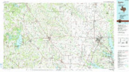
5 surveys from 10 printed sheetsMatched by testing this settlement's coordinate against the published boundary of every sheet in the United States Geological Survey's historical collection. Each opens the scanned sheet at the Survey.
- 1954 USGS Sherman quadrangle1:250000, 2 printings
- 1958 USGS Sherman quadrangle1:250000
- 1960 USGS Justin quadrangle1:24000, 4 printings
- 1985 USGS Denton quadrangle1:100000
- 1991 USGS Denton quadrangle1:100000, 2 printings
Fires near this place
177 since 2002Regional context, not property-specific evidence. The federal wildfire occurrence database lists 177 fires within 5 miles of Justin between 2002 and 2020, burning about 385 acres in total. 3 started naturally. 2 were recorded as arson. Distance is straight-line from the map coordinates, so a fire counted here may appear on a neighbouring settlement's page as well.
| Reported cause | Fires |
|---|---|
| Missing data/not specified/undetermined | 115 |
| Equipment and vehicle use | 24 |
| Debris and open burning | 16 |
| Smoking | 9 |
| Railroad operations and maintenance | 5 |
| Natural | 3 |
| Power generation/transmission/distribution | 2 |
| Arson/incendiarism | 2 |
| Misuse of fire by a minor | 1 |
The most recent of them, most recent first, with the day each was reported and the service that recorded it.
| Date | Cause | Size | Reported by | Name on the report |
|---|---|---|---|---|
| 9 September 2011 | Equipment and vehicle use | 1.5 acres | Texas A & M Forest Service | 7225 FAITH LN |
| 4 September 2011 | Missing data/not specified/undetermined | under an acre | Texas A & M Forest Service | 5413 TIM DONALD |
| 27 September 2009 | Smoking | under an acre | Texas A & M Forest Service | 22199 KIOWA |
| 20 September 2013 | Debris and open burning | under an acre | Texas A & M Forest Service | 1020 W FIFTH ST |
| 18 September 2013 | Missing data/not specified/undetermined | under an acre | Texas A & M Forest Service | 6634 TIM DONALD |
| 14 September 2014 | Missing data/not specified/undetermined | under an acre | Texas A & M Forest Service | WOODSIDE |
| 13 September 2013 | Missing data/not specified/undetermined | 1.5 acres | Texas A & M Forest Service | 2390 FM 407 |
| 8 August 2020 | Missing data/not specified/undetermined | under an acre | Texas A & M Forest Service | I35 |
Settlements close enough to share some of these fires:
Mines and quarries near this place
6 within 5 milesRegional context, not property-specific evidence. The federal mineral resources record lists 6 workings within 5 miles of Justin: 5 past producers, 1 producer. 1 still produces. What was taken out: Sand and Gravel, Construction. Distance is straight-line from the map coordinates, so a quarry counted here may appear on a neighbouring settlement's page as well.
| Where | Site | Commodity | Status | Recorded |
|---|---|---|---|---|
| Deussen Gravel Company Operation | Sand and Gravel, Construction | Producer | ||
| Unknown | Sand and Gravel, Construction | Past Producer | ||
| Unknown | Sand and Gravel, Construction | Past Producer | ||
| Unknown | Sand and Gravel, Construction | Past Producer | ||
| Unknown | Sand and Gravel, Construction | Past Producer | ||
| Unknown | Sand and Gravel, Construction | Past Producer |
Storms near this place
60 of 69 shownRegional context, not property-specific evidence. The National Weather Service names Justin in 69 storm reports between 1994 and 2025: 31 hail, 23 thunderstorm wind, 6 flash flood, 6 flood. The reports record 1 death. Each account below is quoted exactly as the forecast office filed it, from the NOAA Storm Events Database, and each date opens the federal record of that event.
| When | Event | Place named | Harm | What the report says |
|---|---|---|---|---|
| February 1997 | Flash Flood | Justin | 1 killed | no account filed |
| April 2024 | Hail | Justin | $700,000 | A public report indicated a 3.4 inch hail stone measured by a caliper 2.7 miles southwest of Justin. |
| April 2024 | Hail | Justin | $600,000 | no account filed |
| April 2024 | Hail | Justin | $400,000 | Amateur radio reported tennis ball sized hail in Northlake. |
| March 2017 | Hail | Justin | $400,000 | A trained spotter reported baseball sized hail near the community of Northlake. |
| March 2025 | Thunderstorm Wind | Justin | $110,000 | KAFW measured a 76 mph wind gust. A member of the public reported that multiple hangars were damaged and several planes blown into each other at Alliance Airport. |
| April 2024 | Hail | Justin | $100,000 | no account filed |
| June 2020 | Lightning | Justin | $50,000 | A local newspaper reported a house in the 7700 Block of Willow Ridge Drive in Northlake was damaged by a fire caused by lightning. |
| June 2019 | Flood | Justin | $50,000 | Cars were stalled in water at Sam Reynolds Rd and Boss Range Road in Justin. The road and the bridge were shut down. |
| April 2019 | Tornado (EF1) | Justin | $50,000 | This tornado initially formed in open pasture land approximately 1.2 miles east southeast of Justin, snapping small trees. The tornado moved northeastward, crossing Denton Creek immediately east of the FM 407 bridge over this stream. In this heavily forested bottomland, numerous large hardwood trees were snapped and twisted approximately 25-50 feet off the ground. Winds along this portion of the path were estimated at 85-90 mph, resulting in a maximum low end EF-1 intensity rating. The tornado continued northeastward, uprooting or snapping several trees along FM 407 beyond the Denton Creek bridge, before finally recrossing FM 407 near the entrance to the Northridge Estates subdivision in Northlake. Several homes in this subdivision sustained minor roof and tree damage consistent with 60-70 mph EF-0 winds. The tornado dissipated soon after entering this neighborhood. |
| April 2011 | Thunderstorm Wind | Justin | $40,000 | Numerous fences were blown down and shingles were blown off roofs in Justin. |
| August 2001 | Thunderstorm Wind | Justin | $30,000 | A downburst from a severe thunderstorm blew two airplane hangars off their foundations,destroyed an recreational vehicle storage building, did minor damage to three aircraft, and minor wind damage to other structures. |
| March 2023 | Thunderstorm Wind | Justin | $20,000 | A large billboard was knocked down by thunderstorm winds. |
| June 2010 | Thunderstorm Wind | Justin | $15,000 | There was minor roof damage and windows blown out of a residence due to high winds. The shed next to the residence was destroyed. |
| August 2020 | Thunderstorm Wind | Justin | $10,000 | A National Weather Service employee reported several homes with minor roof damage and multiple trees down near Propwash Airport. |
| October 2014 | Hail | Justin | $10,000 | Golf ball sized hail was reported by amateur radio at the Texas Motor Speedway. |
| June 2024 | Hail | Justin | $8,000 | Reported via mPing. |
| May 2009 | Thunderstorm Wind | Justin | $6,000 | A trained spotter estimated 70-75 mph winds 3 miles north-northwest of Northlake. Windows were broken out and small trees were uprooted. |
| May 2024 | Thunderstorm Wind | Justin | $5,000 | Multiple homes with shingles torn off by thunderstorm wind gusts in a neighborhood near Hwy 114 and Hwy 156. |
| October 2014 | Thunderstorm Wind | Justin | $5,000 | Emergency management reported that a 1-foot diameter tree was broken, power poles were broken with power lines down on Boss Range Rd ad John Wiley Rd. |
| March 2009 | Hail | Justin | $5,000 | Quarter to Golfball size hail was reported 6 miles west of the Texas Motor Speedway. |
| March 2009 | Hail | Justin | $5,000 | Golfball size hail was reported at FM 157 and Highway 114 at Northwest High School. |
| June 2009 | Thunderstorm Wind | Justin | $5,000 | Numerous fences were down in the Harriet Creek Subdivision located near FM 156 and HWY 114. Winds were estimated to be 70 mph. |
| February 2001 | Thunderstorm Wind | Justin | $5,000 | A tree was blown down onto a truck. |
| April 1994 | Thunderstorm Wind | Justin | $5,000 | Trees were blown down across a road. |
| October 2014 | Thunderstorm Wind | Justin | $1,000 | A public report was received of shingles blown off of roofs and a small shed damaged. |
| May 1999 | Thunderstorm Wind | Justin | $400 | Power lines were blown down by thunderstorm winds. |
| April 2025 | Hail | Justin | - | Mping report of quarter size hail. |
| May 2024 | Thunderstorm Wind | Justin | - | A 59 mph wind gust was measured three miles west of the I-35W and 114 exchange. |
| May 2024 | Hail | Justin | - | Report from mPING: Quarter (1.00 in.). |
| March 2023 | Thunderstorm Wind | Justin | - | The Fort Worth Alliance ASOS measured a 61 mph wind gust. A spotter also reported 60+ mph winds near Hwy 114 and Hwy 156 just north of the airport. |
| October 2019 | Hail | Justin | - | Emergency management reported dime sized hail in the city of Justin, TX. |
| June 2019 | Flood | Justin | - | Water was over the road at Ben-Bert Rd and Hwy 114 with a depth of 1.5 feet. |
| April 2019 | Hail | Justin | - | Amateur radio reported quarter size hail in the city of Justin, TX. |
| March 2016 | Flash Flood | Justin | - | Emergency management reported a swift water rescue on FM 407 where Denton Creek had flooded the road. The occupant was rescued about 100 yards west of the main road. |
| April 2016 | Hail | Justin | - | A trained spotter reported penny sized hail near the Texas Motor Speedway in Justin, TX. |
| December 2015 | Flood | Justin | - | Seven roads were closed on the 27th due to high water from creek and stream flooding: Eakin Cemetery Rd, Jackson, Old Alton, Rector, Swafford, and C Wolfe Roads. On the 28th, high water forced the closure of one lane in each direction on I-35E at North Texas Blvd in Denton. |
| November 2015 | Flood | Justin | - | Some areas, especially near creeks and streams, remained flooded into the afternoon hours. Several county roads were flooded in the pre-dawn hours. A few roads remained closed in the afternoon hours including Old Alton Road and County Club Drive in Denton. |
| August 2012 | Flash Flood | Justin | - | Highway 114 near the Texas Motor Speedway was flooded under Highway 156. Rainfall totals as high as 2 in 30 minutes were measured during the heavy rain event. |
| August 2012 | Flood | Justin | - | Areal flooding continued for several hours after scattered to numerous thunderstorms producing heavy rainfall produced flash flooding in southern Denton County. Between 1-3 of rain had fallen over the area; resulting in the flooding of several creeks, underpasses, and streets. |
| July 2012 | Hail | Justin | - | Spotters reported pea to dime sized hail 3 miles west of Justin. |
| April 2011 | Hail | Justin | - | Penny to quarter sized hail was reported for several minutes in Justin. |
| June 2011 | Hail | Justin | - | Quarter sized hail fell 2 miles southwest of Justin. |
| September 2010 | Flood | Justin | - | Several roads and creeks across the county remained closed due to high water after the heavy rain had ended. Up to 7 inches of rain fell across the county. |
| February 2009 | Thunderstorm Wind | Justin | - | A spotter measured a 63 MPH wind gust west of Texas Motor Speedway. |
| March 2006 | Flash Flood | Justin | - | The intersection of Creekhill Way and 12th Street was underwater and barricaded. |
| April 2004 | Thunderstorm Wind | Justin | - | Large signs were blown down. |
| June 2004 | Flash Flood | Justin | - | Water was reported over FM 407. |
| March 2000 | Hail | Justin | - | Hail was reported at the Texas Motor Speedway. |
| May 1998 | Thunderstorm Wind | Justin | - | Thunderstorm winds blew down several trees onto FM 156. No dollar estimate of damage was provided. |
| May 1997 | Flash Flood | Justin | - | The intersection of Farm-to-Market Road 156 at Highway 114 was reported under water. |
| June 1997 | Thunderstorm Wind | Justin | - | Strong winds blew down trees. |
| April 1994 | Hail | Justin | - | During the evening hours of the 25th, three supercell thunderstorms moved across the Dallas/Fort Worth metropolitan area producing torrential rain, large hail, high winds, and six tornadoes. Three persons were killed and 55 injured from the tornadoes. The ,hailstorms across Tarrant County did 50-100 million dollars damage, the DeSoto tornado approximately 50 million dollars damage, and the Lancaster tornado approximately 100 million dollars damage. Storm A moved across northern Tarrant and northern Dallas counties between 1800 CST and 1930 CST producing hail up to 2 inches in diameter and torrential rains. Storm B moved eastward into western Tarrant County at approximately 1800 CST. This storm had a history of producing large hail across Stephens, Palo Pinto, and Parker Counties. Once again, this storm produced large hail across the southern half of Fort Worth and Arlington, and a brief tornado touchdown in south Fort Worth 2 miles south of Edgecliff Village at 1842 CST. By 1930 CST, Storm B had moved into southwest Dallas County, producing a brief tornado touchdown at Joe Pool Lake. A second tornado occurred at approximately 1950 CST, doing considerable damage in DeSoto. At 2030 CST, a strong tornado developed rapidly just west of Lancaster, and the storm began turning to the right, moving east-southeast. At 2040 CST, Lancaster was devastated by a tornado producing upper scale F3 and lower scale F4 damage. At 2058 CST, Storm B moved to the Dallas-Ellis county line, and a tornado was reported 2 miles south of Red Oak, in extreme northern Ellis County. Storm C began developing rapidly at 1840 CST, 5 miles southwest of Weatherford, moving to the east. Storm C quickly became severe, producing hail up to golf ball-size on the Parker-Tarrant county line by 1930 CST. Storm C continued to move east across southern Tarrant County producing torrential rain and up to baseball-size hail. At 2030 CST, Storm C, now located in southeast Tarrant County near Mansfield, turned right and began moving southeast toward Midlothian. At 2058 CST, a tornado was reported 4 miles west of Midlothian. |
| April 2024 | Hail | Justin | - | no account filed |
| June 2023 | Hail | Justin | - | no account filed |
| May 2011 | Hail | Justin | - | no account filed |
| July 2003 | Hail | Justin | - | no account filed |
| April 2002 | Hail | Justin | - | no account filed |
| April 2000 | Hail | Justin | - | no account filed |
| March 2000 | Hail | Justin | - | no account filed |
Nearest settlements
The eight closest, with where each one stands in the county. Distances are straight-line, computed from the Geographic Names Information System coordinates.
| Map | Place | Distance | Sheets |
|---|---|---|---|
| DISH | 3.3 miles | 8 | |
| Northlake | 3.4 miles | 8 | |
| Corral City | 3.9 miles | 11 | |
| Elizabethtown | 4.5 miles | 10 | |
| Drop | 4.5 miles | 8 | |
| Argyle | 6.5 miles | 11 | |
| Marshall Creek | 6.6 miles | 11 | |
| Roanoke | 6.7 miles | 11 |
Elsewhere
Matched on this settlement's Geographic Names Information System number rather than its name, so it cannot be a different place of the same name in another state.
| Wikipedia article on Justin | An encyclopaedic summary. Its text is share-alike, so it is linked here rather than copied. |
| Wikidata item Q979539 | The structured record the population and elevation above come from. Public domain (CC0). |
Provenance
This settlement is recorded in the Geographic Names Information System as feature 1338936. The sheet list is computed by point-in-boundary test against the United States Geological Survey's historical topographic inventory. Both are works of the United States government and carry no copyright under 17 U.S.C. 105.
Wildfire. Short, Karen C. 2022. Spatial wildfire occurrence data for the United States, 1992-2020 [FPA_FOD_20221014]. 6th Edition. Fort Collins, CO: Forest Service Research Data Archive. https://doi.org/10.2737/RDS-2013-0009.6 Collected with United States Government funding and usable without additional permissions or fees.
Mines and quarries. USGS Mineral Resources Data System (MRDS) https://mrdata.usgs.gov/mrds/ A work of the United States government, no copyright under 17 U.S.C. 105.
Storms. NOAA National Centers for Environmental Information, Storm Events Database https://www.ncei.noaa.gov/stormevents/ A work of the United States government, no copyright under 17 U.S.C. 105. Narratives are quoted verbatim from the National Weather Service report and are not edited or summarised.