 Block
BlockLa Grange, Texas
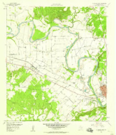
11 topographic sheets cover this place, the earliest surveyed in 1953 and the latest in 1985. It stands in the La Grange census division. It lies in ZIP code area 78945. It lies near Clement Island. The Survey maps it on the La Grange West quadrangle. 4,391 people lived here at the 2020 count. It stands 266 feet above sea level.
Research this city
On record in La Grange
Buildings and businesses the archive holds for this place. Each opens its own page, with the source record it came from.
On the National Register 7 records
 Fayette County Courthouse and Jaillisted 1975
 Fayette County Courthouse Square Historic Districtlisted 2001
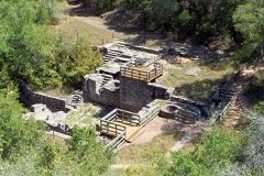 Henry L. Kreische Brewery and Houselisted 1975
 Mier Expedition and Dawson's Men Monument and Tomblisted 2019
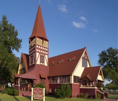 St. James Episcopal Churchlisted 1976
 State Highway 71 Bridge at the Colorado Riverlisted 1996
- Nathaniel W. Faison Houselisted 2010
Population over time
3 figuresLa Grange grew from 1,165 to 4,391 between 1870 and 2020. These are the recorded population figures Wikidata holds for this place, reached through the Geographic Names Information System number this page is keyed on rather than by name, so they belong to this place and not to another of the same name. Most are census counts, but not all are: an early figure may be a founding or settlement estimate, and an estimate published within five years of a census is left out. The change column is computed, and is left blank where more than 20 years separate a figure from the one before it, because a gap that long is not a change between two counts.
| Year | People | Change |
|---|---|---|
| 1870 | 1,165 | |
| 2010 | 4,641 | |
| 2020 | 4,391 | -250 (-5%) |
Topographic sheets covering this place
5 surveys from 11 printed sheetsMatched by testing this settlement's coordinate against the published boundary of every sheet in the United States Geological Survey's historical collection. Each opens the scanned sheet at the Survey.
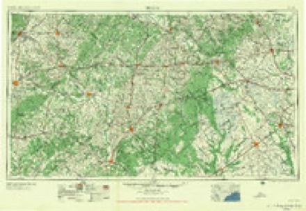
- 1953 USGS Seguin quadrangle1:250000, 4 printings
- 1956 USGS La Grange quadrangle1:62500
- 1958 USGS La Grange West quadrangle1:24000, 3 printings
- 1958 USGS Seguin quadrangle1:250000
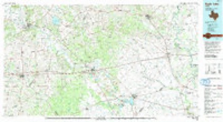
- 1985 USGS Eagle Lake quadrangle1:100000, 2 printings
What the histories say of this town
2,385 words1 chapter about La Grange from the published histories of the county, public domain and reproduced complete.
| Chapter | From | Length |
|---|---|---|
| Fayette County, Her History and Her People | Fayette County, Her History and Her People (1902) | 2,385 words |
Fires near this place
32 since 1993Regional context, not property-specific evidence. The federal wildfire occurrence database lists 32 fires within 5 miles of La Grange between 1993 and 2020, burning about 346 acres in total. None started naturally. None was recorded as arson. Distance is straight-line from the map coordinates, so a fire counted here may appear on a neighbouring settlement's page as well.
| Reported cause | Fires |
|---|---|
| Debris and open burning | 19 |
| Missing data/not specified/undetermined | 7 |
| Equipment and vehicle use | 4 |
| Power generation/transmission/distribution | 2 |
The most recent of them, most recent first, with the day each was reported and the service that recorded it.
| Date | Cause | Size | Reported by | Name on the report |
|---|---|---|---|---|
| 7 September 2017 | Power generation/transmission/distribution | under an acre | Texas A & M Forest Service | PINEY CREEK RD |
| 28 September 1993 | Missing data/not specified/undetermined | 2.0 acres | Texas A & M Forest Service | not named |
| 24 September 2005 | Equipment and vehicle use | 3.0 acres | Texas A & M Forest Service | CENTRAL TX - 26 |
| 23 September 2005 | Debris and open burning | 4.0 acres | Texas A & M Forest Service | CENTRAL TX - 24 |
| 23 September 2005 | Missing data/not specified/undetermined | 150 acres | Texas A & M Forest Service | CENTRAL TX - 25 |
| 22 September 2005 | Debris and open burning | 5.0 acres | Texas A & M Forest Service | CENTRAL TX - 21 |
| 21 September 2005 | Debris and open burning | 10 acres | Texas A & M Forest Service | CENTRAL TX - 20 |
| 17 September 1993 | Equipment and vehicle use | 1.0 acres | Texas A & M Forest Service | not named |
Settlements close enough to share some of these fires:
Mines and quarries near this place
4 within 5 milesRegional context, not property-specific evidence. The federal mineral resources record lists 4 workings within 5 miles of La Grange: 2 past producers, 2 producers. 2 still produce. What was taken out: Sand and Gravel, Construction. Distance is straight-line from the map coordinates, so a quarry counted here may appear on a neighbouring settlement's page as well.
| Where | Site | Commodity | Status | Recorded |
|---|---|---|---|---|
| Halsted Mine | Sand and Gravel, Construction | Past Producer | Flint, Gravel | |
| La Grange Pit | Sand and Gravel, Construction | Producer | ||
| Lagrange Pit | Sand and Gravel, Construction | Producer | Gravel, Sand | |
| Unknown | Sand and Gravel, Construction | Past Producer |
Storms near this place
39 since 1994Regional context, not property-specific evidence. The National Weather Service names La Grange in 39 storm reports between 1994 and 2025: 14 hail, 11 thunderstorm wind, 10 flash flood, 3 tornado. No death or injury is recorded in these reports. Each account below is quoted exactly as the forecast office filed it, from the NOAA Storm Events Database, and each date opens the federal record of that event.
| When | Event | Place named | Harm | What the report says |
|---|---|---|---|---|
| June 2003 | Thunderstorm Wind | La Grange | $80,000 | Severe thunderstorm winds were reported by the Fayette County Sheriff's Department to have blown down trees and power lines in the LaGrange area. |
| April 2023 | Hail | La Grange | $50,000 | A thunderstorm produced hail up to two inches in diameter in La Grange. The hail dented vehicles in the area. |
| August 2003 | Thunderstorm Wind | La Grange | $50,000 | Severe thunderstorm winds knocked over trees and blew down power lines in the LaGrange area. |
| June 2007 | Flash Flood | La Grange | $30,000 | Up to 3 inches of rain was produced by showers and thunderstorms in less than one hour between Plum and LaGrange. As a result of the heavy rainfall, FM609, FM154 were closed through the late night and into the early morning. |
| December 2002 | Tornado (F0) | La Grange | $20,000 | The tornado, as surveyed by the Fayette County Emergency Manager, touched down along East Radhost School Road, approximately 6 miles south of LaGrange at 1735 CST and moved for three-fourths of a mile toward the northeast. It was estimated at 50 yards wide and damaged a 20 foot by 20 foot carport and a 15 foot by 20 foot wooden building before dissipating near 1740CST. The tornado was rated F0 on the Fujita Scale. |
| March 1995 | Tornado (F0) | La Grange | $20,000 | A small tornado struck an outbuilding and moved mobile homes off their pads a it struck briefly near La Grange. The tornado moved southeastward, doing minor roof damage and knocking over some street signs before lifting up and disappearing. It picked up a two-by-four and propelled it through a window in the unused bedroom of a home, but caused no injuries. Persons near the path of the tornado reported hearing a "roaring sound." |
| April 1998 | Hail | La Grange | $10,000 | no account filed |
| June 2019 | Thunderstorm Wind | La Grange | $5,000 | A thunderstorm produced wind gusts estimated at 70 mph that knocked down multiple trees in La Grange. |
| May 1994 | Thunderstorm Wind | La Grange | $5,000 | no account filed |
| April 2015 | Thunderstorm Wind | La Grange | $1,000 | Multiple large trees were downed blocking a roadway in the city of La Grange. Special equipment was required in order to move the trees off the road. |
| May 2024 | Thunderstorm Wind | La Grange | $500 | A thunderstorm produced wind gusts estimated at 60 mph that blew down some three inch diameter tree limbs in LaGrange. |
| May 2025 | Hail | La Grange | - | A thunderstorm produced dime to quarter size hail in La Grange. |
| April 2023 | Hail | La Grange | - | A thunderstorm produced ping pong ball size hail in La Grange. |
| May 2023 | Hail | La Grange | - | A thunderstorm produced nickel to quarter size hail in La Grange. |
| May 2023 | Flash Flood | La Grange | - | Thunderstorms produced heavy rain that led to flash flooding. A video on social media showed water flowing over a low water crossing on Guenther Rd. at Lane Pool Creek south of La Grange. |
| May 2021 | Flash Flood | La Grange | - | Thunderstorms produced heavy rain that led to flash flooding. The Fayette County Sheriff reported five water rescues and multiple roads closed around the county. |
| April 2016 | Flash Flood | La Grange | - | Thunderstorms produced heavy rain that caused flash flooding closing Hwy 71 in several locations east of La Grange. Swift water rescues were performed and cars were under water. |
| April 2016 | Flash Flood | La Grange | - | Thunderstorms produced heavy rain that caused flash flooding closing W. Travis St. at Hwy 77. |
| April 2015 | Hail | La Grange | - | Quarter size hail was reported along highway 77 north of the city of La Grange. |
| May 2011 | Thunderstorm Wind | La Grange | - | A thunderstorm produced wind gusts estimated at 50 knots which knocked down some large tree limbs in La Grange. |
| May 2011 | Hail | La Grange | - | A thunderstorm produced hail from pea to quarter size. |
| May 2010 | Flash Flood | La Grange | - | Thunderstorms produced heavy rain which flooded and closed numerous roads east of FM237 and FM71. |
| February 2008 | Hail | La Grange | - | The general public reported quarter size hail two miles south of La Grange. |
| November 2007 | Flash Flood | La Grange | - | Thunderstorms moved slowly across southern Fayette County during the evening of November 17 producing very heavy rainfall. Radar estimates showed in excess of 4 inches of rain from 6 PM until midnight and CoCoRAHS observer La Grange 10.2NW reported 7.96 inches in 24 hours ending at 8 AM on November 18. The heavy rain led to flash flooding which closed Highway 77 from La Grange to Schulenburg due to water covering the road. |
| March 2007 | Thunderstorm Wind | La Grange | - | Trees were blown down from just northeast of LaGrange to Round Top by high winds from thunderstorms. The information was obtained from a damage survey conducted by a Texas DPS Regional Liaison Officer. |
| May 2007 | Flash Flood | La Grange | - | Scattered showers and thunderstorms produced general 1 to 3 inch rain amounts in southern Fayette County, with up to 4 inches falling near Engle. Flash flooding closed many of the roads in the southern half of the county, including FM609 and FM154. |
| May 2007 | Flood | La Grange | - | The Colorado River at LaGrange crested at 30.14 ft at 1315 CST on May 28, where flood stage is 26 ft. |
| November 2007 | Flash Flood | La Grange | - | During the morning of November 18 thunderstorms moved over northern parts of Fayette County and produced 3 to 3.5 inches of rain after the county had seen over 4 inches overnight (CoCoRAHS observer La Grange 10.2NW reported 7.96 inches in 24 hours ending at 8 AM). Runoff from this additional rain led to flash flooding. Farm to market road 155 south of La Grange was closed due to water over the road. |
| September 2006 | Flash Flood | La Grange | - | Thunderstorms formed in the late afternoon over the western portions of Fayette County and eastern portions of Bastrop County, producing general 2-3 inch totals. Up to 4 inches fell between LaGrange and Warda, causing flash flooding that closed FM609 and FM153. |
| August 2004 | Thunderstorm Wind | La Grange | - | The Fayette County Sheriff's Department reported numerous trees blown down between LaGrange and Round Top. |
| November 2004 | Tornado (F0) | La Grange | - | The Fayette County Sheriff's Department reported that a small tornado had touched down very briefly in LaGrange and had knocked over a small structure on Reynolds St. Minor damage was also reported to cars and windows of buildings in the area. The tornado remained on the ground for approximately one quarter mile, then lifted and dissipated. It was rated F0 on the Fujita Scale. |
| May 1995 | Thunderstorm Wind | La Grange | - | Winds damaged 10 roofs, knocked over numerous trees and blew out several transformers. |
| May 2011 | Hail | La Grange | - | no account filed |
| June 2007 | Hail | La Grange | - | no account filed |
| November 2004 | Thunderstorm Wind | La Grange | - | no account filed |
| May 2003 | Hail | La Grange | - | no account filed |
| March 2000 | Hail | La Grange | - | no account filed |
| May 2000 | Hail | La Grange | - | no account filed |
| November 2000 | Hail | La Grange | - | no account filed |
Nearest settlements
The eight closest, with where each one stands in the county. Distances are straight-line, computed from the Geographic Names Information System coordinates.
| Map | Place | Distance | Sheets |
|---|---|---|---|
| Wendt | 1.2 miles | 11 | |
| Cozy Corner | 3.5 miles | 10 | |
| Rabbs Prairie | 4.1 miles | 11 | |
| Joiner | 4.7 miles | 10 | |
| Hostyn | 4.7 miles | 10 | |
| Halsted | 5.0 miles | 10 | |
| Rutersville | 5.1 miles | 10 | |
| Mullins Prairie | 5.1 miles | 10 |
Elsewhere
Matched on this settlement's Geographic Names Information System number rather than its name, so it cannot be a different place of the same name in another state.
| Wikipedia article on La Grange | An encyclopaedic summary. Its text is share-alike, so it is linked here rather than copied. |
| Wikidata item Q974145 | The structured record the population and elevation above come from. Public domain (CC0). |
Provenance
This settlement is recorded in the Geographic Names Information System as feature 1360798. The sheet list is computed by point-in-boundary test against the United States Geological Survey's historical topographic inventory. Both are works of the United States government and carry no copyright under 17 U.S.C. 105.
Wildfire. Short, Karen C. 2022. Spatial wildfire occurrence data for the United States, 1992-2020 [FPA_FOD_20221014]. 6th Edition. Fort Collins, CO: Forest Service Research Data Archive. https://doi.org/10.2737/RDS-2013-0009.6 Collected with United States Government funding and usable without additional permissions or fees.
Mines and quarries. USGS Mineral Resources Data System (MRDS) https://mrdata.usgs.gov/mrds/ A work of the United States government, no copyright under 17 U.S.C. 105.
Storms. NOAA National Centers for Environmental Information, Storm Events Database https://www.ncei.noaa.gov/stormevents/ A work of the United States government, no copyright under 17 U.S.C. 105. Narratives are quoted verbatim from the National Weather Service report and are not edited or summarised.