 Block
BlockMission, Texas
11 topographic sheets cover this place, the earliest surveyed in 1949 and the latest in 2002. It stands in the Mission census division. It lies in ZIP code area 78572. The Survey maps it on the Mission quadrangle. 85,778 people lived here at the 2020 count. It stands 141 feet above sea level.
Research this city
On record in Mission
Buildings and businesses the archive holds for this place. Each opens its own page, with the source record it came from.
On the National Register 10 records
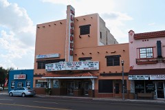 Border Theaterlisted 1998
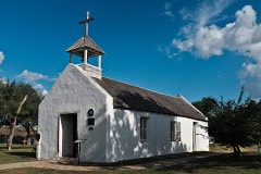 La Lomita Historic Districtlisted 1975
 Mission Canal Company Second Lift Pumphouselisted 2002
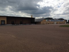 Mission Citrus Growers Union Packing Shedlisted 2002
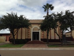 Roosevelt School Auditorium and Classroom Additionlisted 2002
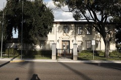 John Shary Buildinglisted 2002
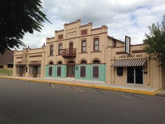 Teatro La Pazlisted 2002
- Lomita Boulevard Commercial Historic Districtlisted 1998
- Oblate Park Historic districtlisted 2005
- Shary Heightslisted 2026
Population over time
2 figuresMission grew from 77,058 to 85,778 between 2010 and 2020. These are the recorded population figures Wikidata holds for this place, reached through the Geographic Names Information System number this page is keyed on rather than by name, so they belong to this place and not to another of the same name. Most are census counts, but not all are: an early figure may be a founding or settlement estimate, and an estimate published within five years of a census is left out. The change column is computed, and is left blank where more than 20 years separate a figure from the one before it, because a gap that long is not a change between two counts.
| Year | People | Change |
|---|---|---|
| 2010 | 77,058 | |
| 2020 | 85,778 | +8,720 (+11%) |
Topographic sheets covering this place
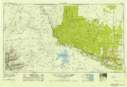
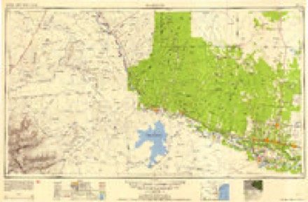
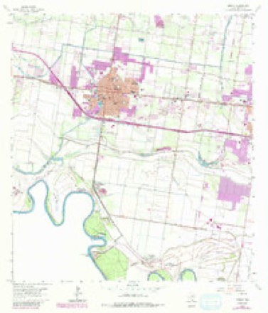
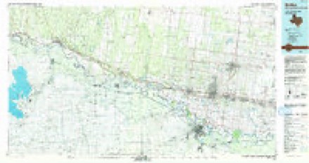
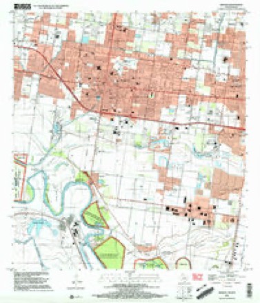
8 surveys from 11 printed sheetsMatched by testing this settlement's coordinate against the published boundary of every sheet in the United States Geological Survey's historical collection. Each opens the scanned sheet at the Survey.
- 1949 USGS Mc Allen quadrangle1:250000
- 1954 USGS McAllen quadrangle1:250000
- 1957 USGS Mc Allen quadrangle1:250000, 2 printings
- 1962 USGS McAllen quadrangle1:250000
- 1963 USGS Mission quadrangle1:24000, 3 printings
- 1983 USGS Mc Allen quadrangle1:250000
- 1992 USGS Mc Allen quadrangle1:100000
- 2002 USGS Mission quadrangle1:24000
Fires near this place
326 since 1993Regional context, not property-specific evidence. The federal wildfire occurrence database lists 326 fires within 5 miles of Mission between 1993 and 2020, burning about 2,126 acres in total. None started naturally. 71 were recorded as arson. Distance is straight-line from the map coordinates, so a fire counted here may appear on a neighbouring settlement's page as well.
| Reported cause | Fires |
|---|---|
| Missing data/not specified/undetermined | 124 |
| Debris and open burning | 113 |
| Arson/incendiarism | 71 |
| Equipment and vehicle use | 11 |
| Misuse of fire by a minor | 3 |
| Other causes | 2 |
| Smoking | 1 |
| Railroad operations and maintenance | 1 |
The most recent of them, most recent first, with the day each was reported and the service that recorded it.
| Date | Cause | Size | Reported by | Name on the report |
|---|---|---|---|---|
| 8 September 2009 | Missing data/not specified/undetermined | 1.0 acres | South Texas Refuge Complex | LUNCH |
| 7 September 2005 | Debris and open burning | under an acre | South Texas Refuge Complex | BENTSEN PILE |
| 6 September 2009 | Missing data/not specified/undetermined | under an acre | Lower Rio Grande Valley National Wildlife Refuge | DOVE |
| 5 September 1993 | Missing data/not specified/undetermined | under an acre | Lower Rio Grande Valley National Wildlife Refuge | TORTUGA |
| 28 September 2010 | Debris and open burning | under an acre | South Texas Refuge Complex | LA HOMA RD |
| 25 September 2016 | Missing data/not specified/undetermined | 5.0 acres | Texas A & M Forest Service | BRYAN RD FIRE |
| 11 September 2004 | Debris and open burning | 1.0 acres | South Texas Refuge Complex | 1 1/2 MILE |
| 5 August 2015 | Missing data/not specified/undetermined | 110 acres | Lower Rio Grande Valley National Wildlife Refuge | EL MORILLO |
Settlements close enough to share some of these fires:
Mines and quarries near this place
2 within 5 milesRegional context, not property-specific evidence. The federal mineral resources record lists 2 workings within 5 miles of Mission: 2 unknowns. None of them still produces. What was taken out: Clay, Sand and Gravel, Construction. Distance is straight-line from the map coordinates, so a quarry counted here may appear on a neighbouring settlement's page as well.
Storms near this place
38 since 1996Regional context, not property-specific evidence. The National Weather Service names Mission in 38 storm reports between 1996 and 2024: 16 thunderstorm wind, 9 hail, 5 flash flood, 3 tornado. The reports record 1 death and 2 injuries. Each account below is quoted exactly as the forecast office filed it, from the NOAA Storm Events Database, and each date opens the federal record of that event.
| When | Event | Place named | Harm | What the report says |
|---|---|---|---|---|
| June 1996 | Lightning | Mission | 1 killed, 2 hurt | no account filed |
| April 2023 | Thunderstorm Wind | Mission | $90,000 | An NWS Storm Survey found roofing material still in plastic along with pull back of cinder block cladding near the intersection of S Bryan Road and W Frontage Road. A little ways east, a large billboard and pole fell onto vehicles. Pole was anchored into dirt, but sitting on high water from recent rains and uprooted. Lower wind speeds used based on poor anchoring and lack of surrounding damage. |
| May 2001 | Tornado (F1) | Mission | $70,000 | An F1 Tornado touched down briefly at a baseball field. The twister blew aluminum bleachers that surrounded the baseball diamond into the pitcher's mound. It also damaged the roof of a nearby city law enforcement building. |
| May 2006 | Thunderstorm Wind | Mission | $50,000 | Damage to mobile homes was reported by law enforcement in Mission. |
| May 2001 | Tornado (F1) | Mission | $30,000 | An F1 tornado ripped through a neighborhood. The tornado peeled roofs and blew out a window ofa home. It also ripped up a newly built children play scape. The tornado also took carport panelsand blew them into the center and wrapped a large panel around a tree. A large 2 by 4 was embedded into the ground. |
| April 2023 | Thunderstorm Wind | Mission | $20,000 | Broadcast media shared a picture of a few food trucks and trailers flipped over near the intersection of Bryan Road and Business 83 near Mission City Hall. Time estimated by radar. |
| April 2023 | Thunderstorm Wind | Mission | $20,000 | A member of the public shared pictures of the Burger King in Palmview with its windows blown out around the play area. It's located at the intersection of Frontage Road and La Homa Road. Timing estimated from radar. |
| May 2010 | Flash Flood | Mission | $15,000 | The squall line that tore through the heart of populated Hidalgo County dropped very heavy rainfall in an hour or less, creating numerous reports of urban flooding with embedded, more dangerous flash flooding especially in poor drainage locations of Mission, McAllen, and Edinburg. Four inches fell at the McAllen Cooperative (water plant) location, 2.82 inches at McAllen/Miller Airport, and 2.95 inches just southeast of McAllen. In Mission, the Fire Department reported several roads throughout were under two to three feet of water. In McAllen, the City transportation department reported 7 to 9 automobiles stalled in floodwaters halfway up the doors at 10th and Pecan. A video submitted via Twitter showed the depth of the water, at least 2 feet in some places, on the sides of the road. Attendees of the Texas Hurricane Conference in McAllen reported significant high water along the Expressway 83 Frontage Road during the same time. ||In Edinburg, University Drive was blocked by high water just east of the courthouse due to high water, which threatened businesses but appeared to have remained outside of them. |
| June 2013 | Thunderstorm Wind | Mission | $10,000 | Mission police department reported several car ports damaged or destroyed in the 800 block of East 21st Street in Mission. ASOS at KMFE, about 5 miles to the SE, reported peak wind gust of 39 knots during the thunderstorm. |
| May 2001 | Thunderstorm Wind | Mission | $10,000 | Strong thunderstorm winds removed a roof from a mobile home and knocked down trees. |
| August 1998 | Lightning | Mission | $10,000 | Strike caused house fire. |
| May 2014 | Thunderstorm Wind | Mission | $7,000 | Media reported damage to a corrugated metal building, near the intersection of Inspiration Road and Highway 83 in Mission. At approximately the same time, one large limb weighing at least 100 pounds was blown off a mesquite tree nearby. |
| May 2014 | Thunderstorm Wind | Mission | $5,000 | Local law enforcement had several reports of trees and powerlines down in Mission. The peak wind gust at McAllen/Miller Airport was 43 knots (48 mph) at 1935 CST, but from the multiple data reports it is assumed that pockets of wind reached 50 knots or higher in portions of Mission. |
| February 1998 | Thunderstorm Wind | Mission | $3,000 | Extensive tree damage. |
| June 2024 | Thunderstorm Wind | Mission | $2,000 | A small business La Michoacana Paletria y Neveria had visible damage to the exterior wall and roofing. A submitted photo of the damage was later confirmed by the broadcast media and emergency management. Winds estimated from similar damage to poor to fair construction in past events in the Rio Grande Valley. Other minor damage occurred at Mission Fire Station 4, where the bottom of a garage was peeled back. |
| May 2024 | Thunderstorm Wind | Mission | $1,000 | Emergency Management reported trees down in Mission, Texas near Solar and Francisco. |
| May 2015 | Thunderstorm Wind | Mission | $1,000 | Public reported a tree blown over in the city of Mission. |
| August 2008 | Flash Flood | Mission | $1,000 | Slow moving thunderstorms with torrential rains affected portions of south central Hidalgo County which had only recently been recovering from floodwaters associated with Hurricane Dolly. In Mission, two feet of water was reported flowing across Inspiration Road; the road had to be barricaded due to the flooding. In nearby San Juan, flood waters of unknown depth closed down Cesar Chavez Road between Sioux and Eldora; however, this situation was likely related to prior events. According to law enforcement, several colonias also dealt with some flooding issues, mainly west of Edinburg. |
| April 2023 | Hail | Mission | - | A member of the public reported hail up to golf balls (1.75) in and around the Mission area. |
| April 2023 | Hail | Mission | - | Public reported quarter (1.0) sized hail covering the yard with the largest stones estimated to be tennis ball (2.5) sized in the Mission area. |
| April 2023 | Thunderstorm Wind | Mission | - | Weslaco Fire Marshal reported damage to four to five trees in his neighborhood in Mission. |
| June 2021 | Flash Flood | Mission | - | Report received from the public, via the MPing app but confirmed with social media reports, of streets flooded with some vehicles stranded as well along Griffin Parkway north of the center of Mission. |
| June 2021 | Flood | Mission | - | The City of Mission's social media page shared multiple reports of street closures due to minor flooding, mainly in the southeast portion of the center of Mission near Keralum Avenue, which is east of Conway, south of 9th, and west of Bryan Road. |
| May 2020 | Flash Flood | Mission | - | There were a couple of stalled vehicles reported on a roadway in Mission reported by the public. |
| August 2015 | Hail | Mission | - | Palmview Police Department reported golf ball size hail near the intersection of La Homa Road and U.S. Highway 83. |
| August 2015 | Hail | Mission | - | Mission Police Department reported quarter size hail throughout much of the city of Mission. |
| August 2014 | Heavy Rain | Mission | - | A trained spotter in Mission reported 1.5 inches of rain fell in 30 minutes. |
| April 2012 | Thunderstorm Wind | Mission | - | Public reported 60 mph wind gusts at Stewart and 21st in Mission. No damage was reported with the gusts. |
| April 2010 | Thunderstorm Wind | Mission | - | Wind Gust measured in the City of Mission. |
| June 2009 | Hail | Mission | - | The public reported hail of approximately one inch in diameter continued falling as a severe thunderstorm raced through western Hidalgo County. |
| July 2007 | Hail | Mission | - | Golf ball size hail reported by a spotter in Mission. |
| July 2005 | Tornado (F0) | Mission | - | Tornado was reported by local media in Mission near the intersection of Glasscock and F.M. road 495. No damage noted. |
| September 2004 | Funnel Cloud | Mission | - | Numerous reports of funnel clouds were received from trained spotters and the local media, primarily north of Mission and northwest of McAllen. |
| September 2002 | Flash Flood | Mission | - | Flash flooding of roads, homes, and businesses in Mission occurred as intense thunderstorms dropped heavy rain over the area. |
| April 2003 | Hail | Mission | - | no account filed |
| April 2003 | Hail | Mission | - | no account filed |
| December 2002 | Thunderstorm Wind | Mission | - | no account filed |
| March 1997 | Hail | Mission | - | no account filed |
Nearest settlements
The eight closest, with where each one stands in the county. Distances are straight-line, computed from the Geographic Names Information System coordinates.
| Map | Place | Distance | Sheets |
|---|---|---|---|
| Conway Plaza Colonia | 0.7 miles | 11 | |
| Leona Colonia | 0.8 miles | 11 | |
| Carlos G Leal, Junior Colonia | 0.9 miles | 11 | |
| Palm Acres Number 1 Colonia | 1.1 miles | 11 | |
| Tolle Colonia | 1.2 miles | 11 | |
| Bodine Colonia | 1.2 miles | 11 | |
| Las Brisas Colonia | 1.4 miles | 11 | |
| Tolle Colonia Number 2 | 1.4 miles | 11 |
Elsewhere
Matched on this settlement's Geographic Names Information System number rather than its name, so it cannot be a different place of the same name in another state.
| Wikipedia article on Mission | An encyclopaedic summary. Its text is share-alike, so it is linked here rather than copied. |
| Wikidata item Q239877 | The structured record the population and elevation above come from. Public domain (CC0). |
Provenance
This settlement is recorded in the Geographic Names Information System as feature 1341738. The sheet list is computed by point-in-boundary test against the United States Geological Survey's historical topographic inventory. Both are works of the United States government and carry no copyright under 17 U.S.C. 105.
Wildfire. Short, Karen C. 2022. Spatial wildfire occurrence data for the United States, 1992-2020 [FPA_FOD_20221014]. 6th Edition. Fort Collins, CO: Forest Service Research Data Archive. https://doi.org/10.2737/RDS-2013-0009.6 Collected with United States Government funding and usable without additional permissions or fees.
Mines and quarries. USGS Mineral Resources Data System (MRDS) https://mrdata.usgs.gov/mrds/ A work of the United States government, no copyright under 17 U.S.C. 105.
Storms. NOAA National Centers for Environmental Information, Storm Events Database https://www.ncei.noaa.gov/stormevents/ A work of the United States government, no copyright under 17 U.S.C. 105. Narratives are quoted verbatim from the National Weather Service report and are not edited or summarised.