 Block
BlockPharr, Texas
14 topographic sheets cover this place, the earliest surveyed in 1914 and the latest in 1992. It stands in the McAllen-Pharr census division. It lies in ZIP code area 78577. The Survey maps it on the Pharr quadrangle. 79,715 people lived here at the 2020 count. It stands 112 feet above sea level.
On record in Pharr
Buildings and businesses the archive holds for this place. Each opens its own page, with the source record it came from.
On the National Register 1 record
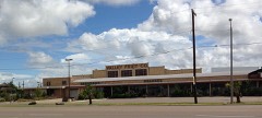 Valley Fruit Companylisted 2011
Topographic sheets covering this place
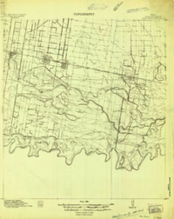
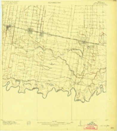
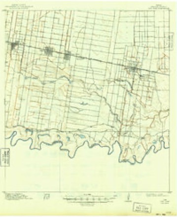
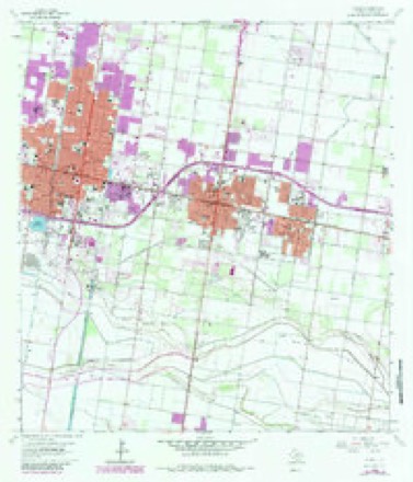
10 surveys from 14 printed sheetsMatched by testing this settlement's coordinate against the published boundary of every sheet in the United States Geological Survey's historical collection. Each opens the scanned sheet at the Survey.
- 1914 USGS San Juan quadrangle1:48000
- 1914 USGS San Juan quadrangle1:62500
- 1916 USGS San Juan quadrangle1:62500, 3 printings
- 1949 USGS Mc Allen quadrangle1:250000
- 1954 USGS McAllen quadrangle1:250000
- 1957 USGS Mc Allen quadrangle1:250000, 2 printings
- 1962 USGS McAllen quadrangle1:250000
- 1963 USGS Pharr quadrangle1:24000, 2 printings
- 1983 USGS Mc Allen quadrangle1:250000
- 1992 USGS Mc Allen quadrangle1:100000
Fires near this place
493 since 1996Regional context, not property-specific evidence. The federal wildfire occurrence database lists 493 fires within 5 miles of Pharr between 1996 and 2018, burning about 826 acres in total. None started naturally. 8 were recorded as arson. Distance is straight-line from the map coordinates, so a fire counted here may appear on a neighbouring settlement's page as well.
| Reported cause | Fires |
|---|---|
| Debris and open burning | 441 |
| Missing data/not specified/undetermined | 23 |
| Power generation/transmission/distribution | 16 |
| Arson/incendiarism | 8 |
| Equipment and vehicle use | 4 |
| Railroad operations and maintenance | 1 |
The most recent of them, most recent first, with the day each was reported and the service that recorded it.
| Date | Cause | Size | Reported by | Name on the report |
|---|---|---|---|---|
| 7 September 2012 | Debris and open burning | 1.0 acres | Texas A & M Forest Service | GRASS FIRE |
| 7 September 2007 | Debris and open burning | 1.0 acres | Texas A & M Forest Service | not named |
| 7 September 2006 | Debris and open burning | 1.0 acres | Texas A & M Forest Service | not named |
| 5 September 2008 | Debris and open burning | 1.0 acres | Texas A & M Forest Service | not named |
| 4 September 2011 | Debris and open burning | 1.0 acres | Texas A & M Forest Service | 11-656 |
| 30 September 2015 | Debris and open burning | 1.0 acres | Texas A & M Forest Service | FIRE CALL |
| 3 September 2017 | Debris and open burning | 1.0 acres | Texas A & M Forest Service | TRASH FIRE |
| 3 September 2012 | Debris and open burning | 1.0 acres | Texas A & M Forest Service | GRASS FIRE |
Settlements close enough to share some of these fires:
Storms near this place
13 since 1996Regional context, not property-specific evidence. The National Weather Service names Pharr in 13 storm reports between 1996 and 2025: 4 thunderstorm wind, 2 flash flood, 2 heavy rain, 2 hail. The reports record 1 injury. Each account below is quoted exactly as the forecast office filed it, from the NOAA Storm Events Database, and each date opens the federal record of that event.
| When | Event | Place named | Harm | What the report says |
|---|---|---|---|---|
| October 1996 | Lightning | Pharr | 1 hurt | no account filed |
| June 2015 | Flash Flood | Pharr | $23,000,000 | Numerous roads were closed in east Edinburg and the surrounding colonias, including San Carlos, as 6 to 18 inches of water covered roadways. Numerous vehicles became stalled in the waters. Water entered numerous homes and businesses. City of Edinburg officials reported that nearly 50 people had to be evacuated due to flood waters. According to City of Edinburg officials, preliminary damage estimates totaled about $23 million. An estimated 510 homes sustained damage, 225 incurred major damage and 285 incurred minor damage, for an estimated total of $18.5 million. 25 businesses sustained some damage and approximately $4.5 million in road infrastructure damage was sustained, including potholes and washed away roads. |
| April 2023 | Thunderstorm Wind | Pharr | $15,000 | An official NWS Survey found several sections of netting ripped at the Topgolf in Pharr. Timing estimated by radar. |
| May 2019 | Flood | Pharr | $5,000 | Street flooding of some poor drainage neighborhoods and urban areas was reported in Pharr when a steadily moving thunderstorm with heavy rainfall passed through the area. Near the intersection of Jackson Road and West Sam Houston Boulevard, one call was stalled in the road in water depth of approximately 2 feet. Other areas had one foot or more of water, with some diversion of traffic around the flood. No non-vehicle property damage was reported. |
| August 2014 | Thunderstorm Wind | Pharr | $1,000 | A tree, 8 inches in diameter, was uprooted in Pharr near the intersection of W. Bell and Dahlia, just south of Expressway 83 (IH-2). |
| May 2025 | Hail | Pharr | - | A member of the public reported one inch size hail in north Pharr near the McAllen city line. |
| August 2025 | Flood | Pharr | - | Local broadcast media (KRGV Channel 5 News) provided video and still photos of street flooding in Weslaco, with 1 to 2 feet of water depth (estimated). Rainfall of 2.4 fell with a cluster of storms, including more than 2 inches in 90 minutes, at the Mid Valley Airport in Weslaco. Similar rainfall totals were estimated in urban/poor drainage locations west to Pharr. |
| April 2023 | Thunderstorm Wind | Pharr | - | Member of the public shared an image of the roof blown off the Car Check Auto Service and Ultimate Dental Care building at the corner of N Cage Blvd and W Clark Ave. Timing estimated by radar. |
| May 2021 | Thunderstorm Wind | Pharr | - | As thunderstorms moved through the area, an anemometer at the Pharr Emergency Operations Center measured a wind gust to 73 mph, or 63 knots. The anemometer is situated 90 feet (27 meters) above the ground, nearly three times higher than standard NWS measuring equipment and more than four times higher than eye level; wind speed listed here (56 knots) was reduced to account for near-ground friction. |
| May 2016 | Hail | Pharr | - | City of Pharr Emergency Manager reported golf ball size hail south of Pharr. |
| June 2015 | Heavy Rain | Pharr | - | Pharr Police Department reported an estimated 3 inches of rain had fallen in Pharr and that intersection of Highway 495 and Highway 281 was closed due to water on the road. the Hidalgo County Sheriffs Office reported 1 to 2 feet of water on Highway 495 between Tower Road and Border Road. |
| September 2014 | Heavy Rain | Pharr | - | Numerous social media posts reported street flooding in McAllen, with water near the top of tire wells in some locations. |
| September 2006 | Flash Flood | Pharr | - | Several streets in Pharr closed due to flash flooding produced by heavy rains. |
Nearest settlements
The eight closest, with where each one stands in the county. Distances are straight-line, computed from the Geographic Names Information System coordinates.
| Map | Place | Distance | Sheets |
|---|---|---|---|
| McDaniel Colonia | 0.5 miles | 14 | |
| Palm Heights Colonia | 0.7 miles | 14 | |
| L R Bell Colonia | 0.9 miles | 14 | |
| Diaz Colonia | 1.1 miles | 14 | |
| Tagle Colonia Number 1 | 1.3 miles | 14 | |
| Whalen Acres Colonia | 1.3 miles | 14 | |
| Lantana Colonia | 1.3 miles | 14 | |
| Ridge Road Colonia | 1.4 miles | 14 |
Elsewhere
Matched on this settlement's Geographic Names Information System number rather than its name, so it cannot be a different place of the same name in another state.
| Wikipedia article on Pharr | An encyclopaedic summary. Its text is share-alike, so it is linked here rather than copied. |
| Wikidata item Q982364 | The structured record the population and elevation above come from. Public domain (CC0). |
Provenance
This settlement is recorded in the Geographic Names Information System as feature 1343930. The sheet list is computed by point-in-boundary test against the United States Geological Survey's historical topographic inventory. Both are works of the United States government and carry no copyright under 17 U.S.C. 105.
Wildfire. Short, Karen C. 2022. Spatial wildfire occurrence data for the United States, 1992-2020 [FPA_FOD_20221014]. 6th Edition. Fort Collins, CO: Forest Service Research Data Archive. https://doi.org/10.2737/RDS-2013-0009.6 Collected with United States Government funding and usable without additional permissions or fees.
Storms. NOAA National Centers for Environmental Information, Storm Events Database https://www.ncei.noaa.gov/stormevents/ A work of the United States government, no copyright under 17 U.S.C. 105. Narratives are quoted verbatim from the National Weather Service report and are not edited or summarised.