 Block
BlockRockport, Texas
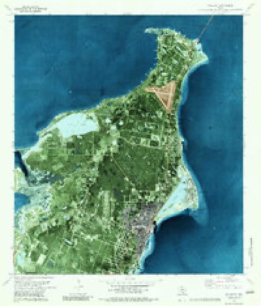
11 topographic sheets cover this place, the earliest surveyed in 1953 and the latest in 1985. It stands in the Rockport census division. It lies in ZIP code area 78382. The Survey maps it on the Rockport quadrangle. 10,070 people lived here at the 2020 count. It stands 7 feet above sea level.
Research this city
On record in Rockport
Buildings and businesses the archive holds for this place. Each opens its own page, with the source record it came from.
On the National Register 4 records
 Hoopes-Smith Houselisted 1994
 T. H. Mathis Houselisted 1971
- Bracht Houselisted 2023
- Rockport Schoollisted 2024
Population over time
2 figuresRockport grew from 8,766 to 10,070 between 2010 and 2020. These are the recorded population figures Wikidata holds for this place, reached through the Geographic Names Information System number this page is keyed on rather than by name, so they belong to this place and not to another of the same name. Most are census counts, but not all are: an early figure may be a founding or settlement estimate, and an estimate published within five years of a census is left out. The change column is computed, and is left blank where more than 20 years separate a figure from the one before it, because a gap that long is not a change between two counts.
| Year | People | Change |
|---|---|---|
| 2010 | 8,766 | |
| 2020 | 10,070 | +1,304 (+15%) |
Topographic sheets covering this place
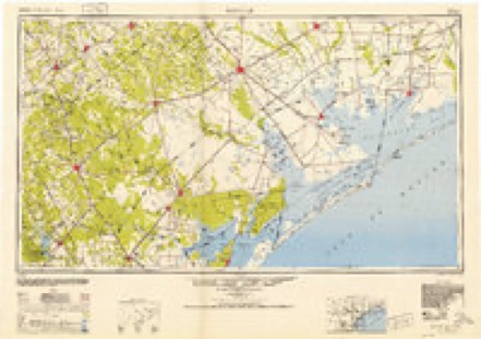
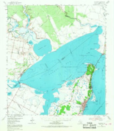
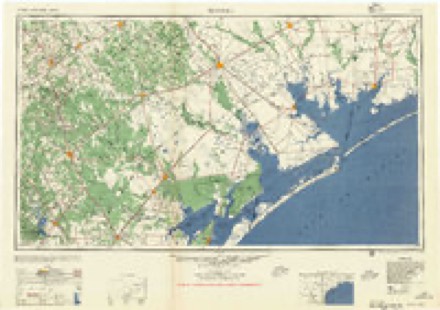
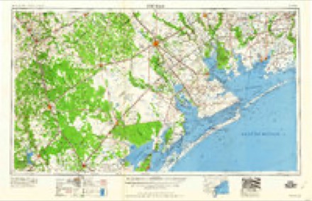
6 surveys from 11 printed sheetsMatched by testing this settlement's coordinate against the published boundary of every sheet in the United States Geological Survey's historical collection. Each opens the scanned sheet at the Survey.
- 1953 USGS Beeville quadrangle1:250000
- 1954 USGS Rockport quadrangle1:62500, 2 printings
- 1956 USGS Beeville quadrangle1:250000, 2 printings
- 1960 USGS Beeville quadrangle1:250000
- 1979 USGS Rockport quadrangle1:24000, 3 printings
- 1985 USGS Beeville quadrangle1:100000, 2 printings
Fires near this place
205 since 2006Regional context, not property-specific evidence. The federal wildfire occurrence database lists 205 fires within 5 miles of Rockport between 2006 and 2020, burning about 1,233 acres in total. 3 started naturally. 9 were recorded as arson. Distance is straight-line from the map coordinates, so a fire counted here may appear on a neighbouring settlement's page as well.
| Reported cause | Fires |
|---|---|
| Missing data/not specified/undetermined | 110 |
| Debris and open burning | 51 |
| Equipment and vehicle use | 11 |
| Arson/incendiarism | 9 |
| Power generation/transmission/distribution | 8 |
| Smoking | 7 |
| Misuse of fire by a minor | 6 |
| Natural | 3 |
The most recent of them, most recent first, with the day each was reported and the service that recorded it.
| Date | Cause | Size | Reported by | Name on the report |
|---|---|---|---|---|
| 7 September 2011 | Missing data/not specified/undetermined | 1.0 acres | Texas A & M Forest Service | FULTON WISHERT BRUSH FIRE |
| 6 September 2011 | Missing data/not specified/undetermined | 1.0 acres | Texas A & M Forest Service | 3300 BYPASS 35 |
| 5 September 2011 | Missing data/not specified/undetermined | 10 acres | Texas A & M Forest Service | ROCKPORT BRUSHFIRE ASSIST |
| 4 September 2008 | Missing data/not specified/undetermined | 40 acres | Texas A & M Forest Service | not named |
| 3 September 2011 | Debris and open burning | 1.0 acres | Texas A & M Forest Service | 2101 MRYTLE |
| 24 September 2013 | Missing data/not specified/undetermined | under an acre | Texas A & M Forest Service | 418 RATTLESNAKE POINT RD |
| 23 September 2016 | Debris and open burning | 3.0 acres | Texas A & M Forest Service | CLUB |
| 14 September 2015 | Missing data/not specified/undetermined | under an acre | Texas A & M Forest Service | 414 OLD SALT LAKE RD |
Settlements close enough to share some of these fires:
Mines and quarries near this place
1 within 5 milesRegional context, not property-specific evidence. The federal mineral resources record lists 1 working within 5 miles of Rockport: 1 occurrence. None of them still produces. What was taken out: Limestone, General. Distance is straight-line from the map coordinates, so a quarry counted here may appear on a neighbouring settlement's page as well.
| Where | Site | Commodity | Status | Recorded |
|---|---|---|---|---|
| Redfish Bay Deposit | Limestone, General | Occurrence |
Storms near this place
60 of 85 shownRegional context, not property-specific evidence. The National Weather Service names Rockport in 85 storm reports between 1995 and 2026: 31 flash flood, 20 thunderstorm wind, 14 hail, 8 flood. No death or injury is recorded in these reports. Each account below is quoted exactly as the forecast office filed it, from the NOAA Storm Events Database, and each date opens the federal record of that event.
| When | Event | Place named | Harm | What the report says |
|---|---|---|---|---|
| July 2006 | Flash Flood | Rockport | $1,500,000 | Widespread flooding occurred in Rockport, where between 5 and 8 inches of rain fell, much over a 2 hour period. Almost all city streets became flooded, including Market Street and Austin Street where numerous businesses had water enter their buildings. There was also several homes throughout the city that were flooded. Two nursing homes also had water enter their buildings. City officials reported over 100 cars stalled in high water. In addition, an 11 year old boy had to be rescued when he slipped into a storm drain while playing near the high water. The following are 24 rainfall totals from around the area:Rockport (ASOS): 3.34 inchesRockport (City): 7.15 inchesRockport 3N: 4.18 inchesLamar Peninsula: 3.77 inchesAransas Wildlife Refuge: 2.30 inchesProperty damage estimates are rough, and may be underestimated. |
| July 2021 | Flash Flood | Rockport | $500,000 | Numerous water rescues occurred due to flooded streets with vehicles stranded. Some residents were evacuated due to water entering buildings. Water was a foot deep at the Presbyterian Church. Multiple roads were closed in Rockport and Fulton, including Market Street, Champions Drive at Royal Oaks Drive, and FM 2165 from Business 35 to Linden. |
| January 2011 | Thunderstorm Wind | Rockport | $400,000 | Wood roof and awning of home blown completely off. Part of the roof blown into roof of nearby house. One snapped tree limb blown through wall of house. Roof damage and trees uprooted along a two mile path from Live Oak Elementary school to the intersection of Nopal and Austin Streets. |
| May 2016 | Flash Flood | Rockport | $250,000 | Many roads were flooded in the northern parts of Aransas Pass. North Commercial Avenue, North Houston, and North Avenue A were under flood waters. Numerous homes were affected by flood waters. |
| June 2010 | Tornado (EF2) | Rockport | $250,000 | An NWS survey team concluded a tornado touched down 4 miles west of Rockport. The tornado was on the ground for roughly 3.75 miles, traveling southeast and ending near Bypass 35 and 16th streets. The maximum wind speed was estimated at 120 mph, an EF-2, and had a maximum width of almost 3/10 of a mile. Several homes were damaged, an RV flipped, and 4 boats damaged. A home weather station recorded a peak wind gust to 103 mph before failing. Over 20 large tension poles were snapped completely off along Hwy 1069. Hundreds of trees and tree limbs were snapped. Vehicles at a salvage yard were moved several yards, and a garage was completely destroyed. An 18 wheeler was flipped over along Bypass 35. |
| June 2015 | Flash Flood | Rockport | $100,000 | Flash flooding occurred across much of the county. Stadium Drive near Rockport High School was flooded. Water entered a home in Rockport. Much of Highway 35 from Aransas Pass to north of Lamar was flooded. Water, Enterprise, West Market, Omohundro, Broadway, East Sabinal, Fuqua, and East Laurel Streets were flooded in Rockport. Several vehicles were stranded in high water near Sonny Watkins Drive in Rockport. |
| April 2015 | Thunderstorm Wind | Rockport | $100,000 | Power poles were blown down southwest of Rockport. |
| May 2021 | Flash Flood | Rockport | $50,000 | Roads under water in Rockport with cars stuck in the flood waters. |
| June 2010 | Thunderstorm Wind | Rockport | $20,000 | At the Cove Harbor Marina signs were snapped and roofs partially damaged. Several power lines and trees were reported downed throughout the city of Rockport. |
| October 2009 | Thunderstorm Wind | Rockport | $20,000 | Straight-line winds ripped the patio roof off the bait shop at the Fin and Feather RV park. Two power poles were knocked down and a vehicle was damaged in the parking lot. |
| May 2012 | Hail | Rockport | $10,000 | Golf ball sized hail was reported on the southwest side of Rockport. |
| August 2009 | Tornado (EF0) | Rockport | $10,000 | Damage was confined to power lines blown down north of Aransas Pass, along Highway 35. |
| March 2007 | Thunderstorm Wind | Rockport | $10,000 | Large metal storage shed on 12th St. and Bypass 35 was destroyed. A roof was blown off of a boat barn. Broken tree limbs also reported in the Country Club area along with wind damage to the siding of house. Fences were blown down in a development just suth of Cove Harbor. Three boats were flipped on side at Business 35 and the harbor.| |
| February 2017 | Thunderstorm Wind | Rockport | $7,000 | A front porch and roof were damaged at a house on Jacoby Lane. |
| June 2024 | Tornado (EF0) | Rockport | $5,000 | Two brief EF-0 tornadoes were produced from the same parent|circulation as a waterspout came ashore near Rockport, TX. The initial|damage as it came on shore was confined to some minor tree damage and a|few shingles missing from a couple homes. The tornado then lifted and |eventually reformed near FM1781 where it destroyed a couple carports and|two sheds. It also snapped some smaller trees and broke numerous large|branches before dissipating. |
| May 2019 | Flash Flood | Rockport | $5,000 | Videos on social media showed street flooding across portions of Rockport. |
| May 2019 | Hail | Rockport | $5,000 | Quarter sized hail occurred in Rockport. |
| March 2016 | Thunderstorm Wind | Rockport | $5,000 | Roof damage occurred to a home along Rattlesnake Point Road near Rockport. |
| May 2015 | Thunderstorm Wind | Rockport | $5,000 | A small wooden building was destroyed near the pharmacy. |
| May 2012 | Hail | Rockport | $5,000 | Spotter reported quarter sized hail southwest of Rockport. |
| July 2010 | Tornado (EF0) | Rockport | $5,000 | A tornado briefly touched down near the intersection of 9th Street and Business 35. Windows were blown out of the Kimco Business. This tornado occurred in the outer rainbands of Hurricane Alex. |
| February 2026 | Thunderstorm Wind | Rockport | - | Sheet metal from a carport ripped off. Time estimated by radar. |
| May 2025 | Flood | Rockport | - | Report from mPING of Cropland/Yard Flooding. |
| November 2025 | Flood | Rockport | - | Report from mping. |
| September 2025 | Heavy Rain | Rockport | - | Weather station near Rockport measured 2.53 inches. |
| June 2024 | Flash Flood | Rockport | - | Flooding with water over roads at FM1069 near Port Bay. |
| June 2024 | Heavy Rain | Rockport | - | Personal rain gauge observed 9.55 of rain through 7 PM as Tropical Storm Alberto rainbands moved through. |
| May 2023 | Flash Flood | Rockport | - | Rockport Police Department reported several streets flooded across the city with roads impassable for small cars. |
| September 2022 | Flood | Rockport | - | Farm to Market Road 70 was closed between US Highway 77 and State Highway 286 due to flooding on Petronila Creek. |
| May 2021 | Flash Flood | Rockport | - | Report from Mping of roads flooded and some streets closed in Rockport. |
| May 2021 | Flood | Rockport | - | Minor flooding of roadways reported west of Rockport from heavy rain. |
| May 2021 | Flood | Rockport | - | Street flooding reported near Rockport. |
| July 2021 | Flood | Rockport | - | Flood waters were slow to recede across most of Rockport into the evening hours. Flood waters were as deep as a foot near the Presbyterian Church and some roads remained impassable. |
| July 2021 | Flash Flood | Rockport | - | Social media reported street flooding occurred throughout the city of Rockport. |
| July 2021 | Flash Flood | Rockport | - | FM 1069 and Highway 35 near Aransas Pass was closed due to flooding. |
| November 2021 | Thunderstorm Wind | Rockport | - | Public report of weather station recording a wind gust to 64 mph west of Rockport. |
| May 2021 | Flash Flood | Rockport | - | Street closure reported due to heavy rain. |
| May 2021 | Flash Flood | Rockport | - | Streets flooded in Aransas County near Bypass 35 with motorists unable to cross several roadways. |
| April 2018 | Thunderstorm Wind | Rockport | - | Storm spotter measured a 62 mph wind gust in Rockport. |
| June 2018 | Flash Flood | Rockport | - | Roads from Market Street to Key Allegro were closed due to water over the road in Rockport. |
| May 2017 | Thunderstorm Wind | Rockport | - | NOS site in Rockport measured a gust to 51 knots. |
| May 2017 | Hail | Rockport | - | Ping pong ball sized hail occurred near Sparks Colony Drive west of Rockport. |
| June 2017 | Flash Flood | Rockport | - | Water covered the road at Enterprise Boulevard and Omohundro Street in Rockport. The road became impassable. |
| May 2016 | Flash Flood | Rockport | - | Several roads in the southern portion of Rockport were under water. |
| March 2015 | Flash Flood | Rockport | - | Several streets were flooded in Rockport. |
| May 2015 | Funnel Cloud | Rockport | - | A funnel cloud was sighted near Rockport. |
| September 2015 | Flash Flood | Rockport | - | Water covered the roadways in several locations in Rockport including West Market Street, Business 35, and Austin Street. |
| April 2015 | Flash Flood | Rockport | - | Numerous roads and intersections flooded around Rockport. |
| September 2013 | Flash Flood | Rockport | - | Aransas County Sheriff's Office reported water was up to 1.5 feet near Market Street and Highway 35 Bypass. |
| May 2012 | Funnel Cloud | Rockport | - | Spotter reported a funnel cloud near Highway 35. |
| July 2010 | Funnel Cloud | Rockport | - | Brief funnel cloud observed in Rockport. |
| January 2010 | Flood | Rockport | - | Water was reported over the southbound lane of Business 35L near Stapp St. Water was reported over FM 1781, near FM 1069. Water was reported over FM 1069 at various locations between 1069 and SH 188. Flooding of these roads, creeks, and lowland fields were observed several hours after the heavy rainfall had ended. |
| September 2010 | Flood | Rockport | - | FM 1069 from State Highway 188 to Business 35 is closed due to high water. |
| September 2010 | Flash Flood | Rockport | - | Roads flooded and impassible around the Rockport High School area. Some vehicles needed assistance getting out of the flooded roadways. |
| September 2010 | Heavy Rain | Rockport | - | Rainfall amount of 4.5 inches with 2.5 inches in 1 hour between 3 and 4 PM.|Water was over the roads but passable. |
| September 2007 | Tornado (EF0) | Rockport | - | This weak tornado orginally began as a waterspout over Copano Bay. The tornado dissipated shortly after making landfall. |
| June 2006 | Flash Flood | Rockport | - | Between 4 and 6 inches of rain fell in Rockport, leaving some city streets flooded, including Market Street at Business 35. |
| May 2006 | Flash Flood | Rockport | - | Heavy rain associated with a squall line resulted in Market Street in Rockport being flooded, along with many roads in the downtown Rockport area, South Rockport and along Omohundro Street. Rising water entered some shops in the downtown Rockport area. |
| September 2005 | Flash Flood | Rockport | - | Thunderstorms with heavy rainfall trained across far eastern San Patricio, Aransas, and southern Refugio counties. Doppler radar estimated between 2 and 3 inches of rain fell across Aransas county in a 1 to 2 hour timeframe, resulting in flooding of several roadways in and around Rockport. Most notable was the State Highway 35 bypass at Market Street. |
| June 2003 | Thunderstorm Wind | Rockport | - | County sheriff reported downed power lines. |
Nearest settlements
The eight closest, with where each one stands in the county. Distances are straight-line, computed from the Geographic Names Information System coordinates.
| Map | Place | Distance | Sheets |
|---|---|---|---|
| Shell Ridge | 1.6 miles | 15 | |
| Key Allegro | 1.9 miles | 11 | |
| Fulton | 2.9 miles | 11 | |
| Palm Harbor | 4.0 miles | 15 | |
| Estes | 4.6 miles | 15 | |
| Copano Village | 4.7 miles | 11 | |
| City-by-the Sea | 5.5 miles | 15 | |
| Lamar | 8.6 miles | 9 |
Elsewhere
Matched on this settlement's Geographic Names Information System number rather than its name, so it cannot be a different place of the same name in another state.
| Wikipedia article on Rockport | An encyclopaedic summary. Its text is share-alike, so it is linked here rather than copied. |
| Wikidata item Q982338 | The structured record the population and elevation above come from. Public domain (CC0). |
Provenance
This settlement is recorded in the Geographic Names Information System as feature 1345420. The sheet list is computed by point-in-boundary test against the United States Geological Survey's historical topographic inventory. Both are works of the United States government and carry no copyright under 17 U.S.C. 105.
Wildfire. Short, Karen C. 2022. Spatial wildfire occurrence data for the United States, 1992-2020 [FPA_FOD_20221014]. 6th Edition. Fort Collins, CO: Forest Service Research Data Archive. https://doi.org/10.2737/RDS-2013-0009.6 Collected with United States Government funding and usable without additional permissions or fees.
Mines and quarries. USGS Mineral Resources Data System (MRDS) https://mrdata.usgs.gov/mrds/ A work of the United States government, no copyright under 17 U.S.C. 105.
Storms. NOAA National Centers for Environmental Information, Storm Events Database https://www.ncei.noaa.gov/stormevents/ A work of the United States government, no copyright under 17 U.S.C. 105. Narratives are quoted verbatim from the National Weather Service report and are not edited or summarised.