 Block
BlockRoma, Texas
9 topographic sheets cover this place, the earliest surveyed in 1949 and the latest in 1985. It stands in the Roma-Los Saenz census division. It lies in ZIP code area 78584. It lies near Arroyo Roma. The Survey maps it on the Roma-Los Saenz West quadrangle. 11,561 people lived here at the 2020 count. It stands 213 feet above sea level.
On record in Roma
Buildings and businesses the archive holds for this place. Each opens its own page, with the source record it came from.
On the National Register 1 record
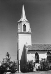 Roma Historic DistrictNational Historic Landmark · listed 1972
Population over time
2 figuresRoma grew from 9,765 to 11,561 between 2010 and 2020. These are the recorded population figures Wikidata holds for this place, reached through the Geographic Names Information System number this page is keyed on rather than by name, so they belong to this place and not to another of the same name. Most are census counts, but not all are: an early figure may be a founding or settlement estimate, and an estimate published within five years of a census is left out. The change column is computed, and is left blank where more than 20 years separate a figure from the one before it, because a gap that long is not a change between two counts.
| Year | People | Change |
|---|---|---|
| 2010 | 9,765 | |
| 2020 | 11,561 | +1,796 (+18%) |
Topographic sheets covering this place
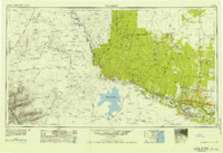
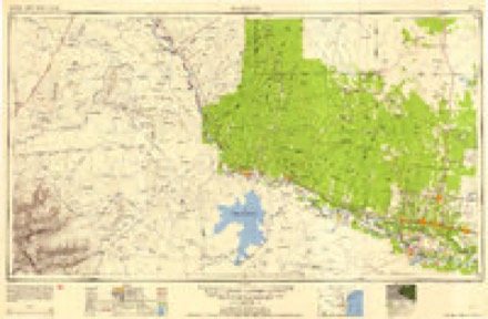
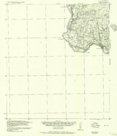
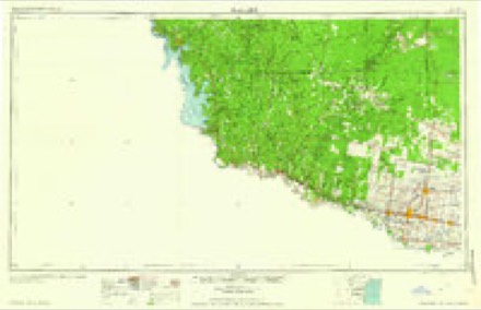
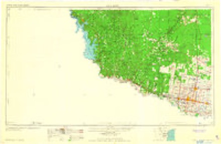
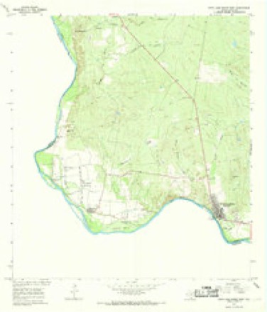
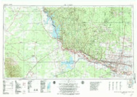
8 surveys from 9 printed sheetsMatched by testing this settlement's coordinate against the published boundary of every sheet in the United States Geological Survey's historical collection. Each opens the scanned sheet at the Survey.
- 1949 USGS Mc Allen quadrangle1:250000
- 1954 USGS McAllen quadrangle1:250000
- 1956 USGS Roma quadrangle1:62500
- 1957 USGS Mc Allen quadrangle1:250000, 2 printings
- 1962 USGS McAllen quadrangle1:250000
- 1965 USGS Roma-Los Saenz West quadrangle1:24000
- 1983 USGS Mc Allen quadrangle1:250000
- 1985 USGS Roma-Los Saenz quadrangle1:100000

Fires near this place
620 since 1999Regional context, not property-specific evidence. The federal wildfire occurrence database lists 620 fires within 5 miles of Roma between 1999 and 2020, burning about 3,126 acres in total. None started naturally. 31 were recorded as arson. Distance is straight-line from the map coordinates, so a fire counted here may appear on a neighbouring settlement's page as well.
| Reported cause | Fires |
|---|---|
| Missing data/not specified/undetermined | 466 |
| Debris and open burning | 113 |
| Arson/incendiarism | 31 |
| Equipment and vehicle use | 5 |
| Smoking | 3 |
| Misuse of fire by a minor | 1 |
| Railroad operations and maintenance | 1 |
The most recent of them, most recent first, with the day each was reported and the service that recorded it.
| Date | Cause | Size | Reported by | Name on the report |
|---|---|---|---|---|
| 9 September 2018 | Debris and open burning | 1.0 acres | Texas A & M Forest Service | BAZAN AVE. |
| 7 September 2018 | Debris and open burning | 1.0 acres | Texas A & M Forest Service | 6 N SAN JULIAN RD. |
| 7 September 2015 | Missing data/not specified/undetermined | 1.0 acres | Texas A & M Forest Service | DOCKER RD. |
| 7 September 2012 | Missing data/not specified/undetermined | 1.0 acres | Texas A & M Forest Service | CINDY'S AVE. |
| 6 September 2012 | Missing data/not specified/undetermined | 20 acres | Texas A & M Forest Service | VICTOR LN. |
| 6 September 2011 | Missing data/not specified/undetermined | 2.0 acres | Texas A & M Forest Service | DOLPHIN ST. |
| 5 September 2015 | Missing data/not specified/undetermined | 50 acres | Texas A & M Forest Service | BAZAN RD. |
| 5 September 2015 | Missing data/not specified/undetermined | 5.0 acres | Lower Rio Grande Valley National Wildlife Refuge | GARCENO |
Settlements close enough to share some of these fires:
Mines and quarries near this place
1 within 5 milesRegional context, not property-specific evidence. The federal mineral resources record lists 1 working within 5 miles of Roma: 1 producer. All of them still produce. What was taken out: Sand and Gravel, Construction. Distance is straight-line from the map coordinates, so a quarry counted here may appear on a neighbouring settlement's page as well.
| Where | Site | Commodity | Status | Recorded |
|---|---|---|---|---|
| Guerra Pit | Sand and Gravel, Construction | Producer | Gravel, Sand |
Storms near this place
19 since 1993Regional context, not property-specific evidence. The National Weather Service names Roma in 19 storm reports between 1993 and 2026: 8 flash flood, 6 hail, 2 thunderstorm wind, 2 flood. No death or injury is recorded in these reports. Each account below is quoted exactly as the forecast office filed it, from the NOAA Storm Events Database, and each date opens the federal record of that event.
| When | Event | Place named | Harm | What the report says |
|---|---|---|---|---|
| August 2008 | Flood | Roma | $150,000 | After the rains had long ended, remaining flood waters around and near teh city of Roma continued to remain an issue for many. At least eight residents were rescued from the Las Flores subdivision, and a number of residents in the Robinson subdivision self evacuated as water continued to rise or remain high. Another resident was evacuated off of Ranchito Street from high water in a residence, and a rescue call was received for four children who may have been affected by the flood waters; thankfully, all were found unharmed.||Aircraft video confirmed that high standing water continued well into the 25th in many neighborhoods, particularly those which received the heaviest rains between the 22nd and 24th and were either low lying or had poorly draining streets. Other affected streets were caked with mud. While most of the flooded roads and residences had 2 feet or less of water in them on the 25th, some pockets of 3 feet of water may have remained.||At least 67 residents sought shelter during the night, with several remaining for the next few days as the flood waters gradually receded. |
| August 2008 | Flash Flood | Roma | $50,000 | Only a few hours after rains had tapered off Starr County, another complex of thunderstorms crept into the already flooded areas of southwestern portions of the area, and an additional 4 inches or more fell in or near areas impacted by the original floods during the evening of the 22nd, causing perhaps up to eight or nine neighborhoods to have a number of road closures, as well as homes having water pushed into them by passing vehicles. After the rains subsided, the event evolved into an area wide flood which continued well into the night, requiring additional water rescues. |
| March 2026 | Flash Flood | Roma | $25,000 | Torrential rains estimated up to 2.5 in 30 to 45 minutes in Roma filled|up culverts near Arroyo Roma, and an estimated additional 1 to 2 following the|supercell overflowed drainage, resulting in a flash flood in the hilly parts of the city. Flooding began around 1 AM CST, and persisted until just after 4 AM CDT (3 AM CST), peaking at 320 AM CDT (220 AM CST). ||The combination of intense rainfall/rainfall rate, hilly terrain and poor|drainage, and rapid runoff due to prior extreme drought led to the flash flood|in Roma. Fast flowing water in streets was between 2 and 3 feet high at|the peak. ||The floodwaters pulled up pavement from several neighborhood streets in|the city. Up to 30 homes reported water levels inside, ranging from 6 to 1|foot, during peak flooding. A 2- to 3-foot deep hole was scoured out by the floodwaters next to a home near the intersection of Rau-Con St. and Bravo Ave., and several vehicles parked in driveways near the fast-flowing water had grass and mud left behind, up to 2 feet high on the sides of the vehicles. |
| March 2026 | Thunderstorm Wind | Roma | $15,000 | An NWS Storm Survey conducted on March 8th found a track of wind damage from Roma High School to the east side of the city neighborhood grid. Average wind speed for all damage points was estimated at 65 mph, though the surveyed swath suggested 60 to 70 mph in the area. Damage included the following:|* Temporary fencing and benches blown down, field goal posts bent, and a sign adjacent to the baseball field bent of out the ground at Roma High School.|*Large wooden pole holding an election billboard ripped out of the ground across from the school.|*Several medium to large branches of healthy mesquite trees blown down in City of Roma neighborhoods.|*Electrical pole leaning at a 30 degree angle in the City of Roma. |
| August 2008 | Flash Flood | Roma | $10,000 | Numerous thunderstorms developing in Starr and Zapata County during the late afternoon of the 22nd merged into a relatively small, but intense, complex across extreme western and southwestern Starr County, extending from across the west side of Roma northward toward, but just south, of Falcon Dam. Thankfully for residents living in the east side of Roma, extending into Escobares and Garceo, these torrential rains - estimated to be at least 7 inches or more in a few spots - never stretched east toward previously swollen arroyos from the east side of Roma toward Escobares and Garceno. ||While these torrential rains caused widespread street flooding in the western and northwestern portions of Roma (along the northward bend in Highway 83), as reported by law enforcement, no structures were threatened. Lighter rains followed overnight into early Saturday in Starr County, with little additional impact.||The heaviest rains, perhaps nearing 9 inches, fell just across the Rio Grande in Ciudad Aleman, Mexico. No information on impacts to this location was received by the NWS office in Brownsville. |
| May 2008 | Thunderstorm Wind | Roma | $5,000 | Law enforcement in Starr County reported power lines down and power outages occurred in Roma due to high winds from strong to severe thunderstorms in and near the area. |
| September 2006 | Flash Flood | Roma | $5,000 | City officials in Roma reported flash flooding in the Roma Creek with produced damage to the home of one resident in the area. |
| September 2008 | Flash Flood | Roma | $1,000 | Emergency Management officials from Starr County reported that six inches of water was covering and flowing across Highway 83 near La Rosita. It is likely that other minor flooding occurred near Roma, where an estimated 6 inches more rain fell on top of prodigious rainfall of more than 15 inches during the last third of August. |
| June 2019 | Flood | Roma | - | The Roma Police Department reported several roads with minor flooding. Time of overall flooding is estimated based on report received at 1930 CDT. |
| May 2017 | Flash Flood | Roma | - | Roma Police Department reported six inches of flowing water at the intersection of Harrison and Raucon near the Arroyo Roma in the city of Roma. |
| April 2004 | Flash Flood | Roma | - | Local officials in Roma reported flash flooding of roads and low lying areas. |
| April 2004 | Tornado (F0) | Roma | - | Local law enforcement reported a tornado just west of Roma. The tornado moved very slowly south with time and produced no damage before dissipating. |
| April 2004 | Hail | Roma | - | Very large hail was reported by the general public. |
| September 2003 | Flash Flood | Roma | - | The general public reported street and yard flooding. Rising water levels were also reported in the Los Morenos creek. |
| May 2002 | Hail | Roma | - | 0.75 inch hail observed by Fire and Rescue |
| November 2000 | Hail | Roma | - | Penny size hail was reported in Falcon Lake State Park by the public. |
| May 1993 | Hail | Roma | - | Golf ball-size hail was reported south of Roma. |
| May 2005 | Hail | Roma | - | no account filed |
| June 1998 | Hail | Roma | - | no account filed |
Nearest settlements
The eight closest, with where each one stands in the county. Distances are straight-line, computed from the Geographic Names Information System coordinates.
| Map | Place | Distance | Sheets |
|---|---|---|---|
| Roma-Los Saenz | 0.0 miles | 9 | |
| De La Cruz Colonia | 0.3 miles | 9 | |
| Campobello Colonia | 0.6 miles | 9 | |
| Campobello Number 2 Colonia | 0.7 miles | 9 | |
| Garza Addition Colonia | 0.9 miles | 9 | |
| Moreno Colonia | 0.9 miles | 9 | |
| Ala Blanca Colonia | 1.0 miles | 9 | |
| Humberto Y Saenz Colonia | 1.0 miles | 9 |
Elsewhere
Matched on this settlement's Geographic Names Information System number rather than its name, so it cannot be a different place of the same name in another state.
| Wikipedia article on Roma | An encyclopaedic summary. Its text is share-alike, so it is linked here rather than copied. |
| Wikidata item Q93022 | The structured record the population and elevation above come from. Public domain (CC0). |
Provenance
This settlement is recorded in the Geographic Names Information System as feature 2413667. The sheet list is computed by point-in-boundary test against the United States Geological Survey's historical topographic inventory. Both are works of the United States government and carry no copyright under 17 U.S.C. 105.
Wildfire. Short, Karen C. 2022. Spatial wildfire occurrence data for the United States, 1992-2020 [FPA_FOD_20221014]. 6th Edition. Fort Collins, CO: Forest Service Research Data Archive. https://doi.org/10.2737/RDS-2013-0009.6 Collected with United States Government funding and usable without additional permissions or fees.
Mines and quarries. USGS Mineral Resources Data System (MRDS) https://mrdata.usgs.gov/mrds/ A work of the United States government, no copyright under 17 U.S.C. 105.
Storms. NOAA National Centers for Environmental Information, Storm Events Database https://www.ncei.noaa.gov/stormevents/ A work of the United States government, no copyright under 17 U.S.C. 105. Narratives are quoted verbatim from the National Weather Service report and are not edited or summarised.