 Block
BlockSan Carlos, Texas
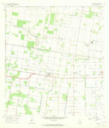
10 topographic sheets cover this place, the earliest surveyed in 1949 and the latest in 2002. It stands in the Edinburg census division. It lies in ZIP code area 78542. The Survey maps it on the La Blanca quadrangle. 3,087 people lived here at the 2020 count. It stands 75 feet above sea level.
Population over time
2 figuresSan Carlos fell from 3,130 to 3,087 between 2010 and 2020. These are the recorded population figures Wikidata holds for this place, reached through the Geographic Names Information System number this page is keyed on rather than by name, so they belong to this place and not to another of the same name. Most are census counts, but not all are: an early figure may be a founding or settlement estimate, and an estimate published within five years of a census is left out. The change column is computed, and is left blank where more than 20 years separate a figure from the one before it, because a gap that long is not a change between two counts.
| Year | People | Change |
|---|---|---|
| 2010 | 3,130 | |
| 2020 | 3,087 | -43 (-1%) |
Topographic sheets covering this place
8 surveys from 10 printed sheetsMatched by testing this settlement's coordinate against the published boundary of every sheet in the United States Geological Survey's historical collection. Each opens the scanned sheet at the Survey.
- 1949 USGS Mc Allen quadrangle1:250000
- 1954 USGS McAllen quadrangle1:250000
- 1957 USGS Mc Allen quadrangle1:250000, 2 printings
- 1962 USGS McAllen quadrangle1:250000
- 1963 USGS La Blanca quadrangle1:24000, 2 printings
- 1983 USGS Mc Allen quadrangle1:250000
- 1992 USGS Mc Allen quadrangle1:100000
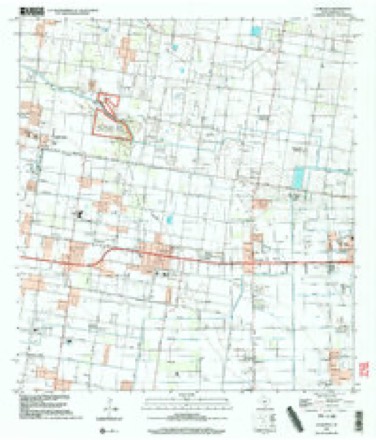
- 2002 USGS La Blanca quadrangle1:24000
Fires near this place
363 since 2002Regional context, not property-specific evidence. The federal wildfire occurrence database lists 363 fires within 5 miles of San Carlos between 2002 and 2018, burning about 844 acres in total. 2 started naturally. 12 were recorded as arson. Distance is straight-line from the map coordinates, so a fire counted here may appear on a neighbouring settlement's page as well.
| Reported cause | Fires |
|---|---|
| Debris and open burning | 210 |
| Missing data/not specified/undetermined | 130 |
| Arson/incendiarism | 12 |
| Equipment and vehicle use | 6 |
| Natural | 2 |
| Recreation and ceremony | 2 |
| Smoking | 1 |
The most recent of them, most recent first, with the day each was reported and the service that recorded it.
| Date | Cause | Size | Reported by | Name on the report |
|---|---|---|---|---|
| 6 September 2006 | Missing data/not specified/undetermined | 1.0 acres | Texas A & M Forest Service | not named |
| 6 September 2006 | Missing data/not specified/undetermined | 1.0 acres | Texas A & M Forest Service | not named |
| 4 September 2008 | Debris and open burning | 1.0 acres | Texas A & M Forest Service | not named |
| 3 September 2006 | Debris and open burning | 1.0 acres | Texas A & M Forest Service | not named |
| 3 September 2006 | Missing data/not specified/undetermined | 1.0 acres | Texas A & M Forest Service | not named |
| 29 September 2008 | Missing data/not specified/undetermined | 1.0 acres | Texas A & M Forest Service | not named |
| 27 September 2017 | Debris and open burning | 1.0 acres | Texas A & M Forest Service | BRUSH FIRE |
| 27 September 2017 | Debris and open burning | 1.0 acres | Texas A & M Forest Service | PALM TREE FIRE |
Settlements close enough to share some of these fires:
Storms near this place
11 since 2009Regional context, not property-specific evidence. The National Weather Service names San Carlos in 11 storm reports between 2009 and 2025: 7 thunderstorm wind, 2 hail, 2 flash flood. No death or injury is recorded in these reports. Each account below is quoted exactly as the forecast office filed it, from the NOAA Storm Events Database, and each date opens the federal record of that event.
| When | Event | Place named | Harm | What the report says |
|---|---|---|---|---|
| June 2015 | Flash Flood | San Carlos | $2,000,000 | An estimated 2 to 4 inches of rainfall fell quickly across the San Carlos area caused flash flooding across the colonia. Several families evacuated flooded homes after daybreak on the 18th, with one report stating that up to 60 homes were surrounded by water, with water reaching into a number them. |
| April 2015 | Thunderstorm Wind | San Carlos | $125,000 | The strong damaging winds damaged and destroyed many properties. A barn, made of aluminum and tin and built in the 1930s, was completely destroyed. A number of poorly constructed mobile homes, that were not tied down, and had no or poorly anchored roofs were destroyed and rendered uninhabitable. One mobile home, completely unanchored, was rolled by the winds. One home lost portions of a metal roof. |
| June 2025 | Thunderstorm Wind | San Carlos | $100,000 | Just after 740 PM CDT on June 12, 2025, a strong microburst descended from a severe thunderstorm in North Alamo, near the city line with Muniz, causing damage to traffic lights, a stand alone tower, powerlines/poles, fences and trees as well as ripped off the roof of a house, flipped a trailer and dislocated a metal structure. Altogether, the damage locations were along a northwest to southeast oriented line with six of the seven surveyed locations north of Expressway 83/east of Interstate 69C (beginning near the Muniz/North Alamo city line) and the 7th spot of Expressway 83 in Donna. For most of the damage path, estimated wind speeds ranged from 75 to 85 mph.||Detailed damage along the track included:|*Partial collapse of a single family home under construction at El Dora Road near N. Tower Road in north Alama (65 mph)|*Blown roof off of a single family poorly constructed home along Roman Circle, just north of Owassa Road in Muniz (sheet metal, manufactured-style) (80 mph)|*A metal structure thrown an unknown distance from a farm, landing along Val Verde Road in north Alamo (78 mph)|*Damaged traffic lights next to a collapsed building along El Dora Road in north Donna (70 mph)|*Fifteen power poles were blown down in a row along El Dora Road near N. Val Verde Road in north Donna (80 to 85 mph)|*Downed fence and a flipped trailer along Wood Ave. in Donna (80 mph).|*Flipped trailer blown onto Val Verde road near Donna North High School, which included minor fence damage. This was also near the report of the bent free-standing tower (80 to 85 mph)||The most notable damage was to a metal stand alone tower nearby the Donna North High School, which was bent perpendicular to the tower's base and rated at 90 mph. |
| September 2023 | Thunderstorm Wind | San Carlos | $30,000 | Pictures from social media shows a metal structure crumpled up and blown several yards into the field across the street. Timing estimated by radar. |
| September 2023 | Thunderstorm Wind | San Carlos | $20,000 | Pictures from social media show awning/roof damage to The End of the Trail Sports Bar #1 along FM493. |
| April 2015 | Thunderstorm Wind | San Carlos | $10,000 | Strong thunderstorm winds of 65 to 70 mph lifted a poorly anchored roof from a mobile home and moved a poorly constructed and poorly anchored mobile home off of its blocks. |
| September 2023 | Thunderstorm Wind | San Carlos | $5,000 | Pictures from social media show a large tree down in the backyard of a house across the street from Rick & Ron's Auto Sales. Minor roof damage was noted by the owner. |
| August 2014 | Thunderstorm Wind | San Carlos | $3,000 | A tree fell on a church near Lopezville and a mobile home had a roof overhang removed. |
| May 2021 | Flash Flood | San Carlos | - | Social media report received of streets flooded in the San Cristobal Subdivision in Edinburg. Water depth was estimated to be 2 to 3 feet in some spots. |
| May 2010 | Hail | San Carlos | - | Nickel sized hail was reported in San Carlos, 4 miles east of Edinburg. |
| June 2009 | Hail | San Carlos | - | The Hidalgo County Emergency Manager reported penny to nickel size hail fell along East Wisconsin Road during another severe thunderstorm on June 1. |
Nearest settlements
The eight closest, with where each one stands in the county. Distances are straight-line, computed from the Geographic Names Information System coordinates.
| Map | Place | Distance | Sheets |
|---|---|---|---|
| Colonia Tejana | 0.2 miles | 10 | |
| Ruthven Colonia Number 2 | 0.2 miles | 10 | |
| Ruthven Number 1 Colonia | 0.3 miles | 10 | |
| Las Brisas Estates Colonia | 0.3 miles | 10 | |
| D T Villareal Colonia | 0.4 miles | 10 | |
| San Carlos Farms Colonia | 0.5 miles | 10 | |
| Ebony Acres Colonia | 0.5 miles | 10 | |
| San Carlos Acres Colonia | 0.8 miles | 10 |
Elsewhere
Matched on this settlement's Geographic Names Information System number rather than its name, so it cannot be a different place of the same name in another state.
| Wikipedia article on San Carlos | An encyclopaedic summary. Its text is share-alike, so it is linked here rather than copied. |
| Wikidata item Q982112 | The structured record the population and elevation above come from. Public domain (CC0). |
Provenance
This settlement is recorded in the Geographic Names Information System as feature 1346316. The sheet list is computed by point-in-boundary test against the United States Geological Survey's historical topographic inventory. Both are works of the United States government and carry no copyright under 17 U.S.C. 105.
Wildfire. Short, Karen C. 2022. Spatial wildfire occurrence data for the United States, 1992-2020 [FPA_FOD_20221014]. 6th Edition. Fort Collins, CO: Forest Service Research Data Archive. https://doi.org/10.2737/RDS-2013-0009.6 Collected with United States Government funding and usable without additional permissions or fees.
Storms. NOAA National Centers for Environmental Information, Storm Events Database https://www.ncei.noaa.gov/stormevents/ A work of the United States government, no copyright under 17 U.S.C. 105. Narratives are quoted verbatim from the National Weather Service report and are not edited or summarised.