 Block
BlockThrockmorton, Texas
8 topographic sheets cover this place, the earliest surveyed in 1954 and the latest in 1985. It stands in the Throckmorton census division. It lies in ZIP code area 76483. It lies near Thacker Mountain. The Survey maps it on the Throckmorton quadrangle. 727 people lived here at the 2020 count. It stands 1,319 feet above sea level.
On record in Throckmorton
Buildings and businesses the archive holds for this place. Each opens its own page, with the source record it came from.
On the National Register 1 record
 Throckmorton County Courthouse and Jaillisted 1978
Population over time
2 figuresThrockmorton fell from 828 to 727 between 2010 and 2020. These are the recorded population figures Wikidata holds for this place, reached through the Geographic Names Information System number this page is keyed on rather than by name, so they belong to this place and not to another of the same name. Most are census counts, but not all are: an early figure may be a founding or settlement estimate, and an estimate published within five years of a census is left out. The change column is computed, and is left blank where more than 20 years separate a figure from the one before it, because a gap that long is not a change between two counts.
| Year | People | Change |
|---|---|---|
| 2010 | 828 | |
| 2020 | 727 | -101 (-12%) |
Topographic sheets covering this place
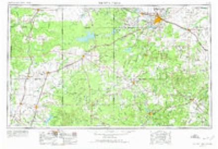
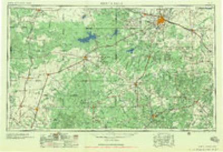
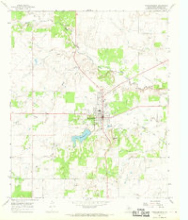
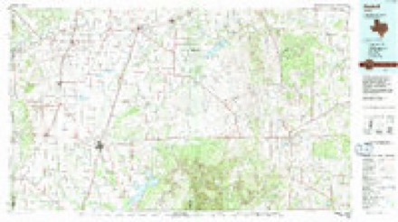
4 surveys from 8 printed sheetsMatched by testing this settlement's coordinate against the published boundary of every sheet in the United States Geological Survey's historical collection. Each opens the scanned sheet at the Survey.
- 1954 USGS Wichita Falls quadrangle1:250000, 3 printings
- 1958 USGS Wichita Falls quadrangle1:250000
- 1966 USGS Throckmorton quadrangle1:24000, 2 printings
- 1985 USGS Haskell quadrangle1:100000, 2 printings
Fires near this place
13 since 2006Regional context, not property-specific evidence. The federal wildfire occurrence database lists 13 fires within 5 miles of Throckmorton between 2006 and 2020, burning about 3,086 acres in total. 3 started naturally. None was recorded as arson. Distance is straight-line from the map coordinates, so a fire counted here may appear on a neighbouring settlement's page as well.
| Reported cause | Fires |
|---|---|
| Missing data/not specified/undetermined | 5 |
| Equipment and vehicle use | 3 |
| Natural | 3 |
| Power generation/transmission/distribution | 2 |
The most recent of them, most recent first, with the day each was reported and the service that recorded it.
| Date | Cause | Size | Reported by | Name on the report |
|---|---|---|---|---|
| 11 September 2019 | Missing data/not specified/undetermined | 10 acres | Texas A & M Forest Service | KEETER/KOONSMAN |
| 4 August 2006 | Missing data/not specified/undetermined | 15 acres | Texas A & M Forest Service | not named |
| 16 August 2020 | Natural | 2,498 acres | Texas A & M Forest Service | RAIN DANCE |
| 31 July 2006 | Equipment and vehicle use | 150 acres | Texas A & M Forest Service | THROCKMORTON |
| 19 June 2011 | Natural | 360 acres | Texas A & M Forest Service | KATHEY |
| 19 June 2011 | Natural | 25 acres | Texas A & M Forest Service | LAKE |
| 13 May 2011 | Equipment and vehicle use | 5.0 acres | Texas A & M Forest Service | FM 923 |
| 9 April 2009 | Power generation/transmission/distribution | 1.0 acres | Texas A & M Forest Service | WATT |
Storms near this place
60 of 164 shownRegional context, not property-specific evidence. The National Weather Service names Throckmorton in 164 storm reports between 1993 and 2025: 100 hail, 37 thunderstorm wind, 12 tornado, 10 flash flood. The reports record 1 injury. Each account below is quoted exactly as the forecast office filed it, from the NOAA Storm Events Database, and each date opens the federal record of that event.
| When | Event | Place named | Harm | What the report says |
|---|---|---|---|---|
| September 2010 | Thunderstorm Wind | Throckmorton | 1 hurt | Damaging thunderstorm winds flipped a camper trailer on U.S. Highway 380 near the Haskell and Throckmorton County line. The occupant sustained minor injuries. |
| June 2017 | Flash Flood | Throckmorton | $460,000 | About four homes and 2 businesses were flooded on the south side of Throckmorton. In addition, many roads were closed because of high water. Also, 3 cars were were damaged by flood waters. Firefighters rescued a couple from their residence located near the spillway. |
| October 2018 | Flood | Throckmorton | $400,000 | Prolonged heavy rainfall flooded roads across Throckmorton County. This flooding caused damage to some of the roads. |
| April 2000 | Thunderstorm Wind | Throckmorton | $400,000 | A downburst tore through the central and western sections of Throckmorton County during the early morning hours, causing extensive wind damage. Grain silos and power lines were damaged west of the town of Throckmorton, but the town itself took the brunt of the storm. The winds peeled parts of the roofs off of both the local high school and the hospital in Throckmorton, allowing rain to enter into the buildings and damage the contents. Many other homes and businesses throughout the town suffered severe roof damage as well. |
| April 2021 | Thunderstorm Wind | Throckmorton | $50,000 | Damaging thunderstorm winds tore some of the metal roofing off a home. Hail broke out windows of about five to six homes, flipped a Recreational Vehicle on its side, and damaged a smaller outbuilding. The damaging thunderstorm winds caused an older barn to lean over. A porch awning was also damaged. |
| May 2005 | Thunderstorm Wind | Throckmorton | $30,000 | A mobile home was totaled when it was ripped by thunderstorm winds. |
| April 2000 | Thunderstorm Wind | Throckmorton | $15,000 | Thunderstorm winds overturned a tractor trailer on Highway 283 north of Throckmorton. |
| June 2004 | Thunderstorm Wind | Throckmorton | $10,000 | A tree was blown down and half of a roof blown off of a home. |
| April 2002 | Tornado (F2) | Throckmorton | $10,000 | Immediately after the first tornado dissipated, a second larger, more stable multiple vortex tornado developed. Tracking along a 7 mile long path across western Throckmorton County, this tornado would reach over three quarters of a mile wide. Fortunately, the tornado tracked largely over open county and damage was minimal for a tornado of this size. Partially buried fence posts were torn out of the ground and disappeared, while a 300 yard path was swept clean and a large mesquite tree was ripped out of the ground. |
| June 2004 | Thunderstorm Wind | Throckmorton | $8,000 | Power lines and trees down in Throckmorton. |
| June 1994 | Thunderstorm Wind | Throckmorton | $5,000 | The roof of a nursing home was damaged by thunderstorm winds. |
| May 1999 | Hail | Throckmorton | $500 | Baseball size hail broke the windshield out of a Throckmorton County Sheriffs officer's car. |
| May 2025 | Hail | Throckmorton | - | Public reported quarter size hail. |
| May 2025 | Thunderstorm Wind | Throckmorton | - | A mesonet observation station reported a 58 mph wind gust. |
| April 2025 | Hail | Throckmorton | - | A County Official reported golf ball size hail or a little larger hail. |
| April 2024 | Hail | Throckmorton | - | Public reported quarter size hail. |
| April 2024 | Hail | Throckmorton | - | Public reported penny size hail. |
| November 2024 | Thunderstorm Wind | Throckmorton | - | Mesonet station reported a 58 mph wind gust. |
| May 2023 | Hail | Throckmorton | - | The reports was from mping. |
| May 2023 | Hail | Throckmorton | - | The public reported golf ball size hail 8 miles south-southwest of Throckmorton. The report was from mping. |
| May 2023 | Hail | Throckmorton | - | The large hail was found off Highway 283. |
| May 2023 | Thunderstorm Wind | Throckmorton | - | Law Enforcement reported a wind gust of 70 mph in Throckmorton. |
| June 2023 | Thunderstorm Wind | Throckmorton | - | Mesonet station reported 68 mph wind gust. |
| May 2023 | Hail | Throckmorton | - | The public reported hail 2 to 2.25 inches in diameter 3 miles east of Irby. |
| May 2022 | Hail | Throckmorton | - | The public reported tennis ball size hail in Throckmorton. |
| May 2022 | Hail | Throckmorton | - | The Throckmorton Sheriff Office reported hen egg size hail just northeast of Throckmorton. |
| April 2021 | Hail | Throckmorton | - | Law enforcement official reported a broken windshield from golf ball size hail and damaging thunderstorm winds. |
| April 2021 | Hail | Throckmorton | - | Wind driven golf ball sized hail damaged about five to six homes located 9 miles west of Throckmorton. The large hail and wind broke windows on the north and west facing sides Some of the homes had roof and water damage in their homes. |
| March 2020 | Tornado (EFU) | Throckmorton | - | Storm chasers videotaped a brief touchdown of a tornado 8 miles northwest of Throckmorton. |
| June 2020 | Thunderstorm Wind | Throckmorton | - | The wind gust was reported by the Texas Tech West Texas Mesonet at Throckmorton. |
| March 2019 | Thunderstorm Wind | Throckmorton | - | The Throckmorton Mesonet measured a wind gust of 60 mph. |
| May 2019 | Tornado (EFU) | Throckmorton | - | A trained spotter took a picture of a photogenic tornado in northwest Throckmorton County near Millersview Reservoir. He said the tornado stayed on the ground for approximately 5 to 6 minutes. He left the location because the tornado was approaching his location. As he left, he could still see the tornado in his rearview mirror. |
| May 2019 | Hail | Throckmorton | - | A trained spotter reported half dollar size hail 10 miles east of Irby. |
| May 2019 | Flood | Throckmorton | - | The public reported street flooding, roads closed, and stranded vehicles in Throckmorton. |
| May 2019 | Thunderstorm Wind | Throckmorton | - | West Texas Mesonet station near Throckmorton measured a peak wind gust of 62 mph from the northwest. |
| October 2018 | Flood | Throckmorton | - | The Throckmorton Sheriff's office reported flooding on the south side of town. The city park is flooded, the creek is full and a business park is moving merchandise out of the building as a precaution. |
| June 2017 | Flash Flood | Throckmorton | - | U.S. Highway 183 about 2 miles south of Throckmorton was closed because of high water according to the Texas Department of Transportation's Highway Department. |
| June 2017 | Flash Flood | Throckmorton | - | Multiple roads were closed in and around Throckmorton, including U.S. Highway 380 east. |
| June 2017 | Flash Flood | Throckmorton | - | At 942 AM, the West Texas Mesonet located near Lake Throckmorton measured 7.09 inches of rainfall. A total of 8.44 inches of rain fell. |
| October 2017 | Hail | Throckmorton | - | A trained spotter reported ping pong size hail in Throckmorton. |
| April 2016 | Thunderstorm Wind | Throckmorton | - | The fire Department reported a wind gust of 70 mph about 4 miles north of Throckmorton. |
| April 2016 | Hail | Throckmorton | - | A National Weather Service Employee reported quarter size hail covering the ground in Throckmorton. |
| May 2015 | Tornado (EF0) | Throckmorton | - | This was a large tornado reported by multiple storm chasers near the intersection of U.S. Highway 380 and Texas Highway 222 or about 6 to 8 miles west northwest of Throckmorton. The tornado became rain wrapped as it moved across an open field northeast of the intersection. |
| May 2015 | Tornado (EF0) | Throckmorton | - | The sheriff's office reported a tornado about 1 mile north of Throckmorton. |
| May 2015 | Funnel Cloud | Throckmorton | - | A storm chaser observed a funnel cloud as it crossed U.S. Highway 183 approximately 8 miles north of Throckmorton. |
| May 2015 | Tornado (EF0) | Throckmorton | - | Storm chasers provide multiple reports of a cone shaped tornado approximately 8 miles northwest of Throckmorton. The path length and width of the tornado were estimated. |
| May 2015 | Thunderstorm Wind | Throckmorton | - | The public estimated a thunderstorm wind gust of 60 mph in Throckmorton. |
| May 2015 | Thunderstorm Wind | Throckmorton | - | The public estimated a thunderstorm wind gust of 60 mph in Throckmorton. |
| May 2015 | Thunderstorm Wind | Throckmorton | - | A law enforcement official estimated a thunderstorm wind gust of 60 mph in Elbert. |
| May 2015 | Tornado (EF0) | Throckmorton | - | The public reported a tornado about 13 miles northwest of Throckmorton. |
| April 2014 | Hail | Throckmorton | - | The fire department reported baseball size hail covering the ground. |
| April 2014 | Hail | Throckmorton | - | The Throckmorton Volunteer Fire Department reported quarter size hail covering the road 4 miles south of Throckmorton. |
| April 2014 | Hail | Throckmorton | - | Law enforcement reported pea to golf ball size hail covering U.S. Highway 183 from the intersection of U.S. Highways 183 and 283 to Woodson. |
| August 2013 | Thunderstorm Wind | Throckmorton | - | The Fire Department reported four power lines blown down. |
| April 2013 | Hail | Throckmorton | - | Golf ball size hail was reported near U.S. Highway 380 and State Highway 222 or near the Haskell/Throckmorton County line. |
| May 2012 | Thunderstorm Wind | Throckmorton | - | The public reported a 52 MPH wind gust in Throckmorton. |
| October 2012 | Hail | Throckmorton | - | This hail was accompained by wind gusts to near 50 mph. |
| May 2012 | Thunderstorm Wind | Throckmorton | - | Broken tree limbs were reported in Throckmorton. |
| May 2011 | Hail | Throckmorton | - | Golfball size hail was reported on the south side of Throckmorton. |
| April 2010 | Flash Flood | Throckmorton | - | City officials reported flooding along with some road closures around Throckmorton. |
Nearest settlements
The eight closest, with where each one stands in the county. Distances are straight-line, computed from the Geographic Names Information System coordinates.
| Map | Place | Distance | Sheets |
|---|---|---|---|
| Elbert | 11.5 miles | 8 | |
| Bartholomew Crossing | 11.8 miles | 8 | |
| McKeichan Crossing | 11.9 miles | 8 | |
| Gentry Crossing | 12.1 miles | 8 | |
| Reynolds Crossing | 12.5 miles | 8 | |
| Hayford Crossing | 12.6 miles | 8 | |
| Woodson | 13.1 miles | 8 | |
| Paint Crossing | 13.5 miles | 8 |
Elsewhere
Matched on this settlement's Geographic Names Information System number rather than its name, so it cannot be a different place of the same name in another state.
| Wikipedia article on Throckmorton | An encyclopaedic summary. Its text is share-alike, so it is linked here rather than copied. |
| Wikidata item Q982474 | The structured record the population and elevation above come from. Public domain (CC0). |
Provenance
This settlement is recorded in the Geographic Names Information System as feature 1369910. The sheet list is computed by point-in-boundary test against the United States Geological Survey's historical topographic inventory. Both are works of the United States government and carry no copyright under 17 U.S.C. 105.
Wildfire. Short, Karen C. 2022. Spatial wildfire occurrence data for the United States, 1992-2020 [FPA_FOD_20221014]. 6th Edition. Fort Collins, CO: Forest Service Research Data Archive. https://doi.org/10.2737/RDS-2013-0009.6 Collected with United States Government funding and usable without additional permissions or fees.
Storms. NOAA National Centers for Environmental Information, Storm Events Database https://www.ncei.noaa.gov/stormevents/ A work of the United States government, no copyright under 17 U.S.C. 105. Narratives are quoted verbatim from the National Weather Service report and are not edited or summarised.