 Block
BlockWeslaco, Texas
10 topographic sheets cover this place, the earliest surveyed in 1953 and the latest in 2002. It stands in the Southeast Hidalgo census division. It lies in ZIP code area 78596. The Survey maps it on the Mercedes quadrangle. 40,160 people lived here at the 2020 count. It stands 79 feet above sea level.
On record in Weslaco
Buildings and businesses the archive holds for this place. Each opens its own page, with the source record it came from.
On the National Register 1 record
- Cortez Hotellisted 2004
Population over time
2 figuresWeslaco grew from 35,670 to 40,160 between 2010 and 2020. These are the recorded population figures Wikidata holds for this place, reached through the Geographic Names Information System number this page is keyed on rather than by name, so they belong to this place and not to another of the same name. Most are census counts, but not all are: an early figure may be a founding or settlement estimate, and an estimate published within five years of a census is left out. The change column is computed, and is left blank where more than 20 years separate a figure from the one before it, because a gap that long is not a change between two counts.
| Year | People | Change |
|---|---|---|
| 2010 | 35,670 | |
| 2020 | 40,160 | +4,490 (+13%) |
Topographic sheets covering this place
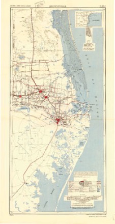
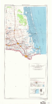
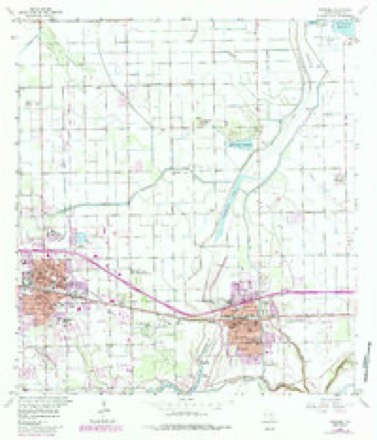
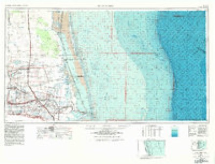
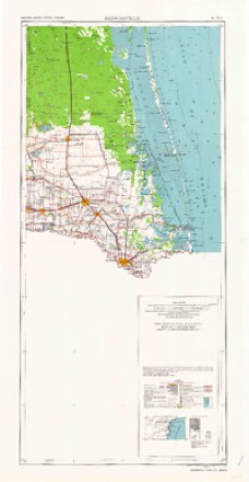
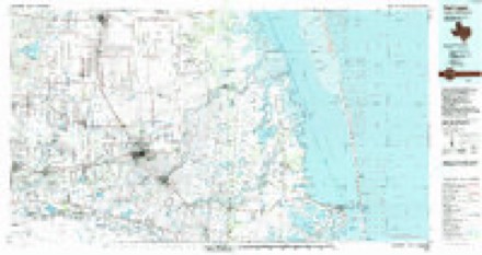
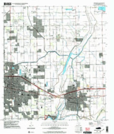
7 surveys from 10 printed sheetsMatched by testing this settlement's coordinate against the published boundary of every sheet in the United States Geological Survey's historical collection. Each opens the scanned sheet at the Survey.
- 1953 USGS Brownsville quadrangle1:250000
- 1956 USGS Brownsville quadrangle1:250000, 2 printings
- 1956 USGS Mercedes quadrangle1:24000, 3 printings
- 1956 USGS Port Isabel quadrangle1:250000
- 1962 USGS Brownsville quadrangle1:250000
- 1992 USGS Harlingen quadrangle1:100000
- 2002 USGS Mercedes quadrangle1:24000
Fires near this place
85 since 2002Regional context, not property-specific evidence. The federal wildfire occurrence database lists 85 fires within 5 miles of Weslaco between 2002 and 2017, burning about 849 acres in total. None started naturally. 13 were recorded as arson. Distance is straight-line from the map coordinates, so a fire counted here may appear on a neighbouring settlement's page as well.
| Reported cause | Fires |
|---|---|
| Debris and open burning | 60 |
| Arson/incendiarism | 13 |
| Missing data/not specified/undetermined | 11 |
| Misuse of fire by a minor | 1 |
The most recent of them, most recent first, with the day each was reported and the service that recorded it.
| Date | Cause | Size | Reported by | Name on the report |
|---|---|---|---|---|
| 7 September 2012 | Debris and open burning | 10 acres | Texas A & M Forest Service | 4 WEST FIRE |
| 22 September 2011 | Debris and open burning | 1.0 acres | Texas A & M Forest Service | DIAMOND FIRE |
| 21 September 2016 | Missing data/not specified/undetermined | 94 acres | Lower Rio Grande Valley National Wildlife Refuge | TAORMINA |
| 12 September 2011 | Debris and open burning | 13 acres | Texas A & M Forest Service | 11-675 |
| 9 August 2015 | Arson/incendiarism | under an acre | Lower Rio Grande Valley National Wildlife Refuge | 1015 |
| 7 August 2014 | Debris and open burning | 1.0 acres | Texas A & M Forest Service | TRASH FIRE |
| 31 August 2010 | Debris and open burning | 4.6 acres | Lower Rio Grande Valley National Wildlife Refuge | VICTORIA |
| 3 August 2004 | Arson/incendiarism | under an acre | Lower Rio Grande Valley National Wildlife Refuge | JOSE PORTILLO |
Settlements close enough to share some of these fires:
Storms near this place
34 since 1999Regional context, not property-specific evidence. The National Weather Service names Weslaco in 34 storm reports between 1999 and 2025: 11 flash flood, 6 thunderstorm wind, 6 hail, 4 tornado. No death or injury is recorded in these reports. Each account below is quoted exactly as the forecast office filed it, from the NOAA Storm Events Database, and each date opens the federal record of that event.
| When | Event | Place named | Harm | What the report says |
|---|---|---|---|---|
| June 2019 | Flash Flood | Weslaco | $30,000,000 | Measured and estimated rainfall between 6 and 15 inches that fell predominantly from early evening June 24th through a bit after midnight on June 25th produced widespread flash flooding across southeastern Hidalgo County. Hardest hit locations were near the Cameron and Willacy County line, including locations just west of Santa Rosa through Monte Alto, and between Sebastian and Elsa. ||In the tri-county area (western Willacy, northwestern Cameron, and southeastern Hidalgo), 1188 homes were considered destroyed or with major damage, with an additional 182 homes with minor damage. Hundreds of streets flooded, including 30 Texas-managed highways. This included the frontage roads of Interstate 2 and Interstate 69E. More than 100 persons were evacuated to higher ground when dozens of homes were threatened by 2 to 4 feet of water in each county; Monte Alto was hardest hit in Hidalgo County. Individual Assistance costs were estimated at $27.6 million as of early August 2019; Public Assistance values were unknown but likely to add to the damage, which will be estimated at $75 million in all three counties. Daily rainfall records were set in the flood area, including 6.95 inches in Weslaco, more than 3 inches above the prior record for the date set in 1951. ||Despite the flooding and damage, much which occurred in the dark, there were no know deaths of injuries directly attributed to the flood. |
| May 2021 | Flash Flood | Weslaco | $100,000 | Public report received of flood waters reaching up over the top of car wheel wells in the Weslaco area. Emergency managers also reported water depth of up to 3 feet in spots during this event, mostly in the area just south of Interstate Highway 2 between Westgate and Airport Boulevard. |
| May 2009 | Lightning | Weslaco | $100,000 | An emergency manager reported that lightning struck a home in Weslaco during an early morning thunderstorm. A fire engulfed the home which was completed destroyed. There were no injuries reported. |
| September 2003 | Flash Flood | Weslaco | $75,000 | Flash flooding of city streets was reported by the City of Weslaco Emergency Management Coordinator due to heavy rains. The water produced minor damage to several businesses and homes. |
| April 2023 | Thunderstorm Wind | Weslaco | $50,000 | The ASOS station at the Mid Valley Airport (KTXW) recorded a wind gust of 50 knots at 12:55AM CDT. |
| May 2006 | Thunderstorm Wind | Weslaco | $50,000 | Damaging winds associated with a severe thunderstorm caused a roof collapse at a city maintenance facility. The roof fell on severeal vehicles. |
| September 2006 | Flash Flood | Weslaco | $50,000 | Frontage roads in Weslaco flooded and neighborhood flooding reported around Mile 6W. |
| June 2010 | Lightning | Weslaco | $30,000 | A structure fire was reported in Weslaco near the intersection of Salinas and Mile 12 North Road. The fire began after a thunderstorm moved through the area during the afternoon producing numerous lightning strikes in which a lightning bolt started the blaze. |
| June 2011 | Flash Flood | Weslaco | $25,000 | The Weslaco/Donna Emergency Manager reported extensive flooding along both sides of Highway 83 (frontage roads along the expressway), as well as significant street flooding along Business 83 and Texas Boulevard (Farm to Market 88). Local media reports indicated more than 2 feet of water in roads, some which impacted properties in town. The flooding was caused by another round of torrential, tropical rains between 130 and 330 PM, which dropped more than 3 inches on top of the 2.84 inches which had fallen on the 22nd. More than 6 inches fell in Weslaco during the two day period. |
| June 2005 | Tornado (F0) | Weslaco | $25,000 | A short-lived F0 tornado uprooted several trees, blew over a semi-trailer, produced roof damage to several homes and a warehouse. The Weslaco Police Department also reported several cruisers with broken windows. |
| April 2023 | Thunderstorm Wind | Weslaco | $20,000 | The Fire Chief for Weslaco called and reported several business signs either damaged or blown down along Business 83. The largest sign blown down was an 8 foot tall Long John Silvers sign. An NWS Survey found there to be rust at the bottom of the sign, which kept wind estimates from being higher. |
| October 2017 | Flood | Weslaco | $15,000 | Bands of heavy rainfall associated with repeating thunderstorms eventually were too much for local drainage systems to handle in the south part of Weslaco to the north part of Progresso. Bias corrected radar estimates of more than 5 inches of rain likely contributed to street flooding in the Quail Hollow neighborhood in south Weslaco, where 2 feet of standing water backed up and allowed minimal passage of vehicles through the neighborhood. Water failed to flow through a nearby drain, worsening the situation. |
| August 1999 | Tornado (F0) | Weslaco | $6,000 | F0 tornado touched down briefly near 10th Street and Bridge Avenue. |
| August 2015 | Thunderstorm Wind | Weslaco | $5,000 | Estimated thunderstorm wind gusts of 50 to 60 mph knocked down trees and caused roof and antenna damage across the middle Rio Grande Valley, including the city of Weslaco. |
| May 2010 | Thunderstorm Wind | Weslaco | $2,000 | The Hidalgo County Emergency Manager reported strong winds occurred during a thunderstorm which knocked down some power lines in Weslaco. A funnel cloud was reported by the emergency manager approximately two miles west of Weslaco as the thunderstorm moved through the area. Peak winds of 43 mph were reported at the Mid Valley Airport, 2 miles east of Weslaco, estimated at around 812 AM CST. |
| May 2025 | Hail | Weslaco | - | Broadcast media shared a resident report of estimated 1 inch hail in Weslaco. Time estimated based on radar data. |
| July 2021 | Flash Flood | Weslaco | - | Public reports received of water covering North Border Avenue near Weslaco High School. |
| June 2021 | Flood | Weslaco | - | Reports received of street flooding in Weslaco, with standing water at the intersection of Westgate Drive and W Pike Boulevard. |
| June 2019 | Flood | Weslaco | - | Slow drainage of torrential rains of 6 to 15 inches in just six hours during the evening of June 24th through just after midnight on June 25th maintained widespread flooding of 1 to as much as 3 feet of water depth across many neighborhoods and roads in the eastern portion of the Rio Grande Valley. Hundreds of roads remained closed or impassible, and hundreds to more than a thousand homes continued to have some water in them for several (mainly fair weather days) following the causative event. Water did not recede completely in some neighborhoods until up to 2 weeks following the rains, much due to the interconnected drainage system which was unable to handle the rainfall rate, which was a 1 in 500 probability event occurring in locations only built to sustain 1 in 5 or 1 in 10 probability events. ||Please note: Damage listed here is only a fraction of the total damage which is shown in the flash flood entries for these locations. |
| May 2015 | Heavy Rain | Weslaco | - | Weslaco Police Department reported 1 foot of water on Airport Road from Business 83 to 8th Street and 1.5 to 2 feet of water at the intersection of Westgate and Pike. |
| August 2015 | Heavy Rain | Weslaco | - | Between 4 and 7 inches of rain fell over a three hour period across the Weslaco area. Weslaco Co-Op observer reported over 5 inches of rain. |
| September 2014 | Flash Flood | Weslaco | - | Flash flooding was reported by various sources of flash flooding along the frontage roads in Weslaco along Highway 83/I-2 and road closures in Weslaco. Several feet of water was noted, as well as water to the top of tire wells. |
| May 2009 | Hail | Weslaco | - | Quarter size hail fell along Milagros Road between Donna and Weslaco during a thunderstorm that moved through Hidalgo County. A news reporter from KRGV-TV-5 reported nickel size hail in the vicinity at around the same time. |
| May 2009 | Hail | Weslaco | - | A trained spotter reported that half-dollar size hail fell in Weslaco during a thunderstorm that moved through Hidalgo County. |
| June 2009 | Hail | Weslaco | - | The public reported three quarters inch hail occurred during a rapidly developing thunderstorm during the early evening, just east of Weslaco. |
| September 2009 | Flash Flood | Weslaco | - | The public reported Heavy rainfall in a thunderstorm which produced flooding on Business Highway 83 between Airport Drive and Texas. Some homes in the area were reported to have water up to the door steps. Major flooding was reported in nearby streets. Six inches of rain was estimated to have fallen during the thunderstorm. The Hidalgo County Emergency Manager reported thirteen intersections were closed due to the flooding and several cars were totaled due to the flood waters. |
| July 2007 | Flash Flood | Weslaco | - | High water over several streets and water in a few homes. |
| June 2004 | Flash Flood | Weslaco | - | Flash flooding of roads and low lying areas was reported in Weslaco after approximately 5 inches of rain fell in a short period of time. |
| May 2002 | Tornado (F0) | Weslaco | - | National Weather Service storm survey indicated a minimal tornado with numerous large trees downed. There was also evidence of large hail with many windows broken on houses in the Tierra Santa area. One resident reported coming home to find her apartment dark with windows and blinds broken. Many vehicles were also damaged with large hail. |
| May 2002 | Flash Flood | Weslaco | - | Water covering the Lewis Lane exit off Highway 83 |
| October 2002 | Hail | Weslaco | - | A weather spotter reported 3/4 inch hail. |
| August 2000 | Thunderstorm Wind | Weslaco | - | A reporter from a local television station reported a roof from a mobile home was blown off and some out buildings were damaged by the strong winds from a thunderstorm. |
| August 1999 | Tornado (F0) | Weslaco | - | Citrus ande pecan trees damaged. |
| December 2000 | Hail | Weslaco | - | no account filed |
Nearest settlements
The eight closest, with where each one stands in the county. Distances are straight-line, computed from the Geographic Names Information System coordinates.
| Map | Place | Distance | Sheets |
|---|---|---|---|
| West Highway Colonia | 0.5 miles | 16 | |
| Roosevelt School Colonia | 0.7 miles | 10 | |
| Olivarez Number 5 Colonia | 1.1 miles | 10 | |
| Encino Number 1 Colonia | 1.2 miles | 10 | |
| Westgate Estates Colonia | 1.3 miles | 16 | |
| Anaqua Addition Colonia | 1.3 miles | 16 | |
| Rosedale Heights Colonia | 1.4 miles | 16 | |
| La Palma Number 2 Colonia | 1.5 miles | 16 |
Elsewhere
Matched on this settlement's Geographic Names Information System number rather than its name, so it cannot be a different place of the same name in another state.
| Wikipedia article on Weslaco | An encyclopaedic summary. Its text is share-alike, so it is linked here rather than copied. |
| Wikidata item Q976553 | The structured record the population and elevation above come from. Public domain (CC0). |
Provenance
This settlement is recorded in the Geographic Names Information System as feature 1349656. The sheet list is computed by point-in-boundary test against the United States Geological Survey's historical topographic inventory. Both are works of the United States government and carry no copyright under 17 U.S.C. 105.
Wildfire. Short, Karen C. 2022. Spatial wildfire occurrence data for the United States, 1992-2020 [FPA_FOD_20221014]. 6th Edition. Fort Collins, CO: Forest Service Research Data Archive. https://doi.org/10.2737/RDS-2013-0009.6 Collected with United States Government funding and usable without additional permissions or fees.
Storms. NOAA National Centers for Environmental Information, Storm Events Database https://www.ncei.noaa.gov/stormevents/ A work of the United States government, no copyright under 17 U.S.C. 105. Narratives are quoted verbatim from the National Weather Service report and are not edited or summarised.