 Block
BlockFrom the record
One of 82 National Register listings published here for Galveston County · listed in 2002 · category: District.
Sources: the case file at the National Archives · the National Register database, National Park Service
Listed on the National Register of Historic Places in 2002.
One of 82 National Register listings published here for Galveston County · listed in 2002 · category: District.
Sources: the case file at the National Archives · the National Register database, National Park Service
Regional context, not property-specific evidence. The federal mineral resources record lists 2 workings within 5 miles of Denver Court Historic District: 2 producers. All of them still produce. What was taken out: Barium-Barite. Distance is straight-line from the map coordinates, so a quarry counted here may appear on a neighbouring settlement's page as well.
| Where | Site | Commodity | Status | Recorded |
|---|---|---|---|---|
| Galveston Plant | Barium-Barite | Producer | ||
| Milchem Grinding Plant | Barium-Barite | Producer |
Regional context, not property-specific evidence. The National Weather Service names Galveston, the town this property stands in, in 74 storm reports between 1995 and 2025: 29 thunderstorm wind, 14 flash flood, 7 funnel cloud, 6 hail. The reports record 3 deaths and 4 injuries. Each account below is quoted exactly as the forecast office filed it, from the NOAA Storm Events Database, and each date opens the federal record of that event.
| When | Event | Place named | Harm | What the report says |
|---|---|---|---|---|
| August 2006 | Lightning | Galveston | 1 killed, $70,000 | 86 year old man killed in a house fire started by a lightning strike. |
| July 1999 | Lightning | Galveston | 1 killed | Lightning struck and killed 36-year old man at Moody Gardens. |
| September 1997 | Lightning | Galveston | 1 killed | Fisherman struck and killed by lightning at San Luis Pass. |
| August 2009 | Tornado (EF1) | Galveston | 3 hurt, $500,000 | The tornado began as a waterspout moved onto the beach near 29th Street and Seawall Blvd. A police cruiser had its windows blown out and the roof of a souvenir shop at 29th and Seawall was blown off. Further inland, a house on stilts was blown over and the roof of a mobile home was peeled back. A two-story home at the intersection of 31st Street and Avenue Q 1/2 at the end of the damage track had its roof completely removed. Numerous trees and fences also sustained damage. |
| May 2005 | Thunderstorm Wind | Galveston | 1 hurt, $175,000 | Building damage along the Port of Galveston, vehicle blown off the road and trees down. One house shifted about ten feet into another house next door dislodging it from its piers (both homes were Galveston 1900 Storm survivors). |
| May 1999 | Thunderstorm Wind | Galveston | $150,000 | Numerous power poles, street signs and traffic signs blown down between 61st and 71st Streets near Harborside Drive. Roof of home torn off and 2-ton boat blown into car along Channelview Drive. Numerous reports of trees and power lines down across island. |
| February 1997 | Tornado (F0) | Galveston | $120,000 | no account filed |
| May 1999 | Thunderstorm Wind | Galveston | $50,000 | Portion of convienience store on Broadway destroyed. Fence blown down at Gulf Health Care Center |
| May 1997 | Lightning | Galveston | $50,000 | Lightning induced fire destroyed house |
| October 2006 | Flash Flood | Galveston | $35,000 | Numerous roads under water across Galveston Island due to heavy rain. |
| December 2002 | Thunderstorm Wind | Galveston | $30,000 | 140 feet of roof ripped off the Shops at the Balinese on the Galveston seawall. |
| August 1995 | Thunderstorm Wind | Galveston | $30,000 | Ford Bronco blown into canal at Bayou Vista. Road signs blown down along Bolivar Peninsula. |
| May 1999 | Thunderstorm Wind | Galveston | $25,000 | Awning torn off building along 81st St. near Scholes Field. |
| November 1997 | Thunderstorm Wind | Galveston | $25,000 | Hotel roof on 61st St. blown off. |
| August 2025 | Lightning | Galveston | $20,000 | Report of a house fire along Ave P 1/2 due to a lightning strike. Location is estimated and time is estimated based on radar. Damage to the house was contained to the attic according to the local Fire Marshal. |
| April 2002 | Thunderstorm Wind | Galveston | $20,000 | There was an extensive number of power lines down along FM 3005 on Galveston Island. |
| March 2001 | Thunderstorm Wind | Galveston | $20,000 | Utility poles and power lines down; broken windows at a car dealership. |
| June 1998 | Thunderstorm Wind | Galveston | $20,000 | Coast Guard estimated 85 knot winds at the ferry landing. 150 dry dock blew off moorings into a ship. Dredge pipes (75 foot long, 2000-3000 pounds) blown off shore into the water. |
| July 2000 | Thunderstorm Wind | Galveston | $15,000 | Power lines down. |
| November 1997 | Thunderstorm Wind | Galveston | $15,000 | Powerlines down and an 18 -wheeler overturned at Harborside Dr. & Ave A. |
| September 2015 | Flash Flood | Galveston | $10,000 | Flash flooding on Galveston Island included several roads under water and impassable, including 48th Street and Broadway, service roads to Interstate 45, and 51st Street and Harborside Drive where vehicles stalled out. There was also flooding on the TAMU campus. |
| August 2006 | Flash Flood | Galveston | $10,000 | Flooding across the east end of Galveston Island and in The Strand area. |
| September 1998 | Tornado (F0) | Galveston | $10,000 | Brief tornado touchdown on the west end of Galveston Island. House sustained structural damage. |
| April 2000 | Hail | Galveston | $10,000 | no account filed |
| April 1997 | Hail | Galveston | $10,000 | no account filed |
| November 2023 | Flash Flood | Galveston | $5,000 | Roadways flooded between 45th and 39th street. Few high water rescues. |
| January 1998 | Flash Flood | Galveston | $5,000 | High water on Broadway, 45th-47th St, 53rd St, 61st St. on Galveston Island |
| November 1997 | Thunderstorm Wind | Galveston | $5,000 | Garden shed at nursery on 32nd St. destroyed |
| November 1997 | Thunderstorm Wind | Galveston | $5,000 | Powerlines blown down in eastern Galveston. |
| August 1995 | Thunderstorm Wind | Galveston | $5,000 | Sholes Field clocked 58 mph wind gusts. |
| April 1997 | Flash Flood | Galveston | $5,000 | no account filed |
| February 1998 | Thunderstorm Wind | Galveston | $3,000 | 60 mph gusts at 25th St & Seawall Blvd. |
| February 1998 | Thunderstorm Wind | Galveston | $3,000 | Powerpoles blown down at 53rd St. & Ave S1/2. |
| May 2002 | Hail | Galveston | $3,000 | no account filed |
| May 2002 | Flash Flood | Galveston | $2,000 | Street flooding. |
| April 2003 | Hail | Galveston | $2,000 | no account filed |
| March 2018 | Thunderstorm Wind | Galveston | $1,000 | A power pole was downed near an apartment complex on 21st Street. |
| August 2017 | Flash Flood | Galveston | $1,000 | Areas along Highway 87, or Ferry Drive south of Harborside Drive, were flooded and impassable. |
| November 1997 | Thunderstorm Wind | Galveston | $1,000 | Windows blown out at the Moody Center on the Seawall. |
| May 2022 | Thunderstorm Wind | Galveston | $500 | A palm tree was downed on Texas Clipper Road. |
| August 2017 | Tornado (EF0) | Galveston | $500 | Funnel cloud sighting with fence damage near Ferry Road. |
| April 2023 | Hail | Galveston | - | Quarter sized hail was observed on Galveston Island at the intersection of 20th and Market Streets. |
| September 2023 | Flash Flood | Galveston | - | Street flooding was reported along Broadway on the East End of Galveston Island, with several cars stalled due to floodwaters. |
| October 2019 | Heavy Rain | Galveston | - | A 20 x 20 foot portion of the Moody Compress Warehouse collapsed due to accumulated rain on the roof. |
| September 2019 | Flash Flood | Galveston | - | Flooding occurred on many roads in the Strand area as water flowed over the curbs and sidewalks. Ferry Road near UTMB became inundated and impassable due to floodwaters. |
| March 2018 | Thunderstorm Wind | Galveston | - | An oleander tree was knocked down and a wooden bench swing collapsed around the intersection of 15th Street and Avenue M. |
| September 2018 | Flash Flood | Galveston | - | There were flooded roads, with reports of water as high as two feet, around Ball High School. Sections of Harborside Drive-SH 275 from Interstate 45 east to Ferry Road were closed due to high water. |
| October 2018 | Thunderstorm Wind | Galveston | - | Thunderstorm winds downed two palm trees on Harborside Drive and 29th Street. |
| October 2018 | Flash Flood | Galveston | - | There were numerous reports of street flooding on the east end of Galveston Island from Scholes Field eastward towards Ferry Road. High water encroached the dorms at Texas A&M-Galveston on Pelican Island with flooding inundating the Strand and points along Harborside Road towards Ferry Road. |
| October 2018 | Thunderstorm Wind | Galveston | - | There was a report of a collapsed residence on Ave S and 47th street. |
| December 2018 | Flash Flood | Galveston | - | There were sections of Harborside Drive that became impassable due to high flood waters. |
| August 2017 | Funnel Cloud | Galveston | - | A funnel cloud was observed near Harborside Drive on Galveston Island. |
| August 2017 | Funnel Cloud | Galveston | - | A second funnel cloud was observed near Harborside Drive on Galveston Island. |
| May 2016 | Flash Flood | Galveston | - | Flash flooding occurred near the intersection of Interstate 45 and 61st Street in Galveston. |
| July 2014 | Funnel Cloud | Galveston | - | A funnel cloud was sighted on Galveston Island near the intersection of Seawall Blvd and 39th Street. |
| May 2014 | Thunderstorm Wind | Galveston | - | Severe thunderstorm winds blew down a utility pole and power lines in Galveston. |
| August 2013 | Funnel Cloud | Galveston | - | Three funnel clouds were sighted over Galveston Bay near the Texas City Dike. |
| May 2007 | Thunderstorm Wind | Galveston | - | Tree downed in the Gulf Village subdivision near Stewart Road. |
| August 2006 | Funnel Cloud | Galveston | - | Sighted over Galveston Bay. |
| August 2004 | Tornado (F0) | Galveston | - | Brief touchdown on North Galveston Island along Old Port Industrial Road just north of 61st Street. No reported damage. |
No historic map-sheet match is published for this property yet. That does not mean no map exists. This record needs a coordinate-quality review before it can be joined to a sheet boundary. Browse the county's mapped places while that work is pending.
Other National Register properties close enough to walk or drive between, ordered by distance from this one. Both positions come from the same geocoding pass that matched these properties to their map sheets.
| Photograph | Property | Distance | Listed |
|---|---|---|---|
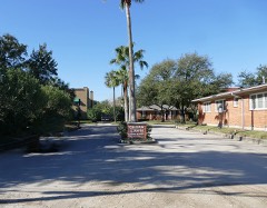 | Cedar Lawn Historic District | 0.8 miles | 2002 |
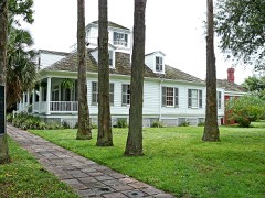 | Samuel May Williams House | 1.0 miles | 1971 |
| Broadway Cemetery Historic District | 1.1 miles | 2014 | |
| Rosewood Cemetery | 1.1 miles | 2024 | |
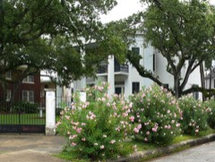 | Powhatan House | 1.1 miles | 1975 |
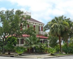 | John Hagemann House | 1.2 miles | 1982 |
| National Archives record | The nomination case file for reference 01001471 in Record Group 79. |
| Galveston County | All 82 listed properties in this county. |