 Block
BlockFrom the record
One of 128 National Register listings published here for Tarrant County · listed in 2003 · category: Building.
Sources: the case file at the National Archives · the National Register database, National Park Service
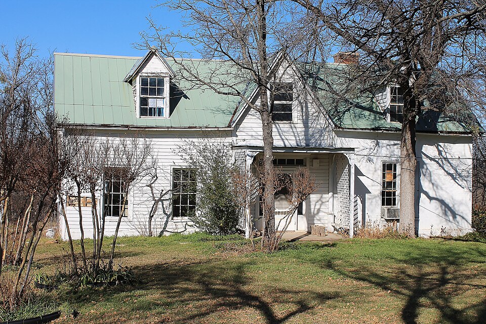
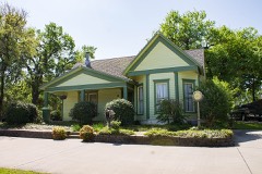
Listed on the National Register of Historic Places in 2003.
One of 128 National Register listings published here for Tarrant County · listed in 2003 · category: Building.
Sources: the case file at the National Archives · the National Register database, National Park Service
Regional context, not property-specific evidence. The federal wildfire occurrence database lists 216 fires within 5 miles of Ralph Sandiford and Julia Boisseau Man House between 2005 and 2013, burning about 781 acres in total. None started naturally. 9 were recorded as arson. Distance is straight-line from the map coordinates, so a fire counted here may appear on a neighbouring settlement's page as well.
| Reported cause | Fires |
|---|---|
| Missing data/not specified/undetermined | 135 |
| Debris and open burning | 37 |
| Equipment and vehicle use | 11 |
| Arson/incendiarism | 9 |
| Misuse of fire by a minor | 8 |
| Smoking | 7 |
| Recreation and ceremony | 5 |
| Power generation/transmission/distribution | 3 |
| Railroad operations and maintenance | 1 |
The most recent of them, most recent first, with the day each was reported and the service that recorded it.
| Date | Cause | Size | Reported by | Name on the report |
|---|---|---|---|---|
| 9 September 2011 | Equipment and vehicle use | 30 acres | Texas A & M Forest Service | MANSFIELD FIRE |
| 8 September 2012 | Missing data/not specified/undetermined | under an acre | Texas A & M Forest Service | WALNUT CREEK FIRE |
| 8 September 2011 | Equipment and vehicle use | under an acre | Texas A & M Forest Service | 2951 HW 917 |
| 7 September 2012 | Smoking | under an acre | Texas A & M Forest Service | 287 FIRE |
| 7 September 2009 | Equipment and vehicle use | 1.0 acres | Texas A & M Forest Service | CALLENDER RD |
| 4 September 2010 | Missing data/not specified/undetermined | under an acre | Texas A & M Forest Service | TEXAN RV |
| 4 September 2009 | Arson/incendiarism | under an acre | Texas A & M Forest Service | HOLLAND RD |
| 23 September 2012 | Missing data/not specified/undetermined | under an acre | Texas A & M Forest Service | SPYGLASS FIRE |
Regional context, not property-specific evidence. The National Weather Service names Mansfield, the town this property stands in, in 82 storm reports between 1993 and 2025: 51 hail, 17 thunderstorm wind, 9 flash flood, 4 tornado. The reports record 2 injuries. Each account below is quoted exactly as the forecast office filed it, from the NOAA Storm Events Database, and each date opens the federal record of that event.
| When | Event | Place named | Harm | What the report says |
|---|---|---|---|---|
| May 2001 | Tornado (F1) | Mansfield | 2 hurt, $5,000,000 | The tornado first touched down in southwest Mansfield near the Tarrant-Johnson County line on Sentry street. The tornado moved northeast across Mansfield, exiting the city near Laura Elizabeth Trail and continued moving northeast across the extreme southeast part of Arlington. The tornado moved into southwest Grand Prairie near highway 360 and New York Avenue and dissipated near the intersection of Lake Ridge Parkway and Lynn street. Two minor injuries were reported. In Mansfield 16 businesses were damaged. 113 homes were damaged, 27 with moderate to heavy damage. In Grand Prairie, 61 homes were damaged, 10 with moderate to heavy damage. The tornado tracked across undeveloped land in Arlington, so no damage occurred there. |
| September 1993 | Tornado (F2) | Mansfield | $5,000,000 | A tornado touched down 5 miles west of Mansfield and moved north-northeast into southwest Arlington before lifting. A large microwave tower was flattened. Additionally, 6 mobile homes, 20 houses, and 3 businesses were damaged. |
| June 2023 | Hail | Mansfield | $1,000,000 | Broadcast media shared a photo of a 5-inch diameter hail stone in Mansfield. |
| June 2023 | Hail | Mansfield | $750,000 | A social media photo indicated a 4-inch diameter hail stone in Mansfield. |
| June 2000 | Flash Flood | Mansfield | $700,000 | Fifty homes were damged by flooding. Five business were also damaged. |
| June 2023 | Hail | Mansfield | $500,000 | no account filed |
| June 2023 | Hail | Mansfield | $250,000 | A social media photo indicated baseball sized hail 4 miles east of Mansfield. |
| January 2017 | Tornado (EF0) | Mansfield | $75,000 | A National Weather Service damage survey crew found evidence of a small tornado near the Johnson/Tarrant County line. The tornado began near Lone Star Road and US 287 in the far southern portion of the City of Mansfield. The tornado did minor damage to four businesses, damaging overhead doors on metal buildings. One manufactured home suffered roof damage in Johnson County, while one barn was destroyed as the tornado moved into far southern Tarrant County. |
| August 2001 | Flash Flood | Mansfield | $50,000 | Highway 287 was closed and all streets in town were flooded. The Silver Leaf Mobile Home Park was flooded. Mansfield reported 4 inches of rain in 3 hours. |
| May 2007 | Thunderstorm Wind | Mansfield | $40,000 | Two construction trailers were rolled over and damage to roofs was reported in Mansfield. Trees were also blown down. |
| April 2008 | Flash Flood | Mansfield | $30,000 | Five houses were flooded in town. |
| April 2008 | Thunderstorm Wind | Mansfield | $30,000 | Tractor-trailers and trucks were blown over on Justice Lane. Trees were also blown down across roads. |
| May 2013 | Thunderstorm Wind | Mansfield | $20,000 | Arlington Emergency Management reported an 18 inch diameter tree fell onto a mobile home in Breezy Oaks mobile home park. |
| May 2014 | Hail | Mansfield | $20,000 | no account filed |
| April 2020 | Hail | Mansfield | $15,000 | Golf ball sized hail was reported near Country Club Drive and Matlock Rd in Mansfield. |
| June 2008 | Thunderstorm Wind | Mansfield | $15,000 | A screening fence was blown over and damaged pumps and equipment at a water park. The fence was anchored to a wall and when it fell it pulled some of the wall down as well. |
| May 2024 | Hail | Mansfield | $13,000 | Public photo showed a 2.1 inch hail stone in Mansfield. |
| April 2009 | Flash Flood | Mansfield | $10,000 | A vehicle was washed off Country Club Road in Mansfield. Twenty-two employees at the country club had to be rescued due to rapidly rising water and the water was waist deep at the time of the rescue. |
| April 2005 | Thunderstorm Wind | Mansfield | $10,000 | Multiple power lines were knocked down by falling tree limbs; also a neighborhood fence was destroyed by strong winds. City crews and tree service companies were dispatched to cut up and shred tree limbs. |
| September 2003 | Flash Flood | Mansfield | $10,000 | 4.7 inches fell in three hours causing flooding in low lying areas and closing some streets. |
| March 2025 | Hail | Mansfield | $7,000 | Reported via mPING northeast of Mansfield. |
| March 2017 | Thunderstorm Wind | Mansfield | $5,000 | Emergency management reported trees down throughout the city of Mansfield, TX. |
| June 2009 | Thunderstorm Wind | Mansfield | $5,000 | A spotter measured a 63 mph wind gust in the Walnut Creek area in Mansfield. |
| January 2017 | Thunderstorm Wind | Mansfield | $2,000 | Shingles off roof near 360 and North Holland Road. |
| March 2013 | Hail | Mansfield | $2,000 | Amateur radio operators reported hail to the size of a half dollar. |
| June 2009 | Thunderstorm Wind | Mansfield | $1,500 | A large tree fell onto Jim's Cleaners on East Broad Street in Mansfield causing approximately $1,000 in damage to the roof. |
| January 2017 | Hail | Mansfield | $1,000 | Hail up to 1 inch was reported in Mansfield. |
| October 2014 | Thunderstorm Wind | Mansfield | $1,000 | A report was received via social media of large tree branches being knocked down in Mansfield. |
| April 2005 | Tornado (F0) | Mansfield | $1,000 | Damage to tree limbs and antennas reported. |
| May 2015 | Flash Flood | Mansfield | $500 | Flooding was reported at Walnut Creek Country Club in Mansfield. |
| May 2024 | Hail | Mansfield | - | Report from mPING: Dime (0.75 in.). |
| May 2024 | Hail | Mansfield | - | Report from mPING: Half Dollar (1.25 in.). |
| May 2024 | Hail | Mansfield | - | Report from mPING: Dime (0.75 in.). |
| May 2024 | Hail | Mansfield | - | Report from mPING: Dime (0.75 in.). |
| May 2024 | Thunderstorm Wind | Mansfield | - | A trained spotter measured a wind gust of 62 mph in Mansfield. |
| May 2024 | Hail | Mansfield | - | Report from mPING: Dime (0.75 in.). |
| May 2024 | Hail | Mansfield | - | Report from mPING: Quarter (1.00 in.). |
| May 2024 | Hail | Mansfield | - | Report from mPING: Quarter (1.00 in.). |
| May 2024 | Hail | Mansfield | - | Report from mPING: Quarter (1.00 in.). |
| May 2024 | Hail | Mansfield | - | A trained spotter reported 1.5 inch hail in Mansfield. |
| May 2023 | Thunderstorm Wind | Mansfield | - | Photos on social media showed snapped trees in Mans Best Friend Dog Park in Mansfield. |
| March 2023 | Hail | Mansfield | - | Reported via mPing. |
| April 2023 | Hail | Mansfield | - | A public report indicated dime sized hail 2 miles northeast of Mansfield, TX. |
| April 2021 | Hail | Mansfield | - | Quarter to ping pong ball sized hail was reported northeast of Mansfield. |
| April 2020 | Hail | Mansfield | - | Hail report received via mPing. |
| October 2019 | Hail | Mansfield | - | Hail slightly larger than quarter sized fell on the southeast side of Mansfield. |
| April 2018 | Hail | Mansfield | - | Amateur radio reported penny-sized hail in the city of Mansfield, TX. |
| January 2017 | Hail | Mansfield | - | A social media report indicated 1 inch diameter hail in the city of Mansfield, TX. |
| March 2017 | Thunderstorm Wind | Mansfield | - | Mansfield Office of Emergency Management measured a wind gust of 85 MPH. |
| May 2015 | Thunderstorm Wind | Mansfield | - | The Mansfield fire department reported wind gusts to near 60 mph in the city of Mansfield. |
| December 2015 | Hail | Mansfield | - | Penny to nickel sized hail was reported in Mansfield. |
| May 2014 | Hail | Mansfield | - | Half dollar sized hail was reported in Mansfield. |
| March 2013 | Hail | Mansfield | - | Pea to nickel sized hail was reported in Mansfield. While the hail was small, it was covering the ground in many locations. |
| April 2011 | Thunderstorm Wind | Mansfield | - | A trained spotter measured a 61 mph wind gust in Mansfield. |
| October 2011 | Hail | Mansfield | - | Dime to quarter sized hail was reported in north Mansfield. |
| July 2004 | Flash Flood | Mansfield | - | Widespread flash flooding in Mansfield as 13.63 inches of rain fell in 12 hours. Virtually every street in the city was flooded, several high water rescues were needed, and some homes were evacuated. |
| June 2004 | Flash Flood | Mansfield | - | Many roads were under water, and a high water rescue was in progress at 936 AM. |
| April 2001 | Thunderstorm Wind | Mansfield | - | Trees were blown down by high winds. |
| July 2001 | Flash Flood | Mansfield | - | A street in Mansfield was closed for one hour due to flash flooding. |
| May 1999 | Hail | Mansfield | - | Hail fell near Joe Pool Lake. |
No historic map-sheet match is published for this property yet. That does not mean no map exists. This record needs a coordinate-quality review before it can be joined to a sheet boundary. Browse the county's mapped places while that work is pending.
Other National Register properties close enough to walk or drive between, ordered by distance from this one. Both positions come from the same geocoding pass that matched these properties to their map sheets.
| Photograph | Property | Distance | Listed |
|---|---|---|---|
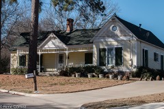 | Botts-Fowler House | 0.1 miles | 1999 |
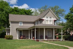 | Wallace-Hall House | 0.4 miles | 2003 |
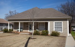 | Lester H. and Mabel Bryant Chorn House | 0.5 miles | 2003 |
| Buchanan-Hayter-Witherspoon House | 0.5 miles | 2003 | |
 | Bratton, Andrew "Cap" and Emma Doughty, House | 0.6 miles | 2003 |
| National Archives record | The nomination case file for reference 03000435 in Record Group 79. |
| Tarrant County | All 128 listed properties in this county. |