 Block
BlockFrom the record
One of 25 National Register listings published here for McLennan County · listed in 2003 · category: Building.
Sources: the case file at the National Archives · the National Register database, National Park Service
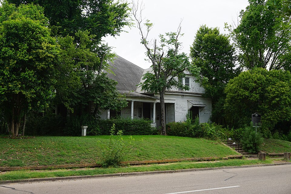
Listed on the National Register of Historic Places in 2003.
One of 25 National Register listings published here for McLennan County · listed in 2003 · category: Building.
Sources: the case file at the National Archives · the National Register database, National Park Service
Regional context, not property-specific evidence. The federal wildfire occurrence database lists 664 fires within 5 miles of Forsgard Homestead between 2005 and 2020, burning about 748 acres in total. 1 started naturally. 1 was recorded as arson. Distance is straight-line from the map coordinates, so a fire counted here may appear on a neighbouring settlement's page as well.
| Reported cause | Fires |
|---|---|
| Debris and open burning | 496 |
| Missing data/not specified/undetermined | 111 |
| Power generation/transmission/distribution | 19 |
| Recreation and ceremony | 12 |
| Smoking | 11 |
| Equipment and vehicle use | 10 |
| Misuse of fire by a minor | 3 |
| Natural | 1 |
| Arson/incendiarism | 1 |
The most recent of them, most recent first, with the day each was reported and the service that recorded it.
| Date | Cause | Size | Reported by | Name on the report |
|---|---|---|---|---|
| 9 September 2020 | Debris and open burning | under an acre | Texas A & M Forest Service | 2530031 |
| 9 September 2017 | Debris and open burning | 1.0 acres | Texas A & M Forest Service | 17-2520007 |
| 9 September 2017 | Debris and open burning | under an acre | Texas A & M Forest Service | 17-2520018 |
| 8 September 2019 | Debris and open burning | under an acre | Texas A & M Forest Service | 2510033 |
| 8 September 2019 | Debris and open burning | under an acre | Texas A & M Forest Service | 2510037 |
| 7 September 2019 | Debris and open burning | under an acre | Texas A & M Forest Service | 2500034 |
| 7 September 2016 | Debris and open burning | under an acre | Texas A & M Forest Service | 16-2510003 |
| 5 September 2019 | Debris and open burning | under an acre | Texas A & M Forest Service | 2480036 |
Regional context, not property-specific evidence. The federal mineral resources record lists 10 workings within 5 miles of Forsgard Homestead: 9 producers, 1 past producer. 9 still produce. What was taken out: Sand and Gravel, Construction, Stone, Crushed/Broken, Clay, Silica. Distance is straight-line from the map coordinates, so a quarry counted here may appear on a neighbouring settlement's page as well.
| Where | Site | Commodity | Status | Recorded |
|---|---|---|---|---|
| Pendley Pit | Silica | Producer | ||
| Universal Atlas Clay Pit | Clay | Producer | ||
| Universal Atlas Cement Plant | Stone, Crushed/Broken | Producer | ||
| Waco Quarry & Plant | Stone, Crushed/Broken | Producer | ||
| Bosqueville Pit & Plant | Sand and Gravel, Construction | Producer | ||
| Burt Plant & Pit | Sand and Gravel, Construction | Producer | ||
| H and B No 1 | Sand and Gravel, Construction | Producer | ||
| H and B No 2 | Sand and Gravel, Construction | Past Producer | ||
| Luckett Pit | Sand and Gravel, Construction | Producer | ||
| Young Brazos River Dredge | Sand and Gravel, Construction | Producer |
Regional context, not property-specific evidence. The National Weather Service names Waco, the town this property stands in, in 121 storm reports between 1993 and 2025: 52 thunderstorm wind, 40 hail, 18 flash flood, 4 lightning. The reports record 1 death. Each account below is quoted exactly as the forecast office filed it, from the NOAA Storm Events Database, and each date opens the federal record of that event.
| When | Event | Place named | Harm | What the report says |
|---|---|---|---|---|
| September 1996 | Flash Flood | Waco | 1 killed | no account filed |
| April 2023 | Hail | Waco | $4,000,000 | Large hail up to 4.5 inches was reported 2 miles east of Waco. Numerous vehicles and buildings were damaged from the large hail that fell in and around Waco. |
| May 2006 | Tornado (F2) | Waco | $3,000,000 | A tornado was reported on Waco Drive by the media, just north of the damage swath produced by the downburst. A damage survey conducted by the National Weather Service in Fort Worth found that a tornado formed south of New Road and just west of Spur 298 (Franklin Avenue), or just north of Richland Mall. The tornado reached its peak intensity of lower F2 and did the most damage just east of Spur 298. Several commercial buildings had large sections of their roofs and walls damaged. A Coca-Cola Bottling Plant lost much of its roof and most of its inventory was damaged. A spokesman for the company stated that the tornado did well over $1 million worth of damage. An owner of an auto repair shop which was badly damaged estimated damages at $600,000. A horse barn owned by Baylor University was leveled and two horses killed. Numerous trees were downed and power lines snapped in and east of this area. The circulation weakened as it approached Interstate 35, and the tornado dissipated approximately three-fourths of a mile east of Interstate 35. A countywide disaster declaration was issued by the McLennan County judge. |
| April 2006 | Tornado (F1) | Waco | $200,000 | The National Weather Service in Fort Worth conducted a damage survey of the tornado that occurred in eastern Waco. Damage was first noted south of Kendall Lane, approximately 1.25 miles west of Loop 340. The tornado partially collapsed a two story house and damaged two other houses and numerous barns and outbuildings as it moved north-northeast between Kendall Lane and Orchard Lane. Several trees were also knocked down. The tornado dissipated north of Orchard Lane and deposited debris in a field to the north. Two people were injured as well as several horses. |
| May 2003 | Thunderstorm Wind | Waco | $150,000 | Report from channel 25 in Waco. The west side of Waco was the hardest hit section of town by the high winds. One business was unroofed, with numerous reports of trees blown onto homes, and power lines blown down. |
| November 1996 | Thunderstorm Wind | Waco | $150,000 | no account filed |
| June 2014 | Thunderstorm Wind | East Waco | $100,000 | Strong thunderstorm winds damaged the 18-foot tall, 5,900-pound statue on top of the McLennan County Courthouse. The statue of Themis lost her left arm. The arm was made of lightweight metal. |
| September 1996 | Heavy Rain | Waco | $100,000 | no account filed |
| April 2023 | Hail | East Waco | $60,000 | Golf ball sized hail was reported on the Baylor Campus. |
| June 2014 | Thunderstorm Wind | Waco | $50,000 | A 10-12 diameter, 60-foot-tall oak tree fell on a house and several vehicles near North 18th Street and Columbus Avenue in Waco. The roof and porch of the house was damaged, and the fallen tree also damaged 3 vehicles. |
| July 1994 | Thunderstorm Wind | Waco | $50,000 | The roof was blown off a building on the east side of Waco at the TSTI Airport. |
| June 1995 | Thunderstorm Wind | Waco | $30,000 | Windows were broken in a hospital and a business was unroofed. Trees were blown down at Loop 340 and Highway 6. |
| February 2009 | Thunderstorm Wind | Waco | $25,000 | A transformer was blown over in Waco. Several road and stop signs were down in Downtown Waco and 20 to 30 windows were blown out of an apartment building on Austin Avenue and 13th Street. A tree was blown onto a house on Morrow Avenue. Power lines were also down in Waco. |
| April 2011 | Hail | Waco | $25,000 | no account filed |
| January 1996 | Thunderstorm Wind | Waco | $25,000 | no account filed |
| August 2008 | Flash Flood | Waco | $20,000 | High water rescues were required in the 4000 block of Herring Avenue and North 19th Street where a high water rescue was required. Water was two-feet deep on Waco Drive and 12th, 20th, and 24th Streets. At least ten cars stalled near the intersection of Dallas Street and Carver Avenue, and Skeet Eason Drive and Flat Rock Road were also flooded. |
| September 1996 | Flash Flood | Waco | $20,000 | no account filed |
| April 2019 | Thunderstorm Wind | Waco | $15,000 | A trained spotter reported large trees down in the city of Waco, TX. |
| April 2018 | Hail | Waco | $10,000 | A trained spotter reported two-inch diameter hail off of Hwy 84 in the city of Waco, TX. |
| February 2009 | Thunderstorm Wind | East Waco | $10,000 | A roof was blown off a restaurant near Baylor University. |
| April 1999 | Thunderstorm Wind | Waco | $10,000 | Numerous buildings lost shingles and a garage collapsed due to thunderstorm winds. A fence was knocked down by a trampoline. |
| April 2009 | Heavy Rain | East Waco | $7,000 | A car driver hydroplanned and flipped at Forrest Street and Interstate 35 in Waco. The driver sustained minor injuries. |
| August 2008 | Thunderstorm Wind | Waco | $6,000 | Large limbs downed power lines and caused power outages across the county. |
| March 2004 | Thunderstorm Wind | Waco | $6,000 | A barn was unroofed between Axtell and Leroy. |
| October 2014 | Hail | East Waco | $5,000 | Golf ball sized hail was reported just east of Baylor University. |
| October 2014 | Thunderstorm Wind | Waco | $5,000 | Broadcast media reported an overturned semi truck near Hwy 84 and Central Parkway in Waco, TX. |
| October 2014 | Thunderstorm Wind | Waco | $5,000 | Emergency management reported apartment building damage in Waco, TX. |
| October 2014 | Thunderstorm Wind | Waco | $5,000 | Broadcast media reported roof damage to a strip shopping center on Bosque Blvd. |
| May 2014 | Lightning | Waco | $5,000 | Lightning started a house fire in the 2700 block of Alexander Ave in Waco. |
| May 2014 | Lightning | Waco | $5,000 | Lightning started a house fire near the intersection of North 17th St and Colcord Ave in Waco. |
| May 2006 | Hail | Waco | $5,000 | Golf ball-size hail was reported near 40th Street and Columbus Avenue. |
| October 2001 | Thunderstorm Wind | Waco | $5,000 | Fences were blown down by high winds. |
| April 1998 | Lightning | Waco | $5,000 | A lightning strike started a fire in a vacant house. |
| June 1998 | Lightning | Waco | $4,000 | Lightning started a house fire. |
| July 1997 | Thunderstorm Wind | Waco | $4,000 | Strong winds blew down trees and power lines. |
| July 1997 | Thunderstorm Wind | Waco | $4,000 | Strong winds blew down trees and power lines. |
| June 2011 | Thunderstorm Wind | Waco | $2,000 | Trees and tree limbs were blown down due to strong thunderstorm winds in Waco. |
| April 2010 | Thunderstorm Wind | East Waco | $2,000 | A 55 MPH wind gust was estimated at the Baylor Discovery Center on University Parks Drive. |
| June 1996 | Thunderstorm Wind | Waco | $2,000 | no account filed |
| January 1996 | Thunderstorm Wind | Waco | $2,000 | no account filed |
| January 2017 | Thunderstorm Wind | Waco | $1,000 | A social media report indicated that shingles were blown off of a home in Waco, TX. |
| October 2014 | Thunderstorm Wind | Waco | $1,000 | Amateur radio reported that a stage was blown down at the Heart of Texas State Fair. |
| June 2009 | Thunderstorm Wind | Waco | $1,000 | Tree limbs were down in west Waco. The power was out for about 2,500 customers in Waco. |
| May 2008 | Thunderstorm Wind | Waco | $1,000 | A large tree was blown across a road in downtown Waco. |
| June 1999 | Thunderstorm Wind | Waco | $1,000 | Thunderstorm winds caused trees to blow down in a city park. Some windows were blown out in the downtown area. |
| August 1995 | Thunderstorm Wind | Waco | $1,000 | A sign was blown down by high winds. |
| November 2011 | Hail | East Waco | $500 | Dime sized hail covered the ground at the Baylor University campus. |
| May 2025 | Hail | East Waco | - | Emergency manager reported nickel sized hail at the Waco EOC. |
| May 2024 | Flash Flood | Waco | - | Emergency management reported roads closed just north of Beverly Hills. |
| May 2024 | Thunderstorm Wind | Waco | - | A public report indicated trees snapped near Franklin and 7th in downtown Waco. |
| May 2024 | Thunderstorm Wind | Waco | - | A public report indicated 3-inch tree limbs and power poles broken. |
| May 2024 | Flash Flood | East Waco | - | Report from mPING: Street/road flooding; Street/road closed; Vehicles stranded. |
| May 2024 | Flash Flood | East Waco | - | Broadcast media reported multiple flooded roads throughout Waco. |
| May 2024 | Flash Flood | East Waco | - | Emergency management reported multiple closed roads due to high water near and west of I-35 in Waco, TX. |
| April 2019 | Hail | Waco | - | Broadcast media reported quarter size hail in the city of Waco, TX. |
| June 2019 | Hail | Waco | - | A social media report indicated dime to quarter size hail in the city of Waco, TX. |
| April 2018 | Hail | Waco | - | Amateur radio reported nickel sized hail near the intersection of I-35 and Torres Road in the city of Waco, TX. |
| March 2016 | Flood | Waco | - | A public report was received stating that the 1800 through 2900 block of Franklin Avenue in Waco, TX was impassible due to high water. |
| April 2012 | Hail | Waco | - | Quarter sized hail was reported on the northwest side of Waco. |
| November 2011 | Hail | Waco | - | Brief dime to nickel sized hail fell on the south side of Waco at I-35 and New Road. |
No historic map-sheet match is published for this property yet. That does not mean no map exists. This record needs a coordinate-quality review before it can be joined to a sheet boundary. Browse the county's mapped places while that work is pending.
Other National Register properties close enough to walk or drive between, ordered by distance from this one. Both positions come from the same geocoding pass that matched these properties to their map sheets.
| Photograph | Property | Distance | Listed |
|---|---|---|---|
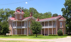 | John Wesley Mann House | 0.4 miles | 1972 |
 | Waco High School | 0.5 miles | 2009 |
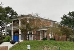 | McCulloch House | 0.6 miles | 1972 |
 | McClennan County Courthouse | 0.6 miles | 1978 |
| Waco Downtown Historic District | 0.7 miles | 2012 | |
 | Washington Avenue Bridge | 0.7 miles | 1998 |
| National Archives record | The nomination case file for reference 03001161 in Record Group 79. |
| McLennan County | All 25 listed properties in this county. |