 Block
BlockFrom the record
One of 69 National Register listings published here for Collin County · listed in 2010 · category: District.
Sources: the case file at the National Archives · the National Register database, National Park Service
Listed on the National Register of Historic Places in 2010.
One of 69 National Register listings published here for Collin County · listed in 2010 · category: District.
Sources: the case file at the National Archives · the National Register database, National Park Service
Regional context, not property-specific evidence. The federal wildfire occurrence database lists 109 fires within 5 miles of Fairview H&TC Railroad Historic District between 2005 and 2017, burning about 239 acres in total. 1 started naturally. 2 were recorded as arson. Distance is straight-line from the map coordinates, so a fire counted here may appear on a neighbouring settlement's page as well.
| Reported cause | Fires |
|---|---|
| Missing data/not specified/undetermined | 51 |
| Debris and open burning | 31 |
| Equipment and vehicle use | 11 |
| Smoking | 8 |
| Recreation and ceremony | 3 |
| Arson/incendiarism | 2 |
| Railroad operations and maintenance | 2 |
| Natural | 1 |
The most recent of them, most recent first, with the day each was reported and the service that recorded it.
| Date | Cause | Size | Reported by | Name on the report |
|---|---|---|---|---|
| 8 September 2011 | Equipment and vehicle use | 1.0 acres | Texas A & M Forest Service | 4001 N 75 |
| 5 September 2011 | Debris and open burning | 1.0 acres | Texas A & M Forest Service | 1414 S TENNESSEE |
| 4 September 2013 | Equipment and vehicle use | 1.0 acres | Texas A & M Forest Service | 13-0258 |
| 4 September 2011 | Equipment and vehicle use | under an acre | Texas A & M Forest Service | 100 CENTRAL EXSPY |
| 30 September 2015 | Missing data/not specified/undetermined | under an acre | Texas A & M Forest Service | 15-389 |
| 28 September 2011 | Missing data/not specified/undetermined | under an acre | Texas A & M Forest Service | S AIRPORT RD |
| 25 September 2015 | Missing data/not specified/undetermined | under an acre | Texas A & M Forest Service | 15-350 |
| 13 September 2014 | Debris and open burning | under an acre | Texas A & M Forest Service | 14-373 |
Regional context, not property-specific evidence. The federal mineral resources record lists 2 workings within 5 miles of Fairview H&TC Railroad Historic District: 2 past producers. None of them still produces. What was taken out: Stone, Crushed/Broken. Distance is straight-line from the map coordinates, so a quarry counted here may appear on a neighbouring settlement's page as well.
Regional context, not property-specific evidence. The National Weather Service names Fairview, the town this property stands in, in 18 storm reports between 1996 and 2025: 9 hail, 6 thunderstorm wind, 2 flash flood, 1 flood. No death or injury is recorded in these reports. Each account below is quoted exactly as the forecast office filed it, from the NOAA Storm Events Database, and each date opens the federal record of that event.
| When | Event | Place named | Harm | What the report says |
|---|---|---|---|---|
| April 2017 | Hail | Fairview | $200,000 | Storm Spotter reported tennis ball size hail near highway 121 and US 75. |
| May 2013 | Thunderstorm Wind | Fairview | $50,000 | The McKinney COOP observer reported large tree limbs and branches blown down. |
| April 2022 | Flash Flood | Fairview | $25,000 | Fire and rescue reported a water rescue near the 5000 block of McKinney Ranch Parkway in McKinney, TX. |
| April 2022 | Flash Flood | Fairview | $15,000 | Fire and Rescue reported a high water rescue near the intersection of Park View Avenue and Gerry R. Lane. |
| March 2019 | Hail | Fairview | $10,000 | A trained spotter reported golf ball size hail approximately 5 miles west-southwest of the city of McKinney, TX. |
| March 2019 | Hail | Fairview | $10,000 | A social media report indicated hen-egg size hail approximately 1 mile southeast of the intersection of Lake Forest Dr and Eldorado Parkway in the city of McKinney, TX. |
| April 2017 | Hail | Fairview | $5,000 | An storm spotter reported half dollar size hail near McKinney. |
| December 2015 | Thunderstorm Wind | Fairview | $5,000 | Strong thunderstorm winds damaged shingles on roofs, tore down wood fences, and broke tree limbs around Gardenia Lane in McKinney. |
| August 1996 | Thunderstorm Wind | Fairview | $2,000 | no account filed |
| March 2025 | Hail | Fairview | - | An amateur radio reported ping pong ball sized hail at Hardin and Eldorado in McKinney. |
| March 2025 | Hail | Fairview | - | Amateur radio operator reported ping pong ball sized hail just west of Fairview. |
| March 2025 | Thunderstorm Wind | Fairview | - | A public report indicated widespread tree damage in Town Lake Park in the city of McKinney. Images included trees both snapped and uprooted. |
| March 2025 | Thunderstorm Wind | Fairview | - | Between 5:34 and 5:41 AM, 63 mph wind gusts were measured at KTKI. |
| March 2023 | Thunderstorm Wind | Fairview | - | The McKinney National Airport ASOS measured a 64 mph wind gust. |
| March 2017 | Hail | Fairview | - | A trained spotter reported quarter-sized hail 2 miles southwest of McKinney. |
| May 2015 | Flood | Fairview | - | Collin County Sheriff's Department reported that CR 117 was closed due to flooding. |
| June 2021 | Hail | Fairview | - | no account filed |
| March 2017 | Hail | Fairview | - | no account filed |
No historic map-sheet match is published for this property yet. That does not mean no map exists. This record needs a coordinate-quality review before it can be joined to a sheet boundary. Browse the county's mapped places while that work is pending.
Other National Register properties close enough to walk or drive between, ordered by distance from this one. Both positions come from the same geocoding pass that matched these properties to their map sheets.
| Photograph | Property | Distance | Listed |
|---|---|---|---|
 | Allen Water Station | 2.4 miles | 2009 |
 | McKinney Cotton Mill Historic District | 3.1 miles | 1987 |
 | E. W. Kirkpatrick House and Barn | 3.2 miles | 1987 |
| McKinney Hospital, Old | 3.3 miles | 1987 | |
| McKinney Hospital, Old | 3.3 miles | 1987 | |
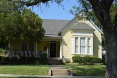 | House at 704 Parker | 3.4 miles | 1987 |
| National Archives record | The nomination case file for reference 10000247 in Record Group 79. |
| Collin County | All 69 listed properties in this county. |