 Block
BlockFrom the record
One of 7 National Register listings published here for Orange County · listed in 2010 · category: Structure.
Sources: the case file at the National Archives · the National Register database, National Park Service
Listed on the National Register of Historic Places in 2010.
One of 7 National Register listings published here for Orange County · listed in 2010 · category: Structure.
Sources: the case file at the National Archives · the National Register database, National Park Service
Regional context, not property-specific evidence. The federal wildfire occurrence database lists 16 fires within 5 miles of Cow Bayou Swing Bridge between 1998 and 2018, burning about 125 acres in total. 2 started naturally. 2 were recorded as arson. Distance is straight-line from the map coordinates, so a fire counted here may appear on a neighbouring settlement's page as well.
| Reported cause | Fires |
|---|---|
| Debris and open burning | 7 |
| Missing data/not specified/undetermined | 4 |
| Natural | 2 |
| Arson/incendiarism | 2 |
| Railroad operations and maintenance | 1 |
The most recent of them, most recent first, with the day each was reported and the service that recorded it.
| Date | Cause | Size | Reported by | Name on the report |
|---|---|---|---|---|
| 23 September 1999 | Missing data/not specified/undetermined | 2.0 acres | Texas A & M Forest Service | not named |
| 21 September 1999 | Missing data/not specified/undetermined | 6.0 acres | Texas A & M Forest Service | not named |
| 5 August 1998 | Missing data/not specified/undetermined | 5.0 acres | Texas A & M Forest Service | not named |
| 23 August 2005 | Natural | 48 acres | Sabine National Wildlife Refuge | 8/23/2005-6 FIRE |
| 13 August 2000 | Arson/incendiarism | 4.0 acres | Texas A & M Forest Service | WOODVILLE - 503 |
| 17 May 2018 | Arson/incendiarism | 6.0 acres | Texas A & M Forest Service | ORANGE 14:37 |
| 15 April 2006 | Railroad operations and maintenance | 25 acres | Texas A & M Forest Service | 538 S 16 |
| 24 March 2002 | Debris and open burning | 1.0 acres | Texas A & M Forest Service | WOODVILLE - 84 |
Regional context, not property-specific evidence. The federal mineral resources record lists 4 workings within 5 miles of Cow Bayou Swing Bridge: 4 producers. All of them still produce. What was taken out: Sand and Gravel, Construction, Clay. Distance is straight-line from the map coordinates, so a quarry counted here may appear on a neighbouring settlement's page as well.
| Where | Site | Commodity | Status | Recorded |
|---|---|---|---|---|
| Alpha Portland Clay Pit | Clay | Producer | ||
| Big Sandy Sand Pit | Sand and Gravel, Construction | Producer | Sand | |
| Big Sandy Sand Pit | Sand and Gravel, Construction | Producer | ||
| R A Mann Bayon Sand Pit | Sand and Gravel, Construction | Producer |
Regional context, not property-specific evidence. The National Weather Service names Bridge City, the town this property stands in, in 28 storm reports between 1997 and 2024: 10 flash flood, 9 hail, 3 flood, 3 thunderstorm wind. The reports record 11 deaths. Each account below is quoted exactly as the forecast office filed it, from the NOAA Storm Events Database, and each date opens the federal record of that event.
| When | Event | Place named | Harm | What the report says |
|---|---|---|---|---|
| August 2017 | Flash Flood | Bridge City | 10 killed, $1,500,000,000 | Widespread 30 to 50 inches of rainfall fell across Orange County during Harvey. This resulted in 27,742 homes being flooded. The hardest hit areas were Orange, Vidor, Orangefield, Pine Forest, West Orange, Rose City, Mauriceville, Rose City, and Lake View. Record crests occurred on the lower Neches and Cow Bayou. The Sabine River was at its highest level since Hurricane Ike in 2008. Water covered and closed portions of Interstate 10 in the county. Only 1 home was reported not flooded in Rose City and the community's drinking water was interrupted for near a month. 10 people perished during the event with 2 of them being from electrocution in a flooded home. |
| March 2012 | Flood | Bridge City | 1 killed, $1,000 | The line of slow moving storms finally departed Southeast Texas in the early morning hours. As water receded a car was found in a ditch in Orange near the Lake Cypress-Mauriceville High School the next day. The driver had driven into the ditch after the rain had stopped during the night and drown. The flood waters from the heavy rain event took a week to recede. |
| October 2013 | Tornado (EF1) | Bridge City | $100,000 | The tornado began south of West Round Bunch Road near Susan Circle and traveled generally west and crossed Highway 87/73 south of Cow Bayou. The tornado then turned northwest to parallel Highway 87/73 after crossing the bayou and moved across FM 1006 and lifted before reaching Western AVE. The tornado was strongest before crossing Highway 87/73 and produced EF1 damage to homes and trees. EF0 damage was done after crossing 87/73. Roofs, carports, sheds and trees were damaged along the path. |
| June 1997 | Heavy Rain | Bridge City | $40,000 | no account filed |
| July 1998 | Thunderstorm Wind | Bridge City | $30,000 | no account filed |
| April 2009 | Flash Flood | Bridge City | $20,000 | KFDM-TV and the public reported widespread flash flooding across Orange County. Several homes in Bridge City and West Orange received minor flooding. |
| October 1998 | Flash Flood | Bridge City | $20,000 | no account filed |
| January 1998 | Flash Flood | Bridge City | $20,000 | no account filed |
| September 2004 | Flash Flood | Bridge City | $10,000 | no account filed |
| September 1997 | Flood | Bridge City | $10,000 | no account filed |
| July 2009 | Thunderstorm Wind | Bridge City | $1,000 | Local media reported power lines blown down in Bridge City. |
| June 2024 | Flash Flood | Bridge City | - | Multiple streets flooded in Bridge City including East Young Drive and Katherine Avenue. Water also covered yards and approached homes. |
| July 2022 | Flash Flood | Bridge City | - | Several inches of rainfall provided mostly minor flooding in Orange and Bridge City, however several streets were closed during the event. |
| September 2021 | Flash Flood | Bridge City | - | Multiple streets in Orange County were flooded while Nicholas moved through the region. Most flooded roads were in West Orange. |
| June 2017 | Flash Flood | Bridge City | - | Posts to social media indicated extensive street flooding in Bridge City and Orange. Many streets were impassable and water approached some structures. |
| September 2017 | Flood | Bridge City | - | Heavy rain from Tropical Storm Harvey caused record or near record flooding along the lower Sabine and Neches Rivers. While the crests of the rivers was during the last couple days of August to the first days of September the rivers remained in major flood stage through the first week. Some roadways and residences remained flooded near the rivers through the first week of the month. |
| April 2016 | Flash Flood | Bridge City | - | Media relayed a video of flooding along Cormier and Cherokee Streets in Vidor. Flooding was also reported along some streets in Pinehurst. Over 5 inches of rain was reported in Orange near the Sabine River. |
| February 2014 | Hail | Bridge City | - | The thunderstorm that produced quarter sized hail in Orangefield traveled east and produced nickel sized hail in Bridge City. |
| August 2010 | Funnel Cloud | Bridge City | - | KBMT-TV reported a funnel cloud in Bridge City, which was confirmed by photos and video. |
| April 2009 | Hail | Bridge City | - | Bridge City Police Department reported penny size hail lasted two minutes. |
| December 2007 | Hail | Bridge City | - | no account filed |
| March 2003 | Hail | Bridge City | - | no account filed |
| August 2003 | Hail | Bridge City | - | no account filed |
| May 2002 | Thunderstorm Wind | Bridge City | - | no account filed |
| May 1999 | Hail | Bridge City | - | no account filed |
| May 1999 | Hail | Bridge City | - | no account filed |
| January 1998 | Hail | Bridge City | - | no account filed |
| March 1998 | Hail | Bridge City | - | no account filed |
No historic map-sheet match is published for this property yet. That does not mean no map exists. This record needs a coordinate-quality review before it can be joined to a sheet boundary. Browse the county's mapped places while that work is pending.
Other National Register properties close enough to walk or drive between, ordered by distance from this one. Both positions come from the same geocoding pass that matched these properties to their map sheets.
| Photograph | Property | Distance | Listed |
|---|---|---|---|
 | Sims House | 5.8 miles | 1980 |
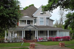 | Joseph and Annie Lucas House | 5.9 miles | 1997 |
 | Lutcher Memorial Church Building | 6.0 miles | 1982 |
 | W. H. Stark House | 6.1 miles | 1976 |
| Navy Park Historic District | 6.9 miles | 1999 |
| National Archives record | The nomination case file for reference 10000252 in Record Group 79. |
| Orange County | All 7 listed properties in this county. |