 Block
BlockFrom the record
One of 13 National Register listings published here for Denton County · listed in 2019 · category: Building.
Sources: the National Register database, National Park Service
Listed on the National Register of Historic Places in 2019.
One of 13 National Register listings published here for Denton County · listed in 2019 · category: Building.
Sources: the National Register database, National Park Service
Regional context, not property-specific evidence. The federal wildfire occurrence database lists 93 fires within 5 miles of Fairhaven Retirement Home between 2005 and 2018, burning about 1,164 acres in total. 2 started naturally. 2 were recorded as arson. Distance is straight-line from the map coordinates, so a fire counted here may appear on a neighbouring settlement's page as well.
| Reported cause | Fires |
|---|---|
| Debris and open burning | 46 |
| Missing data/not specified/undetermined | 27 |
| Equipment and vehicle use | 9 |
| Smoking | 3 |
| Arson/incendiarism | 2 |
| Power generation/transmission/distribution | 2 |
| Natural | 2 |
| Misuse of fire by a minor | 1 |
| Recreation and ceremony | 1 |
The most recent of them, most recent first, with the day each was reported and the service that recorded it.
| Date | Cause | Size | Reported by | Name on the report |
|---|---|---|---|---|
| 4 September 2014 | Debris and open burning | under an acre | Texas A & M Forest Service | 4001 S I-35 EAST |
| 28 September 2014 | Debris and open burning | under an acre | Texas A & M Forest Service | 2444 WEST OAK STREET |
| 24 September 2014 | Debris and open burning | under an acre | Texas A & M Forest Service | 1316 EAST MCKINNEY STREET |
| 24 September 2014 | Debris and open burning | under an acre | Texas A & M Forest Service | 2900 N. LOCUST STREET |
| 2 September 2014 | Debris and open burning | under an acre | Texas A & M Forest Service | N ELM STREET |
| 2 September 2007 | Smoking | 1.0 acres | Texas A & M Forest Service | not named |
| 16 September 2014 | Debris and open burning | under an acre | Texas A & M Forest Service | LONG ROAD |
| 5 August 2008 | Equipment and vehicle use | 40 acres | Texas A & M Forest Service | not named |
Regional context, not property-specific evidence. The federal mineral resources record lists 1 working within 5 miles of Fairhaven Retirement Home: 1 producer. All of them still produce. What was taken out: Sand and Gravel, Construction. Distance is straight-line from the map coordinates, so a quarry counted here may appear on a neighbouring settlement's page as well.
| Where | Site | Commodity | Status | Recorded |
|---|---|---|---|---|
| Denton Pit and Plant No. 536 | Sand and Gravel, Construction | Producer |
Regional context, not property-specific evidence. The National Weather Service names Denton, the town this property stands in, in 179 storm reports between 1993 and 2025: 74 hail, 64 thunderstorm wind, 31 flash flood, 4 lightning. The reports record 5 deaths. Each account below is quoted exactly as the forecast office filed it, from the NOAA Storm Events Database, and each date opens the federal record of that event.
| When | Event | Place named | Harm | What the report says |
|---|---|---|---|---|
| November 1996 | Flash Flood | Denton | 3 killed | no account filed |
| July 2017 | Flood | Denton | 1 killed | A news report indicated that 3 homeless men were swept away by flood waters. Two of the men made it out of the water, but the body of the third man was found in a retention pond behind the Walmart at Rayzor Ranch Marketplace. |
| May 2016 | Flood | Denton | 1 killed | Two homeless people were swept into a canal near Bell Place and McKinney Street around 5 AM Saturday May 14. A female adult was rescued about half a mile downstream. A male was found deceased another half a mile or so downstream near S Loop 288 and Shady Oaks at 10 AM. |
| April 2014 | Hail | Denton | $500,000,000 | Softball sized hail was reported by a trained spotter one-eighth of a mile west of the Texas Woman's Campus in Denton. Additionally, this storm covered much of the city of Denton, and a considerable part of the County as well. The Insurance Council of Texas estimated approximately 35,000 vehicles, and 22,000 homes were damaged in some fashion with this storm. The damage estimate is aproximately 500 million dollars. |
| April 2016 | Hail | Denton | $50,000,000 | A public report indicated grapefruit sized hail near the intersection of Audra Lane and East McKinney St. |
| April 2014 | Hail | Denton | $15,000,000 | Golf ball to hen egg sized hail was reported by a trained spotter 1.8 miles northeast of Denton. |
| April 2014 | Hail | Denton | $12,000,000 | A public report of 3.5 inch diameter hail in Denton. |
| April 2014 | Hail | Denton | $10,000,000 | Ping pong to baseball sized hail was reported by a member of the public in Denton. |
| April 2014 | Hail | Denton | $10,000,000 | A trained spotter reported tennis ball sized hail on the campus of Texas Woman's University in Denton. |
| April 2007 | Flash Flood | Denton | $2,000,000 | Major flash flooding was reported across the county, and more than 60 people were rescued from floodwaters. One observer reported over 10 inches of rain for the day. A roof of an elementary school collapsed due to the weight of the water. About a half foot of water was reported over streets in Shady Shores, Little Elm, the University of North Texas campus, and along I-35 east service roads. A nursing home and a mobile home park were both evacuated due to threatening flood waters. Several roads remained closed for more than 24 hours, including Corbin Road, Mayhill Road, and East Hickory Street. Several roads and guardrails were damaged by the water. Denton County was declared a disaster area and was therefore able to recieve federal aid. At least a hundred people reported flood damage to their local jurisdictions. Some had water 3 feet high in their homes and businesses. |
| April 1997 | Thunderstorm Wind | Denton | $2,000,000 | Many vehicles at an RV dealership in northern Denton were damaged by winds estimated at 80 to 100 mph. Two 18-wheelers were overturned at a truck stop. The roof of an outlet mall was removed and several businesses in the mall sustained major water damage. |
| August 1996 | Thunderstorm Wind | Denton | $1,000,000 | no account filed |
| April 2016 | Hail | Denton | $500,000 | A social media report indicated tennis ball sized hail in Denton, TX. |
| April 2014 | Hail | Denton | $500,000 | Ping pong ball sized hail was reported by a member of the public approximately 2.5 miles north of Denton, TX at Hwy 288. |
| June 2008 | Lightning | Denton | $400,000 | A four-thousand square-foot house in Justin was burned down after lightning struck it. |
| April 2014 | Hail | Denton | $250,000 | Golf ball sized hail was reported by a trained spotter 4 miles north of Denton, TX. |
| April 2019 | Tornado (EF1) | Denton | $200,000 | This tornado formed on the east side of the Texas Woman's University (TWU) campus, initially producing some minor tree damage behind Jones Hall. Moving northeastward, the tornado uprooted several large trees along the edge of the TWU golf course before crossing University Drive. The track continued northeastward through heavily wooded neighborhoods in northeast Denton, snapping or uprooting numerous trees. Several large trees (and many smaller trees/limbs) fell on homes and vehicles, resulting in significant property damage. This tornado crossed Loop 288 and caused some minor tree damage before dissipating near the intersection of Sherman Drive (FM 428) and Hartlee Fields Road. During the vast majority of its lifetime, the tornado produced EF-0 damage on the order of 60- 75 mph. However, tree damage at a couple of locations, particularly just south of University Drive, was consistent with high end EF-0/low end EF-1 intensity winds on the order of 85-90 mph. |
| April 2008 | Thunderstorm Wind | Denton | $200,000 | A commercial building suffered roof damage and a residence in Denton lost part of its roof and had its windows blown in. About half a dozen trees were blown down. The North Texas State Fairgrounds north of Highway 380 sustained about $2,500 in damages when a portion of its roof was blown off. The roof subsequently knocked down power lines. |
| April 2016 | Hail | Denton | $150,000 | A trained spotter reported golf-ball sized hail near the intersection of Locust Dr and University St in Denton, TX. |
| April 2016 | Hail | Denton | $150,000 | A report received via amateur radio indicated golf-ball sized hail in the northeast part of Denton, TX. |
| March 2000 | Lightning | Denton | $125,000 | Lightning struck a vacant new home, setting it on fire. The home was declared a complete loss. |
| May 2020 | Hail | Denton | $100,000 | Multiple reports of hail up to the size of 2 (hen egg) was received around the city of Denton proper. |
| April 2014 | Hail | Denton | $100,000 | Hen egg sized hail was reported by amateur radio in Denton, TX. |
| June 2025 | Flash Flood | Denton | $60,000 | Law enforcement, trained spotters and the public reported several roads across Denton were flooded. A trained spotter reported that South Carroll Avenue, one half mile south of US 380, was impassable due to flooding with stalled vehicles. |
| April 2014 | Hail | Denton | $50,000 | Golf ball sized hail was reported by a member of the broadcast media near the intersection of Interstate 35 and Highway 380. |
| April 2014 | Hail | Denton | $50,000 | Golf ball sized hail was reported by amateur radio in Denton, TX. The public also reported quarter sized hail in Denton at this time. |
| April 2008 | Hail | Denton | $50,000 | Tennis ball size hail was reported in northeast Denton. |
| May 2003 | Thunderstorm Wind | Denton | $50,000 | A widespread swath of damage from straight line winds estimated at 80 mph occurred mainly across the western half of Denton. Approximately 20 wooden power poles were blown down, along with numerous trees and fences. One apartment complex had a section of the roof was blown off, with shingles blown off another apartment complex. |
| July 1994 | Thunderstorm Wind | Denton | $50,000 | Thunderstorm winds did approximately $37,000 damage to a gas station and convenience store. |
| July 1994 | Thunderstorm Wind | Denton | $50,000 | Trees were blown down by high winds, a construction trailer was blown over, and damage occurred to signs and roofs. |
| April 2011 | Hail | Denton | $45,000 | no account filed |
| April 2007 | Tornado (EF0) | Denton | $40,000 | The tornado touched down near the community of Lincoln Park. Damage was concentrated to a small area and was mainly inflicted on a restaurant and adjacent grounds. Roof damage to the restaurant was significant. Trees limbs were snapped and a gas station sign was damaged. A nearby trailer was rolled about 20 feet. Wind speeds were estimated at 70-75 MPH. |
| February 2001 | Thunderstorm Wind | Denton | $30,000 | High winds blew down seven utility poles, unroofed a business, did heavy roof damage to a church, damaged the roof of a courthouse, blew down fences and trees, and damaged several schools. |
| November 1996 | Flash Flood | Denton | $30,000 | no account filed |
| May 2020 | Hail | Denton | $25,000 | Hail report received via mPing. |
| April 2011 | Thunderstorm Wind | Denton | $25,000 | A church suffered significant roof damage in the city of Denton. Several trees were also snapped at North Lakes Park in Denton. |
| April 2008 | Hail | Denton | $25,000 | Golfball-size hail was reported over south Denton. |
| May 2007 | Flash Flood | Denton | $25,000 | A woman and four children had to be rescued when their SUV stalled in high water on Foundation Street near Highway 377. The water was halfway up the sides of the vehicle. Old Stony Road near the Wise County line was closed after parts of it washed out. |
| May 2024 | Thunderstorm Wind | Denton | $20,000 | Guinn Hall at TWU in Denton gusted 83 mph. Trees were also reported down around downtown Denton. |
| April 2014 | Thunderstorm Wind | Denton | $20,000 | Numerous reports of tree damage in the city of Denton. |
| April 2008 | Thunderstorm Wind | Denton | $20,000 | A large tree crashed through a ceiling at a residence. |
| February 2000 | Thunderstorm Wind | Denton | $20,000 | Two trailers were blown off their foundations on the east side of Denton. |
| August 1996 | Thunderstorm Wind | Denton | $20,000 | no account filed |
| June 2018 | Thunderstorm Wind | Denton | $15,000 | The Automated Surface Observation System measured a wind gust of 67 MPH at Denton Enterprise Airport. |
| March 2016 | Hail | Denton | $15,000 | Hail up to the size of golf balls was reported 6 miles west of the city of Denton near Highway 380 and FM 156. |
| June 2011 | Thunderstorm Wind | Denton | $15,000 | Three to four inch diameter trees were snapped at the ground 2 miles southwest of Denton. Other large tree branches were also snapped around the city of Denton and its vicinity. Some of the broken tree branches damaged cars. |
| May 2024 | Thunderstorm Wind | Denton | $10,000 | A 66 mph wind gust was reported at TWU. |
| October 2004 | Lightning | Denton | $10,000 | Lightning struck two homes, causing moderate electrical damage to one, and blowing a hole in the roof of the other. |
| April 2014 | Hail | Denton | $8,000 | Golf ball to hen egg sized hail was reported by a trained spotter near the intersection of Interstate 35 and Highway 288. |
| April 2011 | Thunderstorm Wind | Denton | $8,000 | Large tree branches were knocked down in Denton. At least one large branch landed on the roof of a house. |
| August 2005 | Thunderstorm Wind | Denton | $8,000 | Two power lines knocked down and an awning ripped off a roof. |
| April 2015 | Thunderstorm Wind | Denton | $7,000 | An amateur radio operator estimated 60 mph winds approximately 2 miles north of Denton. |
| April 2011 | Thunderstorm Wind | Denton | $7,000 | The county Emergency Manager estimated 70 mph winds near Interstate 35 and Mayhill Rd. |
| April 2016 | Hail | Denton | $6,000 | Amateur radio spotters reported golf ball sized hail approximately two miles north of the city of Denton. |
| September 2025 | Thunderstorm Wind | Denton | $5,000 | A 68 mph wind gust was measured at TWU in Denton. |
| September 2025 | Thunderstorm Wind | Denton | $5,000 | A 64 mph wind gust was measured at Hwy 288 and I-35 on the north side of Denton. |
| October 2014 | Hail | Denton | $5,000 | Amateur radio reported golf ball sized hail near the intersection of Interstate 35 and Hwy 288 on the north side of Denton. |
| October 2014 | Thunderstorm Wind | Denton | $5,000 | Emergency management reported that power poles were blown down on Highway 380 on the west side of Denton, TX. |
| February 2001 | Thunderstorm Wind | Denton | $5,000 | A mobile home was damaged just east of Denton. |
| May 2001 | Thunderstorm Wind | Denton | $5,000 | Wind damaged trees and a barn. |
No historic map-sheet match is published for this property yet. That does not mean no map exists. This record needs a coordinate-quality review before it can be joined to a sheet boundary. Browse the county's mapped places while that work is pending.
Other National Register properties close enough to walk or drive between, ordered by distance from this one. Both positions come from the same geocoding pass that matched these properties to their map sheets.
| Photograph | Property | Distance | Listed |
|---|---|---|---|
 | Pioneer Woman Monument | 0.9 miles | 2018 |
| Denton County Courthouse Square Historic District | 0.9 miles | 2000 | |
 | Denton County Courthouse | 1.5 miles | 1977 |
| West Denton Residential Historic District | 1.5 miles | 2021 | |
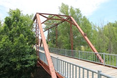 | Rector Road Bridge at Clear Creek | 6.6 miles | 2004 |
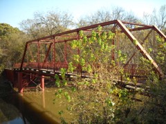 | Old Alton Bridge | 7.5 miles | 1988 |
| National Archives record | The nomination case file for reference 100004431 in Record Group 79. |
| Denton County | All 13 listed properties in this county. |