 Block
BlockFrom the record
One of 316 National Register listings published here for Harris County · listed in 2010 · category: Building.
Sources: the case file at the National Archives · the National Register database, National Park Service
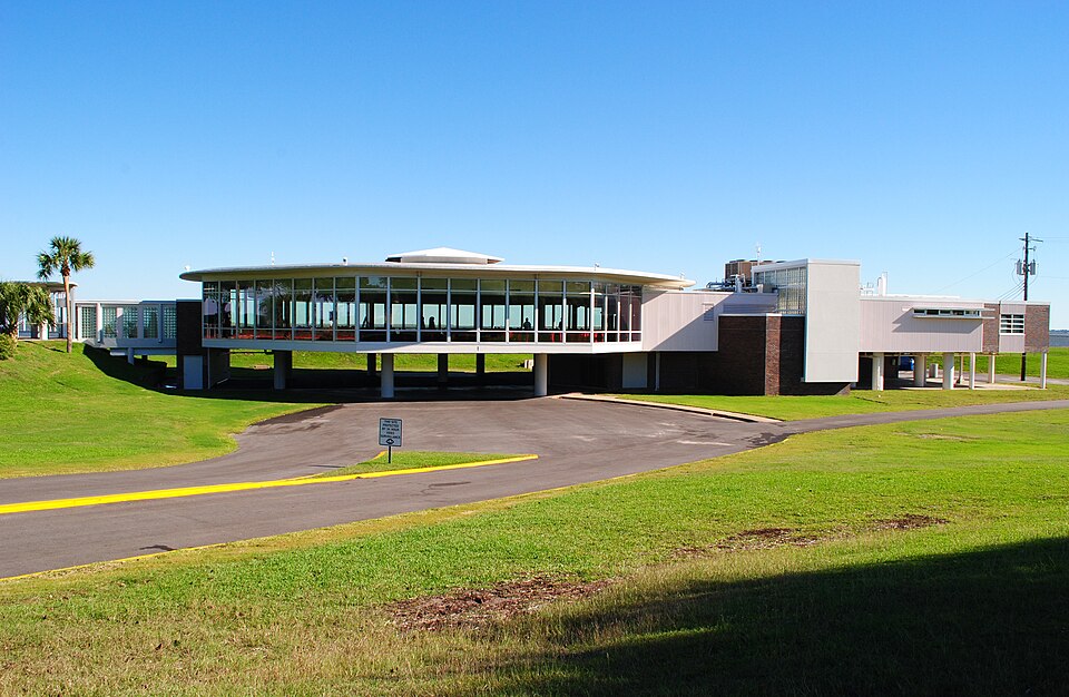
Listed on the National Register of Historic Places in 2010.
One of 316 National Register listings published here for Harris County · listed in 2010 · category: Building.
Sources: the case file at the National Archives · the National Register database, National Park Service
Regional context, not property-specific evidence. The federal wildfire occurrence database lists 3 fires within 5 miles of Sylvan Beach Pavilion between 1992 and 2015, burning about 4 acres in total. None started naturally. None was recorded as arson. Distance is straight-line from the map coordinates, so a fire counted here may appear on a neighbouring settlement's page as well.
| Reported cause | Fires |
|---|---|
| Equipment and vehicle use | 1 |
| Debris and open burning | 1 |
| Missing data/not specified/undetermined | 1 |
The most recent of them, most recent first, with the day each was reported and the service that recorded it.
| Date | Cause | Size | Reported by | Name on the report |
|---|---|---|---|---|
| 24 September 2015 | Debris and open burning | under an acre | Texas A & M Forest Service | DYGLIESHA JEFFERSON |
| 12 September 1992 | Missing data/not specified/undetermined | 2.0 acres | Texas Point National Wildlife Refuge | TPHATFIELD |
| 4 October 2015 | Equipment and vehicle use | 2.0 acres | Texas A & M Forest Service | C15-13570 |
Regional context, not property-specific evidence. The federal mineral resources record lists 3 workings within 5 miles of Sylvan Beach Pavilion: 2 producers, 1 occurrence. 2 still produce. What was taken out: Perlite, Perlite, Vermiculite, Halite. Distance is straight-line from the map coordinates, so a quarry counted here may appear on a neighbouring settlement's page as well.
| Where | Site | Commodity | Status | Recorded |
|---|---|---|---|---|
| Cedar Point Salt Dome | Halite | Occurrence | 1938 | |
| Filter Media Inc | Perlite, Vermiculite | Producer | ||
| Laporte Perlite Plant | Perlite | Producer |
Regional context, not property-specific evidence. The National Weather Service names La Porte, the town this property stands in, in 22 storm reports between 1995 and 2025: 8 thunderstorm wind, 6 tornado, 5 hail, 2 flash flood. The reports record 2 injuries. Each account below is quoted exactly as the forecast office filed it, from the NOAA Storm Events Database, and each date opens the federal record of that event.
| When | Event | Place named | Harm | What the report says |
|---|---|---|---|---|
| March 2017 | Tornado (EF1) | La Porte | 2 hurt, $300,000 | This EF-1 was the third brief tornado with the larger mesocyclone associated with the HP supercell which moved across La Porte and Morgans Point. This couplet |was well defined on the Houston Hobby terminal doppler radar which spun up quickly|along the north side of strong westerly outflow winds from the initial couplet that was responsible for two earlier weak tornadoes near and in parts of La Porte. This tornado was witnessed to start near the railroad tracks near Highway 146 and it tracked east southeastward across the Barbours Cut Port Facility and parts of Morgans Point. Much of the more significant damage was to industrial areas around the Port complex. Large steel storage tanks were bent inward from the wind, and many large, metal shipping containers were toppled over. The tornado lifted near the eastern end of Morgans Point near the Ship Channel. Estimated peak winds were around 105 mph. |
| March 2002 | Tornado (F3) | La Porte | $350,000 | This Tornado began its path in the Shoreacres subdivision, 3 miles south of La Porte, with a home on Greenleaf Road receiving structural and roof damage (F1), then moved northeast and partially demolished a Super Mart on Broadway (F3), then ripped through an apartment complex across the street causing major roof and window damage and knocking down trees (F2), collapsing a car garage and destroying at least one car. Just northeast of the apartments, a few homes had minor damage with fences and large trees down. On Carlisle Street, in the Bayside Terrace subdivision, a few homes had minor roof damage, yard trees down, and debris from the convenience store, while part of the roof off the Super Mart dropped onto a Truck parked at the north end of Carlisle next to Galveston Bay. No injuries were reported. A survey was conducted. |
| April 2015 | Flash Flood | La Porte | $300,000 | There were numerous reports of flooded roadways and stranded vehicles in high water in and around the city of Houston, Bellaire, Pasadena, La Porte and the Clear Lake/Webster areas. There were fire department high water rescues over the southeastern sector of the county. Impassable roads due to high flood waters include, but are not limited to, South Shepard Street, West Alabama Street, Westheimer Street, Bellaire Blvd, Spur 527 off of Highway 59, Scarsdale Blvd in Pasadena and southbound feeder roads of I-45 around Hobby Airport. There was water in a home off of Scarsdale Blvd in Pasadena. There were approximately 40 flooded homes in the town of La Porte. |
| July 2005 | Thunderstorm Wind | La Porte | $115,000 | Gate and roof damage, overturned trailers and car windows blown out around a chemical plant. |
| April 1995 | Tornado (F0) | La Porte | $50,000 | The roof of a business in La Porte was damaged by a tornado. |
| September 1999 | Hail | La Porte | $15,000 | no account filed |
| May 2014 | Thunderstorm Wind | La Porte | $13,000 | A severe thunderstorm wind gust overturned an 18 wheeled truck on the Fred Hartman Bridge. |
| July 2005 | Thunderstorm Wind | La Porte | $10,000 | Power line down along with residential roof and trailer park damage. |
| May 1999 | Thunderstorm Wind | La Porte | $10,000 | Wind gust of 60 mph at Baytown-La Porte bridge. |
| May 1999 | Hail | La Porte | $10,000 | no account filed |
| June 1997 | Hail | La Porte | $5,000 | Hail at Sealand Marine. |
| June 1997 | Thunderstorm Wind | La Porte | $5,000 | Powerlines blown down at Sealand Marine. |
| January 1998 | Hail | La Porte | $5,000 | no account filed |
| October 2003 | Tornado (F0) | La Porte | $3,000 | Tornado caused damage to trees and to a storefront window near the intersection of Fairmont and Broadway Avenues. Originated as a waterspout over Galveston Bay. |
| April 2003 | Hail | La Porte | $3,000 | no account filed |
| March 2025 | Thunderstorm Wind | La Porte | - | Mesonet station 9221D at Morgan's Point measured a 58 mph wind gust. |
| May 2024 | Thunderstorm Wind | La Porte | - | Wind gust occurred at mesonet station 9221D Morgan's Point. |
| April 2024 | Flash Flood | La Porte | - | Multiple streets were flooded due to heavy rain in La Porte. |
| July 2019 | Thunderstorm Wind | La Porte | - | Trees were uprooted. |
| April 2004 | Funnel Cloud | La Porte | - | Sighted by law enforcement. |
| October 2001 | Tornado (F0) | La Porte | - | A meteorologist reported a tornado near Highway 225. |
| September 1998 | Tornado (F1) | La Porte | - | Tornado touchdown caused moderate damage to homes and apartments. Damage included in T.S. Frances summary. |
No historic map-sheet match is published for this property yet. That does not mean no map exists. This record needs a coordinate-quality review before it can be joined to a sheet boundary. Browse the county's mapped places while that work is pending.
Other National Register properties close enough to walk or drive between, ordered by distance from this one. Both positions come from the same geocoding pass that matched these properties to their map sheets.
| Photograph | Property | Distance | Listed |
|---|---|---|---|
 | Sterling, Ross,S., House | 1.4 miles | 1982 |
| Morgan's Point Historic District | 1.6 miles | 1994 | |
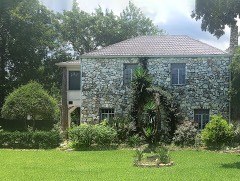 | Walker House | 2.3 miles | 2012 |
| K'nesseth Israel Synagogue | 6.2 miles | 2024 | |
| James and Jessie West Mansion | 7.5 miles | 1994 | |
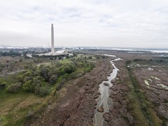 | San Jacinto Battlefield | 7.8 miles | 1966 |
| National Archives record | The nomination case file for reference 10000738 in Record Group 79. |
| Harris County | All 316 listed properties in this county. |