 Block
BlockFrom the record
One of 159 National Register listings published here for Dallas County · listed in 2023 · category: Building.
Sources: the National Register database, National Park Service
Listed on the National Register of Historic Places in 2023.
One of 159 National Register listings published here for Dallas County · listed in 2023 · category: Building.
Sources: the National Register database, National Park Service
Regional context, not property-specific evidence. The federal wildfire occurrence database lists 66 fires within 5 miles of Garland Bank & Trust Company between 2001 and 2018, burning about 291 acres in total. None started naturally. 1 was recorded as arson. Distance is straight-line from the map coordinates, so a fire counted here may appear on a neighbouring settlement's page as well.
| Reported cause | Fires |
|---|---|
| Missing data/not specified/undetermined | 53 |
| Equipment and vehicle use | 9 |
| Arson/incendiarism | 1 |
| Power generation/transmission/distribution | 1 |
| Recreation and ceremony | 1 |
| Debris and open burning | 1 |
The most recent of them, most recent first, with the day each was reported and the service that recorded it.
| Date | Cause | Size | Reported by | Name on the report |
|---|---|---|---|---|
| 5 September 2015 | Missing data/not specified/undetermined | under an acre | Texas A & M Forest Service | WATERCHASE |
| 26 September 2015 | Missing data/not specified/undetermined | under an acre | Texas A & M Forest Service | LA PRADA |
| 19 September 2015 | Missing data/not specified/undetermined | under an acre | Texas A & M Forest Service | EL CAPITAN |
| 19 September 2015 | Missing data/not specified/undetermined | under an acre | Texas A & M Forest Service | CACTUS |
| 13 September 2015 | Missing data/not specified/undetermined | under an acre | Texas A & M Forest Service | MCCREE |
| 9 August 2016 | Missing data/not specified/undetermined | under an acre | Texas A & M Forest Service | 9750 WALNUT |
| 9 August 2001 | Missing data/not specified/undetermined | 250 acres | Texas A & M Forest Service | NORTH BRANCH - 3 |
| 30 August 2015 | Missing data/not specified/undetermined | under an acre | Texas A & M Forest Service | LOCHWOOD |
Regional context, not property-specific evidence. The federal mineral resources record lists 1 working within 5 miles of Garland Bank & Trust Company: 1 producer. All of them still produce. What was taken out: Stone, Crushed/Broken. Distance is straight-line from the map coordinates, so a quarry counted here may appear on a neighbouring settlement's page as well.
| Where | Site | Commodity | Status | Recorded |
|---|---|---|---|---|
| Pilliaro Pit & Mill | Stone, Crushed/Broken | Producer |
Regional context, not property-specific evidence. The National Weather Service names Garland, the town this property stands in, in 106 storm reports between 1994 and 2025: 46 hail, 39 thunderstorm wind, 20 flash flood, 1 tornado. The reports record 3 deaths and 1 injury. Each account below is quoted exactly as the forecast office filed it, from the NOAA Storm Events Database, and each date opens the federal record of that event.
| When | Event | Place named | Harm | What the report says |
|---|---|---|---|---|
| June 2021 | Flash Flood | Garland | 1 killed | A woman drowned after her car was surrounded by water while trying to cross Spring Creek on Holford Drive in Garland. Her car was swept downstream. |
| June 2007 | Flash Flood | Garland | 1 killed | Swift water rescues were required, and a boy drowned during a rescue attempt in Duck Creek in Garland. |
| December 1998 | Flash Flood | Garland | 1 killed | A woman was swept away and drowned as she fled her stalled car, in Duck Creek, to move to higher ground. |
| March 2016 | Thunderstorm Wind | Garland | 1 hurt, $10,000 | Garland P.D. reported damage to buildings and vehicles at the 2600 block of Industrial lane in Garland, TX. One injury was also reported. |
| October 2019 | Tornado (EF2) | Garland | $400,000,000 | The tornado started on Kenmore Street just north of West Miller Road where part of a Sears Facility warehouse was heavily damaged. A wide section of the metal roof was peeled off and subsequently the adjacent metal walls were also torn away. Some of the interior support columns and beams were bent, causing another part of the roof to collapse. In addition, an empty 18 wheeler was tipped over and a van was also on its side. The tornado then struck a newly built warehouse to the east of this facility where nearly the entire building collapsed. The interior support columns were bent to the ground in this facility as the pre-case concrete tilt-up walls collapsed to the east. The damage to these two facilities indicated high end EF-2 damage with winds of 135 mph. Damage from the second warehouse was blown into the adjacent neighborhood to the east across Shiloh Road and damaged some homes. The tornado also snapped and uprooted many trees and damaged many roofs and homes along its path through the residential area from Shiloh Road to Garland Avenue. Roof damage consisted of a combination of loss of decking and shingles. Some roofs were also damaged by fallen trees and other debris. One house in particular on the corner of Westway Avenue and Patricia Lane sustained damage to the garage which partially collapsed. Damage in this neighborhood was consistent of EF-0 and EF-1 damage. The tornado then moved across Garland Ave towards Central Park damaging more roofs and trees near Degge Circle, and then damaging baseball fields and fences at the park. The tornado continued northeast from the park causing minor damage as it weakened, dissipating near Avenue D and Santa Fe Street. |
| March 1995 | Hail | Garland | $10,000,000 | Large hail broke windows and damaged homes, businesses, and automobiles. |
| April 2012 | Hail | Garland | $600,000 | Golf ball sized hail was reported near Williams Stadium in Garland. |
| September 2023 | Hail | Garland | $150,000 | Several reports of hail up to 2.5 hail was reported in northern Garland via mPing and the public. |
| September 2023 | Hail | Garland | $50,000 | Reports from mPing of 1-2 hail across northern Garland. |
| April 2011 | Hail | Garland | $50,000 | Golfball sized hail fell in Garland. |
| April 2011 | Thunderstorm Wind | Garland | $50,000 | Spotters estimated 80 mph winds in Garland along with golfball sized hail. |
| April 2011 | Hail | Garland | $50,000 | Golfball sized hail fell in Garland. |
| April 2011 | Thunderstorm Wind | Garland | $50,000 | Spotters measured a 64 mph wind gust along with nickel sized hail in Garland. |
| April 2011 | Thunderstorm Wind | Garland | $50,000 | Spotters measured a 74 mph wind gust in Garland. |
| May 2013 | Thunderstorm Wind | Garland | $30,000 | A trained spotter measured a wind gust of 69 mph in Garland. |
| September 2007 | Flash Flood | Garland | $25,000 | The following intersections were barricaded due to flooding: Wynn-Joyce Road and Country Club Road and 1st Street and Avenue D. Several cars were flooded. |
| May 2015 | Flash Flood | Garland | $20,000 | A social media report relayed a message from Garland PD stating that cars had been swept from driveways near Duck Creek at the intersection of Glenbrook and Carroll Drives. |
| August 2005 | Thunderstorm Wind | Garland | $20,000 | A tree was blown onto a car in an apartment complex. |
| September 2023 | Hail | Garland | $15,000 | Reported via mPing. |
| March 2008 | Flash Flood | Garland | $15,000 | A high water rescue was required in north Garland after an SUV drove into high water. |
| September 2011 | Hail | Garland | $15,000 | no account filed |
| June 2019 | Thunderstorm Wind | Garland | $10,000 | A trained spotter reported numerous trees down across northern Dallas County including the Garland and Buckner areas. One tree was reported to be blown onto a house. |
| May 2013 | Thunderstorm Wind | Garland | $10,000 | A sustained wind of 58 mph was measured at a home in Garland. Report came in through e-spotter. |
| October 2011 | Thunderstorm Wind | Garland | $10,000 | A 70 MPH wind gust was reported in Garland by a trained spotter. Limbs up to 5 inches in diameter were knocked down and hail covered the ground. In addition, the strong winds knocked a Chick-Fil-A cow off a billboard along LBJ Freeway in Garland. One accident occurred due to the debris on the highway. |
| October 2011 | Thunderstorm Wind | Garland | $10,000 | Tree branches were covering the road along Douglas Street in Garland. At least two tree branches fell on cars, damaging two cars. |
| August 2025 | Flash Flood | Garland | $5,000 | Garland PD closed Northwest Hwy at LBJ due to 2-3 feet of water on the roadway, and South 1st St at Centerville Rd and Duck Creek Dr was flooded. |
| October 2018 | Thunderstorm Wind | Garland | $5,000 | Broadcast media reported downed power lines in the city of Garland, TX. |
| March 2017 | Thunderstorm Wind | Garland | $5,000 | Emergency management reported that a shed was destroyed, and wind damage to both the roof and the outer wall of a home occurred in the city of Garland, TX. |
| October 2014 | Thunderstorm Wind | Garland | $5,000 | Emergency management reported several mature trees and numerous power outages throughout south and central portions of Garland, TX. |
| July 2009 | Hail | Garland | $5,000 | Quarter to Golfball size hail fell in the city of Garland. |
| April 1999 | Thunderstorm Wind | Garland | $5,000 | Thunderstorms winds blew down several trees. A tree was blown onto the roof of a house and chimneys were blown off several roofs. |
| November 1994 | Thunderstorm Wind | Garland | $5,000 | Power lines were blown down by high winds. |
| October 2011 | Hail | Garland | $4,000 | Hail up to the size of quarters fell for several minutes in Garland. In some places, the hail completely covered the ground. A skylight was damaged by the hail. |
| August 2013 | Thunderstorm Wind | Garland | $3,000 | Emergency management reported trees down, and a steeple and air conditioning unit blown off a church. |
| March 2023 | Thunderstorm Wind | Garland | $2,000 | Fence damage and large tree limbs broken in Garland. |
| April 1995 | Thunderstorm Wind | Garland | $2,000 | Power lines were blown down in South Garland. |
| June 1996 | Thunderstorm Wind | Garland | $2,000 | no account filed |
| April 1996 | Thunderstorm Wind | Garland | $2,000 | no account filed |
| March 2017 | Thunderstorm Wind | Garland | $1,000 | Emergency management reported shingles removed from a home in Garland, TX. |
| January 2025 | Flash Flood | Garland | - | Law enforcement reported several roads flooded and closed in Garland including Campbell Rd at Water Oak Dr, E. Campbell Rd at Kinnertone Ln, Naaman Rd at E. Brand Rd, Naaman at E. Kingsbridge Dr, Castle Dr at Lost Pines Ln, and Castle Dr at Hickox Rd. |
| May 2025 | Hail | Garland | - | Spotter reported 1 inch hail in Garland. |
| May 2025 | Hail | Garland | - | Social media picture of half dollar sized hail in North Garland. |
| May 2025 | Hail | Garland | - | Report from mPING: Quarter (1.00 in.). |
| March 2023 | Thunderstorm Wind | Garland | - | A 68 mph wind gust was reported by an emergency manager in Garland. |
| April 2023 | Hail | Garland | - | A public report indicated nickel sized hail in Garland. |
| September 2023 | Hail | Garland | - | Reported via mPing. |
| September 2023 | Hail | Garland | - | Reported via mPing. |
| March 2022 | Hail | Garland | - | A public report indicated nickel to quarter sized hail near Belt Line Rd and Crist Rd in Garland. |
| March 2022 | Hail | Garland | - | A public report indicated nickel sized hail in Garland, TX. |
| June 2021 | Flash Flood | Garland | - | Flood gates were closed along Naaman School Road between Brand Road and Miles Road, and between Pleasant Valley Road and Castle Road. Part of the road was inundated by the rising of Spring Creek that crosses the road. |
| June 2019 | Hail | Garland | - | Garland Police Department reported ping pong ball size hail in the city of Garland, TX. |
| July 2017 | Hail | Garland | - | A trained spotter reported quarter-sized hail in the city of Garland, TX. |
| April 2016 | Hail | Garland | - | A trained spotter reported nickel-sized hail near the intersection of Interstate 30 and Bobtown Road in Garland, TX. |
| March 2016 | Hail | Garland | - | Quarter sized hail was reported in the northern portions of Garland. |
| May 2015 | Flash Flood | Garland | - | A social media report indicated that water was approaching the doors of one home on Resistol Rd in Garland, TX. |
| May 2015 | Flash Flood | Garland | - | Emergency management reported that Duck Creek in Garland, TX was out of its banks and rising. |
| June 2012 | Hail | Garland | - | Penny sized hail was reported at the Firewheel Town Center in Sachse. |
| April 2012 | Hail | Garland | - | Quarter to half dollar sized hail was reported in Garland. |
| October 2011 | Hail | Garland | - | Quarter sized hail was reported by a trained spotter at the intersection of North Shiloh Road and West Buckingham Road in Garland. |
| October 2011 | Hail | Garland | - | Nickel sized hail was reported along Douglas Street in Garland. |
No historic map-sheet match is published for this property yet. That does not mean no map exists. This record needs a coordinate-quality review before it can be joined to a sheet boundary. Browse the county's mapped places while that work is pending.
Other National Register properties close enough to walk or drive between, ordered by distance from this one. Both positions come from the same geocoding pass that matched these properties to their map sheets.
| Photograph | Property | Distance | Listed |
|---|---|---|---|
| Travis College Hill Historic District | 0.3 miles | 2017 | |
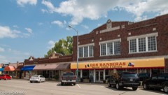 | Garland Downtown Historic District (Boundary Increase) | 0.6 miles | 2017 |
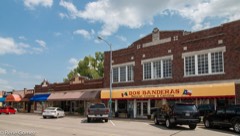 | Garland Downtown Historic District | 0.6 miles | 2017 |
 | DeGolyer Estate | 7.4 miles | 1978 |
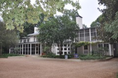 | Alfred and Juanita Bromberg House | 8.0 miles | 2008 |
| National Archives record | The nomination case file for reference 100008552 in Record Group 79. |
| Dallas County | All 159 listed properties in this county. |