 Block
BlockFrom the record
One of 24 National Register listings published here for Fayette County · listed in 1979 · category: Structure.
Sources: the case file at the National Archives · the National Register database, National Park Service
Listed on the National Register of Historic Places in 1979.
One of 24 National Register listings published here for Fayette County · listed in 1979 · category: Structure.
Sources: the case file at the National Archives · the National Register database, National Park Service
Regional context, not property-specific evidence. The federal wildfire occurrence database lists 40 fires within 5 miles of Schulenburg Cotton Compress between 1999 and 2013, burning about 222 acres in total. None started naturally. None was recorded as arson. Distance is straight-line from the map coordinates, so a fire counted here may appear on a neighbouring settlement's page as well.
| Reported cause | Fires |
|---|---|
| Debris and open burning | 22 |
| Missing data/not specified/undetermined | 10 |
| Equipment and vehicle use | 5 |
| Smoking | 3 |
The most recent of them, most recent first, with the day each was reported and the service that recorded it.
| Date | Cause | Size | Reported by | Name on the report |
|---|---|---|---|---|
| 23 September 2012 | Equipment and vehicle use | 8.0 acres | Texas A & M Forest Service | GRASS FIRE |
| 16 September 2008 | Debris and open burning | 3.0 acres | Texas A & M Forest Service | not named |
| 15 September 2006 | Missing data/not specified/undetermined | 1.0 acres | Texas A & M Forest Service | not named |
| 13 September 2008 | Smoking | 1.0 acres | Texas A & M Forest Service | not named |
| 11 September 2008 | Missing data/not specified/undetermined | 35 acres | Texas A & M Forest Service | not named |
| 1 September 2013 | Missing data/not specified/undetermined | 1.0 acres | Texas A & M Forest Service | HIGH HILL |
| 30 August 2008 | Debris and open burning | 5.0 acres | Texas A & M Forest Service | not named |
| 30 August 2008 | Debris and open burning | 2.0 acres | Texas A & M Forest Service | not named |
Regional context, not property-specific evidence. The National Weather Service names Schulenburg, the town this property stands in, in 23 storm reports between 1993 and 2026: 9 hail, 7 thunderstorm wind, 6 flash flood, 1 funnel cloud. The reports record 1 death. Each account below is quoted exactly as the forecast office filed it, from the NOAA Storm Events Database, and each date opens the federal record of that event.
| When | Event | Place named | Harm | What the report says |
|---|---|---|---|---|
| April 2009 | Flash Flood | Schulenburg | 1 killed, $10,000 | A law enforcement official reported a stalled car in an underpass in Schulenburg with the water rising rapidly. The car was on Highway 77 and the car stalled while going underneath the railroad underpass. An elderly couple was in the car. The woman was rescued, the elderly man drowned. |
| April 2002 | Thunderstorm Wind | Schulenburg | $50,000 | A severe downburst blew over trees and knocked down large tree limbs in the Schulenburg area. |
| August 1998 | Thunderstorm Wind | Schulenburg | $30,000 | no account filed |
| April 2026 | Thunderstorm Wind | Schulenburg | $10,000 | A thunderstorm produced wind gusts estimated at 60 mph. The wind knocked down a tree and caused some minor structural damage in southwestern portions of Schulenburg. |
| May 1997 | Thunderstorm Wind | Schulenburg | $5,000 | Severe winds blew over trees and power lines in Schulenburg. |
| April 2026 | Flash Flood | Schulenburg | - | Thunderstorms produced heavy rain that led to flash flooding. Local media reported three feet of water over Hwy 77 under the Union Pacific Railroad bridge in Schulenburg. |
| May 2025 | Hail | Schulenburg | - | A thunderstorm produced nickel to quarter size hail in Schulenburg. |
| May 2025 | Hail | Schulenburg | - | A thunderstorm produced nickel size hail in Schulenburg. |
| January 2024 | Flash Flood | Schulenburg | - | Thunderstorms produced heavy rain that led to flash flooding closing several low water crossings in the Schulenburg area. |
| May 2021 | Thunderstorm Wind | Schulenburg | - | A thunderstorm produced wind gusts measured at 55 kts. by a Davis Weather station in Schulenburg. |
| May 2019 | Hail | Schulenburg | - | A thunderstorm produced quarter size hail in Schulenburg. Report was from Twitter. |
| April 2015 | Thunderstorm Wind | Schulenburg | - | A thunderstorm produced wind gusts estimated at 70 mph knocked down trees and powerlines. |
| August 2011 | Thunderstorm Wind | Schulenburg | - | A thunderstorm produced wind gusts estimated at 60 mph. There were power outages across the city of Schulenburg. |
| November 2007 | Flash Flood | Schulenburg | - | During the morning of November 18 thunderstorms moved over northern parts of Fayette County and produced 3 to 3.5 inches of rain after the county had seen over 4 inches overnight (CoCoRAHS observer La Grange 10.2NW reported 7.96 inches in 24 hours ending at 8 AM). Runoff from this additional rain led to flash flooding. Farm to market road 957 southwest of Schulenburg was closed due to water over the road. |
| June 2004 | Flash Flood | Schulenburg | - | Late night showers and thunderstorms dropped between 3 and 4 inches of rain in the Schulenburg area. Roads were reported under water until just before midnight. |
| February 1993 | Hail | Schulenburg | - | Several reports of large hail were made in the county. Golf ball-size hail was reported by a rainfall observer west of Fayette. A weather observer reported quarter-size hail in Schulenburg, nickel-size hail was also reported by a radio station in town a few minutes later. The public reported golf ball-size hail in downtown Flatonia. |
| February 1993 | Hail | Schulenburg | - | Several reports of large hail were made in the county. Golf ball-size hail was reported by a rainfall observer west of Fayette. A weather observer reported quarter-size hail in Schulenburg, nickel-size hail was also reported by a radio station in town a few minutes later. The public reported golf ball-size hail in downtown Flatonia. |
| May 2011 | Hail | Schulenburg | - | no account filed |
| May 2011 | Hail | Schulenburg | - | no account filed |
| March 2005 | Hail | Schulenburg | - | no account filed |
| December 2002 | Funnel Cloud | Schulenburg | - | no account filed |
| June 1998 | Hail | Schulenburg | - | no account filed |
| June 1996 | Flash Flood | Schulenburg | - | no account filed |
No historic map-sheet match is published for this property yet. That does not mean no map exists. This record needs a coordinate-quality review before it can be joined to a sheet boundary. Browse the county's mapped places while that work is pending.
Other National Register properties close enough to walk or drive between, ordered by distance from this one. Both positions come from the same geocoding pass that matched these properties to their map sheets.
| Photograph | Property | Distance | Listed |
|---|---|---|---|
 | Bedstead Truss Bridge | 0.2 miles | 2013 |
 | Sengelmann Hall and City Meat Market Building | 0.5 miles | 2009 |
 | Nativity of Mary, Blessed Virgin Catholic Church | 2.8 miles | 1983 |
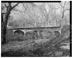 | East Navidad River Bridge | 3.0 miles | 2014 |
| Simon Pytlovany House | 5.0 miles | 1975 | |
| Dubina Historic District | 5.8 miles | 2003 |
| National Archives record | The nomination case file for reference 79002938 in Record Group 79. |
| Fayette County | All 24 listed properties in this county. |