 Block
BlockFrom the record
One of 101 National Register listings published here for Bastrop County · listed in 1982 · category: District.
Sources: the case file at the National Archives · the National Register database, National Park Service
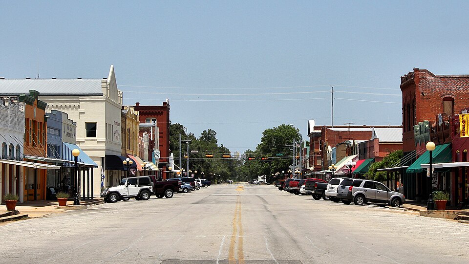
Listed on the National Register of Historic Places in 1982.
One of 101 National Register listings published here for Bastrop County · listed in 1982 · category: District.
Sources: the case file at the National Archives · the National Register database, National Park Service
Regional context, not property-specific evidence. The federal wildfire occurrence database lists 71 fires within 5 miles of Smithville Commercial Historic District between 1992 and 2020, burning about 5,234 acres in total. 7 started naturally. None was recorded as arson. Distance is straight-line from the map coordinates, so a fire counted here may appear on a neighbouring settlement's page as well.
| Reported cause | Fires |
|---|---|
| Debris and open burning | 30 |
| Missing data/not specified/undetermined | 18 |
| Equipment and vehicle use | 8 |
| Natural | 7 |
| Smoking | 3 |
| Power generation/transmission/distribution | 2 |
| Misuse of fire by a minor | 1 |
| Fireworks | 1 |
| Recreation and ceremony | 1 |
The most recent of them, most recent first, with the day each was reported and the service that recorded it.
| Date | Cause | Size | Reported by | Name on the report |
|---|---|---|---|---|
| 8 September 2012 | Debris and open burning | 1.0 acres | Texas A & M Forest Service | PARK RD FIRE |
| 4 September 2000 | Missing data/not specified/undetermined | 3.0 acres | Texas A & M Forest Service | SOUTH BRANCH - 102 |
| 24 September 2011 | Missing data/not specified/undetermined | 6.0 acres | Texas A & M Forest Service | VYVJALA RD FIRE |
| 17 September 1996 | Natural | 30 acres | Texas A & M Forest Service | not named |
| 14 September 2000 | Missing data/not specified/undetermined | 1.0 acres | Texas A & M Forest Service | SOUTH BRANCH - 123 |
| 11 September 1992 | Smoking | 1.0 acres | Texas A & M Forest Service | not named |
| 10 September 1997 | Natural | 15 acres | Texas A & M Forest Service | not named |
| 3 August 2020 | Natural | 15 acres | Texas A & M Forest Service | BIG LETTER |
Regional context, not property-specific evidence. The federal mineral resources record lists 1 working within 5 miles of Smithville Commercial Historic District: 1 past producer. None of them still produces. What was taken out: Sand and Gravel, Construction. Distance is straight-line from the map coordinates, so a quarry counted here may appear on a neighbouring settlement's page as well.
| Where | Site | Commodity | Status | Recorded |
|---|---|---|---|---|
| Unknown | Sand and Gravel, Construction | Past Producer |
Regional context, not property-specific evidence. The National Weather Service names Smithville, the town this property stands in, in 24 storm reports between 1995 and 2023: 12 hail, 7 thunderstorm wind, 5 flash flood. No death or injury is recorded in these reports. Each account below is quoted exactly as the forecast office filed it, from the NOAA Storm Events Database, and each date opens the federal record of that event.
| When | Event | Place named | Harm | What the report says |
|---|---|---|---|---|
| August 2003 | Thunderstorm Wind | Smithville | $20,000 | A severe thunderstorm, moving southwestward through Bastrop County, produced a downburst as it approached Smithville that knocked over several trees. |
| May 1999 | Thunderstorm Wind | Smithville | $20,000 | Severe winds blew down trees in the Smithville area. The wind was measured by a hand-held anemometer. |
| August 1995 | Thunderstorm Wind | Smithville | $15,000 | Damage was reported to roofs with some tree limbs downed as a brief gust struck the city. One roof was lifted and dropped on several cars. The storm also knocked down power lines for several blocks. |
| April 2023 | Hail | Smithville | - | A thunderstorm produced golf ball size hail in Smithville. We received a picture of the hail on Facebook. |
| May 2021 | Hail | Smithville | - | A thunderstorm produced half dollar size hail near Smithville Middle School. |
| June 2019 | Hail | Smithville | - | A thunderstorm produced quarter to golf ball size hail at a gas station in Smithville. |
| October 2019 | Hail | Smithville | - | A thunderstorm produced one inch hail in Smithville. |
| March 2018 | Hail | Smithville | - | A thunderstorm produced four to five inch hail south of Smithville. Several locations on the south side of Smithville from Hwy 95 to CR 230 posted pictures of giant hail. |
| August 2017 | Flash Flood | Smithville | - | Heavy rain from Tropical Storm Harvey produced flash flooding leading to a swift water rescue in Smithville. |
| August 2017 | Flash Flood | Smithville | - | Heavy rain from Tropical Storm Harvey produced flash flooding leading to a water rescue near Smithville. |
| August 2017 | Flash Flood | Smithville | - | Heavy rain from Tropical Storm Harvey produced flash flooding leading to a swift water rescue in Smithville. |
| April 2016 | Thunderstorm Wind | Smithville | - | A thunderstorm produced wind gusts estimated at 60 mph that uprooted trees in Smithville. |
| April 2015 | Thunderstorm Wind | Smithville | - | A thunderstorm produced wind gusts estimated at 65 mph that blew down several trees in Smithville. |
| April 2015 | Hail | Smithville | - | Golf ball size hail was reported along County Road 535 southwest of the city of Smithville. |
| April 2015 | Flash Flood | Smithville | - | Thunderstorms produced heavy rain that led to flash flooding closing many roads in Bastrop County. ATXFloods reported FM535 at AJ Rod Rd between Smithville and Rosanky was closed due to flooding. |
| April 2015 | Hail | Smithville | - | Quarter size hail was reported along County Road 535 southwest of the city of Smithville. |
| March 2012 | Flash Flood | Smithville | - | Thunderstorms produced heavy rain that caused flash flooding closing Potato Smith Rd in Elgin, Caldwell Ln in Smithville, and several other low water crossings in the county. |
| February 2010 | Hail | Smithville | - | Hail was reported in Smithville. |
| August 2004 | Thunderstorm Wind | Smithville | - | Severe thunderstorm winds blew down power lines near Smithville. |
| May 1995 | Thunderstorm Wind | Smithville | - | Widespread damage was reported to trees, roofs and to large signs. |
| May 2016 | Hail | Smithville | - | no account filed |
| April 2013 | Hail | Smithville | - | no account filed |
| February 1999 | Hail | Smithville | - | no account filed |
| June 1998 | Hail | Smithville | - | no account filed |
No historic map-sheet match is published for this property yet. That does not mean no map exists. This record needs a coordinate-quality review before it can be joined to a sheet boundary. Browse the county's mapped places while that work is pending.
Other National Register properties close enough to walk or drive between, ordered by distance from this one. Both positions come from the same geocoding pass that matched these properties to their map sheets.
| Photograph | Property | Distance | Listed |
|---|---|---|---|
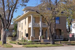 | Smithville Residential Historic District | 0.2 miles | 1995 |
| National Archives record | The nomination case file for reference 82004489 in Record Group 79. |
| Bastrop County | All 101 listed properties in this county. |