 Block
BlockFrom the record
One of 63 National Register listings published here for Taylor County · listed in 1992 · category: Building.
Sources: the case file at the National Archives · the National Register database, National Park Service
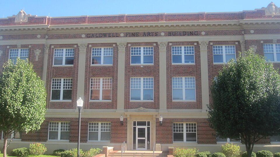
Listed on the National Register of Historic Places in 1992.
One of 63 National Register listings published here for Taylor County · listed in 1992 · category: Building.
Sources: the case file at the National Archives · the National Register database, National Park Service
Regional context, not property-specific evidence. The federal wildfire occurrence database lists 499 fires within 5 miles of Caldwell Hall between 2006 and 2020, burning about 2,312 acres in total. 2 started naturally. 5 were recorded as arson. Distance is straight-line from the map coordinates, so a fire counted here may appear on a neighbouring settlement's page as well.
| Reported cause | Fires |
|---|---|
| Missing data/not specified/undetermined | 223 |
| Debris and open burning | 140 |
| Equipment and vehicle use | 41 |
| Power generation/transmission/distribution | 36 |
| Smoking | 28 |
| Recreation and ceremony | 13 |
| Misuse of fire by a minor | 7 |
| Arson/incendiarism | 5 |
| Railroad operations and maintenance | 4 |
| Natural | 2 |
The most recent of them, most recent first, with the day each was reported and the service that recorded it.
| Date | Cause | Size | Reported by | Name on the report |
|---|---|---|---|---|
| 8 September 2017 | Missing data/not specified/undetermined | 1.0 acres | Texas A & M Forest Service | YEOMANS |
| 8 September 2015 | Missing data/not specified/undetermined | under an acre | Texas A & M Forest Service | SAN JOSE |
| 8 September 2015 | Missing data/not specified/undetermined | under an acre | Texas A & M Forest Service | HAILEY |
| 7 September 2020 | Debris and open burning | under an acre | Texas A & M Forest Service | 1817 CLINTON |
| 7 September 2016 | Missing data/not specified/undetermined | 1.0 acres | Texas A & M Forest Service | OVERLAND |
| 7 September 2015 | Missing data/not specified/undetermined | under an acre | Texas A & M Forest Service | DON JUAN |
| 7 September 2015 | Missing data/not specified/undetermined | under an acre | Texas A & M Forest Service | CAPITOL |
| 7 September 2015 | Missing data/not specified/undetermined | under an acre | Texas A & M Forest Service | CONGRESS |
Regional context, not property-specific evidence. The federal mineral resources record lists 4 workings within 5 miles of Caldwell Hall: 2 producers, 1 occurrence, 1 past producer. 2 still produce. What was taken out: Sand and Gravel, Construction, Copper, Clay. Distance is straight-line from the map coordinates, so a quarry counted here may appear on a neighbouring settlement's page as well.
| Where | Site | Commodity | Status | Recorded |
|---|---|---|---|---|
| Abilene Brick Co Pit | Clay | Producer | ||
| Kendall-1 | Copper | Occurrence | 1916 | |
| Plant No. 3 | Sand and Gravel, Construction | Producer | ||
| Unknown | Sand and Gravel, Construction | Past Producer |
Regional context, not property-specific evidence. The National Weather Service names Abilene, the town this property stands in, in 276 storm reports between 1993 and 2026: 136 hail, 95 thunderstorm wind, 31 flash flood, 8 flood. The reports record 1 injury. Each account below is quoted exactly as the forecast office filed it, from the NOAA Storm Events Database, and each date opens the federal record of that event.
| When | Event | Place named | Harm | What the report says |
|---|---|---|---|---|
| April 1998 | Thunderstorm Wind | Abilene | 1 hurt, $2,000 | A skylight at the mall was shattered, with falling glass injuring a child below. |
| August 2007 | Flood | Abilene | $5,000,000 | Excessive rainfall from heavy rains Friday night into Saturday morning across southwest Taylor County caused water to spill over the main spillway at Lake Abilene. This water flowed into Elm Creek and flooded several streets, homes, and businesses in the City of Abilene Sunday morning, prompting the Abilene Emergency Operations Center to call for a mandatory evacuation of the affected locations. |
| May 2001 | Hail | Abilene | $4,000,000 | Baseball size hail pounded the eastern sections of Abilene. The area around Abilene Christian University was the hardest hit, with numerous windows broken at the school. Many vehicles were hard hit as well, with windshields broken out and holes punched through the roofs of convertibles. |
| October 2000 | Flash Flood | Abilene | $2,000,000 | no account filed |
| June 1996 | Hail | Abilene | $1,000,000 | no account filed |
| May 2019 | Tornado (EF1) | Abilene | $750,000 | A National Weather Service survey team surveyed this tornado on June 13, and |found evidence of another tornado track. This EF-1 tornado began on the north side |of Abilene and tracked north northeast into Jones County. This twister tore the roof of a metal building, blew out windows and damaged an exterior wall on the north side of Abilene. The twister also ripped up a billboard and flipped over an eighteen wheeler. As the tornado continued to travel north northeast, it damaged or uprooted trees as it moved into Jones County. It tore off part of the roofs of two residences and damaged trees and outbuildings in Jones County just northwest of Fort Phantom Lake. This tornado was also videotaped on the north side of Abilene. |
| June 1997 | Flash Flood | Abilene | $500,000 | Torrential rain, up to three inches an hour, in northern Taylor County flooded service roads along Interstate 20 in Abilene. Many city streets were flooded with stalled cars in the floodwaters. Elm Creek, which flows through Abilene was high and wide with large trees floating down the creek. South of the city, water flowed over the spillway at Lake Abilene and Abilene State Park was evacuated. In nearby Buffalo Gap, floodwaters entered some homes. |
| October 1994 | Thunderstorm Wind | Abilene | $500,000 | A large steel beam sign was blown down at a service station, crushing three cars. |
| June 1996 | Flash Flood | Abilene | $500,000 | no account filed |
| May 2013 | Lightning | Abilene | $250,000 | Lightning struck the Trinity Church of the Nazarene in the 3300 block of State Street. A church official estimated the damage to be two hundred and fifty thousand dollars. |
| May 1997 | Flash Flood | Abilene | $250,000 | Heavy rainfall occurred overnight May 14-15. This rain resulted from an upper level low pressure system that moved across west central Texas and combined with numerous outflow boundaries from earlier thunderstorms. A large area of one to two inch rainfall occurred from a line from southwest Crockett County through San Angelo to Albany in Shackelford County. A few spots received up to three inches of rain. Flash flood warnings were issued for several counties with street flooding reported in Abilene. Floodwaters entered some homes in Abilene. |
| May 1996 | Thunderstorm Wind | Abilene | $250,000 | no account filed |
| May 1997 | Hail | Abilene | $200,000 | Hail up to golfball-size fell over the city of Abilene and surrounding areas. |
| April 2011 | Hail | Abilene | $150,000 | This large softball size hail was reported near the Abilene Mall and busted automobile windshields and damaged roofs in the area. Many insurance adjusters came to the area. |
| June 2009 | Thunderstorm Wind | Abilene | $100,000 | A roof was blown off the Century Lodge on South 1st Street. |
| June 1997 | Flash Flood | Abilene | $100,000 | no account filed |
| September 1996 | Flash Flood | Abilene | $100,000 | no account filed |
| September 1996 | Thunderstorm Wind | Abilene | $100,000 | no account filed |
| July 1995 | Thunderstorm Wind | Abilene | $75,000 | Widespread wind damage was reported across Abilene, including numerous reports of trees blown down, roof and fence damage, and damage to signs and carports. A 100 foot radio tower was blown down on the east side of town. |
| May 2005 | Hail | Abilene | $50,000 | Tennis ball size hail caused damage to several vehicles and homes. |
| June 1997 | Thunderstorm Wind | Abilene | $50,000 | no account filed |
| September 1996 | Thunderstorm Wind | Abilene | $50,000 | no account filed |
| April 2004 | Flash Flood | Abilene | $30,000 | Heavy rains over the city of Abilene caused severe street flooding that resulted in several road closures and water rescues. |
| April 2004 | Lightning | Abilene | $25,000 | Lightning caused a structure fire that resulted in damage. |
| October 2004 | Flash Flood | Abilene | $15,000 | Several cars were stranded in high water and water rescues had to be performed. |
| August 2003 | Thunderstorm Wind | Abilene | $10,000 | Trees and power lines were down in Abilene after a severe thunderstorm moved through the area. Several homes also received roof damage. |
| July 1998 | Thunderstorm Wind | Abilene | $10,000 | A roof was torn off a building and tossed into an adjacent parking lot. |
| August 1997 | Thunderstorm Wind | Abilene | $10,000 | Winds blew down a few power poles. |
| July 1995 | Thunderstorm Wind | Abilene | $10,000 | A carport was blown off a house in southwest Abilene. |
| March 2007 | Flood | Abilene | $9,000 | Significant urban flooding resulted from heavy rains across Abilene. Water rescues had to be performed and many vehicles were left stranded. |
| May 2002 | Thunderstorm Wind | Abilene | $9,000 | A barn was destroyed by high thunderstorm winds. |
| June 2007 | Flash Flood | Abilene | $7,000 | Law enforcement officials reported six feet of water at Pine street and South First at the underpass. Many other streets around the shopping mall were flooded by two feet of water. Also Cat Claw creek was bankfull and about one foot from overflowing its banks. |
| May 2005 | Hail | Abilene | $7,000 | Another storm just to the northeast of Abilene produced golfball size hail. |
| May 1995 | Thunderstorm Wind | Abilene | $5,000 | Signs and large tree limbs were blown down west of ACU Hill in the northern part of Abilene. |
| May 1994 | Thunderstorm Wind | Abilene | $5,000 | Trees, signs, and power lines were blown down by thunderstorm winds. |
| November 1994 | Thunderstorm Wind | Abilene | $5,000 | Trees and power lines were blown down across town by high winds. |
| July 2006 | Thunderstorm Wind | Abilene | $4,000 | Microburst produced downed trees and roof damage to outbuildings. |
| July 2006 | Thunderstorm Wind | Abilene | $4,000 | Downburst produced wind damage to cars in the KTXS parking lot. The wind was measured with an anemoter at the TV station. |
| April 2002 | Thunderstorm Wind | Abilene | $4,000 | An 18 wheeler was overturned and a house received damage due to strong thunderstorm winds. |
| June 2003 | Thunderstorm Wind | Abilene | $3,000 | Power poles blown down. |
| July 2007 | Flash Flood | Abilene | $2,000 | Law enforcement reported significant street flooding in Abilene. |
| September 2002 | Thunderstorm Wind | Abilene | $2,000 | Strong thunderstorm winds blew down several power poles just southwest of Abilene. |
| September 2001 | Thunderstorm Wind | Abilene | $2,000 | High winds downed a large tree just southwest of Abilene. |
| May 1995 | Thunderstorm Wind | Abilene | $2,000 | Power lines were blown down by high winds. |
| May 2002 | Tornado (F0) | Abilene | $1,000 | A brief tornado blew down a few power poles on the north side of Abilene. |
| March 2000 | Thunderstorm Wind | Abilene | $1,000 | Trees and power lines downed by high winds |
| May 1993 | Thunderstorm Wind | Abilene | $500 | A tree limb was blown onto a car in south Abilene. |
| March 2026 | Hail | Abilene | - | Public reported quarter size hail via social media. |
| March 2025 | Thunderstorm Wind | Abilene | - | There were 1 inch tree limbs broken. |
| April 2025 | Flash Flood | Abilene | - | Public report of street flooding due to flash flooding and a few vehicles stranded. |
| June 2025 | Thunderstorm Wind | Abilene | - | Broadcast media relayed a report from the public of a metal roof blown off of a small building across from the Abilene Livestock Auction barn. |
| June 2025 | Thunderstorm Wind | Abilene | - | Public reported multiple tree branches blown down. A fence was also knocked down. |
| June 2025 | Thunderstorm Wind | Abilene | - | A 78 mph wind gust was measured at the West Texas Mesonet observation station on the Abilene Christian University campus. |
| June 2025 | Flash Flood | Abilene | - | Public report of street flooding. |
| June 2025 | Hail | Abilene | - | Public report of quarter size hail at Abilene Christian University. |
| May 2024 | Thunderstorm Wind | Abilene | - | Broadcast media reported large broken tree limbs that fell onto parked truck. |
| June 2024 | Flash Flood | Abilene | - | Media reported there were water rescues at N 18th Street and Treadway Boulevard, N 10th Street and Westmoreland Street, and along S 1st Street. People were helped out of vehicles in high water. |
| August 2024 | Thunderstorm Wind | Abilene | - | Public reported large tree limbs were blown down. The time is approximated by radar. |
| September 2024 | Flash Flood | Abilene | - | There was street flooding along Barrow street with vehicles stranded in Abilene. |
| March 2023 | Thunderstorm Wind | Abilene | - | A Skywarn spotter reported trees blown over onto power lines in Abilene near the intersection of North Treadway Ave and I-20. This caused a power outage. |
No historic map-sheet match is published for this property yet. That does not mean no map exists. This record needs a coordinate-quality review before it can be joined to a sheet boundary. Browse the county's mapped places while that work is pending.
Other National Register properties close enough to walk or drive between, ordered by distance from this one. Both positions come from the same geocoding pass that matched these properties to their map sheets.
| Photograph | Property | Distance | Listed |
|---|---|---|---|
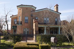 | J. G. Higginbotham House | 0.4 miles | 1992 |
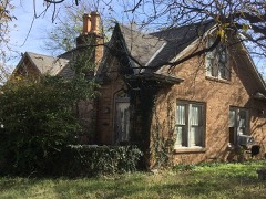 | David C. and Docia Fritz House | 0.5 miles | 1992 |
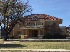 | William and Shirley Swenson House | 0.7 miles | 1987 |
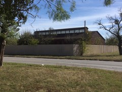 | Abilene Street Railway Company Barn | 1.2 miles | 1992 |
| House at 1127 Ash Street | 1.2 miles | 1992 | |
 | U.S. Weather Bureau Building | 1.3 miles | 1982 |
| National Archives record | The nomination case file for reference 92000206 in Record Group 79. |
| Taylor County | All 63 listed properties in this county. |