 Block
BlockFrom the record
One of 32 National Register listings published here for Wharton County · listed in 1993 · category: Building.
Sources: the case file at the National Archives · the National Register database, National Park Service
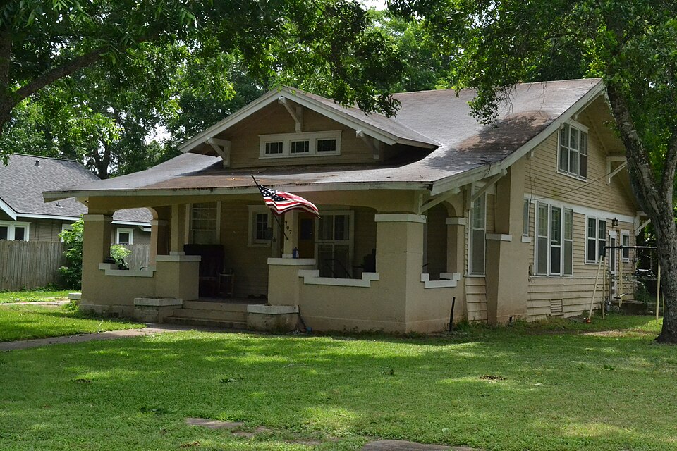
Listed on the National Register of Historic Places in 1993.
One of 32 National Register listings published here for Wharton County · listed in 1993 · category: Building.
Sources: the case file at the National Archives · the National Register database, National Park Service
Regional context, not property-specific evidence. The National Weather Service names Wharton, the town this property stands in, in 59 storm reports between 1996 and 2015: 21 thunderstorm wind, 20 hail, 7 flash flood, 7 tornado. The reports record 6 injuries. Each account below is quoted exactly as the forecast office filed it, from the NOAA Storm Events Database, and each date opens the federal record of that event.
| When | Event | Place named | Harm | What the report says |
|---|---|---|---|---|
| June 2004 | Tornado (F1) | Wharton | 6 hurt, $300,000 | Tornado formed just outside city limits and caused damage to shopping center roof, several homes, and overturned a pump house as it entered Wharton. A mobile home was flipped over, damage occurred to several out houses, and vehicles. Numerous trees and power lines were knocked down. Overall, six minor injuries were reported, mainly from flying glass. |
| June 2004 | Tornado (F1) | Wharton | $100,000 | Second tornado that traveled east of, and nearly parallel to, the first tornado through Wharton. Several 3 to 4 foot diameter trees were snapped in half with power lines knocked down. |
| September 2002 | Flash Flood | Wharton | $95,000 | Water in homes in Wharton. |
| June 2004 | Flash Flood | Wharton | $70,000 | Flooding in and around Wharton with several rescues made from flooded homes. |
| March 2002 | Tornado (F0) | Wharton | $50,000 | A Tornado touchdown damaged a trailer on Nelson Road and Texas Highway 102, reported by Emergency management. |
| December 2002 | Thunderstorm Wind | Wharton | $35,000 | Roof blown off a business. |
| December 2002 | Thunderstorm Wind | Wharton | $35,000 | Roof damage, trees down and light poles down in and around Wharton. |
| November 2004 | Tornado (F0) | Wharton | $25,000 | Four homes were damaged in the Spanish Camp area near the intersection of FM 1161 and FM 640. |
| August 2000 | Thunderstorm Wind | Wharton | $25,000 | Metal building blown 70 feet with large tree down. |
| August 1998 | Thunderstorm Wind | Wharton | $25,000 | Trees blown down (some on houses) in Wharton and in Hungerford. |
| April 2004 | Hail | Wharton | $20,000 | Quarter-size hail in Wharton. |
| April 1997 | Tornado (F0) | Wharton | $20,000 | no account filed |
| June 1996 | Thunderstorm Wind | Wharton | $20,000 | no account filed |
| May 2011 | Thunderstorm Wind | Wharton | $15,000 | Numerous branches, trees and power lines down scattered over large area, mainly north of 59. Fourteen thousand homes were left without power. |
| June 2006 | Hail | Wharton | $15,000 | Golfball-size hail on County Road 120. |
| June 2004 | Flash Flood | Wharton | $15,000 | Flooded roads in and around Wharton. |
| November 2003 | Flash Flood | Wharton | $15,000 | Flooding in and around the town of Wharton. |
| October 2003 | Tornado (F0) | Wharton | $15,000 | Roof damage along with two uprooted gas pumps at convenience store. |
| November 2000 | Thunderstorm Wind | Wharton | $15,000 | Trees down on CR 226. |
| November 2000 | Thunderstorm Wind | Wharton | $15,000 | Trees down on Alabama Road near CR 129. |
| September 1997 | Hail | Wharton | $15,000 | Severe roof and car damage. |
| April 1997 | Flash Flood | Wharton | $15,000 | no account filed |
| December 2002 | Thunderstorm Wind | Wharton | $12,000 | Some power lines down and a roof blown off a barn on Chudalla Road. |
| June 2010 | Thunderstorm Wind | Wharton | $10,000 | Several trees were reported downed along with damage to a telephone pole. |
| August 2004 | Thunderstorm Wind | Wharton | $10,000 | Power lines down. |
| April 1997 | Hail | Wharton | $10,000 | no account filed |
| June 2008 | Hail | Wharton | $9,000 | Penny to quarter size hail was observed in Wharton and lasted for approximately twenty minutes. |
| March 2003 | Hail | Wharton | $9,000 | no account filed |
| March 2005 | Thunderstorm Wind | Wharton | $8,000 | Local newspaper reported a light pole and a couple of power lines downed. |
| October 2002 | Flash Flood | Wharton | $7,000 | Six streets closed and eight others with very high water in Wharton and El Campo. |
| February 1998 | Thunderstorm Wind | Wharton | $7,000 | Trees and powerpoles blown down near the country club. |
| March 2003 | Hail | Wharton | $6,000 | no account filed |
| March 2003 | Hail | Wharton | $6,000 | no account filed |
| February 2011 | Thunderstorm Wind | Wharton | $5,000 | Downed trees blocked roadways at the intersection of Avenue A and Texas, Cornell and Elm, and in the 800 block of North Alabama in the city of Wharton. |
| March 2007 | Thunderstorm Wind | Wharton | $5,000 | Tree down on a home. |
| June 2006 | Hail | Wharton | $5,000 | Penny-size hail. |
| March 2005 | Hail | Wharton | $5,000 | Reported at the sheriff's office. |
| April 1997 | Hail | Wharton | $5,000 | no account filed |
| April 1997 | Hail | Wharton | $5,000 | no account filed |
| May 1996 | Hail | Wharton | $5,000 | no account filed |
| May 1996 | Thunderstorm Wind | Wharton | $5,000 | no account filed |
| September 1996 | Thunderstorm Wind | Wharton | $5,000 | no account filed |
| March 2008 | Hail | Wharton | $3,000 | Golfball size hail was observed in the town of Wharton. |
| April 2006 | Thunderstorm Wind | Wharton | $3,000 | Tree down on the Highway 59 bridge over the Colorado River. |
| September 1997 | Hail | Wharton | $3,000 | no account filed |
| June 2008 | Thunderstorm Wind | Wharton | $2,000 | Thunderstorm winds downed tree limbs and power lines throughout the city of Wharton. Several streets and highways, including U.S. 59 southbound at the Colorado bridge, were blocked. |
| October 2006 | Thunderstorm Wind | Wharton | $2,000 | Strong wind gusts knocked down two power lines. |
| October 1998 | Flash Flood | Wharton | $2,000 | Minor street flooding in Wharton. |
| September 1997 | Hail | Wharton | $2,000 | no account filed |
| March 2007 | Hail | Wharton | $1,000 | Nickel-size hail. |
| April 2015 | Hail | Wharton | - | Nickel sized hail was reported in the Wharton area. |
| September 2014 | Funnel Cloud | Wharton | - | Two funnel clouds were sighted over the west side of the city of Wharton. |
| May 2014 | Funnel Cloud | Wharton | - | A funnel cloud was reported between the towns of Wharton and Pierce. |
| April 2013 | Hail | Wharton | - | A severe thunderstorm produced quarter sized hail. |
| April 2013 | Hail | Wharton | - | A severe thunderstorm produced quarter to golf ball sized hail. |
| June 2007 | Thunderstorm Wind | Wharton | - | Trees downed. |
| June 2004 | Funnel Cloud | Wharton | - | Funnel cloud sighted at Highway 60 and FM 1299. |
| November 2003 | Tornado (F0) | Wharton | - | Tornado reported touching down near Highway 59 and Colorado River. |
| June 2004 | Funnel Cloud | Wharton | - | no account filed |
No historic map-sheet match is published for this property yet. That does not mean no map exists. This record needs a coordinate-quality review before it can be joined to a sheet boundary. Browse the county's mapped places while that work is pending.
Other National Register properties close enough to walk or drive between, ordered by distance from this one. Both positions come from the same geocoding pass that matched these properties to their map sheets.
| Photograph | Property | Distance | Listed |
|---|---|---|---|
 | St. John's Evangelical Lutheran Church | under 500 feet | 1993 |
 | Louis F. Worthing House | under 500 feet | 1993 |
 | Moran-Moore House | 0.1 miles | 1993 |
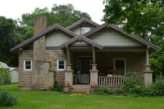 | House at 512 North Resident | 0.1 miles | 1993 |
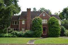 | Merrell-Roten House | 0.2 miles | 1993 |
| Henry B. Garrett House | 0.3 miles | 1993 |
| National Archives record | The nomination case file for reference 93000122 in Record Group 79. |
| Wharton County | All 32 listed properties in this county. |