 Block
BlockFrom the record
One of 9 National Register listings published here for Starr County · listed in 1993 · category: District.
Sources: the case file at the National Archives · the National Register database, National Park Service
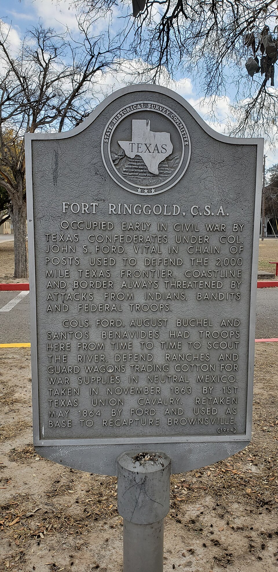
Listed on the National Register of Historic Places in 1993.
One of 9 National Register listings published here for Starr County · listed in 1993 · category: District.
Sources: the case file at the National Archives · the National Register database, National Park Service
Regional context, not property-specific evidence. The federal wildfire occurrence database lists 369 fires within 5 miles of Fort Ringgold Historic District between 1996 and 2020, burning about 2,154 acres in total. None started naturally. 26 were recorded as arson. Distance is straight-line from the map coordinates, so a fire counted here may appear on a neighbouring settlement's page as well.
| Reported cause | Fires |
|---|---|
| Missing data/not specified/undetermined | 189 |
| Debris and open burning | 140 |
| Arson/incendiarism | 26 |
| Equipment and vehicle use | 7 |
| Misuse of fire by a minor | 6 |
| Other causes | 1 |
The most recent of them, most recent first, with the day each was reported and the service that recorded it.
| Date | Cause | Size | Reported by | Name on the report |
|---|---|---|---|---|
| 7 September 2005 | Debris and open burning | 1.0 acres | Texas A & M Forest Service | not named |
| 6 September 2011 | Arson/incendiarism | 1.0 acres | Texas A & M Forest Service | GRASS FIRE |
| 3 September 2020 | Debris and open burning | 1.0 acres | Texas A & M Forest Service | 10 PARROT LN. |
| 3 September 2018 | Debris and open burning | 1.0 acres | Texas A & M Forest Service | W. HINOJOSA ST. |
| 3 September 2015 | Missing data/not specified/undetermined | 1.0 acres | Texas A & M Forest Service | LA REFORMA ST. |
| 3 September 2009 | Missing data/not specified/undetermined | 1.0 acres | Texas A & M Forest Service | LA MESA ST./MI RANCHITA DR. |
| 28 September 2010 | Missing data/not specified/undetermined | under an acre | South Texas Refuge Complex | 83 |
| 23 September 2015 | Missing data/not specified/undetermined | 2.0 acres | Texas A & M Forest Service | FOREST ST. |
Regional context, not property-specific evidence. The National Weather Service names Rio Grande City, the town this property stands in, in 40 storm reports between 1997 and 2024: 17 flash flood, 11 thunderstorm wind, 11 hail, 1 heavy rain. No death or injury is recorded in these reports. Each account below is quoted exactly as the forecast office filed it, from the NOAA Storm Events Database, and each date opens the federal record of that event.
| When | Event | Place named | Harm | What the report says |
|---|---|---|---|---|
| May 2007 | Thunderstorm Wind | Rio Grande City | $75,000 | Display signs and posts blown over on top of automobiles at Ramirez Ford. |
| May 2018 | Flash Flood | Rio Grande City | $50,000 | Slow moving thunderstorm clusters dumped torrential rains over and near Rio Grande City during the early to mid evening of May 4th, with storm totals likely between 4 and 5 inches across the area. A combination of reports from law enforcement, emergency management, and social media indicated dangerous flooding in parts of the city, with several water rescues and minor flooding reaching into several homes on the east side of town. Social media photos and discussion reported a yard with 1 to 2 feet of water flowing through it at around 8 PM CST; water rescues from stranded vehicles were reported along US 83 on the east side of town at around 8:55 PM CST, and another vehicle was reported stranded in floodwaters at the intersection of Flores and Monroe Street, also on the east side of town. The NWS cooperative observer reported 4.28 inches with the event, most falling within two to three hours. |
| October 1998 | Flash Flood | Rio Grande City | $35,000 | Widespread street flooding. Fifty houses damaged by high water, mainly in the Las Lomas and Chaparral Subdivisions. |
| May 2007 | Thunderstorm Wind | Rio Grande City | $30,000 | Sheriff's Office reported roof damage to structures. |
| June 1997 | Flash Flood | Rio Grande City | $28,000 | 263 dwellings damaged by water. |
| May 2020 | Flash Flood | Rio Grande City | $25,000 | Starr County Sheriffs Office reported floodwater entering at least 10 homes on the west side of Rio Grande City when an arroyo overspilled its banks in the neighborhood. Damage values are estimated. |
| May 2015 | Flash Flood | Rio Grande City | $25,000 | Starr County Sheriffs Office reported at least a dozen water rescues in and near Rio Grande City, including the Las Lomas neighborhood and Garciasville, where some homes had up to 3 feet of water inside them after a likely combination of freshwater (drainage) and arroyo flooding from an estimated/measure five to seven inches of rain in two to three hours. Portions of U.S. 83 were closed in southeast Starr County, mainly from Rio Grande City to near the Hidalgo County line, due to standing water of 2 to 4 feet. |
| May 2005 | Flash Flood | Rio Grande City | $25,000 | no account filed |
| May 2020 | Flash Flood | Rio Grande City | $10,000 | Starr County Sheriffs Office reports floodwater entering at least one home in east central Rio Grande City as a nearby Arroyo overspilled its banks and combined with heavy rainfall to flood city roads. An estimated 1 to 2 feet of fast flowing water impacting U.S. highway 83 on the east side of Rio Grande City. |
| June 1997 | Thunderstorm Wind | Rio Grande City | $5,000 | Numerous power lines and poles down. Tree damage. |
| September 1998 | Flash Flood | Rio Grande City | $4,000 | Three to four inches of rain caused extensive flooding of streets and some houses located in low lying areas. |
| April 2018 | Thunderstorm Wind | Rio Grande City | $2,000 | A newspaper report from Starr County indicated a large restaurant sign blew onto a vehicle and caused an unknown amount of damage to the vehicle during the passage of a thunderstorm in Rio Grande City a little after 8 PM on April 25th. |
| May 2024 | Hail | Rio Grande City | - | Quarter size hail was reported just north of Rio Grande City, via web report. |
| May 2024 | Hail | Rio Grande City | - | Half dollar size hail was reported along FM 755 north of town. Report received via the internet. |
| April 2023 | Thunderstorm Wind | Rio Grande City | - | Social media posts showed a destroyed metal baseball backstop along with several large tree limbs down on the northern side of Rio Grande City. Timing estimated by radar and social media posts. |
| April 2022 | Thunderstorm Wind | Rio Grande City | - | Thunderstorm winds estimated at 50 knots downed several large tree limbs between Cenizo Street and the intersection of E Eisenhower St and FM755 in Rio Grande City. Additionally, one set of traffic lights were left dangling at the intersection of E Eisenhower St and FM755. The public also shared pictures of numerous trampolines that were blown down the street. |
| May 2020 | Hail | Rio Grande City | - | Social media public reported ping pong sized hail in Starr County. |
| June 2020 | Hail | Rio Grande City | - | Rio Grande City Police Department reported that dime-size hail fell for about 2 to 3 minutes around 415 PM CDT. |
| March 2018 | Hail | Rio Grande City | - | Facebook reports relayed to the NWS office in Brownsville reported two large hail reports east of Rio Grande City: Golfball sized hail 4.6 miles east, near La Puerta, and half-dollar sized hail (1.25) 4 miles east southeast of Rio Grande City near Los Velas road. |
| May 2017 | Flash Flood | Rio Grande City | - | Rio Grande City Police Department reported flooding on Embassy Street, La Loma, and at the intersection of Main Street and Washington Street. Radar imagery estimated 2.5 to 3.0 inches of rainfall. |
| April 2015 | Flash Flood | Rio Grande City | - | Rio Grande City Police reported that 20 to 30 streets across the Rio Grande City were flooded with at least a foot of flowing water, that the police substation parking lot had 8 to 12 inches of water and that Highway 83 had 2 to 3 inches of water on the roadway. No homes were reported flooded in the city. |
| September 2014 | Heavy Rain | Rio Grande City | - | A COOP observer in Rio Grande City reported 6.30 inches of rain. |
| May 2014 | Hail | Rio Grande City | - | Trained spotter reported quarter size hail and provided a video that suggested hail up to half dollar size fell. |
| May 2014 | Thunderstorm Wind | Rio Grande City | - | Public reported multiple large tree limbs down FM 755. |
| May 2014 | Thunderstorm Wind | Rio Grande City | - | Trained spotter reported wind gusts of 50 to 60 mph in Rio Grande City. |
| July 2007 | Flash Flood | Rio Grande City | - | Rio Grande City Police Department reports heavy rain and street flooding. |
| July 2007 | Flash Flood | Rio Grande City | - | Starr County sheriff reports Los Olmos Creek through Rio Grande City over bank full. |
| July 2007 | Flash Flood | Rio Grande City | - | Rio Grande City law enforcement reports water inside homes from flooding in the Las Lomas and Los Trevinos subdivisions. |
| July 2007 | Flash Flood | Rio Grande City | - | Texas Department of Transportation reports two feet of water on expressway 83 in Rio Grande City. Texas Department of Transportation reports 5 feet of water on Embassy road, Hernandez road and Roca Guerra road in Rio Grande City and one foot of water in homes on these roads. |
| April 2003 | Thunderstorm Wind | Rio Grande City | - | Severe wind gusts associated with a thunderstorm downed power lines near Rio Grande City. |
| May 2002 | Hail | Rio Grande City | - | Law Enforcement Officials reported 1.75 inch hail |
| September 2002 | Flash Flood | Rio Grande City | - | Highway 755 between Highways 490 and 2294 was closed due to flash flooding produced by strong thunderstorms. |
| June 2001 | Thunderstorm Wind | Rio Grande City | - | Large tree limbs (greater than 2 inches in diameter) were reported down, and 6 roofs were removed from barns. |
| June 2001 | Thunderstorm Wind | Rio Grande City | - | A 59 mph wind gust was measured at the Aerostat site located north of Rio Grande City. |
| August 2001 | Flash Flood | Rio Grande City | - | McAllen DPS reported that FM 490 was impassable due to high water over the road which continued through the night. In fact, secondary gravel roads remained flooded into the next day. |
| October 2006 | Flash Flood | Rio Grande City | - | no account filed |
| May 2004 | Hail | Rio Grande City | - | no account filed |
| February 1998 | Hail | Rio Grande City | - | no account filed |
| February 1998 | Hail | Rio Grande City | - | no account filed |
| February 1998 | Hail | Rio Grande City | - | no account filed |
No historic map-sheet match is published for this property yet. That does not mean no map exists. This record needs a coordinate-quality review before it can be joined to a sheet boundary. Browse the county's mapped places while that work is pending.
Other National Register properties close enough to walk or drive between, ordered by distance from this one. Both positions come from the same geocoding pass that matched these properties to their map sheets.
| Photograph | Property | Distance | Listed |
|---|---|---|---|
 | Rio Grande City Downtown Historic District | 0.3 miles | 2005 |
 | LaBorde House, Store and Hotel | 0.6 miles | 1980 |
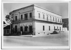 | de la Pena, Silverio, Drugstore and Post Office | 0.7 miles | 1980 |
| Yzaquirre-Longoria House | 1.0 miles | 2005 | |
 | Mifflin Kenedy Warehouse and Old Starr County Courthouse | 1.1 miles | 2005 |
| Fred and Nell Kain Guerra House | 1.5 miles | 2005 |
| National Archives record | The nomination case file for reference 93000196 in Record Group 79. |
| Starr County | All 9 listed properties in this county. |