 Block
BlockFrom the record
One of 7 National Register listings published here for Waller County · listed in 1999 · category: Building.
Sources: the case file at the National Archives · the National Register database, National Park Service
Listed on the National Register of Historic Places in 1999.
One of 7 National Register listings published here for Waller County · listed in 1999 · category: Building.
Sources: the case file at the National Archives · the National Register database, National Park Service
Regional context, not property-specific evidence. The federal wildfire occurrence database lists 66 fires within 5 miles of Hilliard Hall between 1996 and 2018, burning about 250 acres in total. None started naturally. 4 were recorded as arson. Distance is straight-line from the map coordinates, so a fire counted here may appear on a neighbouring settlement's page as well.
| Reported cause | Fires |
|---|---|
| Missing data/not specified/undetermined | 33 |
| Debris and open burning | 27 |
| Arson/incendiarism | 4 |
| Equipment and vehicle use | 1 |
| Railroad operations and maintenance | 1 |
The most recent of them, most recent first, with the day each was reported and the service that recorded it.
| Date | Cause | Size | Reported by | Name on the report |
|---|---|---|---|---|
| 5 September 2016 | Missing data/not specified/undetermined | 1.0 acres | Texas A & M Forest Service | GRASS FIRE |
| 24 September 2016 | Missing data/not specified/undetermined | 1.0 acres | Texas A & M Forest Service | GRASS FIRE |
| 15 September 2017 | Missing data/not specified/undetermined | 1.0 acres | Texas A & M Forest Service | HAY FIRE |
| 9 August 2017 | Missing data/not specified/undetermined | 1.0 acres | Texas A & M Forest Service | GRASS FIRE |
| 8 August 2016 | Debris and open burning | 1.0 acres | Texas A & M Forest Service | HEAVY SMOKE IN AREA |
| 26 August 2015 | Arson/incendiarism | 1.0 acres | Texas A & M Forest Service | GRASS FIRE |
| 24 August 2017 | Missing data/not specified/undetermined | 1.0 acres | Texas A & M Forest Service | GRASS FIRE |
| 2 August 2017 | Missing data/not specified/undetermined | 3.0 acres | Texas A & M Forest Service | GRASS FIRE |
Regional context, not property-specific evidence. The National Weather Service names Prairie View, the town this property stands in, in 15 storm reports between 1995 and 2024: 9 thunderstorm wind, 3 hail, 2 flash flood, 1 funnel cloud. No death or injury is recorded in these reports. Each account below is quoted exactly as the forecast office filed it, from the NOAA Storm Events Database, and each date opens the federal record of that event.
| When | Event | Place named | Harm | What the report says |
|---|---|---|---|---|
| May 2024 | Thunderstorm Wind | Prairie View | $1,000,000 | Trees were downed by strong winds in the Prairie View area as the derecho moved through. Damage totals include other wind damage across the county. |
| November 2000 | Thunderstorm Wind | Prairie View | $15,000 | Trees down near Yogi Bear Park. |
| September 2009 | Thunderstorm Wind | Prairie View | $5,000 | A severe thunderstorm damaged a metal shed roof and a fence. |
| October 1997 | Hail | Prairie View | $5,000 | no account filed |
| June 2005 | Hail | Prairie View | $3,000 | Penny size hail at intersection of Highway 290 and FM 362. |
| May 1995 | Thunderstorm Wind | Prairie View | $2,000 | Sheriffs reported trees down in Prairie View. |
| May 1995 | Thunderstorm Wind | Prairie View | $2,000 | Sheriff reported trees down in Prairie View. |
| May 2024 | Thunderstorm Wind | Prairie View | - | Social media reports indicated widespread tree damage from the derecho in the Prairie View area. |
| October 2023 | Thunderstorm Wind | Prairie View | - | Some trees were downed near the Bowler Road and Kyle Drive intersection. |
| October 2021 | Flash Flood | Prairie View | - | FM 1488 at Wyatt Chapel Rd was impassable due to floodwaters, with water heights reaching up to the guardrail on the side of the road. |
| May 2019 | Hail | Prairie View | - | Quarter sized hail was reported. |
| August 2017 | Flash Flood | Prairie View | - | Multiple lanes of Highway 290 at the FM 2920 intersection near the town of Waller were closed due to flooding.||In the southern part of the county, sections of FM 3318 near the Brazos River flooded and became inaccessible. There was significant countywide home flooding along the various creeks/bayous and their tributaries. |
| August 2012 | Thunderstorm Wind | Prairie View | - | Trees were downed, mostly around the intersection of Mayer Road and FM 1488. |
| June 2011 | Thunderstorm Wind | Prairie View | - | A severe thunderstorm downed some trees in northern Waller County. |
| August 2004 | Funnel Cloud | Prairie View | - | Funnel cloud sighted at the FM 1488 and FM 362 intersection. |
No historic map-sheet match is published for this property yet. That does not mean no map exists. This record needs a coordinate-quality review before it can be joined to a sheet boundary. Browse the county's mapped places while that work is pending.
Other National Register properties close enough to walk or drive between, ordered by distance from this one. Both positions come from the same geocoding pass that matched these properties to their map sheets.
| Photograph | Property | Distance | Listed |
|---|---|---|---|
 | L.C. Anderson Hall | under 500 feet | 1999 |
| G.R. Woolfolk Social and Political Science Building | 0.1 miles | 1999 | |
 | Annie Laurie Evans Hall | 0.1 miles | 1999 |
 | Veterninary Hospital | 0.3 miles | 1999 |
 | W.R. Banks Library | 0.6 miles | 1999 |
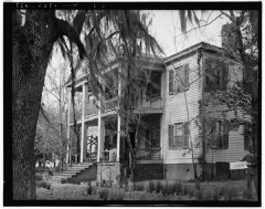 | Liendo Plantation | 3.0 miles | 1971 |
| National Archives record | The nomination case file for reference 99000614 in Record Group 79. |
| Waller County | All 7 listed properties in this county. |