 Block
Barro, Utah
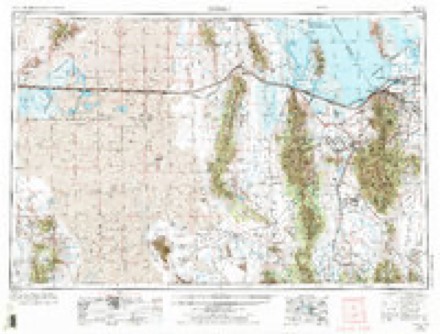
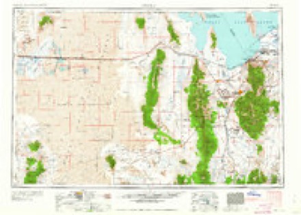
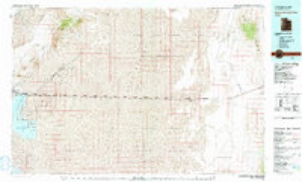
8 topographic sheets cover this place, the earliest surveyed in 1953 and the latest in 1979. It stands in the Dugway-Wendover census division. It lies in ZIP code area 84029. The Survey maps it on the Barro quadrangle.
Topographic sheets covering this place
4 surveys from 8 printed sheetsMatched by testing this settlement's coordinate against the published boundary of every sheet in the United States Geological Survey's historical collection. Each opens the scanned sheet at the Survey.
- 1953 USGS Tooele quadrangle1:250000, 3 printings
- 1955 USGS Tooele quadrangle1:250000, 3 printings
- 1973 USGS Barro quadrangle1:24000
- 1979 USGS Bonneville Salt Flats quadrangle1:100000

Storms near this place
57 since 2007Regional context, not property-specific evidence. The National Weather Service names Barro in 57 storm reports between 2007 and 2025: 57 thunderstorm wind. No death or injury is recorded in these reports. Each account below is quoted exactly as the forecast office filed it, from the NOAA Storm Events Database, and each date opens the federal record of that event.
| When | Event | Place named | Harm | What the report says |
|---|---|---|---|---|
| August 2016 | Thunderstorm Wind | Barro | $10,000 | Strong thunderstorm winds blew over a semitruck on Interstate 80 at Milepost 27. |
| June 2017 | Thunderstorm Wind | Barro | $1,000 | A maximum wind gust of 93 mph was recorded by the I-80 @ mp 29 sensor. The Utah Department of Transportation reported that a variable message sign at milepost 29 was blown down. |
| May 2025 | Thunderstorm Wind | Barro | - | The WEST OF WILDCAT MTN mesonet station recorded an initial strong wind gust of 59 mph at 10:50 am MST, followed by a subsequent peak wind gust of 63 mph at 10:55 am MST. These wind gusts were the result of outflow winds associated with a nearby cluster of showers and thunderstorms moving through the area. |
| May 2025 | Thunderstorm Wind | Barro | - | The INTERSTATE 80 mesonet station recorded a wind gust of 58 mph as a result of outflow winds associated with a nearby cluster of showers and thunderstorms moving through the area. |
| May 2025 | Thunderstorm Wind | Barro | - | The I-80 @ mp 29 mesonet station recorded a wind gust of 68 mph as a result of outflow winds associated with a nearby cluster of showers and thunderstorms moving through the area. |
| June 2025 | Thunderstorm Wind | Barro | - | A wind gust of 62 mph was recorded at the West of Wildcat Mtn mesonet site. |
| August 2025 | Thunderstorm Wind | Barro | - | A wind gust of 58 mph was recorded at the West of Wildcat Mtn mesonet site. |
| July 2025 | Thunderstorm Wind | Barro | - | The WEST OF WILDCAT MTN mesonet station recorded a wind gust of 58 mph as a result of outflow winds associated with a nearby cluster of showers and thunderstorms moving through the area. |
| July 2025 | Thunderstorm Wind | Barro | - | The INTERSTATE 80 mesonet station recorded a wind gust of 59 mph as a result of outflow winds associated with a nearby cluster of showers and thunderstorms moving through the area. |
| July 2025 | Thunderstorm Wind | Barro | - | The WEST OF WILDCAT MTN mesonet station recorded a wind gust of 58 mph as a result of outflow winds associated with a nearby cluster of showers and thunderstorms moving through the area. |
| July 2025 | Thunderstorm Wind | Barro | - | The INTERSTATE 80 mesonet station recorded a wind gust of 75 mph as a result of outflow winds associated with a nearby cluster of showers and thunderstorms moving through the area. |
| July 2024 | Thunderstorm Wind | Barro | - | The I-80 @ mp 29 mesonet station recorded a wind gust of 64 mph at 6:10 pm MST as a result of outflow winds associated with a nearby cluster of showers and thunderstorms moving through the area. A following peak wind gust of 72 mph was subsequently recorded at 6:20 pm MST. |
| July 2024 | Thunderstorm Wind | Barro | - | The INTERSTATE 80 mesonet station recorded an initial peak wind gust of 73 mph at 6:15 pm MST, followed by a subsequent wind gust of 61 mph at 6:20 pm MST. These wind gusts were the result of outflow winds associated with a nearby cluster of showers and thunderstorms moving through the area. |
| June 2024 | Thunderstorm Wind | Barro | - | A wind gust of 60 mph was measured by the Interstate 80 mesonet site. |
| March 2024 | Thunderstorm Wind | Barro | - | The I-80 at MP 29 mesonet station recorded a wind gust of 73 mph as a result of a convective section of a cold frontal boundary advancing through the area. |
| March 2024 | Thunderstorm Wind | Barro | - | The INTERSTATE 80 mesonet station recorded a wind gust of 71 mph as a result of a convective section of a cold frontal boundary advancing through the area. |
| September 2024 | Thunderstorm Wind | Barro | - | The I-80 @ mp 29 mesonet station recorded a wind gust of 58 mph as a result of outflow winds associated with a nearby cluster of showers and thunderstorms moving through the area. |
| May 2023 | Thunderstorm Wind | Barro | - | The I-80 at MP29 mesonet station recorded a wind gust of 63 mph as a result of outflow winds associated with a nearby cluster of showers and thunderstorms moving through the area. |
| June 2023 | Thunderstorm Wind | Barro | - | A wind gust of 58 mph was recorded at the Wildcat Mountain mesonet site. |
| September 2023 | Thunderstorm Wind | Barro | - | The INTERSTATE 80 mesonet station recorded a wind gust of 64 mph as a result of outflow winds associated with a nearby cluster of showers and thunderstorms moving through the area. |
| September 2023 | Thunderstorm Wind | Barro | - | The I-80 @ mp 29 mesonet station recorded a wind gust of 60 mph as a result of outflow winds associated with a nearby cluster of showers and thunderstorms moving through the area. |
| July 2023 | Thunderstorm Wind | Barro | - | The I-80 at MP 29 mesonet station recorded a wind gust of 60 mph as a result of outflow winds associated with a nearby cluster of showers and thunderstorms moving through the area, which formed after the passage of the squall line earlier in the evening. |
| June 2023 | Thunderstorm Wind | Barro | - | A wind gust of 60 mph was recorded at the I-80 at Dugway mesonet site. |
| September 2023 | Thunderstorm Wind | Barro | - | The INTERSTATE 80 mesonet station recorded a wind gust of 70 mph as a result of outflow winds associated with a nearby cluster of showers and thunderstorms moving through the area. |
| May 2022 | Thunderstorm Wind | Barro | - | The West of Wildcat Mountain automated weather station recorded a peak wind gust 70 mph. |
| May 2022 | Thunderstorm Wind | Barro | - | The Interstate 80 automated weather station recorded a peak wind gust of 59 mph. |
| July 2022 | Thunderstorm Wind | Barro | - | The U.S. Army Dugway Proving Ground I-80 mesonet station measured a wind gust of 60 mph at 3:00 pm MST as a result of a nearby microburst's outflow. |
| July 2022 | Thunderstorm Wind | Barro | - | The Utah Department of Transportation I-80 @ mp 29 mesonet station measured a wind gust of 61 mph at 3:00 pm MST as a result of a nearby microburst's outflow. |
| July 2022 | Thunderstorm Wind | Barro | - | U.S. Army Dugway Proving Ground West of Wildcat Mountain mesonet station measured a wind gust of 72 mph at 3:55 pm MST as a result of a nearby microburst's outflow. |
| June 2022 | Thunderstorm Wind | Barro | - | A thunderstorm and associated outflow resulted in a wind gust of 61 mph being measured at the Dugway Interstate 80 weather observing station. |
| September 2021 | Thunderstorm Wind | Barro | - | The Wildcat Mountain automated weather station recorded a peak wind gust of 59 mph. |
| May 2020 | Thunderstorm Wind | Barro | - | The U.S. Army Dugway Proving Ground Interstate 80 station recorded a peak wind gust of 63 mph. |
| July 2020 | Thunderstorm Wind | Barro | - | An apparent microburst from a light rain shower, produced a peak wind gust of 78 mph along Interstate 80, overturning a semitrailer. |
| June 2020 | Thunderstorm Wind | Barro | - | At semitrailer was blown over at milepost 30 on Interstate 80. |
| June 2019 | Thunderstorm Wind | Barro | - | The U.S. Army Dugway Proving Ground Interstate 80 sensor recorded a peak gust of 69 mph. |
| June 2017 | Thunderstorm Wind | Barro | - | Multiple sensors along Interstate 80 recorded strong wind gusts, including 59 mph at the U.S. Army Dugway Proving Ground Interstate 80 sensor and 58 mph at the I-80 @ mp 29 sensor. |
| September 2017 | Thunderstorm Wind | Barro | - | The Interstate 80 sensor recorded a peak wind gust of 60 mph. |
| September 2017 | Thunderstorm Wind | Barro | - | The I-80 @ mp 29 sensor recorded a peak wind gust of 60 mph. |
| July 2017 | Thunderstorm Wind | Barro | - | A line of thunderstorms produced several severe wind gusts across Interstate 80 and the U.S. Army Dugway Proving Ground mesonet, with peak recorded gusts of 65 mph at the Interstate 80 sensor, 64 mph at the I-80 @ mp 29 sensor, 62 mph at the Salt Flats sensor, 60 mph at Wig Mountain, and 59 mph at Playa Station. |
| June 2016 | Thunderstorm Wind | Barro | - | The mesonet sensor at Intersate 80 at Milepost 29 recorded a peak wind gust of 60 mph. |
| December 2016 | Thunderstorm Wind | Barro | - | A 61 mph wind gust was recorded at the Interstate 80 at Milepost 29 sensor. |
| December 2016 | Thunderstorm Wind | Barro | - | The West of Wildcat sensor in the U.S. Army Dugway Proving Ground mesonet recorded a peak wind gust of 63 mph. |
| June 2015 | Thunderstorm Wind | Barro | - | The Interstate 80 sensor in the Dugway Proving Ground mesonet recorded a maximum wind gust of 66 mph. |
| August 2015 | Thunderstorm Wind | Barro | - | The West of Wildcat Mountain sensor in the Dugway Proving Ground mesonet recorded a wind gust of 69 mph. |
| July 2015 | Thunderstorm Wind | Barro | - | Strong thunderstorm winds impacted Interstate 80 with a 72 mph gust recorded at the Interstate 80 sensor in the Dugway Proving Ground mesonet and a 64 mph wind gust recorded at the Interstate 80 at Milepost 29 sensor. |
| June 2014 | Thunderstorm Wind | Barro | - | A maximum wind gust of 60 mph was recorded at the Interstate 80 at Milepost 29 sensor. |
| June 2014 | Thunderstorm Wind | Barro | - | The Interstate 80 sensor in the Dugway Proving Ground mesonet recorded a peak wind gust of 60 mph. |
| July 2013 | Thunderstorm Wind | Barro | - | Multiple sensors recorded severe wind gusts as this thunderstorm crossed Interstate 80. The Interstate 80 at Milepost 29 sensor recorded 66 mph winds; in the Dugway Proving Ground mesonet, the Diddle Knoll sensor recorded a 65 mph wind gust, and the Interstate 80 sensor topped out at 58 mph. |
| September 2012 | Thunderstorm Wind | Barro | - | A maximum wind gust of 62 mph was reported at the Interstate 80 sensor. |
| May 2011 | Thunderstorm Wind | Barro | - | The Interstate 80 sensor in the Dugway Proving Ground mesonet recorded a maximum wind gust of 60 mph. |
| August 2011 | Thunderstorm Wind | Barro | - | The Interstate 80 sensor recorded a maximum wind gust of 58 mph. |
| August 2011 | Thunderstorm Wind | Barro | - | The Interstate 80 sensor in the Dugway Proving Ground mesonet recorded a maximum wind gust of 58 mph. |
| July 2010 | Thunderstorm Wind | Barro | - | The West of Wildcat Mountain sensor in the Dugway Proving Ground mesonet recorded a wind gust of 59 mph. |
| August 2009 | Thunderstorm Wind | Barro | - | The West of Wildcat Mountain sensor in the Dugway mesonet recorded a wind gust of 60 mph. |
| October 2007 | Thunderstorm Wind | Barro | - | Interstate 80 Dugway sensor measured a 62 mph wind gust. |
| October 2007 | Thunderstorm Wind | Barro | - | Interstate 80 Dugway sensor measured a 61 mph wind gust. |
| June 2007 | Thunderstorm Wind | Barro | - | A wind gust of 63 knots was measured at a remote sensor along I-80. |
Nearest settlements
The eight closest, with where each one stands in the county. Distances are straight-line, computed from the Geographic Names Information System coordinates.
Elsewhere
Matched on this settlement's Geographic Names Information System number rather than its name, so it cannot be a different place of the same name in another state.
| Wikipedia article on Barro | An encyclopaedic summary. Its text is share-alike, so it is linked here rather than copied. |
| Wikidata item Q107462815 | The structured record the population and elevation above come from. Public domain (CC0). |
Provenance
This settlement is recorded in the Geographic Names Information System as feature 1437497. The sheet list is computed by point-in-boundary test against the United States Geological Survey's historical topographic inventory. Both are works of the United States government and carry no copyright under 17 U.S.C. 105.
Storms. NOAA National Centers for Environmental Information, Storm Events Database https://www.ncei.noaa.gov/stormevents/ A work of the United States government, no copyright under 17 U.S.C. 105. Narratives are quoted verbatim from the National Weather Service report and are not edited or summarised.