 Block
From the record
One of 111 National Register listings published here for Beaver County · listed in 1982 · category: Building · built in 1883.
Sources: the case file at the National Archives · the National Register database, National Park Service
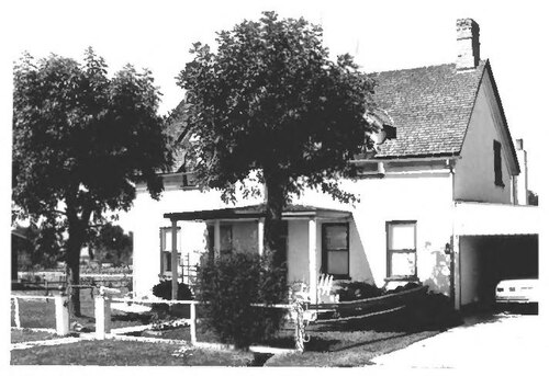
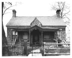
Built in 1883. Listed on the National Register of Historic Places in 1982.
One of 111 National Register listings published here for Beaver County · listed in 1982 · category: Building · built in 1883.
Sources: the case file at the National Archives · the National Register database, National Park Service
Regional context, not property-specific evidence. The federal wildfire occurrence database lists 105 fires within 5 miles of Robert Stoney House between 1993 and 2020, burning about 579 acres in total. 27 started naturally. 2 were recorded as arson. Distance is straight-line from the map coordinates, so a fire counted here may appear on a neighbouring settlement's page as well.
| Reported cause | Fires |
|---|---|
| Missing data/not specified/undetermined | 36 |
| Natural | 27 |
| Equipment and vehicle use | 13 |
| Power generation/transmission/distribution | 8 |
| Fireworks | 6 |
| Debris and open burning | 6 |
| Firearms and explosives use | 4 |
| Arson/incendiarism | 2 |
| Misuse of fire by a minor | 1 |
| Smoking | 1 |
| Recreation and ceremony | 1 |
The most recent of them, most recent first, with the day each was reported and the service that recorded it.
| Date | Cause | Size | Reported by | Name on the report |
|---|---|---|---|---|
| 9 September 2006 | Natural | under an acre | Utah Division Forestry Fire State Lands | COLE |
| 4 September 2019 | Firearms and explosives use | under an acre | Cedar City Field Office | SOUTH B |
| 30 September 2011 | Natural | under an acre | Utah Division Forestry Fire State Lands | 2B |
| 17 September 1995 | Missing data/not specified/undetermined | under an acre | Utah Division Forestry Fire State Lands | GREENVILLE |
| 16 September 2007 | Missing data/not specified/undetermined | under an acre | Utah Division Forestry Fire State Lands | not named |
| 11 September 2020 | Missing data/not specified/undetermined | 2.0 acres | Southwest Area | ROCKY FIELD |
| 10 September 2018 | Equipment and vehicle use | under an acre | Southwest Area | BW |
| 8 August 2019 | Missing data/not specified/undetermined | under an acre | Cedar City Field Office | 107 |
Regional context, not property-specific evidence. The federal mineral resources record lists 27 workings within 5 miles of Robert Stoney House: 18 past producers, 4 occurrences, 3 producers, 2 prospects. 3 still produce. What was taken out: Sand and Gravel, Construction, Lead. Distance is straight-line from the map coordinates, so a quarry counted here may appear on a neighbouring settlement's page as well.
| Where | Site | Commodity | Status | Recorded |
|---|---|---|---|---|
| White Quail | Lead | Producer | ||
| Borrow Pit | Sand and Gravel, Construction | Past Producer | Surface | |
| Borrow Pit | Sand and Gravel, Construction | Past Producer | Surface | |
| Borrow Pit | Sand and Gravel, Construction | Occurrence | Surface | |
| Borrow Pit | Sand and Gravel, Construction | Past Producer | Surface | |
| Borrow Pit | Sand and Gravel, Construction | Past Producer | Surface | |
| Borrow Pit | Sand and Gravel, Construction | Occurrence | ||
| Borrow Pit | Sand and Gravel, Construction | Past Producer | ||
| Borrow Pit | Sand and Gravel, Construction | Past Producer | ||
| Borrow Pit | Sand and Gravel, Construction | Past Producer |
Regional context, not property-specific evidence. The National Weather Service names Beaver, the town this property stands in, in 12 storm reports between 2004 and 2025: 4 hail, 4 thunderstorm wind, 2 heavy rain, 1 funnel cloud. The reports record 2 injuries. Each account below is quoted exactly as the forecast office filed it, from the NOAA Storm Events Database, and each date opens the federal record of that event.
| When | Event | Place named | Harm | What the report says |
|---|---|---|---|---|
| July 2017 | Lightning | Beaver | 2 hurt | Two girls, ages 8 and 16, were camping with relatives near Big Flat in the Beaver Mountains. The girls were by themselves, accompanied by a family dog, when they were both struck by lightning. The dog returned to camp to alert the rest of the family, and the family found the girls unconscious. Both girls were flown via helicopter to the hospital, and both survived, despite suffering significant injuries. |
| April 2016 | Hail | Beaver | $25,000 | A strong thunderstorm moved over Interstate 15 near mile post 100, dropping heavy rain and significant, accumulating small hail. This storm led to a large pileup accident involving 4 semitrucks and one passenger vehicle. Interstate 15 was shut down in both directions for about 2 hours, and three people (one semitruck driver and two people from the passenger vehicle) were injured. |
| August 2021 | Hail | Beaver | $20,000 | A photo and video on social media showed estimated 2 inch diameter hail, with significant damage to a camper trailer and truck. |
| July 2021 | Thunderstorm Wind | Beaver | $1,000 | A tree fell on a power line in Greenville. |
| June 2025 | Thunderstorm Wind | Beaver | - | A wind gust of 68 mph was recorded at the I-15 at Beaver mesonet site. |
| August 2022 | Thunderstorm Wind | Beaver | - | A wind gust of 64 mph was recorded by the I-15 at Beaver mesonet site. |
| July 2021 | Heavy Rain | Beaver | - | Rainfall total fell in 75 minutes. |
| July 2021 | Hail | Beaver | - | Hail up to 1.25 inches in diameter fell at the Canyon Breeze Golf Course in Beaver. |
| July 2021 | Thunderstorm Wind | Beaver | - | A large pine tree was blown over at Canyon Breeze Golf Course in Beaver. |
| July 2021 | Heavy Rain | Beaver | - | The Interstate 15 at Beaver Ridge automated weather station recorded 0.78 inches of rain in 10 minutes. Flooding and debris was reported along State Route 153 between Main Street and the Canyon Breeze Golf Course. |
| August 2010 | Hail | Beaver | - | Hail measured to be one inch in diameter was reported in Beaver. |
| September 2004 | Funnel Cloud | Beaver | - | no account filed |
No historic map-sheet match is published for this property yet. That does not mean no map exists. This record needs a coordinate-quality review before it can be joined to a sheet boundary. Browse the county's mapped places while that work is pending.
Other National Register properties close enough to walk or drive between, ordered by distance from this one. Both positions come from the same geocoding pass that matched these properties to their map sheets.
| Photograph | Property | Distance | Listed |
|---|---|---|---|
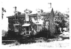 | David Powell House | under 500 feet | 1983 |
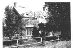 | Joseph Tattersall House | under 500 feet | 1982 |
| Duckworth Grimshaw House | under 500 feet | 1980 | |
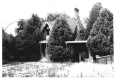 | William Robinson House | 0.1 miles | 1983 |
 | David Muir House | 0.2 miles | 1980 |
| George Albert Bradshaw House | 0.2 miles | 1983 |
| National Archives record | The nomination case file for reference 82004098 in Record Group 79. |
| Beaver County | All 111 listed properties in this county. |