 Block
From the record
7 National Register listings published here.
Sources: the National Register database, National Park Service
41 topographic sheets cover 18 settlements here, and 7 properties are on the National Register of Historic Places.
7 National Register listings published here.
Sources: the National Register database, National Park Service
Every property in this county listed on the National Register of Historic Places, with the year it was listed and the federal nomination document.
| Photograph | Property | Type | Listed | Reference |
|---|---|---|---|---|
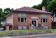 | Clarkston Public Library | building | 1982 | 82004193 |
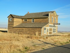 | Cloverland Garage | building | 1986 | 86000895 |
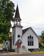 | Full Gospel Church | building | 1972 | 72001266 |
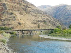 | Grande Ronde River Bridge | structure | 1995 | 95000262 |
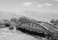 | Indian Timothy Memorial Bridge | structure | 1982 | 82004194 |
 | US Post Office-Clarkston Main | building | 1991 | 91000642 |
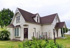 | C. C. Van Arsdol House | building | 1975 | 75001839 |
Every wildfire the federal occurrence database records inside this county: 208 of them, burning about 54,898 acres. 139 started naturally and none was recorded as arson. Each settlement page carries the fires within five miles of it.
| Reported cause | Fires |
|---|---|
| Natural | 139 |
| Missing data/not specified/undetermined | 26 |
| Recreation and ceremony | 21 |
| Debris and open burning | 9 |
| Smoking | 4 |
| Equipment and vehicle use | 4 |
| Power generation/transmission/distribution | 3 |
| Fireworks | 2 |
The five largest, by the area the report gives. None of them was recorded as arson.
| Date | Cause | Size | Reported by | Name on the report |
|---|---|---|---|---|
| 6 July 2007 | Missing data/not specified/undetermined | 17,420 acres | Washington State Department of Natural Resources Headquarters | not named |
| 5 July 2015 | Missing data/not specified/undetermined | 9,859 acres | Washington State Fire Marshal's Office | GILMORE GULCH |
| 2 August 1997 | Natural | 6,500 acres | Spokane District | POWWAHKEE |
| 18 August 2007 | Equipment and vehicle use | 3,399 acres | Umatilla National Forest | COTTONWOOD |
| 25 July 1994 | Natural | 2,580 acres | Umatilla National Forest | BRACKEN |
| 2 August 2012 | Missing data/not specified/undetermined | 2,494 acres | Washington State Fire Marshal's Office | WEISSENFELS RIDGE |
| 8 June 2013 | Missing data/not specified/undetermined | 2,450 acres | Washington State Department of Natural Resources Headquarters | BMIDC INC 217 - MAIL TRAIL |
| 11 August 1997 | Debris and open burning | 1,800 acres | Umatilla National Forest | STAR |
Every settlement page carries the fires within five miles of it - see the settlement index below.
The NOAA Storm Events Database holds 48 reports for this county, causing no deaths, no injuries and about $1,776,250 in recorded property damage. Each settlement page carries the reports that name it.
| Kind of event | Reports |
|---|---|
| Hail | 21 |
| Thunderstorm Wind | 15 |
| Flash Flood | 8 |
| Lightning | 2 |
| Heavy Rain | 1 |
| Flood | 1 |
The most serious of them, by death, then injury, then recorded damage. The accounts are quoted exactly as the forecast office filed them.
| When | Event | Place named | Harm | What the report says |
|---|---|---|---|---|
| April 2017 | Flash Flood | Mountain View | $1,500,000 | A Flash Flood closed Highway 129 near where Rattlesnake Creek meets the Grande Ronde River. The road was closed for three hours and then opened up to one lane of traffic. |
| June 2022 | Flash Flood | Clarkston Hgts | $110,000 | Several roads were inundated with mud and rocks from flash flooding. Four basement apartments on 14th street were flooding. Another residence on Solar Hills Drive was flooded. |
| September 1998 | Flash Flood | Clarkston | $30,000 | Over 0.75" fell over the Clarkston Valley causing flooding on the Interstate bridge and prompting to be closed for two hours. Several roads were also under about a foot of water. |
| September 1998 | Flash Flood | Clarkston | $30,000 | Rainfall amounts of up to 0.87" fell over the Clarkston Valley, causing several streets to flood and mudslides closing roads. |
| June 2023 | Flash Flood | Clarkston Hgts | $20,000 | Flash flooding impacted several roads of Clarkston. Half an inch of rain fell in 15 minutes from 1330LST to 1345LST. Flooding also impacted on State Highway 129 between Asotin and Clarkston, with mud and debris on the roadway. |
| June 2022 | Thunderstorm Wind | Clarkston Hgts | $20,000 | Several trees and power lines down in Clarkston and Clarkston Heights. One incident involved power lines down onto a vehicle. |
| June 2022 | Flash Flood | Cloverland | $12,000 | Asotin County Fire District observed minor flooding at McGuire Gulch where it crosses Asotin Creek Road and said his department received similar reports from the top end of the gulch near where it crosses Peola Road. At the button end of the gulch, Hardin said water entered a shop, flooded a field and surrounded barns. |
| September 2024 | Thunderstorm Wind | Clarkston Hgts | $10,000 | Large tree branches snapped and fell on camper along with power lines. Lewiston Airport reported at gusts of 49 MPH. |
| August 2016 | Lightning | Asotin | $10,000 | A report of lightning causing a house fire in Asotin, WA at 9am on August 7th was received through social media. |
| June 2009 | Thunderstorm Wind | Clarkston | $10,000 | Strong downburst winds from a thunderstorm knocked out power to 2,000 customers in Clarkston when a tree blew down on a power line. An addition, a portable carport was blown into another power line. Another tree was uprooted knocking down another power line and landing on a shop. |
| June 2002 | Thunderstorm Wind | Clarkston | $5,000 | A severe thunderstorm moving off the Blue Mountains blew over power poles. |
| June 2008 | Thunderstorm Wind | Clarkston | $4,000 | no account filed |
| June 2019 | Thunderstorm Wind | Clarkston Hgts | $2,000 | A member of the public reported large tree branches and power lines down in Clarkston. |
| February 2017 | Flash Flood | Mountain View | $2,000 | Flooding occurred along Dreamz Road as a flood wave passed from a disintegrating ice jam farther upstream. Four feet of water was reported in the yard of a home and a small shed was floated and carried by the flood wave. |
| August 2008 | Thunderstorm Wind | Anatone | $2,000 | Six to ten 18 to 24 inch diameter trees were uprooted by winds estimated between 50 to 60 miles per hour along Highway 129 between mile posts 6 and 14. |
| August 2008 | Thunderstorm Wind | Anatone | $2,000 | Small trees were downed by strong wind gusts from a thunderstorm. The wind also damaged and blew away yard objects. |
| May 2006 | Thunderstorm Wind | Clarkston | $2,000 | no account filed |
| August 2024 | Lightning | Clarkston Hgts | $1,000 | Lightning ignited a house fire on the 2300 block of 19th Street. Fire department quickly extinguished the portion of the roof that ignited. |
| July 2012 | Flash Flood | Anatone | $1,000 | Park Ranger reported water out of ditches and over roads. Road damage due to the water. |
| May 1997 | Thunderstorm Wind | Clarkston | $1,000 | 65 mph gust, large tree down |
| June 2007 | Hail | Anatone | $1,000 | no account filed |
| August 2007 | Thunderstorm Wind | Clarkston | $1,000 | no account filed |
| June 2012 | Hail | Anatone | $250 | Hail cracked a windshield at the Boggans Oasis Bar and Grill. |
| June 2022 | Hail | Clarkston Hgts | - | Delayed report via social media. Time and location estimated via radar. |
| June 2020 | Hail | Clarkston | - | A member of the public reported hail with a diameter of 1 inch from thunderstorms near Clarkston. |
| June 2020 | Hail | Cloverland | - | A CO-OP observer reported hail with a diameter of 1 inch from passing thunderstorms in Anatone. |
| July 2019 | Thunderstorm Wind | Clarkston Hgts | - | A grass fire was reported near Silcott caused by power lines blown down by thunderstorm winds. Time estimated from radar data. The local Utility Company reported 2400 customers without power in the Lewiston and Clarkston area as a result of thunderstorm winds bringing down power lines in and around the cities. |
| June 2016 | Hail | Anatone | - | A member of the public reported 1.25 inch size hail which caused dents in a car near Anatone, Washington. |
| July 2014 | Thunderstorm Wind | Mountain View | - | Trained spotter estimated thunderstorm winds of 55 to 60 mph in Anatone near the intersection of Highway 129 and Pine Street. Tree limbs branches were down across town. Hail to the size of pennies was also observed. Larger hail likely accompanied the storms prior to moving into Anatone. |
| July 2014 | Thunderstorm Wind | Clarkston Hgts | - | The Silcott Island observation platform located on an island in the Snake River clocked sustained winds near 35 mph with gusts between 59 and 72 mph. |
| June 2012 | Hail | Cloverland | - | A severe thunderstorm developed in the northeast Blue Mountains and drifted north-northeastward. The thunderstorm produced hail up to the size of quarters before it weakened as it moved off the northern foothills of the Blue Mountains. |
| June 2011 | Hail | Rogersburg | - | A severe thunderstorm moved into Asotin County from northeast Oregon during the late afternoon or early evening hours. The public reported hail stones up to the size of golf balls as the storm moved over Montgomery Ridge. |
| August 2008 | Hail | Anatone | - | Hail accumulated to a depth of several inches. |
| August 1999 | Heavy Rain | Asotin | - | 0.80" of rain in 10 minutes. Small hail also. |
| March 2013 | Thunderstorm Wind | Clarkston Hgts | - | no account filed |
| September 2013 | Hail | Grouse | - | no account filed |
| June 2012 | Hail | Clarkston Hgts | - | no account filed |
| June 2012 | Hail | Anatone | - | no account filed |
| July 2012 | Hail | Mountain View | - | no account filed |
| August 2010 | Hail | Asotin | - | no account filed |
| August 2010 | Hail | Anatone | - | no account filed |
| June 2010 | Flood | Asotin | - | no account filed |
| May 2009 | Hail | Cloverland | - | no account filed |
| August 2008 | Hail | Asotin | - | no account filed |
| August 2008 | Hail | Anatone | - | no account filed |
| August 2006 | Hail | Anatone | - | no account filed |
| August 2000 | Hail | Anatone | - | no account filed |
| June 1961 | Hail | not stated | - | no account filed |
The Survey's mineral resources record lists 47 workings inside this county. 1 still produces and 46 are closed or unrecorded. Each settlement page carries the workings within five miles of it.
| Commodity | Workings |
|---|---|
| Sand and Gravel, Construction | 16 |
| Copper | 12 |
| Stone, Crushed/Broken | 9 |
| Silver | 4 |
| Pumice | 2 |
| Limestone, General | 2 |
| Gold | 2 |
| Zirconium, Titanium, Iron | 2 |
| Silver, Gold | 1 |
| Silver, Lead, Gold | 1 |
| Tungsten | 1 |
| Marble, Dimension | 1 |
| Flagstone | 1 |
| Lead | 1 |
The least common of them first, because a county's hundredth gravel pit says nothing its first ten did not.
| Where | Site | Commodity | Status | Recorded |
|---|---|---|---|---|
| Asotin Creek Quarry | Marble, Dimension | Past Producer | ||
| Clarkston Quarry | Flagstone | Past Producer | ||
| Goldfield Numbers 1 and 3 | Copper, Silver, Gold | Prospect | ||
| Joseph Creek | Tungsten | Unknown | ||
| Lime Hill Prospects | Lead, Copper, Gold, Silver, Zinc | Prospect | ||
| Mammoth Copper | Copper, Silver, Lead, Gold | Prospect | ||
| Prospect No. 40 | Copper, Gold, Silver | Prospect | ||
| Warm Springs Group | Copper, Zinc, Silver, Gold | Prospect | ||
| Asotin Creek | Pumice | Occurrence | ||
| Clarkston Placer | Gold, Zirconium, Titanium, Iron | Past Producer | ||
| Dry Gulch | Pumice | Past Producer | ||
| Pollyann and Limestone Placers | Limestone, General | Prospect | ||
| Rogersburg | Limestone, General | Occurrence | ||
| Snake River Placers | Gold, Zirconium, Titanium, Iron | Past Producer | ||
| Apex | Silver, Copper | Past Producer | ||
| Lode | Copper, Silver | Prospect | ||
| Prospects No. 39 | Copper, Silver | Prospect | ||
| Unnamed Prospect | Copper, Silver | Prospect | ||
| Benedict Quarry | Stone, Crushed/Broken | Past Producer | ||
| Borrow Pit | Stone, Crushed/Broken | Past Producer | ||
| Farrish Quarry | Stone, Crushed/Broken | Past Producer | ||
| Hostettler Quarry | Stone, Crushed/Broken | Past Producer | ||
| Unnamed Pit | Stone, Crushed/Broken | Past Producer | ||
| Unnamed Pit | Stone, Crushed/Broken | Past Producer | ||
| Unnamed Quarry | Stone, Crushed/Broken | Past Producer | ||
| Unnamed Quarry | Stone, Crushed/Broken | Past Producer | ||
| Unnamed Quarry | Stone, Crushed/Broken | Past Producer | ||
| Evening | Copper | Prospect | ||
| Morning | Copper | Prospect | ||
| Prospects No. 48 | Copper | Prospect | ||
| Shovel Creek Lode | Copper | Prospect | ||
| Asotin Pit | Sand and Gravel, Construction | Past Producer | ||
| Clarkston Pit | Sand and Gravel, Construction | Past Producer | ||
| Clarkston Pit | Sand and Gravel, Construction | Past Producer | ||
| Conner's Gulch Pit | Sand and Gravel, Construction | Past Producer | ||
| Dry Gulch Quarry | Sand and Gravel, Construction | Producer | ||
| Fleser Pit | Sand and Gravel, Construction | Past Producer | ||
| Gravel Pit | Sand and Gravel, Construction | Past Producer | ||
| Lunnamed Pit | Sand and Gravel, Construction | Past Producer | ||
| Puyears Pit | Sand and Gravel, Construction | Past Producer | ||
| Silcott Pit | Sand and Gravel, Construction | Past Producer | ||
| Taplin Pit | Sand and Gravel, Construction | Past Producer | ||
| Unnamed Pait | Sand and Gravel, Construction | Past Producer | ||
| Unnamed Pit | Sand and Gravel, Construction | Past Producer | ||
| Unnamed Pit | Sand and Gravel, Construction | Past Producer | ||
| Unnamed Pit | Sand and Gravel, Construction | Past Producer | ||
| Vineland Pit | Sand and Gravel, Construction | Past Producer |
Named settlements recorded in the Geographic Names Information System, each with the topographic sheets covering it. Villages, hamlets and abandoned places alike. Each is shown with the nearest named watercourse or landform and the survey quadrangle it falls on.
Asotin census division · 99402 · Near Hoskins Gulch · Weissenfels Ridge quadrangle
10 sheets, 1944 to 1981
83501 · Near Schoolhouse Draw · Captain John Rapids quadrangle
9 sheets, 1946 to 1981
Asotin census division · 99401 · Near Corral Ridge · Mountain View quadrangle
12 sheets, 1943 to 1995
Asotin census division · 99401 · Near Corral Ridge · Mountain View quadrangle
12 sheets, 1943 to 1995
Asotin census division · 99402 · On Grande Ronde River · Limekiln Rapids quadrangle
10 sheets, 1946 to 1981
Clarkston census division · 99403 · On Silcott Island · Silcott Island quadrangle
10 sheets, 1945 to 1981
Asotin census division · 99402 · Weissenfels Ridge quadrangle
10 sheets, 1944 to 1981
No longer a settlement
Asotin census division · 99402 · Near Montgomery Ridge · Limekiln Rapids quadrangle
10 sheets, 1946 to 1981
No longer a settlement
The vanished settlements of Asotin County: the places named above that are no longer on the map.