Block
From the record
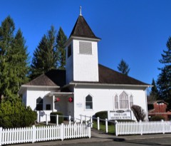
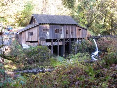
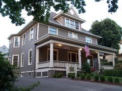
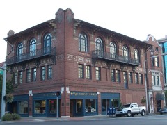
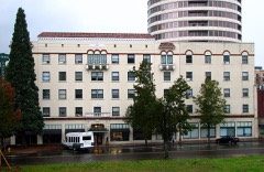
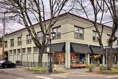
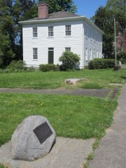
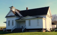
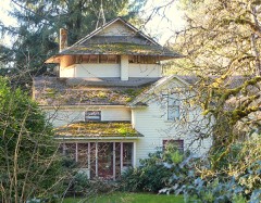
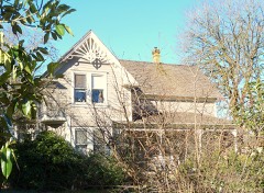
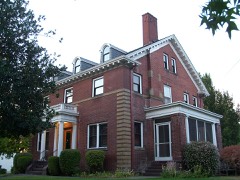
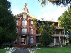
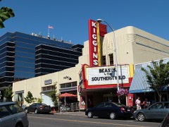
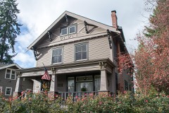
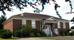
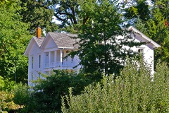
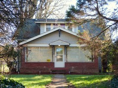
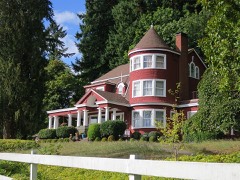
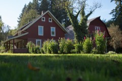
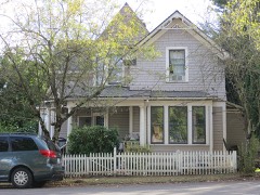
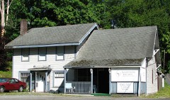
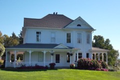
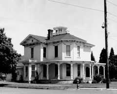
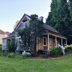
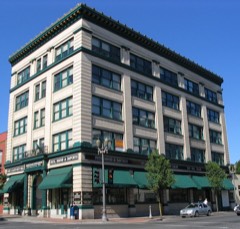
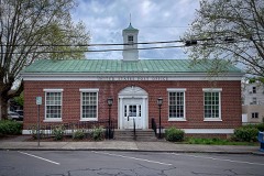
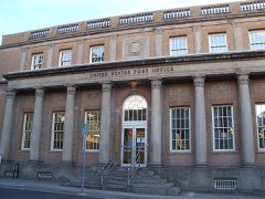
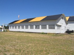
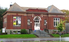
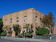
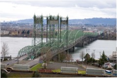
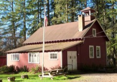
45 National Register listings published here.
Sources: the National Register database, National Park Service
125 topographic sheets cover 86 settlements here, and 45 properties are on the National Register of Historic Places.
45 National Register listings published here.
Sources: the National Register database, National Park Service
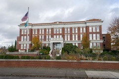
Every property in this county listed on the National Register of Historic Places, with the year it was listed and the federal nomination document.
Every wildfire the federal occurrence database records inside this county: 779 of them, burning about 974 acres. 27 started naturally and 53 were recorded as arson. Each settlement page carries the fires within five miles of it.
| Reported cause | Fires |
|---|---|
| Debris and open burning | 261 |
| Recreation and ceremony | 184 |
| Missing data/not specified/undetermined | 129 |
| Arson/incendiarism | 53 |
| Equipment and vehicle use | 29 |
| Natural | 27 |
| Fireworks | 25 |
| Misuse of fire by a minor | 22 |
| Other causes | 17 |
| Smoking | 17 |
| Power generation/transmission/distribution | 9 |
| Railroad operations and maintenance | 6 |
The five largest, by the area the report gives. One of them was set deliberately.
| Date | Cause | Size | Reported by | Name on the report |
|---|---|---|---|---|
| 8 September 2020 | Missing data/not specified/undetermined | 166 acres | Pacific Cascade Region-DNR | FRUIT VALLEY |
| 5 October 2012 | Missing data/not specified/undetermined | 145 acres | Steigerwald Lake National Wildlife Refuge | STEIGERWALD LAKE |
| 14 August 2010 | Recreation and ceremony | 110 acres | Washington State Department of Natural Resources Headquarters | HILLTOP |
| 11 October 2009 | Arson/incendiarism | 60 acres | Washington State Department of Natural Resources Headquarters | JACKSON 3 |
| 17 August 1992 | Misuse of fire by a minor | 35 acres | Washington State Department of Natural Resources Headquarters | not named |
| 31 May 1995 | Debris and open burning | 30 acres | Washington State Department of Natural Resources Headquarters | not named |
| 15 November 1997 | Debris and open burning | 20 acres | Washington State Department of Natural Resources Headquarters | not named |
| 7 September 2020 | Missing data/not specified/undetermined | 15 acres | Washington State Department of Natural Resources Headquarters | WIEHL |
Every settlement page carries the fires within five miles of it - see the settlement index below.
The NOAA Storm Events Database holds 71 reports for this county, causing 6 deaths, 306 injuries and about $29,355,000 in recorded property damage. Each settlement page carries the reports that name it.
| Kind of event | Reports |
|---|---|
| Tornado | 15 |
| Thunderstorm Wind | 14 |
| Flood | 12 |
| Heavy Rain | 11 |
| Funnel Cloud | 8 |
| Hail | 7 |
| Lightning | 4 |
The most serious of them, by death, then injury, then recorded damage. The accounts are quoted exactly as the forecast office filed them.
| When | Event | Place named | Harm | What the report says |
|---|---|---|---|---|
| April 1972 | Tornado (F3) | not stated | 6 killed, 300 hurt, $25,000,000 | no account filed |
| June 2001 | Thunderstorm Wind | Vancouver | 5 hurt, $25,000 | no account filed |
| June 1989 | Tornado (F1) | not stated | 1 hurt, $2,500 | no account filed |
| December 2015 | Heavy Rain | Hazel Dell | $1,781,000 | Heavy rain resulted in urban flooding across the Vancouver metro area. SE Mill PLain was closed between 172nd and 192nd due to deep standing water. An apartment building in Hazell Dell was evacuated due to a land slide. |
| June 2011 | Flood | Hazel Dell | $1,200,000 | Heavy rain combined with snowmelt runoff to produce flooding on the Columbia River. The Columbia River at Vancouver (VAPW1) crested at 17.43 feet at 07:30 am on June 2nd, 2011. The Clark County Parks Department sustained significant damage at Captain William Clark Park in Camas and inumdation/minor damage at three other parks (Vancouver Lake, Frenchman's Bar, and Salmon Creek Trail) along the Columbia, totaling about $50k - $100k. The Port of Camas-Washougal reports about $100k estimated cost to repair two sections of levee that had significant erosion damage. Vancouver Public Works reported damage to the Vancouver Renaissance Walkway, with a rough estimate of repair costs $100k - $1M. |
| January 2008 | Tornado (EF1) | Hazel Dell | $525,000 | Tornado had estimated wind speeds of 90 to 110 mph. Damage reports along the path of the tornado include: 200+ trees down, most between 12 to 24 inches in diameter, and approximately 6 trees greater than 36 inches; 30 to 40 homes damaged, with primarily roof damage; 19 power poles were snapped off; 3 lightly constructed structures were destroyed; a parked semi-trailer was tipped over, and several dozen sculling boats were damaged near Vancouver Lake. |
| December 2015 | Tornado (EF1) | Battle Ground | $311,000 | Around 36 homes and 2 businesses sustained damage from the tornado. Dozens of trees with a diameter of 1 to 3 feet were uprooted and blown down, and around a half of a dozen 1 to 2 foot diameter trees were snapped. |
| May 2011 | Flood | Hazel Dell | $300,000 | Heavy rain combined with snowmelt runoff to produce flooding on the Columbia River. The Columbia River at Vancouver (VAPW1) crested at 17.43 feet on June 2nd, 2011. |
| September 2021 | Tornado (EF0) | Dollar Corner | $40,000 | An EF-0 tornado with estimated winds of 85 mph (DI:28 ,DOD:3) began near the intersection of NE 72nd Avenue and State Highway 502 at 45.7804 latitude, -122.5982 longitude. The tornado tracked in a northeast direction, ending up near NE 259th St. and NE 147th Ave at 45.8105 latitude and -122.5229 longitude. The tornado path was about 240 yards wide with a track length of about 3.9 miles. The estimated start and end time of the tornado is 1806PST and 1821PST. No injuries or fatalities were reported. The majority of the damage was to trees that were uprooted or snapped. Other damage included a tree that fell on an RV, and fences damaged by toppled trees. |
| October 2015 | Heavy Rain | Washougal | $30,000 | There were several reports of 3 to 4 inches of 24-hour Rain totals in Clark County. A trained spotter reported that the Washougal River was near bank full. Another weather spotter reported a minor mudslide on Washougal River Road between mile posts 3 and 4 where the debris was 3 inches deep. An Emergency Manager claimed were three residential floodings, several places with high water, and two road closures (Southeast Mill Plain and Southeast Village Loop). |
| October 2025 | Thunderstorm Wind | Highland | $25,000 | The NWS Damage Assessment Team surveyed wind damage from a strong convective shower that moved through Longview, Washington around 3:13 PM PDT Oct. 12, 2025. Based on the wind damage, estimated peak winds of 80-85 mph occurred, most likely with a wet microburst that produced damaging straight-line winds over a small geographic area. |
| October 1984 | Tornado (F1) | not stated | $25,000 | no account filed |
| August 1999 | Lightning | La Center | $15,000 | Lightning from one of the many intense thunderstorms in Northwest Oregon and Southwest Washington struck a maple tree on the BS Ranch in Northeast Clark county and killed four beef cows and a bull. |
| October 2021 | Thunderstorm Wind | Amboy | $10,000 | Storm Survey for convective wind damage around 1 pm at Lake Merwin, WA. Somewhat significant tree damage at the Woodland Park area, as well as a fresh large tree, roughly 2 feet, snapped near the Lewis River RV park. |
| March 2013 | Tornado (EF0) | Venersborg | $10,000 | A tornado touched down 2 miles NE of Hockinson Washington. A barn roof was partially torn off. No other damage was noted to nearby trees, structures, or other vegetation around the barn. |
| June 1997 | Lightning | Hockinson | $10,000 | Lightning struck a house in Hockinson and caused a brief fire and damaged home electronics. |
| May 1997 | Tornado (F0) | Vancouver | $10,000 | A weak tornado briefly touched down in the Walnut Grove area of Vancouver, near I-205 and 4th Plain. A car was damaged, the roofing of a house was damaged, and a small shed was blown over. |
| May 2000 | Tornado (F0) | Battle Ground | $10,000 | no account filed |
| April 2004 | Hail | Ridgefield | $7,500 | no account filed |
| May 2005 | Lightning | Ridgefield | $6,000 | Scattered thunderstorms produced heavy rain over the area. A storm near Ridgefield, WA produced heavy rains, sending 6 to 8 inches of water into a pump station. During that same storm, a lightning strike hit the pump station, burning out a control panel and disabling the station. |
| February 2025 | Thunderstorm Wind | Scotton Corner | $5,000 | Public report of a large tree which had fallen on a house via photo on Facebook. Time estimated from radar. |
| June 2018 | Thunderstorm Wind | Vancouver Vrgrn Arpt | $3,000 | A large gust of wind blew through the Harmony Sports Complex and tipped over a wooden equipment shed. A man and young girl standing next to the shed were struck by the edge as it fell. The young girl was trapped under the shed, sustaining non-life-threatening injuries. |
| March 2017 | Tornado (EF0) | Orchards | $2,000 | A short-lived thunderstorms dropped a brief, weak tornado on the west side of Orchards. Tornado damaged a fence in the vicinity of NE 99th Street and NE 140th Ct. On NE 105th Ave. north of NE 67th St. a 12-by-12-foot metal shed was lifted up and placed back down and tree branches about 4 inches in diameter were snapped off. |
| October 2017 | Tornado (EF0) | Salmon Creek | $2,000 | The National Weather Service survey team confirmed an EF-0 tornado. The tornado started north of NE 31st Ave and NE 144th St and ended near the col-de-sac on NE 33rd Ave. Two large trees lost limbs, a couple fences were blown over, and some patio furniture were damaged; however, there was no structural damage to any houses in the neighborhood. |
| October 2025 | Funnel Cloud | La Center | - | Broadcast media reported a funnel cloud associated with a strong rain shower around 3:53 PM PDT Oct. 12, 2025 in La Center, Washington. There were no reports of a tornado on the ground and/or wind damage with this cell. |
| September 2024 | Funnel Cloud | La Center | - | A video posted by the general public on Facebook showed rotation within a funnel cloud. The video was taken from La Center, Washington and showed the funnel to the northwest. The location is an estimate from the video and radar data. |
| October 2024 | Funnel Cloud | Cherry Grove | - | Video showing what looks like an actual funnel cloud. Weak rotation evident on radar with a shower during the time of the report. No debris was being lofted, so confidence is high this was not a tornado. |
| August 2024 | Funnel Cloud | Vancouver | - | A short-lived funnel cloud was observed close to the Columbia River in Vancouver, WA by multiple people in Vancouver, Washington and from across the river in Portland Oregon. |
| December 2023 | Heavy Rain | Lake Shr | - | The AMTRAK rail experienced a small landslide on their track between mile marker 129 and 130.5 near Felida and canceled the train between Seattle and Portland through December 7th. No impacts other than their internal transportation delays occurred. |
| June 2023 | Funnel Cloud | Camas | - | Social Media video shared via Twitter showed a funnel cloud with observable rotation. The person was located in Camas, WA near SE 2nd Ave and SE Cedar St facing south towards the Columbia River. A media article shared another video of the waterspout over the Camas Slough and stated that the waterspout was observed for several minutes. |
| October 2023 | Tornado (EF0) | La Center | - | A brief tornado confirmed by video appeared on the ground for less than 1 minute in La Center, WA. Trash cans and a basketball hoop were blown over, along with a few roof shingles seen swirling in the air. |
| November 2022 | Flood | Hazel Dell | - | Clogged drains resulted in minor street flooding. Up to 3 inches of rain fell on the 4th in the area. |
| November 2022 | Flood | Hazel Dell | - | Clogged drains resulted in minor street flooding. Up to 3 inches of rain fell on the 4th in the area. |
| November 2022 | Flood | Pioneer | - | Clogged drains resulted in minor street flooding. Up to 3 inches of rain fell on the 4th in the area. |
| September 2019 | Funnel Cloud | Minnehaha | - | A trained NWS Spotter reported seeing a funnel cloud in the area. |
| September 2019 | Funnel Cloud | Minnehaha | - | A trained weather spotter reported seeing a funnel cloud. |
| May 2018 | Flood | Vancouver | - | The Columbia River at Vancouver crested several times above flood stage May 17 through May 19th, with the highest crest at 16.14 feet around 8:15 AM on May 17th. This is 0.14 foot above flood stage. No damage was reported. |
| March 2017 | Flood | Vancouver | - | Recent heavy rains and snowmelt from the Cascades and eastern Washington led to rising river levels on the Columbia River. The river crested at 17.59 ft on March 30th, which is 1.59 feet above flood stage. The river remained above flood stage until April 3rd. |
| April 2017 | Flood | Vancouver | - | To start off April, the Columbia River gauge at Vancouver was up around 17.22 ft, which is 1.22 ft above flood stage. On April 3rd, the river finally dropped below flood stage. |
| October 2017 | Flood | Washougal | - | Heavy rain caused the Washougal River at Washougal to flood. The river crested at 14.97 feet, which is 0.97 foot above flood stage. |
| June 2013 | Funnel Cloud | Vancouver | - | A funnel cloud was observed about 2 miles WNW of the Portland International airport. The observer estimated that it extended 200 to 300 feet below the cloud base. The funnel cloud lasted approximately 5 minutes. |
| September 2013 | Flood | Ridgefield | - | A total of 9.54 inches was measured at Rock Creek from September 28, 2013 through September 30, 2013 which caused local flooding. |
| January 2009 | Flood | Washougal | - | Heavy rain and subsequent flooding resulted in the evacuation of 10 homes along the Washoughal River. |
| January 2009 | Flood | Highland | - | Heavy rain and subsequent flooding resulted in the evacuation of 400 people. |
| June 2008 | Thunderstorm Wind | La Center | - | The wind toppled a small tree, which fell onto the roadway. |
| June 2008 | Thunderstorm Wind | La Center | - | A gust of wind knocked power lines down. |
| June 2008 | Thunderstorm Wind | Yacolt | - | A wind gust knocked a small tree down, blocking a roadway. |
| June 2008 | Thunderstorm Wind | Ridgefield | - | A wind gust knocked power lines down, and resulted in quite a lot of tree debris on the road. |
| June 2008 | Thunderstorm Wind | Ridgefield | - | A few wind-fallen trees were blocking a roadway. |
| June 2008 | Thunderstorm Wind | La Center | - | Lots of tree debris reported on the highway. |
| January 2007 | Heavy Rain | Washougal | - | A total accumulation of 1.76 inches was reported at Washougal. |
| December 2007 | Heavy Rain | Evergreen Arpt | - | Storm total precipitation was 3.73 inches. |
| November 2006 | Heavy Rain | Vancouver Pearson Ar | - | Recorded a 5-day total of 7.5 inches. |
| May 2004 | Tornado (F0) | La Center | - | A tornado reportedly touched down 2 miles northeast of La Center and uprooted a 1 1/2 foot diameter tree and tore off part of a barn roof. |
| September 2004 | Tornado (F0) | Ridgefield | - | A tornado ripped through the Ridgefield Wildlife Refuge, lifting and damaging a mobile home office, blowing down trees and snapping large tree limbs. A tree was blown down on top of a car. |
| September 2004 | Thunderstorm Wind | Ridgefield | - | Strong thunderstorms moved through Clark county generating strong winds. The Clark County Emergency Manager reported numerous trees were blown down at the Ridgefield Wildlife Refuge. |
| September 1997 | Tornado (F0) | Yacolt | - | A weak tornado near Yacolt knocked down 3 trees and a telephone pole. |
| September 1997 | Lightning | Sifton | - | A lightning strike caused a widespread power outage that left 20000 homes without power for about 3 hours. A large school and several businesses closed for the day, and 3/4 of the traffic lights in Vancouver were out of service. |
| May 2008 | Hail | Washougal | - | no account filed |
| September 2006 | Hail | Camp Bonneville | - | no account filed |
The Survey's mineral resources record lists 84 workings inside this county. 12 still produce and 72 are closed or unrecorded. Each settlement page carries the workings within five miles of it.
| Commodity | Workings |
|---|---|
| Sand and Gravel, Construction | 45 |
| Stone, Crushed/Broken | 13 |
| Gold | 6 |
| Clay | 6 |
| Iron | 5 |
| Stone | 3 |
| Platinum | 2 |
| Mercury | 2 |
| Aluminum | 2 |
| Lead, Zinc, Silver, Gold, Copper | 1 |
| Nickel | 1 |
| Aluminum, Contained or Metal | 1 |
| Titanium, Iron | 1 |
| Copper | 1 |
The least common of them first, because a county's hundredth gravel pit says nothing its first ten did not.
| Where | Site | Commodity | Status | Recorded |
|---|---|---|---|---|
| (Facility) Vancouver Aluminum Smelter | Aluminum, Contained or Metal | Plant | ||
| Brush Prairie Placer | Gold, Titanium, Iron | Prospect | ||
| Camas Placer | Titanium, Iron, Gold | Unknown | ||
| Red Rock Quarry | Stone, Dimension | Past Producer | ||
| Silver Star Mine | Copper, Zinc, Silver, Lead, Gold, Cobalt, Nickel | Past Producer | ||
| Silver Star Prospect | Lead, Zinc, Silver, Gold, Copper, Nickel | Occurrence | Bornite, Chalcopyrite, Galena, Gold, Malachite, Pyrite, Sphalerite | |
| Sunset Falls | Vanadium | Occurrence | ||
| Boardman | Clay, Aluminum | Occurrence | ||
| Fly Creek Deposit | Aluminum | Occurrence | ||
| Golden Wonder | Mercury, Gold | Occurrence | Cinnabar, Pyrite | |
| Mc Munn Placer | Gold, Platinum | Past Producer | ||
| Smith | Mercury | Occurrence | ||
| South Fork Lewis River | Gold, Platinum | Past Producer | 1895 | |
| Mill Plain Pit | Stone | Producer | ||
| Nichols Pit | Stone | Past Producer | ||
| Woodland Pit | Stone | Producer | ||
| Bokemier Iron Deposit | Iron | Prospect | ||
| Canyon Creek Placer | Iron | Prospect | ||
| Howland Acres Prospect | Iron | Occurrence | Limonite | |
| Washougal Pit | Iron | Producer | ||
| Washougal Prospect | Iron | Occurrence | Magnetite | |
| Hanna Farm | Clay | Prospect | ||
| Hidden Brick Co | Clay | Past Producer | ||
| Image | Clay | Past Producer | ||
| Lewis River Placer | Gold | Past Producer | ||
| R B Muffet Brick and Tile Co | Clay | Past Producer | ||
| Washington | Gold | Unknown | ||
| Wilde | Clay | Past Producer | ||
| B and S Rock Quarry | Stone, Crushed/Broken | Past Producer | ||
| Colt Quarry | Stone, Crushed/Broken | Past Producer | ||
| Crawford | Stone, Crushed/Broken | Past Producer | ||
| Finn Hill Quarry | Stone, Crushed/Broken | Past Producer | ||
| Haag & Shaw Pit | Stone, Crushed/Broken | Past Producer | ||
| Maple Quarry | Stone, Crushed/Broken, Sand and Gravel, Construction | Past Producer | ||
| Unnamed Quarry | Stone, Crushed/Broken | Past Producer | ||
| Unnamed Quarry | Stone, Crushed/Broken, Sand and Gravel, Construction | Past Producer | ||
| Unnamed Quarry | Stone, Crushed/Broken | Past Producer | ||
| Unnamed Quarry | Stone, Crushed/Broken | Past Producer | ||
| Unnamed Quarry | Stone, Crushed/Broken | Past Producer | ||
| Unnamed Quarry | Stone, Crushed/Broken | Past Producer | ||
| Woodland Pit | Stone, Crushed/Broken | Past Producer | ||
| Daybreak Pit | Sand and Gravel, Construction | Past Producer | ||
| Gravel Pit | Sand and Gravel, Construction | Past Producer | ||
| Gravel Pit | Sand and Gravel, Construction | Past Producer | ||
| Gravel Pit | Sand and Gravel, Construction | Past Producer | ||
| Gravel Pit | Sand and Gravel, Construction | Past Producer | ||
| Gravel Pit | Sand and Gravel, Construction | Past Producer | ||
| Haapa Pit | Sand and Gravel, Construction | Past Producer | ||
| Homan Pit | Sand and Gravel, Construction | Past Producer | ||
| Lewis River Pit | Sand and Gravel, Construction | Past Producer | ||
| Lewis River Plant | Sand and Gravel, Construction | Producer | ||
| Livingston Quarry | Sand and Gravel, Construction | Producer | ||
| Lower River Road Pit and Plant | Sand and Gravel, Construction | Past Producer | ||
| Marrion Pit | Sand and Gravel, Construction | Past Producer | ||
| Mill Plain Pit & Plant | Sand and Gravel, Construction | Producer | ||
| Salmon Creek Pit | Sand and Gravel, Construction | Past Producer | ||
| Sand Pit | Sand and Gravel, Construction | Past Producer | ||
| Smith Brothers Pit | Sand and Gravel, Construction | Past Producer | ||
| Tebo Pit | Sand and Gravel, Construction | Producer | ||
| Unnamed | Sand and Gravel, Construction | Past Producer | ||
| Unnamed Operation | Sand and Gravel, Construction | Past Producer | ||
| Unnamed Pit | Sand and Gravel, Construction | Past Producer | ||
| Unnamed Pit | Sand and Gravel, Construction | Past Producer | ||
| Unnamed Pit | Sand and Gravel, Construction | Producer | ||
| Unnamed Pit | Sand and Gravel, Construction | Past Producer | ||
| Unnamed Pit | Sand and Gravel, Construction | Past Producer | ||
| Unnamed Pit | Sand and Gravel, Construction | Past Producer | ||
| Unnamed Pit | Sand and Gravel, Construction | Producer | ||
| Unnamed Pit | Sand and Gravel, Construction | Past Producer | ||
| Unnamed Pit | Sand and Gravel, Construction | Past Producer | ||
| Unnamed Pit | Sand and Gravel, Construction | Past Producer | ||
| Unnamed Pit | Sand and Gravel, Construction | Past Producer | ||
| Unnamed Pit | Sand and Gravel, Construction | Past Producer | ||
| Unnamed Pit | Sand and Gravel, Construction | Past Producer | ||
| Unnamed Pit | Sand and Gravel, Construction | Past Producer | ||
| Unnamed Pit | Sand and Gravel, Construction | Producer | ||
| Unnamed Pit | Sand and Gravel, Construction | Past Producer | ||
| Unnamed Pit | Sand and Gravel, Construction | Past Producer | ||
| Unnamed Pit | Sand and Gravel, Construction | Past Producer | ||
| Unnamed Pit | Sand and Gravel, Construction | Past Producer | ||
| Unnamed Pit | Sand and Gravel, Construction | Past Producer | ||
| Unnamed Pit Nen | Sand and Gravel, Construction | Past Producer | ||
| Washougal Pit | Sand and Gravel, Construction | Producer | ||
| Whatley Pit | Sand and Gravel, Construction | Past Producer |
Named settlements recorded in the Geographic Names Information System, each with the topographic sheets covering it. Villages, hamlets and abandoned places alike. Each is shown with the nearest named watercourse or landform and the survey quadrangle it falls on.
Battle Ground census division · 98604 · On Little Salmon Creek · Yacolt quadrangle
15 sheets, 1941 to 1990
Yacolt census division · 98675 · On Chelatchie Creek · Amboy quadrangle
14 sheets, 1941 to 1979
Battle Ground census division · 98604 · Near Tukes Mountain · Battle Ground quadrangle
16 sheets, 1940 to 1990
Battle Ground census division · 98604 · Near Tukes Mountain · Battle Ground quadrangle
16 sheets, 1940 to 1990
Vancouver census division · 98660 · Sauvie Island quadrangle
23 sheets, 1915 to 1990
Battle Ground census division · 98606 · On Weaver Creek · Orchards quadrangle
33 sheets, 1897 to 1990
Ridgefield census division · 98642 · On Gee Creek · Saint Helens quadrangle
18 sheets, 1922 to 1990
No longer a settlement
La Center census division · 98604 · On Rock Creek · Battle Ground quadrangle
16 sheets, 1940 to 1990
Battle Ground census division · 98604 · Battle Ground quadrangle
16 sheets, 1940 to 1990
Camas census division · 98607 · Near Spud Mountain · Larch Mountain quadrangle
21 sheets, 1918 to 2000
Battle Ground census division · 98675 · On Cedar Creek · Dole quadrangle
15 sheets, 1941 to 2000
Battle Ground census division · 98604 · Battle Ground quadrangle
16 sheets, 1940 to 1990
Vancouver census division · 98664 · On Love Creek · Mount Tabor quadrangle
33 sheets, 1897 to 1990
Vancouver census division · 98685 · On Cougar Canyon Creek · Vancouver quadrangle
33 sheets, 1897 to 1990
Camas census division · 98607 · Near Brunner Hill · Lacamas Creek quadrangle
23 sheets, 1918 to 1990
La Center census division · 98674 · On Hayes Creek · Woodland quadrangle
14 sheets, 1940 to 1990
Vancouver census division · 98665 · Near Cold Canyon · Vancouver quadrangle
33 sheets, 1897 to 1990
Battle Ground census division · 98606 · On Mud Creek · Lacamas Creek quadrangle
23 sheets, 1918 to 1990
Camas census division · 98607 · Near Livingston Mountain · Larch Mountain quadrangle
21 sheets, 1918 to 2000
Battle Ground census division · 98604 · Battle Ground quadrangle
16 sheets, 1940 to 1990
Vancouver census division · 98642 · On Salmon Creek · Vancouver quadrangle
33 sheets, 1897 to 1990
Battle Ground census division · 98604 · Near Tukes Mountain · Battle Ground quadrangle
16 sheets, 1940 to 1990
La Center census division · 98629 · On Brezee Creek · Ridgefield quadrangle
16 sheets, 1940 to 1990
Vancouver census division · 98665 · On Burnt Bridge Creek · Vancouver quadrangle
33 sheets, 1897 to 1990
Vancouver census division · 98665 · On Burnt Bridge Creek · Vancouver quadrangle
33 sheets, 1897 to 1990
Camas census division · 98606 · Near Camp Hill · Lacamas Creek quadrangle
23 sheets, 1918 to 1990
Camas census division · 98682 · Near Munsell Hill · Lacamas Creek quadrangle
23 sheets, 1918 to 1990
Battle Ground census division · 98675 · On Basket Creek · Yacolt quadrangle
15 sheets, 1941 to 1990
Vancouver census division · 98664 · Mount Tabor quadrangle
33 sheets, 1897 to 1990
Battle Ground census division · 98604 · On Weaver Creek · Battle Ground quadrangle
16 sheets, 1940 to 1990
Orchards census division · 98682 · On Spring Branch · Lacamas Creek quadrangle
23 sheets, 1918 to 1990
Vancouver census division · 98663 · Near Cold Canyon · Vancouver quadrangle
33 sheets, 1897 to 1990
Yacolt census division · 98675 · On Big Tree Creek · Yacolt quadrangle
15 sheets, 1941 to 1990
Camas census division · 98671 · On Walton Creek · Washougal quadrangle
24 sheets, 1918 to 1994
Battle Ground census division · 98686 · On Mill Creek · Vancouver quadrangle
33 sheets, 1897 to 1990
Camas census division · 98607 · On Lacamas Creek · Camas quadrangle
24 sheets, 1918 to 1993
Camas census division · 98607 · On Lacamas Creek · Camas quadrangle
24 sheets, 1918 to 1993
Camas census division · 98671 · On Lacamas Creek · Washougal quadrangle
24 sheets, 1918 to 1993
Camas census division · 98682 · On Fifth Plain Creek · Lacamas Creek quadrangle
23 sheets, 1918 to 1990
Ridgefield census division · 98642 · On Gee Creek · Ridgefield quadrangle
16 sheets, 1940 to 1990
Vancouver census division · 98686 · On Pleasant Creek · Orchards quadrangle
33 sheets, 1897 to 1990
Battle Ground census division · 98686 · On LaLonde Creek · Vancouver quadrangle
33 sheets, 1897 to 1990
Vancouver census division · 98642 · On Packard Creek · Ridgefield quadrangle
16 sheets, 1940 to 1990
Battle Ground census division · 98604 · On Morgan Creek · Battle Ground quadrangle
16 sheets, 1940 to 1990
Camas census division · 98607 · On Carnelian Creek · Larch Mountain quadrangle
21 sheets, 1918 to 2000
Battle Ground census division · 98662 · Near Fourth Plains · Orchards quadrangle
33 sheets, 1897 to 1990
Vancouver census division · 98665 · On Burnt Bridge Creek · Vancouver quadrangle
33 sheets, 1897 to 1990
Battle Ground census division · 98604 · On Little Salmon Creek · Yacolt quadrangle
15 sheets, 1941 to 1990
Camas census division · 98671 · Near Woodburn Hill · Washougal quadrangle
24 sheets, 1918 to 1994
The vanished settlements of Clark County: the places named above that are no longer on the map.