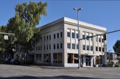
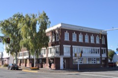
Block
From the record
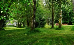
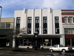
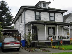
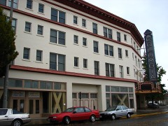
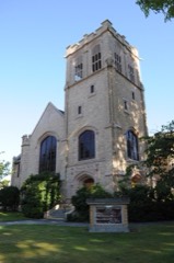
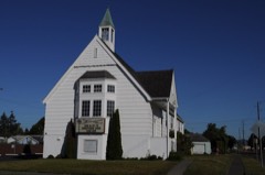
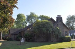
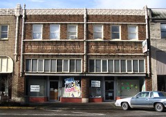
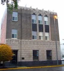
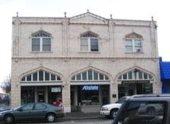
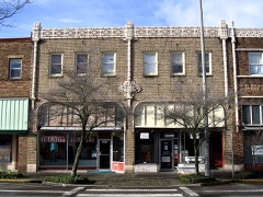
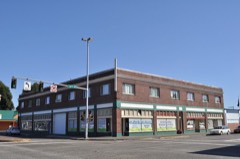
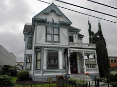
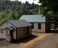
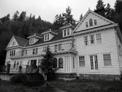
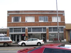
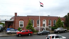
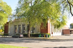
30 National Register listings published here.
Sources: the National Register database, National Park Service
105 topographic sheets cover 46 settlements here, and 30 properties are on the National Register of Historic Places.
30 National Register listings published here.
Sources: the National Register database, National Park Service
Every property in this county listed on the National Register of Historic Places, with the year it was listed and the federal nomination document.
Every wildfire the federal occurrence database records inside this county: 881 of them, burning about 1,264 acres. 37 started naturally and 42 were recorded as arson. Each settlement page carries the fires within five miles of it.
| Reported cause | Fires |
|---|---|
| Debris and open burning | 261 |
| Recreation and ceremony | 204 |
| Missing data/not specified/undetermined | 184 |
| Arson/incendiarism | 42 |
| Equipment and vehicle use | 41 |
| Natural | 37 |
| Smoking | 35 |
| Fireworks | 25 |
| Misuse of fire by a minor | 18 |
| Railroad operations and maintenance | 14 |
| Other causes | 13 |
| Power generation/transmission/distribution | 7 |
The five largest, by the area the report gives. None of them was recorded as arson.
| Date | Cause | Size | Reported by | Name on the report |
|---|---|---|---|---|
| 19 July 2015 | Missing data/not specified/undetermined | 110 acres | Washington State Department of Natural Resources Headquarters | COLVIN CREEK |
| 24 July 2010 | Missing data/not specified/undetermined | 108 acres | Washington State Department of Natural Resources Headquarters | SPEELYAI |
| 21 July 2006 | Missing data/not specified/undetermined | 106 acres | Washington State Department of Natural Resources Headquarters | not named |
| 4 December 2020 | Debris and open burning | 65 acres | Washington State Department of Natural Resources Headquarters | 1440 |
| 19 July 2009 | Recreation and ceremony | 57 acres | Washington State Department of Natural Resources Headquarters | WEST COTTONWOOD |
| 2 September 1998 | Railroad operations and maintenance | 55 acres | Washington State Department of Natural Resources Headquarters | not named |
| 27 July 2005 | Debris and open burning | 34 acres | Washington State Department of Natural Resources Headquarters | WESTSIDE |
| 12 August 2002 | Recreation and ceremony | 30 acres | Washington State Department of Natural Resources Headquarters | not named |
Every settlement page carries the fires within five miles of it - see the settlement index below.
The NOAA Storm Events Database holds 59 reports for this county, causing no deaths, 6 injuries and about $256,357,100 in recorded property damage. Each settlement page carries the reports that name it.
| Kind of event | Reports |
|---|---|
| Flood | 27 |
| Heavy Rain | 16 |
| Tornado | 5 |
| Thunderstorm Wind | 4 |
| Hail | 3 |
| Debris Flow | 2 |
| Funnel Cloud | 1 |
| Lightning | 1 |
The most serious of them, by death, then injury, then recorded damage. The accounts are quoted exactly as the forecast office filed them.
| When | Event | Place named | Harm | What the report says |
|---|---|---|---|---|
| May 2004 | Heavy Rain | Woodland | 4 hurt | no account filed |
| September 2019 | Lightning | Longview | 1 hurt | A Longview mill worker was struck by lightning, and taken to the hospital. This information was discovered from a local media source who wrote an article about the incident. |
| April 2003 | Hail | Kalama | 1 hurt | no account filed |
| September 2020 | Flood | Longview | $250,000,000 | Widespread street flooding in Longview resulting in several businesses in the downtown area experiencing flooding. The first floor of the local Hospital also flooded due to heavy rain. Several videos received from the emergency manager and also noted from broadcast media reports. |
| December 2015 | Flood | Kelso | $2,098,000 | The Cowlitz River at Kelso exceeded flood stage. Rises of the Kalama River resulted in flood damage of many businesses in Kalama including Motel 6, Remax, and the Burger Bar. Camp Kalama was closed due to flooding of the Kalama River. The I-5 offramp in Longview was closed due to high water. |
| December 2015 | Heavy Rain | Longview | $2,098,000 | Heavy rain resulted in multiple land slides between Longview and Kalama. Highway 30 and Kalama River Road were closed due to multiple slides and stranded some residents. A land slide hit a residence and trapped the owner with no injuries. |
| December 2015 | Flood | Castle Rock | $1,799,000 | The Cowlitz River flooded near Castle Rock and Kelso. The heavy rain caused a large land slide in Woodland that closed I-5 overnight. |
| October 2014 | Tornado (EF1) | Longview | $182,000 | Law enforcement confirmed that a tornado touched down near the Safeway in Longview, WA around 1240 PM. The tornado then traveled down Vandercook Way before dissipating near Main St. There was significant roof damage to industrial buildings, minor roof damage to residential buildings, 35 to 30 large trees snapped off or blew down, some power poles downed, and automobiles damaged from debris. |
| April 2023 | Debris Flow | Woodland | $100,000 | An atmospheric river that brought heavy rain caused a landslide that sent debris across I-5 north of Woodland, WA near milepost 24. Around 2.2 inches of rain fell in the Woodland area. Northbound lanes on I-5 were closed for more than 3 hours. |
| March 2022 | Flood | Silver Lake | $25,000 | Between 1 and 3 inches rain fell in the 24 hour leading to a culvert washout in the 2400 block of Tower Road in rural Cowlitz County, closing the road. There was also a landslide that blocked Stewart Creek Road in Longview. |
| March 1985 | Tornado (F1) | not stated | $25,000 | no account filed |
| November 1965 | Tornado (F0) | not stated | $25,000 | no account filed |
| June 2007 | Hail | Yale | $5,000 | Hail was reported by Yale Reservoir Employee. |
| June 2004 | Tornado (F0) | Kalama | $100 | Cowlitz county dispatch received several reports of a tornado that touched down on the Oregon side of the Columbia River, crossed the river to the mouth of the Kalama River as a waterspout, and moved onshore on the Washington side as a tornado. The tornado reportedly knocked down a tree on the Washington side before it dissipated. |
| October 2024 | Tornado (EF0) | Longview | - | A short-lived waterspout over the Columbia River near the Lewis and Clark bridge at Longview occurred with multiple photos taken from the Lewis and Clark Bridge to the west. Indicated on radar and media reported. |
| December 2023 | Flood | Kelso Longview Arpt | - | Heavy rain produced minor flooding along the Cowlitz River at Kelso. The river crested at 22.10 feet at 12 pm on December 6th. Flood stage is 21.5 feet.||A landslide also occurred on the 503 Spur Road which cut off the community of Cougar in Cowlitz County. |
| January 2022 | Flood | Castle Rock | - | The gauge on the Cowlitz River at Kelso rose above flood stage of 21.5 feet at 1330PST, crested at 24.0 feet at 2130PST, the dropped below flood stage on the 7th at 2300PST. There were reports of several side road closed due to flood waters. |
| May 2022 | Hail | Lexington | - | Washington State Patrol reported all lanes of I5 closed around exit 42 due to traffic accidents attributed to hail accumulating on pavement. Three to five vehicles involved in accidents. There was one fatality and one injury. Note: Hail size estimated from other reports in the region. |
| January 2021 | Flood | Lexington | - | The Cowlitz River at Kelso rose above flood stage at 1315PST on the 13th, crested at 22.2 feet, then fell below flood stage 0100PST on the 14th. Flood stage is 21.5 feet. |
| January 2021 | Thunderstorm Wind | Ryderwood | - | Abernathy RAWS (ABNW1) reported a maximum wind of 36 mph gusting to 78 mph. |
| November 2021 | Flood | Lexington | - | The Cowlitz River at Kelso (KELW1) rose above flood stage on the morning of the 11th, created at 21.5 feet around 2000PST on the 11th, then fell below flood stage on the morning of the 12th. |
| February 2019 | Flood | Kalama | - | Both ramps of I-5 northbound at Kalama exit 30 were closed and under water. Many other roads in the area were under water. Rain and runoff also created problems for Kalamas water treatment plant, prompting the city to shut the plant down due to high turbidity from slides along Kalama River Road. |
| February 2019 | Debris Flow | Ariel | - | The Cowlitz County Sheriff's Office said Kalama River Road was partially blocked in the 2800 block and was completely blocked in the 5000 block by landslides. |
| March 2017 | Heavy Rain | Kalama | - | Heavy rain caused a landslide on Kalama River Road near Italian Creek Road, closing the road in both directions. |
| March 2017 | Flood | Longview | - | Recent heavy rains in addition to snow melt upstream caused the Columbia River near Longview to flood. The river crested at 13.92 feet on March 30th, which is 0.42 feet above flood stage. |
| March 2017 | Flood | Kelso | - | Heavy rain in addition to high river levels on the Columbia River caused the Cowlitz River near Kelso to flood. The river crested at 22.10 feet, which is 0.60 feet above flood stage. |
| February 2017 | Flood | Longview | - | Heavy rain caused the Cowlitz River near Kelso to flood. The river crested at 21.6 feet, which is 0.01 feet above flood stage. |
| February 2017 | Heavy Rain | Woodland | - | Additional heavy rain caused a landslide on I-5 near Woodland. |
| July 2016 | Funnel Cloud | Kalama | - | A funnel cloud was observed by a NWS Employee from Interstate 5 near Kalama, Washington. |
| November 2015 | Flood | Kelso | - | Heavy rain caused the Cowlitz River near Kelso to flood. The river crested at 22.1 feet, which is 0.6 ft above flood stage. |
| January 2011 | Flood | Longview Jct | - | Heavy rain combined with snowmelt runoff to produce flooding on the Cowlitz River. The Cowlitz River near Kelso crested at 21.5 feet on January 16th at 20:50 PST. |
| January 2009 | Flood | Kelso | - | Heavy rain caused flooding along the Cowlitz and Coweman Rivers which resulted in the evacuation of 4000 people. |
| January 2009 | Flood | Longview Jct | - | Heavy rain caused the Cowlitz River near Kelso to overflow its banks and flood parts of Cowlitz County. |
| January 2009 | Flood | Woodland Arpt | - | Heavy rainfall caused the Lewis River to overflow its banks and flood sections of Woodland. The Woodland airport among other areas nearby was underwater. |
| January 2009 | Flood | Castle Rock | - | Heavy rain caused major flooding on the Cowlitz River near Castle Rock. |
| January 2009 | Heavy Rain | Yale | - | Heavy rain resulted high water covering highway 503 near milepost 32. |
| January 2007 | Heavy Rain | Castle Rock | - | A total accumulation of 2.13 inches was reported at Castle Rock. |
| January 2007 | Heavy Rain | Kelso | - | A total accumulation of 1.71 inches was reported at Washougal. |
| January 2007 | Heavy Rain | Castle Rock | - | A total accumulation of 1.90 inches was reported at the Abernathy Mountain RAWS. |
| December 2007 | Flood | Kelso | - | The Cowlitz River flooded near Kelso, causing only minor flooding. |
| December 2007 | Heavy Rain | Kelso Longview Arpt | - | Storm total precipitation was 5.16 inches. |
| December 2007 | Heavy Rain | Cougar | - | Storm total precipitation was 6.42 inches at the Coldwater Ridge Visitors Center on Mt. St. Helens. |
| November 2006 | Flood | Castle Rock | - | The Cowlitz River at Castle Rock crested at 49.8 feet on November 7th, with a flood stage of 48.0 feet. |
| November 2006 | Flood | Kelso | - | The Cowlitz River at Kelso crested at 23.1 feet on November 7th, with a flood stage of 21.5 feet. |
| November 2006 | Flood | Woodland | - | The Lewis River at Woodland crested at 24.7 feet on November 7th, with a flood stage of 24.0 feet. |
| November 2006 | Heavy Rain | Oak Pt | - | Recorded a 5-day total of 11.2 inches reported at Abernathy Mtn. RAWS. |
| November 2006 | Heavy Rain | Castle Rock | - | Recorded a 5-day total of 11.0 inches at Coldwater Ridge Visitors Center. |
| January 2006 | Flood | Longview | - | no account filed |
| January 2006 | Flood | Kelso | - | no account filed |
| January 2006 | Flood | Kelso | - | no account filed |
| January 2006 | Flood | Longview | - | no account filed |
| April 2005 | Thunderstorm Wind | Kelso | - | no account filed |
| December 2005 | Flood | Longview | - | no account filed |
| December 2003 | Heavy Rain | Countywide | - | no account filed |
| January 2003 | Heavy Rain | Countywide | - | no account filed |
| March 2003 | Heavy Rain | Countywide | - | no account filed |
| June 2001 | Thunderstorm Wind | Cougar | - | no account filed |
| August 2001 | Heavy Rain | Countywide | - | no account filed |
| November 1984 | Thunderstorm Wind | not stated | - | no account filed |
The Survey's mineral resources record lists 103 workings inside this county. 4 still produce and 99 are closed or unrecorded. Each settlement page carries the workings within five miles of it.
| Commodity | Workings |
|---|---|
| Sand and Gravel, Construction | 46 |
| Stone, Crushed/Broken | 33 |
| Aluminum | 7 |
| Stone | 4 |
| Stone, Dimension | 3 |
| Mercury | 2 |
| Clay | 2 |
| Gold | 1 |
| Zinc, Silver, Lead, Copper | 1 |
| Iron, Silica, Aluminum, Titanium, Water, Free | 1 |
| Gemstone | 1 |
| Silica, Titanium, Iron, Water, Free, Phosphorus-Phosphates | 1 |
| Aluminum, Contained or Metal | 1 |
| Iron | 1 |
The least common of them first, because a county's hundredth gravel pit says nothing its first ten did not.
| Where | Site | Commodity | Status | Recorded |
|---|---|---|---|---|
| (Facility) Longview Aluminum Smelter | Aluminum, Contained or Metal | Plant | ||
| Ayers | Iron | Occurrence | ||
| Cowlitz Clay | Iron, Silica, Aluminum, Titanium, Water, Free | Prospect | 1935, 1937 | |
| Cowlitz-Wahkiakum Area | Aluminum, Silica, Titanium, Iron, Water, Free, Phosphorus-Phosphates | Prospect | 1946 | |
| Green Mountain | Gold, Zinc, Silver, Lead, Copper | Prospect | ||
| Silver Lake | Gemstone | Occurrence | ||
| Soda Springs | Geothermal | Occurrence | ||
| Green River | Mercury | Occurrence | Cinnabar | |
| Red Star | Mercury | Occurrence | ||
| Spirit Lake Road Clay | Clay | Occurrence | ||
| Washout Hill Clay | Clay | Occurrence | ||
| Columbia West Quarry | Stone, Dimension | Producer | ||
| Mount 5640 Quarry | Stone, Dimension | Past Producer | ||
| Spencer Quarry | Stone, Dimension | Producer | ||
| Ash Quarry | Stone | Past Producer | ||
| Bob Walker Pit | Stone | Past Producer | ||
| Grady Quarry | Stone | Past Producer | ||
| Lost Quarry | Stone | Past Producer | ||
| Longview | Aluminum | Occurrence | ||
| Mill Creek Area | Aluminum | Occurrence | ||
| Ostrander Creek | Aluminum | Past Producer | ||
| Section 4 | Aluminum | Occurrence | ||
| Taylor Bros. | Aluminum | Unknown | ||
| Washington Bauxite Dist. | Aluminum | Occurrence | 1946 | |
| 40th Street Quarry | Stone, Crushed/Broken | Past Producer | ||
| 502 Rock Quarry | Stone, Crushed/Broken | Past Producer | ||
| Alder Bluff Quarry | Stone, Crushed/Broken | Past Producer | ||
| Alec Creek Quarry | Stone, Crushed/Broken | Past Producer | ||
| Camp Baker Quarry | Stone, Crushed/Broken | Past Producer | ||
| Cms Rock Quarry | Stone, Crushed/Broken | Past Producer | ||
| Coal Creek Quarry | Stone, Crushed/Broken | Past Producer | ||
| Coal Creek Quarry Co. | Stone, Crushed/Broken | Past Producer | ||
| Corman Quarry | Stone, Crushed/Broken | Past Producer | ||
| Fleshman Pit | Stone, Crushed/Broken | Past Producer | ||
| Fossil Quarry | Stone, Crushed/Broken | Past Producer | ||
| Harbor Rock-Rip 9405 | Stone, Crushed/Broken | Past Producer | ||
| Headquarters Rd. Pit | Stone, Crushed/Broken | Past Producer | ||
| Kalama Quarry | Stone, Crushed/Broken | Past Producer | ||
| Kelley Quarry | Stone, Crushed/Broken | Past Producer | ||
| Memorial Park Road Quarry | Stone, Crushed/Broken | Past Producer | ||
| Mount Coffin Quarry | Stone, Crushed/Broken | Past Producer | ||
| Ocean Beach Tract | Stone, Crushed/Broken | Past Producer | ||
| Open Pit | Stone, Crushed/Broken | Past Producer | ||
| Ostrander Pit | Stone, Crushed/Broken | Past Producer | ||
| Ostrander Rock and Construction Co. | Stone, Crushed/Broken | Past Producer | ||
| Rose Valley Quarry | Stone, Crushed/Broken | Past Producer | ||
| Rose Valley Quarry No. 2 | Stone, Crushed/Broken | Past Producer | ||
| Toutle Quarry | Stone, Crushed/Broken | Past Producer | ||
| Unnamed Quarry | Stone, Crushed/Broken | Past Producer | ||
| Unnamed Quarry | Stone, Crushed/Broken | Past Producer | ||
| Unnamed Quarry | Stone, Crushed/Broken | Past Producer | ||
| Unnamed Quarry | Stone, Crushed/Broken | Past Producer | ||
| Unnamed Quarry | Stone, Crushed/Broken | Past Producer | ||
| Unnamed Quarry | Stone, Crushed/Broken | Past Producer | ||
| Unnamed Quarry | Stone, Crushed/Broken | Past Producer | ||
| Unnamed Quarry | Stone, Crushed/Broken | Past Producer | ||
| Unnamed Quarry Ry | Stone, Crushed/Broken | Past Producer | ||
| Coal Creek Quarry | Sand and Gravel, Construction | Past Producer | ||
| Columbia River Sand & Gravel Pt No3 | Sand and Gravel, Construction | Past Producer | ||
| Cowlitz Pit | Sand and Gravel, Construction | Past Producer | ||
| Cowlitz Pit | Sand and Gravel, Construction | Past Producer | ||
| Cowlitz River Bar | Sand and Gravel, Construction | Past Producer | ||
| Gardner Quarry | Sand and Gravel, Construction | Past Producer | ||
| Hillis Quarry | Sand and Gravel, Construction | Past Producer | ||
| Horsley Gravel Pit | Sand and Gravel, Construction | Past Producer | ||
| Janisch Gravel Co. Pit | Sand and Gravel, Construction | Past Producer | ||
| Lewis River Pit | Sand and Gravel, Construction | Past Producer | ||
| Lewis River Pit | Sand and Gravel, Construction | Past Producer | ||
| Longview Concrete Co. | Sand and Gravel, Construction | Producer | ||
| Martin Pit | Sand and Gravel, Construction | Past Producer | ||
| McKone Pit | Sand and Gravel, Construction | Past Producer | ||
| Monte Kress Pit | Sand and Gravel, Construction | Past Producer | ||
| N-145 Ext | Sand and Gravel, Construction | Past Producer | ||
| Ostrander Rock and Construction Co | Sand and Gravel, Construction | Past Producer | ||
| Peabody Pit | Sand and Gravel, Construction | Past Producer | ||
| Sand Pit | Sand and Gravel, Construction | Past Producer | ||
| Sand Pit | Sand and Gravel, Construction | Past Producer | ||
| Unnamed Pit | Sand and Gravel, Construction | Past Producer | ||
| Unnamed Pit | Sand and Gravel, Construction | Past Producer | ||
| Unnamed Pit | Sand and Gravel, Construction | Past Producer | ||
| Unnamed Pit | Sand and Gravel, Construction | Past Producer | ||
| Unnamed Pit | Sand and Gravel, Construction | Past Producer | ||
| Unnamed Pit | Sand and Gravel, Construction | Past Producer | ||
| Unnamed Pit | Sand and Gravel, Construction | Past Producer | ||
| Unnamed Pit | Sand and Gravel, Construction | Past Producer | ||
| Unnamed Pit | Sand and Gravel, Construction | Past Producer | ||
| Unnamed Pit | Sand and Gravel, Construction | Past Producer | ||
| Unnamed Pit | Sand and Gravel, Construction | Past Producer | ||
| Unnamed Pit | Sand and Gravel, Construction | Past Producer | ||
| Unnamed Pit | Sand and Gravel, Construction | Past Producer | ||
| Unnamed Pit | Sand and Gravel, Construction | Past Producer | ||
| Unnamed Pit | Sand and Gravel, Construction | Past Producer | ||
| Unnamed Pit | Sand and Gravel, Construction | Past Producer | ||
| Unnamed Pit | Sand and Gravel, Construction | Past Producer | ||
| Unnamed Pit | Sand and Gravel, Construction | Past Producer | ||
| Unnamed Pit | Sand and Gravel, Construction | Past Producer | ||
| Unnamed Pit | Sand and Gravel, Construction | Past Producer | ||
| Unnamed Pit | Sand and Gravel, Construction | Past Producer | ||
| Unnamed Pit | Sand and Gravel, Construction | Past Producer | ||
| Unnamed Pit | Sand and Gravel, Construction | Past Producer | ||
| Waters Pit | Sand and Gravel, Construction | Past Producer | ||
| Wheatley and Coover Pit | Sand and Gravel, Construction | Past Producer | ||
| Williamson Pit | Sand and Gravel, Construction | Past Producer |
Named settlements recorded in the Geographic Names Information System, each with the topographic sheets covering it. Villages, hamlets and abandoned places alike. Each is shown with the nearest named watercourse or landform and the survey quadrangle it falls on.
Longview-Kelso census division · 98632 · Near Rocky Point · Kelso quadrangle
11 sheets, 1921 to 1990
Castle Rock census division · 98632 · On Slide Creek · Oak Point quadrangle
15 sheets, 1919 to 1985
Rose Valley census division · 98609 · By Carrolls Bluff · Kalama quadrangle
13 sheets, 1921 to 1990
Castle Rock census division · 98611 · On Whittle Creek · Castle Rock quadrangle
11 sheets, 1941 to 1984
Castle Rock census division · 98632 · On Harmony Creek · Coal Creek quadrangle
15 sheets, 1919 to 1985
Longview-Kelso census division · 98632 · Near Mount Solo · Kelso quadrangle
11 sheets, 1921 to 1990
Woodland census division · 98616 · On Cougar Creek · Cougar quadrangle
17 sheets, 1919 to 1998
Longview-Kelso census division · 98626 · On Harding Creek · Kelso quadrangle
11 sheets, 1921 to 1990
Castle Rock census division · 98632 · On Brock Creek · Coal Creek quadrangle
15 sheets, 1919 to 1985
Castle Rock census division · 98632 · On Brock Creek · Coal Creek quadrangle
15 sheets, 1919 to 1985
Longview-Kelso census division · 98632 · On Clark Creek · Kelso quadrangle
11 sheets, 1921 to 1990
Northeast Cowlitz census division · On Harrington Creek · Elk Mountain quadrangle
16 sheets, 1919 to 1983
Rose Valley census division · 98611 · On Sucker Creek · Mount Brynion quadrangle
12 sheets, 1921 to 1990
Northeast Cowlitz census division · 98649 · Toutle Mountain quadrangle
12 sheets, 1942 to 1984
Longview-Kelso census division · 98626 · On Ostrander Creek · Kelso quadrangle
11 sheets, 1921 to 1990
Longview-Kelso census division · 98632 · On Coweeman River · Rainier quadrangle
12 sheets, 1921 to 1990
Longview-Kelso census division · 98632 · Kelso quadrangle
11 sheets, 1921 to 1990
No longer a settlement
Castle Rock census division · 98632 · On Abernethy Creek · Oak Point quadrangle
15 sheets, 1919 to 1985
Castle Rock census division · 98611 · On Olequa Creek · Castle Rock quadrangle
11 sheets, 1941 to 1984
Longview-Kelso census division · 98626 · On Ostrander Creek · Kelso quadrangle
11 sheets, 1921 to 1990
Rose Valley census division · 98625 · On Gobar Creek · Georges Peak quadrangle
12 sheets, 1943 to 1985
Rose Valley census division · 98626 · On Sandy Bend Creek · Kelso quadrangle
11 sheets, 1921 to 1990
Longview-Kelso census division · 98626 · On Rocky Point · Kelso quadrangle
11 sheets, 1921 to 1990
Rose Valley census division · 98626 · In Rose Valley · Kalama quadrangle
13 sheets, 1921 to 1990
Castle Rock census division · 98581 · On Becker Creek · Wildwood quadrangle
13 sheets, 1953 to 1986
Northeast Cowlitz census division · 98649 · On Bear Creek · Toutle Mountain quadrangle
12 sheets, 1942 to 1984
Castle Rock census division · 98611 · On Sandy Bend Creek · Kelso quadrangle
11 sheets, 1921 to 1990
Castle Rock census division · 98645 · Near Pete Moore Island · Silver Lake quadrangle
11 sheets, 1941 to 1985
Castle Rock census division · 98632 · On Germany Creek · Coal Creek quadrangle
15 sheets, 1919 to 1985
Northeast Cowlitz census division · 98645 · On Outlet Creek · Toutle quadrangle
12 sheets, 1942 to 1985
Longview-Kelso census division · 98632 · On Clark Creek · Kelso quadrangle
11 sheets, 1921 to 1990
Rose Valley census division · 98626 · On Davis Creek · Kalama quadrangle
13 sheets, 1921 to 1990
Longview-Kelso census division · 98632 · On Clark Creek · Kelso quadrangle
11 sheets, 1921 to 1990
Woodland census division · 98603 · On Rock Creek · Amboy quadrangle
14 sheets, 1941 to 1979
The vanished settlements of Cowlitz County: the places named above that are no longer on the map.