 Block
From the record
12 National Register listings published here.
Sources: the National Register database, National Park Service
107 topographic sheets cover 43 settlements here, and 12 properties are on the National Register of Historic Places.
12 National Register listings published here.
Sources: the National Register database, National Park Service
Every property in this county listed on the National Register of Historic Places, with the year it was listed and the federal nomination document.
| Photograph | Property | Type | Listed | Reference |
|---|---|---|---|---|
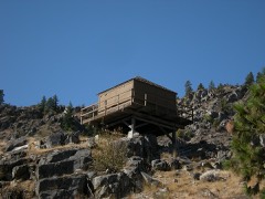 | Badger Mountain Lookout | building | 1990 | 90001915 |
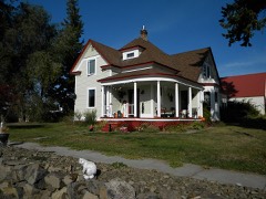 | William J. Canton House | building | 1988 | 88000737 |
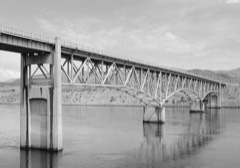 | Columbia River Bridge at Bridgeport | structure | 1995 | 95000632 |
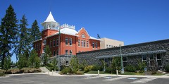 | Douglas County Courthouse | building | 1975 | 75001849 |
| Downtown Waterville Historic District | district | 1988 | 88000629 | |
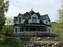 | Gallaher House | building | 1995 | 75001848 |
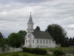 | Lutheran St. Paul's Kirche | building | 1982 | 82004209 |
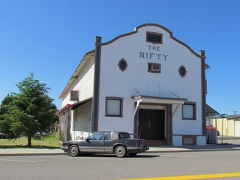 | Nifty Theatre | building | 1999 | 99000402 |
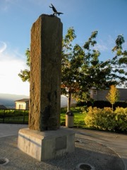 | Pangborn-Herndon Memorial Site | site | 1972 | 72001269 |
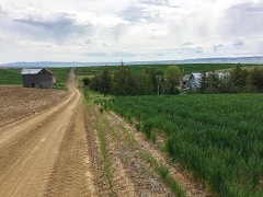 | Christian Schmidt House | building | 1994 | 94001432 |
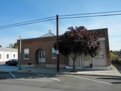 | Smith Hospital and Douglas County Press Building | building | 1989 | 89000402 |
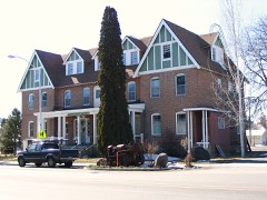 | Waterville Hotel | building | 1984 | 84000170 |
Every wildfire the federal occurrence database records inside this county: 154 of them, burning about 477,041 acres. 44 started naturally and 3 were recorded as arson. Each settlement page carries the fires within five miles of it.
| Reported cause | Fires |
|---|---|
| Missing data/not specified/undetermined | 61 |
| Natural | 44 |
| Debris and open burning | 13 |
| Equipment and vehicle use | 9 |
| Power generation/transmission/distribution | 8 |
| Recreation and ceremony | 7 |
| Fireworks | 4 |
| Arson/incendiarism | 3 |
| Firearms and explosives use | 2 |
| Other causes | 2 |
| Misuse of fire by a minor | 1 |
The five largest, by the area the report gives. None of them was recorded as arson.
| Date | Cause | Size | Reported by | Name on the report |
|---|---|---|---|---|
| 7 September 2020 | Missing data/not specified/undetermined | 223,731 acres | Washington State Department of Natural Resources Headquarters | PEARL HILL |
| 11 August 2018 | Equipment and vehicle use | 76,817 acres | Spokane District | GRASS VALLEY |
| 26 June 2017 | Natural | 37,267 acres | Spokane District | SUTHERLAND CANYON |
| 8 July 2008 | Power generation/transmission/distribution | 15,023 acres | Spokane District | BADGER MT |
| 10 July 2015 | Natural | 14,768 acres | Spokane District | WAGON ROAD |
| 1 August 2008 | Missing data/not specified/undetermined | 12,513 acres | Washington State Fire Marshal's Office | SMITH LAKE FIRE |
| 1 August 2012 | Missing data/not specified/undetermined | 12,500 acres | Washington State Fire Marshal's Office | CRANE ROAD |
| 11 July 2020 | Missing data/not specified/undetermined | 9,330 acres | Washington State Department of Natural Resources Headquarters | ROAD 11 |
Every settlement page carries the fires within five miles of it - see the settlement index below.
The NOAA Storm Events Database holds 50 reports for this county, causing no deaths, 2 injuries and about $1,198,500 in recorded property damage. Each settlement page carries the reports that name it.
| Kind of event | Reports |
|---|---|
| Hail | 16 |
| Thunderstorm Wind | 11 |
| Flash Flood | 8 |
| Debris Flow | 5 |
| Tornado | 3 |
| Heavy Rain | 3 |
| Flood | 2 |
| Funnel Cloud | 2 |
The most serious of them, by death, then injury, then recorded damage. The accounts are quoted exactly as the forecast office filed them.
| When | Event | Place named | Harm | What the report says |
|---|---|---|---|---|
| September 2013 | Thunderstorm Wind | Orondo | 2 hurt | Tree fell onto mobile home that briefly trapped the occupants. Bedroom door was damaged and occupants had to crawl through an opening to the hallway to escape. Minor injuries were sustained to an adult female and a child. |
| July 2023 | Flash Flood | Mc Carteney | $1,000,000 | U.S. Highway 2 closed with a debris flow and damage to the asphalt and guardrail at milepost 171. |
| August 2013 | Thunderstorm Wind | Columbia River | $80,000 | Numerous trees and power lines were downed from thunderstorm winds across southern Douglas County. Two large trees, estimated to be two feet in diameter, were downed at Desert Canyons Lodge. In Orondo, three large trees, estimated to be two feet in diameter and 120 feet tall, were knocked into high voltage power lines starting a small fire. At least 50 apple trees across multiple orchards were also damaged from the high winds. In Waterville, two downed trees landed on houses along Poplar Street and numerous large limbs were on the ground throughout town. |
| July 2010 | Flash Flood | Waterville | $40,000 | no account filed |
| September 2013 | Flash Flood | Mc Carteney | $20,000 | A flash flood deposited mud and rocks approximately two feet deep over Jameson Lake Road at Sulphur Springs Road. Damage costs were estimated. |
| June 2022 | Flash Flood | Bridgeport | $15,000 | Several reports of water inundating roads, rocks on roads, and temporary closures in Bridgeport, including Raymond Avenue, 20th Street, and 16th Street. |
| August 2019 | Hail | Withrow | $10,000 | Dime sized hail from a thunderstorm near Withrow produced crop damage. |
| June 2022 | Thunderstorm Wind | Orondo | $8,000 | Downed power lines in several locations South of Chelan Falls. |
| July 2016 | Debris Flow | Beebe | $7,000 | A Newspaper reported multiple slides on McNeil Canyon Road with one shoulder washed out. In addition two cars and a boat slid several feet due to water flood waters coming down a driveway. This all occurred generally 6 miles east of Chelan, WA. |
| May 2015 | Heavy Rain | Bridgeport | $5,000 | A member of the public reported one inch of rain that fell quickly from a thunderstorm and caused some flooding of Bridgeport Middle School in Bridgeport, WA. Damage and debris left on roads in the vicinity of the school are what caused most of the damage costs. |
| August 2013 | Debris Flow | Waterville | $5,000 | Highway 2 at Pine Canyon was closed due to mud and debris covering the roadway for a period of time. The road was covered in six to eight inches of debris. The water dug three to four foot trenches within the drainage. The Douglas RAWS reported six tenths of rainfall in an one hour period. |
| June 2022 | Thunderstorm Wind | Orondo | $2,000 | Downed wires reported near Lincoln Rock Road and Cascade Loop. |
| August 2019 | Flash Flood | Waterville | $2,000 | Water was reported over State Route 2 and flooding into an adjacent house east of Waterville due to thunderstorm heavy rain. |
| March 2016 | Flood | East Wenatchee | $2,000 | Law enforcement reported two residents in the area that reported minor flooding of their property and homes 3 miles east southeast of Wenatchee, Washington. The extend of flooding or damage is unknown at this time of entry. |
| July 2019 | Flash Flood | Douglas | $1,000 | Flash Flooding caused mud to flow over Highway 2 east of Waterville. The road was fully blocked by mud for about one hour while highway crews worked to clear the road. |
| September 2013 | Thunderstorm Wind | Bridgeport | $1,000 | A tree was knocked down across a roadway. Time was estimated based off of radar. Damage costs were also estimated. |
| August 2019 | Flash Flood | Douglas | $500 | Mud and debris from thunderstorm heavy rain blocked State Route 3 miles east of Douglas. |
| September 2025 | Funnel Cloud | Mc Carteney | - | Observer reported a funnel cloud near Soap Lake. No damage was reported. Location estimated from radar data and photo. |
| July 2023 | Hail | Waterville | - | Several reports of crop damage from hail and flooding between Waterville and Coulee City. Hail ranged from penny to quarter size in this corridor. |
| July 2022 | Hail | Columbia River | - | Hail report received via social media. Time estimated from radar. |
| June 2022 | Hail | Orondo | - | Quarter size hail reported. Observer also estimated wind gusts at 60 mph. |
| February 2021 | Debris Flow | Waterville | - | The Washington Department of Highways reported a large rock slide on US-2 in Pine Canyon. The debris covered approximately 300 yards, which included many large rocks. The highway was closed from MP140 near Orondo to MP148 near Waterville. There was no known time of reopening the road at time of report. |
| August 2021 | Debris Flow | Waterville | - | There was a rock slide, partially blocking a road near a golf course in Orondo, due to brief, heavy rain. |
| May 2020 | Debris Flow | Waterville | - | A rock slide was reported by Washington State Patrol on Highway US-2 in Pine Canyon between Orondo and Waterville. |
| June 2019 | Funnel Cloud | Palisades | - | KING news reported on a funnel cloud photographed by a member of the public near Waterville. The photo showed a clearly defined funnel appending from the base of a nearby thunderstorm. |
| June 2018 | Thunderstorm Wind | Bridgeport | - | A member of the public posted photos of two large fir trees toppled in Bridgeport. A newspaper report indicated 680 customers lost power in Bridgeport. Time of event estimated from radar. |
| May 2017 | Thunderstorm Wind | East Wenatchee | - | A thunderstorm wind gust lofted a glass table top and shattered it near East Wenatchee. |
| July 2016 | Tornado (EF0) | Mold | - | Two separate reports from the public, both with video, noted a tornado approximately 5 miles north northwest of Mold, WA. |
| June 2015 | Hail | Douglas | - | An emergency manager went through a thunderstorm on highway 97 south of Entiat. The storm produced moderate hail, heavy rainfall, and strong winds. Lightning ignited two new fires but the rainfall quuickly put them out. |
| June 2015 | Flash Flood | Waterville | - | Law enforcement reported debris and rocks over highway 2 in Pine Canyon near milepost 145 and 146. |
| June 2015 | Heavy Rain | Mansfield | - | A trained spotter reported 0.70 inches of rain that fell in 25 minutes along with pea size hail in Mansfield, WA. |
| February 2015 | Flood | Rock Is | - | An Emergency Manager reported that nearby Douglas creek flooded 2.5 miles up Palisades Road from Highway 28. It was additionally noted that the county public works were investigating clogged storm drains as a contributor. |
| July 2013 | Hail | St Andrews | - | Hail fell along Highway 2 and St Andrews Road. Some wheat crop damage was reported, but the extent of the damage was unknown. |
| July 2000 | Thunderstorm Wind | Waterville | - | Pea-sized hail piled up to a depth of one inch on US Hwy 2 just east of Waterville. |
| August 1997 | Thunderstorm Wind | Douglas | - | 72 mph gust from automated fire weather station |
| August 1997 | Thunderstorm Wind | Waterville | - | spotter reported 58 mph gust |
| May 1994 | Hail | Bridgeport | - | Strong thunderstorms produced one-quarter inch diameter hail which lasted 40 minutes and severely damaged several apple orchards. |
| July 1994 | Thunderstorm Wind | not stated | - | A thunderstorm produced wind gusts to 66 mph at Waterville. |
| July 2010 | Hail | Waterville Arpt | - | no account filed |
| July 2010 | Hail | Lamoine | - | no account filed |
| July 2008 | Hail | Leahy | - | no account filed |
| July 2006 | Hail | Orondo | - | no account filed |
| May 2004 | Tornado (F0) | East Wenatchee | - | no account filed |
| May 2004 | Hail | East Wenatchee | - | no account filed |
| May 2004 | Hail | Mansfield | - | no account filed |
| June 2001 | Heavy Rain | Countywide | - | no account filed |
| July 1992 | Tornado (F0) | not stated | - | no account filed |
| June 1992 | Hail | not stated | - | no account filed |
| July 1991 | Hail | not stated | - | no account filed |
| August 1956 | Hail | not stated | - | no account filed |
The Survey's mineral resources record lists 101 workings inside this county. 1 still produces and 100 are closed or unrecorded. Each settlement page carries the workings within five miles of it.
| Commodity | Workings |
|---|---|
| Sand and Gravel, Construction | 73 |
| Stone, Crushed/Broken | 15 |
| Silica | 4 |
| Aluminum | 3 |
| Pumice | 3 |
| Clay | 2 |
| Stone | 1 |
| Stone, Dimension | 1 |
The least common of them first, because a county's hundredth gravel pit says nothing its first ten did not.
| Where | Site | Commodity | Status | Recorded |
|---|---|---|---|---|
| Emerson Hanford Property | Stone, Dimension | Past Producer | ||
| State Pit Ps-Do-101 | Stone | Past Producer | ||
| Coulee Chief | Clay | Prospect | ||
| Wenatchee Clay Mine | Clay, Aluminum | Past Producer | ||
| Coulee City Deposit | Aluminum | Occurrence | ||
| Farmer | Pumice | Occurrence | ||
| Hicks Pit | Pumice | Past Producer | ||
| Mcdonald Mine Clay Deposit | Aluminum | Past Producer | ||
| Moses Coulee | Pumice | Past Producer | ||
| Gladding Mcbean | Silica | Occurrence | ||
| Gladding, Mcbean & Co. | Silica | Occurrence | ||
| Pinnacle | Silica | Occurrence | ||
| Spring | Silica | Occurrence | ||
| Batterman Quarry | Stone, Crushed/Broken | Past Producer | ||
| Brewster | Stone, Crushed/Broken | Past Producer | ||
| Case Quarry | Stone, Crushed/Broken | Past Producer | ||
| Hollingshead Quarry | Stone, Crushed/Broken | Past Producer | ||
| Matthieson Quarry | Stone, Crushed/Broken | Past Producer | ||
| Qs-Do-184 | Stone, Crushed/Broken | Past Producer | ||
| Qs-Do-21 | Stone, Crushed/Broken | Past Producer | ||
| State of Wa Pit #045b #1 | Stone, Crushed/Broken | Producer | ||
| Sutor Quarry | Stone, Crushed/Broken | Past Producer | ||
| Unnamed Quarry | Stone, Crushed/Broken | Past Producer | ||
| Unnamed Quarry | Stone, Crushed/Broken | Past Producer | ||
| Unnamed Quarry | Stone, Crushed/Broken | Past Producer | ||
| Unnamed Quarry | Stone, Crushed/Broken | Past Producer | ||
| Unnamed Quarry | Stone, Crushed/Broken | Past Producer | ||
| Wagoner Quarry | Stone, Crushed/Broken | Past Producer | ||
| Bachelor Pit | Sand and Gravel, Construction | Past Producer | ||
| Batterman Pit | Sand and Gravel, Construction | Past Producer | ||
| Batterman Pit | Sand and Gravel, Construction | Past Producer | ||
| Borrow Pit | Sand and Gravel, Construction | Past Producer | ||
| Borrow Pit | Sand and Gravel, Construction | Past Producer | ||
| Bridgeport Sand & Gravel | Sand and Gravel, Construction | Past Producer | ||
| Campbell Pit | Sand and Gravel, Construction | Past Producer | ||
| Coulee Dampit | Sand and Gravel, Construction | Past Producer | ||
| Dept of Highways | Sand and Gravel, Construction | Past Producer | ||
| Farrington Pit | Sand and Gravel, Construction | Past Producer | ||
| Foster Creek Pit | Sand and Gravel, Construction | Past Producer | ||
| Gravel Pit | Sand and Gravel, Construction | Past Producer | ||
| Gravel Pit | Sand and Gravel, Construction | Past Producer | ||
| Gravel Pit | Sand and Gravel, Construction | Past Producer | ||
| Gravel Pit | Sand and Gravel, Construction | Past Producer | ||
| Gravel Pit | Sand and Gravel, Construction | Past Producer | ||
| Guessing Pit | Sand and Gravel, Construction | Past Producer | ||
| Hart Pit | Sand and Gravel, Construction | Past Producer | ||
| Hartl Pit | Sand and Gravel, Construction | Past Producer | ||
| Holcomb Pit | Sand and Gravel, Construction | Past Producer | ||
| Holcomb Pit | Sand and Gravel, Construction | Past Producer | ||
| Holland Pit | Sand and Gravel, Construction | Past Producer | ||
| Leslie Pit | Sand and Gravel, Construction | Past Producer | ||
| Mccormack Pit | Sand and Gravel, Construction | Past Producer | ||
| Nelson Pit | Sand and Gravel, Construction | Past Producer | ||
| Orondo Pit | Sand and Gravel, Construction | Past Producer | ||
| Palisades Pit | Sand and Gravel, Construction | Past Producer | ||
| Palmer Pit | Sand and Gravel, Construction | Past Producer | ||
| Paul Pit | Sand and Gravel, Construction | Past Producer | ||
| Rank Pit | Sand and Gravel, Construction | Past Producer | ||
| Rock Island Pit | Sand and Gravel, Construction | Past Producer | ||
| Rocky Reach Pit | Sand and Gravel, Construction | Past Producer | ||
| Sanford Pit | Sand and Gravel, Construction | Past Producer | ||
| Schmidt Pit | Sand and Gravel, Construction | Past Producer | ||
| Sharyer Pit | Sand and Gravel, Construction | Past Producer | ||
| Sims Pit | Sand and Gravel, Construction | Past Producer | ||
| State Pit Qs-Do-140 | Sand and Gravel, Construction | Past Producer | ||
| Trinidad Pit | Sand and Gravel, Construction | Past Producer | ||
| Unnamed Pit | Sand and Gravel, Construction | Past Producer | ||
| Unnamed Pit | Sand and Gravel, Construction | Past Producer | ||
| Unnamed Pit | Sand and Gravel, Construction | Past Producer | ||
| Unnamed Pit | Sand and Gravel, Construction | Past Producer | ||
| Unnamed Pit | Sand and Gravel, Construction | Past Producer | ||
| Unnamed Pit | Sand and Gravel, Construction | Past Producer | ||
| Unnamed Pit | Sand and Gravel, Construction | Past Producer | ||
| Unnamed Pit | Sand and Gravel, Construction | Past Producer | ||
| Unnamed Pit | Sand and Gravel, Construction | Past Producer | ||
| Unnamed Pit | Sand and Gravel, Construction | Past Producer | ||
| Unnamed Pit | Sand and Gravel, Construction | Past Producer | ||
| Unnamed Pit | Sand and Gravel, Construction | Past Producer | ||
| Unnamed Pit | Sand and Gravel, Construction | Past Producer | ||
| Unnamed Pit | Sand and Gravel, Construction | Past Producer | ||
| Unnamed Pit | Sand and Gravel, Construction | Past Producer | ||
| Unnamed Pit | Sand and Gravel, Construction | Past Producer | ||
| Unnamed Pit | Sand and Gravel, Construction | Past Producer | ||
| Unnamed Pit | Sand and Gravel, Construction | Past Producer | ||
| Unnamed Pit | Sand and Gravel, Construction | Past Producer | ||
| Unnamed Pit | Sand and Gravel, Construction | Past Producer | ||
| Unnamed Pit | Sand and Gravel, Construction | Past Producer | ||
| Unnamed Pit | Sand and Gravel, Construction | Past Producer | ||
| Unnamed Pit | Sand and Gravel, Construction | Past Producer | ||
| Unnamed Pit | Sand and Gravel, Construction | Past Producer | ||
| Unnamed Pit | Sand and Gravel, Construction | Past Producer | ||
| Unnamed Pit | Sand and Gravel, Construction | Past Producer | ||
| Unnamed Pit | Sand and Gravel, Construction | Past Producer | ||
| Unnamed Pit | Sand and Gravel, Construction | Past Producer | ||
| Unnamed Pit O | Sand and Gravel, Construction | Past Producer | ||
| Unnamed Pit El | Sand and Gravel, Construction | Past Producer | ||
| Unnamed Pit Y | Sand and Gravel, Construction | Past Producer | ||
| Unnamed Pit Avel | Sand and Gravel, Construction | Past Producer | ||
| Wall Pit | Sand and Gravel, Construction | Past Producer | ||
| Weakley Pit | Sand and Gravel, Construction | Past Producer | ||
| Wilson Pit | Sand and Gravel, Construction | Past Producer |
Named settlements recorded in the Geographic Names Information System, each with the topographic sheets covering it. Villages, hamlets and abandoned places alike. Each is shown with the nearest named watercourse or landform and the survey quadrangle it falls on.
Waterville census division · 98858 · Near Titchenal Canyon · Alstown quadrangle
6 sheets, 1953 to 1968
Waterville census division · 98845 · Near Sutherland Canyon · Appledale quadrangle
9 sheets, 1953 to 1982
Waterville census division · 99115 · Park Lake quadrangle
6 sheets, 1953 to 1965
No longer a settlement
Bridgeport census division · 98843 · Near McNeil Canyon · Chelan Falls quadrangle
8 sheets, 1953 to 2004
Bridgeport census division · 98813 · Bridgeport Point quadrangle
11 sheets, 1905 to 1983
Bridgeport census division · 98813 · Near Sand Hill · Bridgeport quadrangle
11 sheets, 1905 to 1983
Bridgeport census division · 99133 · On Fiddle Creek · Grand Coulee Dam quadrangle
16 sheets, 1948 to 1989
Waterville census division · 98858 · Near Kummer Draw · Douglas quadrangle
12 sheets, 1901 to 1975
Bridgeport census division · 98812 · Near Rattlesnake Point · Bridgeport quadrangle
11 sheets, 1905 to 1983
East Wenatchee census division · 98802 · Near Sand Canyon · Wenatchee quadrangle
16 sheets, 1913 to 2003
East Wenatchee census division · 98802 · Near Sand Canyon · Wenatchee quadrangle
16 sheets, 1913 to 2003
Bridgeport census division · 98830 · Near Wheeler Hills · Piersol Hills quadrangle
6 sheets, 1953 to 1968
Bridgeport census division · 98858 · Near Landingham Hill · Wells Dam quadrangle
7 sheets, 1953 to 1968
Waterville census division · 98858 · Jameson Lake West quadrangle
6 sheets, 1953 to 1965
No longer a settlement
Bridgeport census division · 98830 · Near Foster Coulee · Leahy quadrangle
6 sheets, 1953 to 1968
Bridgeport census division · 98830 · Mansfield quadrangle
7 sheets, 1953 to 1968
No longer a settlement
Bridgeport census division · 98843 · Near Greens Canyon · Chelan quadrangle
14 sheets, 1901 to 2004
No longer a settlement
Bridgeport census division · 98830 · Near Ragged Butte · Stubblefield Point quadrangle
10 sheets, 1950 to 1983
Waterville census division · 98858 · Near Douglas Draw · Lamoine quadrangle
7 sheets, 1953 to 1968
No longer a settlement
Bridgeport census division · 98843 · Near Corbaley Canyon · Entiat quadrangle
13 sheets, 1901 to 2003
Waterville census division · 98845 · Near Petrified Canyon · Palisades quadrangle
8 sheets, 1953 to 1982
East Wenatchee census division · 98802 · Near Baker Flats · Wenatchee quadrangle
16 sheets, 1913 to 2003
No longer a settlement
Bridgeport census division · 98812 · Near Rattlesnake Point · Bridgeport quadrangle
11 sheets, 1905 to 1983
Waterville census division · 98858 · Jameson Lake SW quadrangle
6 sheets, 1953 to 1965
No longer a settlement
East Wenatchee census division · 98850 · Near Rock Island · Rock Island Dam quadrangle
12 sheets, 1912 to 1975
Waterville census division · 98858 · Near Standpipe Hill · Waterville quadrangle
11 sheets, 1901 to 1975
The vanished settlements of Douglas County: the places named above that are no longer on the map.