 Block
From the record
3 National Register listings published here.
Sources: the National Register database, National Park Service
50 topographic sheets cover 17 settlements here, and 3 properties are on the National Register of Historic Places.
3 National Register listings published here.
Sources: the National Register database, National Park Service
Every property in this county listed on the National Register of Historic Places, with the year it was listed and the federal nomination document.
| Photograph | Property | Type | Listed | Reference |
|---|---|---|---|---|
 | Downtown Pomeroy Historic District | district | 2003 | 03000811 |
 | Garfield County Courthouse | building | 1974 | 74001951 |
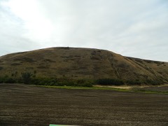 | Lewis and Clark Trail-Travois Road | site | 1974 | 74001952 |
Every wildfire the federal occurrence database records inside this county: 210 of them, burning about 19,176 acres. 151 started naturally and 4 were recorded as arson. Each settlement page carries the fires within five miles of it.
| Reported cause | Fires |
|---|---|
| Natural | 151 |
| Recreation and ceremony | 36 |
| Missing data/not specified/undetermined | 10 |
| Arson/incendiarism | 4 |
| Debris and open burning | 3 |
| Other causes | 2 |
| Smoking | 2 |
| Equipment and vehicle use | 1 |
| Fireworks | 1 |
The five largest, by the area the report gives. None of them was recorded as arson.
| Date | Cause | Size | Reported by | Name on the report |
|---|---|---|---|---|
| 2 August 2016 | Missing data/not specified/undetermined | 11,453 acres | Washington State Fire Marshal's Office | SNAKE RIVER FIRE |
| 28 August 2011 | Natural | 4,002 acres | Washington State Fire Marshal's Office | BELL PLAIN COMPLEX |
| 15 July 2017 | Natural | 3,100 acres | Washington State Fire Marshal's Office | SNAKE RIVER |
| 27 August 2017 | Missing data/not specified/undetermined | 178 acres | Washington State Fire Marshal's Office | HILL FIRE COMPLEX |
| 25 August 2011 | Natural | 60 acres | Umatilla National Forest | BEAR WALLOW |
| 12 September 1996 | Natural | 60 acres | Umatilla National Forest | SNOW |
| 17 July 2016 | Missing data/not specified/undetermined | 52 acres | Washington State Department of Natural Resources Headquarters | DRY GULCH |
| 22 July 2000 | Natural | 40 acres | Washington State Department of Natural Resources Headquarters | not named |
Every settlement page carries the fires within five miles of it - see the settlement index below.
The NOAA Storm Events Database holds 25 reports for this county, causing no deaths, no injuries and about $35,300 in recorded property damage. Each settlement page carries the reports that name it.
| Kind of event | Reports |
|---|---|
| Hail | 12 |
| Thunderstorm Wind | 10 |
| Flash Flood | 2 |
| Flood | 1 |
The most serious of them, by death, then injury, then recorded damage. The accounts are quoted exactly as the forecast office filed them.
| When | Event | Place named | Harm | What the report says |
|---|---|---|---|---|
| January 2000 | Thunderstorm Wind | Pomeroy | $15,000 | Semi truck blown off the road |
| July 2014 | Hail | Pomeroy | $5,000 | Hail ranging from quarters to the size of golf balls fell across northern Garfield County impacting the communities of Pomeroy and Mayview. The hail dented three cars and broke sky lights in a metal building at Dye Seed Ranch. Hail also damaged some of the wheat crop. |
| November 2010 | Thunderstorm Wind | Peola | $5,000 | no account filed |
| November 2010 | Thunderstorm Wind | Peola | $5,000 | no account filed |
| June 1999 | Hail | Dodge | $5,000 | no account filed |
| August 2022 | Thunderstorm Wind | Pataha City | $300 | Large branches of trees were down. |
| February 2025 | Flood | Peyton | - | Minor flooding of the Central Ferry RV Park around 1500PST. No damage to equipment or trailers. Locals stated this is a 25-year flood on the Deadman. |
| August 2022 | Flash Flood | Pataha City | - | Mud and debris over highway 12 from heavy rain from a thunderstorm. One lane closed and police had to help direct traffic. |
| June 2021 | Hail | Pomeroy | - | Numerous reports of hail, from 1 to 1.25 inches, fell in Pomeroy as two strong thunderstorm cells moved across northern Garfield. |
| August 2019 | Hail | Pomeroy | - | A member of the public reported hail with a diameter of 1 inch from a thunderstorms near Pomeroy. |
| May 2017 | Thunderstorm Wind | Peola | - | The Alder Ridge remote weather observing station reported a thunderstorm wind gust of 66 mph. |
| August 2015 | Thunderstorm Wind | Peola | - | The Alder Ridge, Washington Remote Automatic Weather Station (RAWS) measured a 65 mph wind gust. |
| July 2014 | Thunderstorm Wind | Alpowa | - | The Alpowa Summit observation platform located along Highway 12 at 1775 feet clocked sustained winds of 48 mph with gusts to 60 mph. |
| September 2013 | Hail | Rose Spgs | - | Hail was mostly half an inch in diameter, but there were some hail stones up to 1.5 inches in diameter. Time of the event was estimated by radar. |
| May 1997 | Thunderstorm Wind | Pomeroy | - | 70 mph gust |
| May 1997 | Hail | Pomeroy | - | 2 inch diameter hail |
| July 1995 | Thunderstorm Wind | not stated | - | Unofficial wind gusts up to 77 mph where reported by a homeowner before the roof of the house blew off. Crop damage due to wind, rain and hail accompanying the storm. |
| July 1995 | Thunderstorm Wind | not stated | - | Flood and wind damage to crops. Almost one half of the counties farmland was affected. |
| June 2012 | Hail | Peyton | - | no account filed |
| July 2012 | Hail | Columbia Center | - | no account filed |
| July 2012 | Hail | Columbia Center | - | no account filed |
| May 2008 | Flash Flood | Alpowa | - | no account filed |
| June 2006 | Hail | Pomeroy | - | no account filed |
| September 1982 | Hail | not stated | - | no account filed |
| August 1976 | Hail | not stated | - | no account filed |
The Survey's mineral resources record lists 27 workings inside this county. None of them still produces: all are closed or unrecorded. Each settlement page carries the workings within five miles of it.
| Commodity | Workings |
|---|---|
| Stone, Crushed/Broken | 15 |
| Sand and Gravel, Construction | 10 |
| Gold | 1 |
| Titanium, Metal, Zirconium, Platinum, Iron | 1 |
| Stone | 1 |
| Pumice | 1 |
The least common of them first, because a county's hundredth gravel pit says nothing its first ten did not.
| Where | Site | Commodity | Status | Recorded |
|---|---|---|---|---|
| Garfield | Pumice | Occurrence | ||
| Osga Ii Extension Pit | Stone | Past Producer | ||
| Pomeroy | Gold, Titanium, Metal, Zirconium, Platinum, Iron | Occurrence | Stream Placer | |
| Bartlow Pit | Sand and Gravel, Construction | Past Producer | ||
| Cyrus Pit | Sand and Gravel, Construction, Stone, Crushed/Broken | Past Producer | ||
| Gravel Pit | Sand and Gravel, Construction | Past Producer | ||
| Gravel Pit | Sand and Gravel, Construction | Past Producer | ||
| Gravel Pit | Sand and Gravel, Construction | Past Producer | ||
| Gravel Pit | Sand and Gravel, Construction | Past Producer | ||
| Oliphant Pit | Sand and Gravel, Construction | Past Producer | ||
| Trosper Transit Mix Concrete | Sand and Gravel, Construction | Past Producer | ||
| Unnamed Pit | Sand and Gravel, Construction | Past Producer | ||
| Unnamed Quarry | Sand and Gravel, Construction | Past Producer | ||
| Alpowa Hill Quarry | Stone, Crushed/Broken | Past Producer | ||
| Bratlow Quarry | Stone, Crushed/Broken | Past Producer | ||
| Gravel Pit | Stone, Crushed/Broken | Past Producer | ||
| Gravel Pit | Stone, Crushed/Broken | Past Producer | ||
| Keatts Quarry | Stone, Crushed/Broken | Past Producer | ||
| Keatts Quarry | Stone, Crushed/Broken | Past Producer | ||
| Knettle Quarry | Stone, Crushed/Broken | Past Producer | ||
| Oliphant Quarry | Stone, Crushed/Broken | Past Producer | ||
| Pomeroy Quarryy | Stone, Crushed/Broken | Past Producer | ||
| Unnamed Quarry | Stone, Crushed/Broken | Past Producer | ||
| Unnamed Quarry | Stone, Crushed/Broken | Past Producer | ||
| Unnamed Quarry | Stone, Crushed/Broken | Past Producer | ||
| Unnamed Quarry | Stone, Crushed/Broken | Past Producer | ||
| Unnamed Quarryy | Stone, Crushed/Broken | Past Producer |
Named settlements recorded in the Geographic Names Information System, each with the topographic sheets covering it. Villages, hamlets and abandoned places alike. Each is shown with the nearest named watercourse or landform and the survey quadrangle it falls on.
Snake River census division · 99347 · Near Deadman Gulch · Gould City quadrangle
9 sheets, 1950 to 1982
Snake River census division · 99347 · On Casey Creek · Wades Bar quadrangle
9 sheets, 1950 to 1982
Pomeroy census division · 99347 · Near Sweeney Gulch · Alpowa Ridge quadrangle
10 sheets, 1943 to 1981
Pomeroy census division · 99347 · Near Bihmaier Gulch · Pomeroy quadrangle
13 sheets, 1937 to 1981
Pomeroy census division · 99347 · Near Benjamin Gulch · Pomeroy quadrangle
13 sheets, 1937 to 1981
Pomeroy census division · 99347 · Near Stevens Ridge · Rose Springs quadrangle
16 sheets, 1937 to 1995
Snake River census division · 99347 · Near Bear Wallow · Stentz Spring quadrangle
16 sheets, 1937 to 1995
Snake River census division · 99403 · Near Horseshoe Canyon · Stember Creek quadrangle
10 sheets, 1943 to 1981
No longer a settlement
Pomeroy census division · 99347 · Near Tatman Gulch · Zumwalt quadrangle
14 sheets, 1937 to 1981
The vanished settlements of Garfield County: the places named above that are no longer on the map.